Articoli correlati a 2001 Map of London

1:63,360 1 inch to 1 mile The clear, colourful mapping covers the whole of the M25 Motorway and includes comprehensive planning and administrative information supported by street level detail.
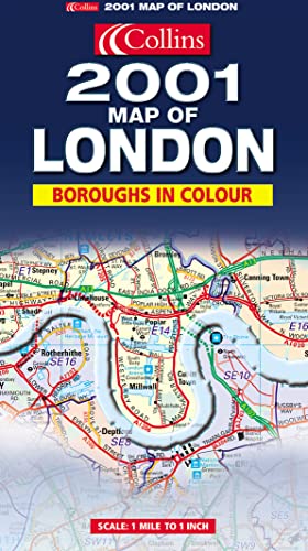
MAIN FEATURES
A clear, colourful map of an area extending to 20 Miles around London. The comprehensive planning and administrative information is supported by street level detail showing full road classification, place names and buildings of interest.
INCLUDES
� Administrative areas named and coloured for easy reference
� Postcode information
� All motorways, main roads and major streets numbered and named
� Shows all important buildings and landmark features
� Fully indexed
� Information on County/Boroughs size, population, contacts etc.
AREA OF COVERAGE
Extends from Windsor in the west to Hornchurch in the east. From Harlow in the north to Leatherhead in the south. Covers the whole of the M25 Orbital Motorway.
WHO THE PRODUCT IS AIMED AT
The definitive planning map of London, essential for those concerned with administration, planning and business.
Le informazioni nella sezione "Riassunto" possono far riferimento a edizioni diverse di questo titolo.
Dalla quarta di copertina:
1:63,360, 1 INCH TO 1 MILE
THE CLEAR, COLOURFUL MAPPING COVERS THE WHOLE OF THE M25 MOTORWAY AND INCLUDES COMPREHENSIVE PLANNING AND ADMINISTRATIVE INFORMATION SUPPORTED BY STREET LEVEL DETAIL.
MAIN FEATURES
A clear colourful map of an area extending to 20 miles around London. The comprehensive planning and administrative information is uspported by street level detail showing full road classification, place names and buildings of interest.
INCLUDES
� Administrative areas named and coloured for easy reference
� Postcode information
� All motorways, main road and major streets numbered and named
� Shows all important buildings and landmark features
� Fully indexed
� Information on County/Borough size, and population, contacts, etc
AREA OF COVERAGE
Extends form Windsor in the west to Hornchurch in the east. From Harlow in the north to leatherhead in the south. Covers the whole of the M25 Orbital Motorway.
WHO THE PRODUCT IS AIMED AT
The definitive planning map of London, essential for those concerned with administration, planning and business.
Le informazioni nella sezione "Su questo libro" possono far riferimento a edizioni diverse di questo titolo.
- EditoreCollins
- Data di pubblicazione2000
- ISBN 10 0007100388
- ISBN 13 9780007100385
- RilegaturaMappa
(nessuna copia disponibile)
Cerca: Inserisci un desiderataSe non trovi il libro che cerchi su AbeBooks possiamo cercarlo per te automaticamente ad ogni aggiornamento del nostro sito. Se il libro � ancora reperibile da qualche parte, lo troveremo!
Inserisci un desiderata