Articoli correlati a Road Map Spain and Portugal
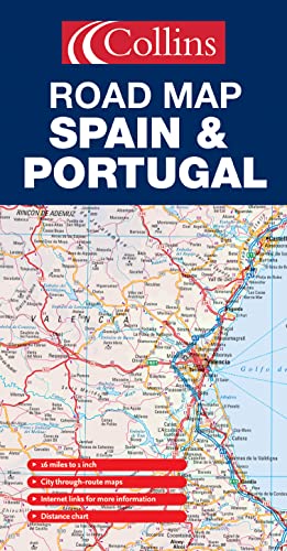

New edition featuring Collins Road Atlas Europe road mapping with distance chart, city through route maps and place-name index.
Scale 1:1 000 000; 1cm to 10 kms; 1 inch to 16 miles
MAIN FEATURES
Fully classified road network shown clearly against a background of attractive hill-shading. Map detail includes road and motorway numbers, numbered motorway junctions, road distances and ferry routes.
INCLUDES
Through route maps of Madrid, Barcelona, Seville, Valencia and Lisbon. Distance chart, information factfile, internet links and comprehensive index to place names.
AREA OF COVERAGE
All of mainland Spain and Portugal from the Pyrenees in the north to Gibraltar in the south and including Andorra and the Balearic Islands.
TARGET MARKET
Tourist, motorist, anyone planning a trip in Spain or Portugal, plus home and business reference.
OTHER PRODUCTS IN THE SERIES
France
Italy
Le informazioni nella sezione "Riassunto" possono far riferimento a edizioni diverse di questo titolo.
- EditoreCollins
- Data di pubblicazione2005
- ISBN 10 0007197063
- ISBN 13 9780007197064
- RilegaturaMappa
Compra usato
Condizioni: molto buonoThe book has been read, but is... Scopri di pi� su questo articolo

EUR 27,80
Spese di spedizione:
EUR 5,60
Da: Regno Unito a: U.S.A.
I migliori risultati di ricerca su AbeBooks
Foto dell'editore
Road Map Spain and Portugal
Editore:
Collins
(2005)
ISBN 10: 0007197063
ISBN 13: 9780007197064
Antico o usato
Paperback
Quantit�: 1
Da:
Valutazione libreria
Descrizione libro Paperback. Condizione: Very Good. The book has been read, but is in excellent condition. Pages are intact and not marred by notes or highlighting. The spine remains undamaged. Codice articolo GOR005583107
Compra usato
EUR 27,80
Convertire valuta
Foto dell'editore
Road Map Spain and Portugal
Editore:
Collins
(2005)
ISBN 10: 0007197063
ISBN 13: 9780007197064
Antico o usato
Paperback
Quantit�: 1
Da:
Valutazione libreria
Descrizione libro Paperback. Condizione: Good. The book has been read but remains in clean condition. All pages are intact and the cover is intact. Some minor wear to the spine. Codice articolo GOR003764289
Compra usato
EUR 27,80
Convertire valuta
Foto dell'editore
Road Map Spain and Portugal
Editore:
Collins
(2005)
ISBN 10: 0007197063
ISBN 13: 9780007197064
Antico o usato
Paperback
Quantit�: 1
Da:
Valutazione libreria
Descrizione libro Paperback. Condizione: Fair. A readable copy of the book which may include some defects such as highlighting and notes. Cover and pages may be creased and show discolouration. Codice articolo GOR005917672
Compra usato
EUR 27,80
Convertire valuta