Articoli correlati a London Pocket Map
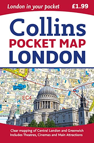

Handy little full colour map of central London with a high level of detail. Clear mapping of central London from Regent’s Park in the north to Kennington in the south, and Kensington Gardens in the west to Tower Bridge in the east at a scale of 1:12,500 (5 inches to 1 mile). Maps of West End shopping and theatres are also included.
Clear, detailed, full colour mapping is presented in a handy format ideal for the pocket or handbag. It is excellent value at only �1.99 and covers the most visited area of central London. It is an essential buy for tourists and residents alike.
INCLUDES
� Detailed central area map
� Theatres and cinemas map
� Shopping map
� Underground map
� The latest congestion zone boundary
Le informazioni nella sezione "Riassunto" possono far riferimento a edizioni diverse di questo titolo.
L'autore:
Explore the world through accurate and up-to-date mapping.
Le informazioni nella sezione "Su questo libro" possono far riferimento a edizioni diverse di questo titolo.
- EditoreCollins
- Data di pubblicazione2015
- ISBN 10 0008104565
- ISBN 13 9780008104566
- RilegaturaMappa
- Numero di pagine96
- Valutazione libreria
I migliori risultati di ricerca su AbeBooks

Foto dell'editore
London Pocket Map
Da:
Valutazione libreria
Descrizione libro Map. Condizione: Used; Good. **SHIPPED FROM UK** We believe you will be completely satisfied with our quick and reliable service. All orders are dispatched as swiftly as possible! Buy with confidence! Greener Books. Codice articolo 4311229
Compra usato
EUR 3,83
Convertire valuta
Foto dell'editore
London Pocket Map
Editore:
HarperCollins Publishers, United Kingdom, London
(2015)
ISBN 10: 0008104565
ISBN 13: 9780008104566
Antico o usato
Paperback
Quantit�: 2
Da:
Valutazione libreria
Descrizione libro Paperback. Condizione: Very Good. Handy little full colour map of central London with a high level of detail. Clear mapping of central London from Regents Park in the north to Kennington in the south, and Kensington Gardens in the west to Tower Bridge in the east at a scale of 1:12,500 (5 inches to 1 mile). Maps of West End shopping and theatres are also included. Clear, detailed, full colour mapping is presented in a handy format ideal for the pocket or handbag. It is excellent value at only 1.99 and covers the most visited area of central London. It is an essential buy for tourists and residents alike. INCLUDES Detailed central area map Theatres and cinemas map Shopping map Underground map The latest congestion zone boundary. The book has been read, but is in excellent condition. Pages are intact and not marred by notes or highlighting. The spine remains undamaged. Codice articolo GOR007705089
Compra usato
EUR 12,43
Convertire valuta
Foto dell'editore
Collins Pocket Map London
Editore:
HarperCollins UK
(1856)
ISBN 10: 0008104565
ISBN 13: 9780008104566
Antico o usato
Quantit�: 4
Da:
Valutazione libreria
Descrizione libro Condizione: Sehr gut. 0 Gepflegter, sauberer Zustand. 25092166/2 Altersfreigabe FSK ab 0 Jahre Landkarte, Gr��e: 8.9 x 0.8 x 14 cm. Codice articolo 250921662
Compra usato
EUR 23,21
Convertire valuta
Foto dell'editore
Collins Pocket Map London
Editore:
HarperCollins UK
(1856)
ISBN 10: 0008104565
ISBN 13: 9780008104566
Antico o usato
Quantit�: 2
Da:
Valutazione libreria
Descrizione libro Condizione: Gut. 0 Gebrauchs- und Lagerspuren. Au�en: Knick. 25092166/3 Altersfreigabe FSK ab 0 Jahre Landkarte, Gr��e: 8.9 x 0.8 x 14 cm. Codice articolo 250921663
Compra usato
EUR 23,21
Convertire valuta