Articoli correlati a The Falls 1931: Co Antrim Sheet 60.12

- EditoreAlan Godfrey Maps
- Data di pubblicazione1989
- ISBN 10 0850542472
- ISBN 13 9780850542479
- RilegaturaMappa
Compra nuovo
Scopri di pi� su questo articolo
EUR 3,55
Spese di spedizione:
EUR 35,56
Da: Regno Unito a: U.S.A.
I migliori risultati di ricerca su AbeBooks
Foto dell'editore
The Falls 1931: Co Antrim Sheet 60.12
Da:
Valutazione libreria
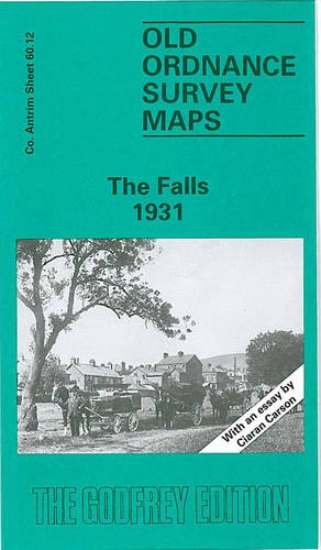
Descrizione libro No Binding. Condizione: New. No Jacket. Here are the details of maps for Belfast (West): Co Antrim Sheet 60.12 The Falls 1931 - published 1989; intro by Ciaran Carson. ISBN.978-0-85054-247-9 This very detailed map covers much of west Belfast, especially the area around the Falls Road. Coverage stretches from Roden Street westward to Whiterock Road and Falls Park, and from Cupar Street southward to Donegall Road. Features on the map include Falls Road itself with houses neatly delineated, Springfield Road, Royal Victoria Hospital, St Mary's Training College, Belfast Children's Hospital, Boyne Bridge Works, tramways, Celtic Park, Belfast Cemetery, Royal Irish Distillery, Broadway Damask Works, match factory, Dunville Park, St Mary's Dominican Convent, Springfield Linen Factory, bakery, Forth River Mills, Mulhouse Works, Grosvenor Finishing Works, Albert Foudnry, Blackstaff Weaving Mill, Milfort Weaving Works, Falls Foundry, Forth River Mills, Clowney Brick Works, Ballymurphy Brick Works, Beech Mount, Mac Rory Park, Corrigan Park etc. On the reverse we include street directory entries for Bombay Street, Falls Road and Raglan Street in 1928. The map links up with sheet 60.08 Shankill to the north, 61.09 Central Belfast to the east. Codice articolo 002888
Compra nuovo
EUR 3,55
Convertire valuta