Articoli correlati a United States Explorer: Wall Maps U.S.
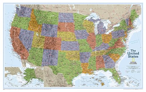

The United States Explorer map is a classic example of the cartographic excellence National Geographic is known for. This colorful political map clearly shows state boundaries, capitals, major highways, rivers, lakes, and many major cities. Insets show detail of Alaska and Hawaii. The color palette is vibrant and stunning shaded relief provides additional texture and detail.
The map is encapsulated in heavy-duty 1.6 mil laminate which makes the paper much more durable and resistant to the swelling and shrinking caused by changes in humidity. Laminated maps can be framed without the need for glass, so the fames can be much lighter and less expensive.
- Map Scale = 1:6,396,000
- Sheet Size = 32" x 20.25"
Le informazioni nella sezione "Riassunto" possono far riferimento a edizioni diverse di questo titolo.
Product Description:
Unusual book
Le informazioni nella sezione "Su questo libro" possono far riferimento a edizioni diverse di questo titolo.
- EditoreNatl Geographic Society Maps
- Data di pubblicazione2012
- ISBN 10 1597750093
- ISBN 13 9781597750097
- RilegaturaMappa
- Numero di pagine1
- Valutazione libreria
Compra usato
Condizioni: molto buono1 Seiten Gebrauchs- und Lagerspuren... Scopri di pi� su questo articolo

EUR 16,56
Spese di spedizione:
EUR 45,00
Da: Germania a: U.S.A.
I migliori risultati di ricerca su AbeBooks
Foto dell'editore
National Geographic: United States Explorer Wall Map - Laminated (32 X 20.25 Inches): Wall Maps U.S. (National Geographic Reference Map)
Editore:
NATL GEOGRAPHIC MAPS
(2019)
ISBN 10: 1597750093
ISBN 13: 9781597750097
Antico o usato
Quantit�: 1
Da:
Valutazione libreria
Descrizione libro Condizione: Gut. 019. 1 Seiten Gebrauchs- und Lagerspuren. 19. Auflage. 23311804/3 Altersfreigabe FSK ab 0 Jahre Landkarte, Gr��e: 8.6 x 7.9 x 91.4 cm. Codice articolo 233118043
Compra usato
EUR 16,56
Convertire valuta
Foto dell'editore
National Geographic: United States Explorer Wall Map - Laminated (32 X 20.25 Inches): Wall Maps U.S. (National Geographic Reference Map)
Editore:
NATL GEOGRAPHIC MAPS
(2019)
ISBN 10: 1597750093
ISBN 13: 9781597750097
Antico o usato
Quantit�: 7
Da:
Valutazione libreria
Descrizione libro Condizione: Sehr gut. 019. 1 Seiten Gepflegter, sauberer Zustand. 19. Auflage. 23311804/2 Altersfreigabe FSK ab 0 Jahre Landkarte, Gr��e: 8.6 x 7.9 x 91.4 cm. Codice articolo 233118042
Compra usato
EUR 16,56
Convertire valuta