Articoli correlati a London Street Atlas (spiral) (A-Z Street Atlas)
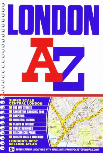

This A-Z map of London is a full colour, spiral bound street atlas featuring 155 pages of continuous street mapping that covers an area extending to:
- Barnet
- Chingford
- Dagenham
- Sidcup
- Chislehurst
- Farnborough
- Croydon
- Surbiton
- Shepperton
- Heathrow Airport (Terminals 1-5)
- Ruislip
- Stanmore
In addition, there is a large scale street map section of central London which extends north to Regent's Park and Shoreditch, south to Chelsea and Vauxhall, west to Hyde Park and east to Bermondsey.
Postcode districts, one-way streets, safety camera locations with their maximum speed limit and the Congestion Charging Zone are all featured on the mapping.
Also included is:
- An overview map of the Congestion Charging Zone
- A West End Theatre map
- The London Connections rail services map
- The full London Underground map
The comprehensive index lists streets, selected flats, walkways and places of interest, place, area and junction names. There are separate index listings for both hospitals, walk-in centres and hospices and for the National Rail, London Tramlink, Docklands Light Railway, London Underground and Overground stations, and River Bus piers covered by this atlas.
Le informazioni nella sezione "Riassunto" possono far riferimento a edizioni diverse di questo titolo.
- EditoreGeographers A-Z Map Company
- Data di pubblicazione2008
- ISBN 10 1843486032
- ISBN 13 9781843486039
- RilegaturaRilegatura a spirale
- Numero di pagine448
- Valutazione libreria
Compra nuovo
Scopri di pi� su questo articolo
EUR 51,82
Spese di spedizione:
EUR 3,73
In U.S.A.
I migliori risultati di ricerca su AbeBooks
Foto dell'editore
London Street Atlas AZ Spiral***
Editore:
Geographers a-Z
(2012)
ISBN 10: 1843486032
ISBN 13: 9781843486039
Nuovo
Paperback
Quantit�: 1
Da:
Valutazione libreria
Descrizione libro Paperback. Condizione: new. Geographers' A-Z Map Company (illustratore). New. Fast Shipping and good customer service. Codice articolo Holz_New_1843486032
Compra nuovo
EUR 51,82
Convertire valuta
Foto dell'editore
London Street Atlas AZ Spiral***
Editore:
Geographers a-Z
(2012)
ISBN 10: 1843486032
ISBN 13: 9781843486039
Nuovo
Paperback
Quantit�: 1
Da:
Valutazione libreria
Descrizione libro Paperback. Condizione: new. Geographers' A-Z Map Company (illustratore). New Copy. Customer Service Guaranteed. Codice articolo think1843486032
Compra nuovo
EUR 93,94
Convertire valuta
Foto dell'editore
London Street Atlas AZ Spiral***
Editore:
Geographers a-Z
(2012)
ISBN 10: 1843486032
ISBN 13: 9781843486039
Nuovo
Paperback
Quantit�: 1
Da:
Valutazione libreria
Descrizione libro Paperback. Condizione: new. Geographers' A-Z Map Company (illustratore). New. Codice articolo Wizard1843486032
Compra nuovo
EUR 94,74
Convertire valuta
Foto dell'editore
London Street Atlas AZ Spiral***
Editore:
Geographers a-Z
(2012)
ISBN 10: 1843486032
ISBN 13: 9781843486039
Nuovo
Paperback
Quantit�: 1
Da:
Valutazione libreria
Descrizione libro Paperback. Condizione: new. Geographers' A-Z Map Company (illustratore). Buy for Great customer experience. Codice articolo GoldenDragon1843486032
Compra nuovo
EUR 95,29
Convertire valuta
Foto dell'editore
LONDON STREET ATLAS AZ SPIRAL***
Editore:
Geographers a-Z
(2012)
ISBN 10: 1843486032
ISBN 13: 9781843486039
Nuovo
Brossura
Quantit�: 1
Da:
Valutazione libreria
Descrizione libro Condizione: New. Geographers' A-Z Map Company (illustratore). New. In shrink wrap. Looks like an interesting title! 1.1. Codice articolo Q-1843486032
Compra nuovo
EUR 93,72
Convertire valuta
Foto dell'editore
London Street Atlas AZ Spiral***
Editore:
Geographers a-Z
(2012)
ISBN 10: 1843486032
ISBN 13: 9781843486039
Nuovo
Spiral-bound
Quantit�: 1
Da:
Valutazione libreria
Descrizione libro Spiral-bound. Condizione: New. Geographers' A-Z Map Company (illustratore). Brand New!. Codice articolo VIB1843486032
Compra nuovo
EUR 121,48
Convertire valuta