Articoli correlati a Bala and Lake Vyrnwy

- EditoreCassini Publishing Ltd
- Data di pubblicazione2007
- ISBN 10 1847362397
- ISBN 13 9781847362391
- RilegaturaMappa
- Numero di pagine1
Compra nuovo
Scopri di pi� su questo articolo
EUR 1,15
Spese di spedizione:
EUR 9,35
Da: Regno Unito a: U.S.A.
I migliori risultati di ricerca su AbeBooks
Immagini fornite dal venditore
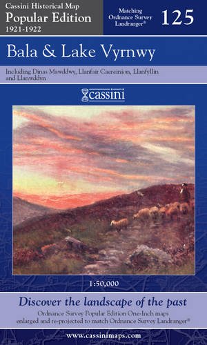
BALA & LAKE VYRNWY, including Llanfair Caereinion, Llanfyllin and Llangynog. (Cassini Popular Series Historical Map POP 125 1921-1922). Matching ORDNANCE SURVEY LANDRANGER No. 125. 1:50,000.
Editore:
Cassini Publishing Limited. Southampton, Hampshire. 2007.
(2007)
ISBN 10: 1847362397
ISBN 13: 9781847362391
Nuovo
Prima edizione
Quantit�: 5
Da:
Valutazione libreria
Descrizione libro Condizione: new. (Map, 2007). (1921) 2007 1st edition thus. Folding map in blue card covers. This map includes Llanfair Caereinion, Dinas Mawddwy, Llanuwcllyn, Bala, Llanfyllin, Llangynog and Corwen. Fine new copy. The Cassini Popular Edition series provides a fascinating snapshot of the human geography of Britain in the period between the two world wars. These maps are taken from the Ordnance Survey One-Inch 'Popular Edition' sheets, surveyed between 1921 and 1922. The original series of maps were 1" to the mile, and surveyed on a grid different from that employed today. In this new series, however, the 1" maps have been reprojected onto the OS National Grid so that all the edges match up. This makes the whole country into one single sheet from which positions can be read off in National Grid Numbers. This single sheet has been redivided, creating new sheets each corresponding precisely to a current Landranger map. The scale is now larger, at 1:50,000. This new series is uniquely useful for exploring the land and accurately pin-pointing where things are, or used to be. Equally useful for comparisons with current maps on the kitchen table. Much to be recommended. PREVIOUS PRICE �9.99. Codice articolo 40389
Compra nuovo
EUR 1,15
Convertire valuta
Foto dell'editore
Cassini HM, POP-125: Bala & lake Vyrnwy 125 Popular Edition 125
Da:
Valutazione libreria
Descrizione libro Map. Condizione: Brand New. popular ed edition. 1 pages. In Stock. Codice articolo __1847362397
Compra nuovo
EUR 2,55
Convertire valuta
Foto dell'editore
Bala and Lake Vyrnwy (Cassini Popular Edition Historical Map)
Da:
Valutazione libreria
Descrizione libro Map. Condizione: New. Shipped from the UK within 2 business days of order being placed. Codice articolo mon0000102500
Compra nuovo
EUR 8,12
Convertire valuta