Articoli correlati a Philip's Street Atlas Fife and Tayside
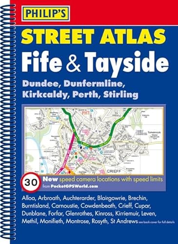

This spiral-bound street atlas of Fife and Tayside gives comprehensive and detailed coverage of the region. The route planner shows all the A and B roads, and can be used when driving to get close to the destination before turning to the relevant large-scale street map.The street maps show every named road, street and lane very clearly, with major roads picked out in colour. The maps are at a scale of 1.75 inches to 1 mile, with larger scale maps at a scale of 3.5 inches to 1 mile in the south and for the following towns: Arbroath, Auchterarder, Brechin, Carnoustie, Crieff, Cupar, Dunblane, Dundee, Forfar, Glenrothes, Kinross, Kirriemuir, Leven, Montrose, Perth, Rattray and St Andrews. Dundee city centre is shown at 7 inches to 1 mile.Other information on the maps includes postcode boundaries, car parks, railway and bus stations, post offices, schools, colleges, hospitals, police and fire stations, places of worship, leisure centres, footpaths and bridleways, camping and caravan sites, golf courses, and many other places of interest. New to this edition are fixed single and multiple speed-camera locations, with corresponding speed limits.The comprehensive index lists street names and postcodes, plus schools, hospitals, railway stations, shopping centres and other such features picked out in red, with other places of interest shown in blue.
Le informazioni nella sezione "Riassunto" possono far riferimento a edizioni diverse di questo titolo.
Descrizione del libro:
Includes fixed single and multiple speed-camera locations, with corresponding speed limits. Shows every street in both urban and rural areas. Route-planning maps show all A and B roads. Street maps show car parks, post offices, schools and many other places of interest. Comprehensive index with every street named, plus postcodes, schools, hospitals, etc. Also available in a pocket paperback format at a scale of 1 1/3 inches to 1 mile, with larger scale maps at 2 2/3 inches to 1 mile. Part of a series of street atlases which covers all of England, Wales, Northern Ireland and much of Scotland.
Le informazioni nella sezione "Su questo libro" possono far riferimento a edizioni diverse di questo titolo.
- EditorePhilip's
- Data di pubblicazione2012
- ISBN 10 1849072310
- ISBN 13 9781849072311
- RilegaturaCopertina flessibile
- Numero di pagine224
Compra usato
Condizioni: buonoMost items will be dispatched the... Scopri di pi� su questo articolo

EUR 10,95
Spese di spedizione:
EUR 9,35
Da: Regno Unito a: U.S.A.
I migliori risultati di ricerca su AbeBooks
Immagini fornite dal venditore
Philip's Street Atlas Fife and Tayside: Spiral Edition
Editore:
Philip's
(2012)
ISBN 10: 1849072310
ISBN 13: 9781849072311
Antico o usato
Brossura
Quantit�: 1
Da:
Valutazione libreria
Descrizione libro Condizione: Good. Most items will be dispatched the same or the next working day. Codice articolo wbs8247040978
Compra usato
EUR 10,95
Convertire valuta