Articoli correlati a Victorian England and Wales 1897 Coloured Ordnance...
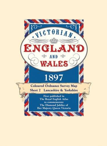
Victorian England and Wales 1897 Coloured Ordnance Survey Map Sheet 2: Lancashire & Yorkshire: No. 2

1897, the year in which these maps first appeared in The Royal English Atlas, was one of great celebration for it marked the Diamond Jubilee of Britain's longest reigning monarch Queen Victoria. But there was much more to celebrate than her continuing occupancy of the throne as the previous sixty years had seen the greatest ever period of industrial development. The rapidly expanding industrial towns and cities were now the homes of workers who once laboured on the land but were now in the factories and mines creating and processing the needs of the mother country and the Empire. To record these changes the Victorians had become great map makers and the Ordnance Survey had already been publishing maps for a century. This series, created from Ordnance Survey maps, were coloured and published in book form. They are now available in sheets for the first time. The construction of the railway network, commenced a mere 72 years before, was now virtually complete with over 20,000 miles in use. They are all marked, as are their 'predecessors' the canals. But, despite all the changes brought about by the Industrial Revolution, the great conurbations we know today were still surprisingly small in 1897. The countryside had changed little for centuries. There were still scores of aristocratic homes surrounded by park land where now the urban sprawl, new towns and industrial estates may be found. Just as interesting is what is not shown. Notice how small the towns and scattered villages are, indeed there is a village just to the west of London on sheet 9 which shows the three or four houses that made up the village of Heathrow. There are no by-passes and all the major trunk roads pass along the high streets of country towns. Motorways had, of course, not even been dreamt about but interestingly the route of a proposed channel tunnel is marked. These maps provide a fascinating insight into the past and will be a delight for local historians, walkers, genealogists and indeed anyone curious to see how their area used to be. Each map has a booklet describing England and Wales in 1897.
Le informazioni nella sezione "Riassunto" possono far riferimento a edizioni diverse di questo titolo.
- EditoreOld House Books
- Data di pubblicazione2005
- ISBN 10 1873590423
- ISBN 13 9781873590423
- RilegaturaMappa
- Numero di pagine1
Compra usato
Condizioni: molto buono1897, the year in which these maps... Scopri di pi� su questo articolo

EUR 9,69
Spese di spedizione:
EUR 5,64
Da: Regno Unito a: U.S.A.
I migliori risultati di ricerca su AbeBooks
Foto dell'editore
Victorian Maps England and Wales, 1897 (2): No. 2 (Victorian Maps, England and Wales 1897 S.)
Editore:
Bloomsbury Publishing PLC, United Kingdom, London
(2005)
ISBN 10: 1873590423
ISBN 13: 9781873590423
Antico o usato
Paperback
Quantit�: 2
Da:
Valutazione libreria
Descrizione libro Paperback. Condizione: Very Good. 1897, the year in which these maps first appeared in The Royal English Atlas, was one of great celebration for it marked the Diamond Jubilee of Britain's longest reigning monarch Queen Victoria. But there was much more to celebrate than her continuing occupancy of the throne as the previous sixty years had seen the greatest ever period of industrial development. The rapidly expanding industrial towns and cities were now the homes of workers who once laboured on the land but were now in the factories and mines creating and processing the needs of the mother country and the Empire. To record these changes the Victorians had become great map makers and the Ordnance Survey had already been publishing maps for a century. This series, created from Ordnance Survey maps, were coloured and published in book form. They are now available in sheets for the first time. The construction of the railway network, commenced a mere 72 years before, was now virtually complete with over 20,000 miles in use. They are all marked, as are their 'predecessors' the canals. But, despite all the changes brought about by the Industrial Revolution, the great conurbations we know today were still surprisingly small in 1897. The countryside had changed little for centuries. There were still scores of aristocratic homes surrounded by park land where now the urban sprawl, new towns and industrial estates may be found. Just as interesting is what is not shown. Notice how small the towns and scattered villages are, indeed there is a village just to the west of London on sheet 9 which shows the three or four houses that made up the village of Heathrow. There are no by-passes and all the major trunk roads pass along the high streets of country towns. Motorways had, of course, not even been dreamt about but interestingly the route of a proposed channel tunnel is marked. These maps provide a fascinating insight into the past and will be a delight for local historians, walkers, genealogists and indeed anyone curious to see how their area used to be. Each map has a booklet describing England and Wales in 1897. The book has been read, but is in excellent condition. Pages are intact and not marred by notes or highlighting. The spine remains undamaged. Codice articolo GOR008869504
Compra usato
EUR 9,69
Convertire valuta
Foto dell'editore
Victorian Maps England and Wales, 1897 (2) (Victorian Maps, England and Wales 1897 S.)
Da:
Valutazione libreria
Descrizione libro No Binding. Condizione: Fine. Old House map in paper wallet. Fine condition, looks as new and unused. Fast shipping from the U/K. Codice articolo ABE-1592906659144
Compra usato
EUR 6,96
Convertire valuta