Articoli correlati a Korea: A Geography Based on the Author's Travels...
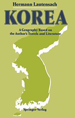
Korea: A Geography Based on the Author's Travels and Literature - Rilegato

 
9783540191391: Korea: A Geography Based on the Author's Travels and Literature
Vedi tutte le copie di questo ISBN:
 
 
Lautensach[s "Korea" is a regional geography, the most comprehensive one ever written on Korea in a western language. It was written before the country was divided and provides a waelth of information on the entire country, particularly on the north, something that has been difficult toobtain in the West in the past forty years. Unfortunately, only very few volumes survived the end of World War II, so that it has been very difficultto get hold of the book. Lautensachh[s "Korea" is considered a classical example of regional geography.

Le informazioni nella sezione "Riassunto" possono far riferimento a edizioni diverse di questo titolo.

Contenuti:
One: Geographical and Historical Background.- 1 Geographical Location and Boundaries.- 2 Topographical and Morphological Features.- 3 Place Names and Their Transcription.- 4 Provincial Boundaries.- 5 National, Political and Cultural History.- Neolithic age.- Dolmens.- Tan-gun and Kija.- Influence from Manchuria China.- Chos?n.- Lolang.- The Three Hans.- The Three Kingdoms.- Unified Shilla.- Kory?.- Chos?n dynasty.- Isolation period.- First decade after the opening of the country.- 6 History of Discovery and Exploration.- Geographical works by Koreans.- Arab traders.- Rubruck and Polo.- First reports by missionaries and first European maps.- Martini, Hamel, Régis.- Last century of the isolation period.- European naval expeditions.- Major expeditions on land.- Russian literature.- Japanese research.- 7 The Author’s Objectives and Travels.- Two: Nature and Traditional Culture.- 1 Geological Structure and Surface Forms.- Main stratigraphical structural regions.- Stratigraphy and tectonic history.- Mineral deposits.- Kot?’s morphological concepts.- Yukpaeksan and Nangnang plains.- Kaema upland.- Sea of Japan.- Echelon pattern.- Structural valleys.- Meandering valleys.- Recent eruptions.- Pleistocene glaciation.- Coasts.- Weathering and erosion forms.- Form series.- Transport of debris.- 2 Climate.- History of research.- Climatography.- Air masses.- Annual cycle.- Climatic boundaries.- Classification.- 3 Rivers and Seas.- River systems.- Water balance.- Floods.- Navigability.- Freezing of rivers.- Tidal range.- Ocean currents.- Salinity and temperatures.- Color of the sea.- History of research.- 4 Flora.- Growing season.- Floristics.- Plant formations.- Autumn foliage.- Red pine forests.- Plant communities.- Classification of the summergreen mixed forest.- Coniferous forests and subalpine zone.- Semispontaneous formations.- Population and vegetation.- 5 Fauna.- Zoogeography.- Forest fauna.- Shrubland fauna.- Animals associated with man’s habitation.- Coastal fauna.- Migratory birds.- Population and wildlife.- 6 The Anthropogeographical Character of Ancient Korea.- Race.- Population development.- Diseases related to climate.- Mentality.- Clothing.- Civil year.- House types.- Pavilions.- Village types.- Permanent settlement.- Fire-field farming.- Cities.- Fortifications.- Religion and landscape.- Agriculture.- Cultivated trees and shrubs.- Types of agriculture.- Animal husbandry.- Skilled trades.- Mining.- Commerce.- Transportation.- Three: The Korean Regions The Principles Behind the Regionalization of Korea.- 1 The North Korean Japan Sea Borderland.- Boundaries.- Rivers.- Landforms.- Climate.- Vegetation.- Agriculture.- Fishing.- Development of hydroelectric power.- Transportation.- Recent upswing.- Settlement.- — Hoery?ng—Unggi section.- Unggi, Najin, Ch’?ngjin, Nanam.- Kilchu-My?ngch’?n section.- Southwestern half.- 2 The Kaema Upland.- Main physiographical features.- Hamgy?ng Range.- Side ridges.- Special climate.- Vegetation.- Fire-field farming.- Forestry.- Permanent cultivation and sedentary settlements.- Cities.- 3 The Paektusan Area.- Structure and landforms.- Climate.- Forests on the basaltic plateau.- Fauna.- Settlement.- Central mountain ring.- 4 The Yalu and the P’y?ngbuk Region.- Boundaries of the P’y?ngbuk region.- — Yalu: meanders.- Bars created by aggradation.- Three segments.- Rafting.- Boundary character.- Overland transportation.- Settlements.- Navigation.- Description of the segments.- P’y?ngbuk region: landforms.- Climate.- Vegetation.- Economy.- Transportation and settlements.- 5 The Taedong Basin.- Location and size.- Taedonggang.- Geological structure.- Relief.- Climate.- Vegetation.- Economy.- P’y?ng-yang.- Chinnamp’o.- Settlements and population density.- 6 The Hwanghae Peninsula.- Boundaries.- Morphological features.- Climate.- Shrub formations.- Agriculture.- Fishing.- Mining.- Region of Koksan and Shin-gye.- Kaes?ng.- Ch’?nmasan.- Haeju.- Northern ranges.- Northwestern part.- Southwestern sector.- Paengny?ng islands.- 7 The Ky?nggi Region and the Capital, Seoul.- Area.- Hangang system.- Landforms.- Coastal fringe.- Climate.- Vegetation.- Agriculture.- Population.- Seoul.- Inch’?n.- 8 The Upper Han-gang Region.- Location.- Geological structure.- Ch’ugary?ng furrow.- Other structural valleys.- Climate.- Economy.- Disadvantageous location.- Ch’unch’?n.- 9 The Wonsan Area.- Y?ngh?ngman.- Wonsan.- Rock and relief zones.- Economy.- Climate.- 10 The T’aebaek Range, Including K?mgangsan.- Area.- Landforms.- Coast.- Climate.- Vegetation.- Settlement.- Economy.- Transportation.- — K?mgangsan.- 11 Ull?ngdo.- Insular peculiarities.- History.- Volcanic nature.- Insular climate.- Endemism.- Culture.- 12 The Naktong Basin.- Overview.- Naktonggang.- Relief.- Destruction of forests.- Climate.- Vegetation.- Economy.- Transportation.- Population density.- Northwestern part.- Southern end of the T’aebaek Range.- Central part.- Basin around Taegu.- Ky?ngju.- Changgi.- Southern part.- Pusan.- 13 Sobaek Range, Including Chirisan.- Overview.- Sections.- Climate.- Economy.- Vegetation.- — Chirisan.- 14 The Ch’ungch’?ng-Ch?lla Region.- Boundaries.- Rivers.- Relief.- Coast and islands.- Climate.- Vegetation 352, Economy.- Transportation.- Population density.- — Northeastern part.- T’aean Peninsula.- Ch’ary?ng Ridge.- Central part.- Kunsan.- Rice paddy plains.- Nory?ng Ridge.- Maisan.- Kwangju.- 15 The Southern Coast Borderland.- Overview.- Structure and forms.- Tidal range and mud flats.- Climate.- Evergreen vegetation.- Economy, ports.- Population density.- 16 Chejudo.- Shape.- History.- Relief.- Climate.- Vegetation.- Pastures and fields.- Fishing.- Population.- Transportation.- Four: Korea as a Japanese Foreign Possession.- 1 Background and History of Japanese Influence.- Attitude of the Koreans.- Attitude of the Japanese.- Strategic, economic and national viewpoints.- History of Japanese influence.- 2 The Japanese Population Element.- Number of Japanese.- Employment structure.- Distribution within the country.- Settlement.- Shint?.- 3 Development and Distribution of Population.- Growth of the Korean population.- Foreigners.- Internal migration.- Emigration.- Koreans living abroad.- Population distribution.- Relationship to agricultural intensity.- 4 The Fields.- Tenancy and landownership.- Attitude.- Japanese landownership.- Government measures.- Japanese agricultural research.- Results.- Landuse.- Paddies.- Permanent dry fields.- Sericulture.- Fruit growing.- Animal husbandry.- Classification of agricultural regions.- 10.1007/978-3-642-73578-3_34.- Condition of the areas supervised by the forestry authorities.- Forestry policies.- Reforestation.- Fire-field farmers.- Lumbering.- 6 The Fishing Grounds.- Oceanographical conditions in the Korean seas.- Warm-water fauna.- Cold-water fauna.- Japanese measures.- Fishing vessels.- Catch.- Structure of the catch.- Sardine catch.- Regionalization of the fish grounds.- Cultivation of marine organisms.- River fishing.- Production of sea salt.- 7 Mining and Industry.- History of mining.- Overview.- The individual branches.- International position.- — Development of industry.- Japanese initiative.- Development of hydroelectric power.- The individual branches.- Distribution.- 8 The Settlements.- Development of villages.- Classification of cities according to growth rates.- Geographical location of cities.- Economic and political function.- Japanese planning.- Japanese buildings.- Classification of types of cities developed by the Japanese.- 9 Traffic Routes and Transportation.- Overview.- Roads.- Railroads.- International ports.- River shipping.- Air traffic.- Communications.- 10 Foreign Trade.- History.- Trade with Japan and foreign countries.- Exporting and importing countries.- Types of goods.- 11 Korea as a Part of Greater Japan.- Location within Greater Japan.- Strategic role.- Role in transportation.- Role in settlement.- Economic role.- — Korea as a conmaritime colony.- Domination colony.- Economic colony.- Assimilation colony.- 12 Résumé: Essence and Change in Korea’s Geographical Character.- Continental-maritime regional change.- Korea as a cultural geographical unit.- Change in a west-easterly direction.- Peripheral-central change.- — Structural change under Japanese influence.- Seasonal change.- Korea’s geographical individuality.- Photographs.- Index of Topics.- Index of Persons.- Index of Place Names.

Le informazioni nella sezione "Su questo libro" possono far riferimento a edizioni diverse di questo titolo.

Compra usato

Condizioni: molto buono
Solid binidng, gently worn at spine... Scopri di più su questo articolo

Spese di spedizione: GRATIS
In U.S.A.

Destinazione, tempi e costi

Aggiungere al carrello

Altre edizioni note dello stesso titolo

9783642735806: Korea: A Geography Based on the Author's Travels and Literature: A Geography Based on the Author’s Travels and Literature

Edizione in evidenza

ISBN 10:  3642735800 ISBN 13:  9783642735806
Casa editrice: Springer-Verlag, 1988
Brossura

  • 9780387191393: Korea: A Geography Based on the Authors Travels and Literature

    Spring..., 1988
    Rilegato

  • 9783642735790: Korea: A Geography Based on the Author's Travels and Literature

    Springer, 2012
    Brossura

I migliori risultati di ricerca su AbeBooks

Immagini fornite dal venditore

Hermann Lautensach
Editore: Springer October 1988 (1988)
ISBN 10: 3540191399 ISBN 13: 9783540191391
Antico o usato Rilegato Quantità: 1
Da:
A Cappella Books, Inc.
(Atlanta, GA, U.S.A.)
Valutazione libreria

Descrizione libro Hardcover. Condizione: Very Good. Solid binidng, gently worn at spine; Clean, sturdy pictoral boards, corners gently bumped; Pages free of markings; An excellent copy. Codice articolo 293286

Informazioni sul venditore | Contatta il venditore

Compra usato
EUR 33,67
Convertire valuta

Aggiungere al carrello

Spese di spedizione: GRATIS
In U.S.A.
Destinazione, tempi e costi
Foto dell'editore

Lautensach, Hermann, 1886-1971 [author]; Dege, Katherine; Dege, Eckart [translators/editors]
ISBN 10: 3540191399 ISBN 13: 9783540191391
Antico o usato Rilegato Quantità: 1
Da:
Second Story Books, ABAA
(Rockville, MD, U.S.A.)
Valutazione libreria

Descrizione libro Hardcover. Octavo, xvii, 598 pages. In Very Good condition. Spine is green with black print. Boards in green cloth with black print. Illustrated: b&w maps, plates, large folded color map in rear pocket. 1373283. FP New Rockville Stock. Codice articolo 1373283

Informazioni sul venditore | Contatta il venditore

Compra usato
EUR 28,86
Convertire valuta

Aggiungere al carrello

Spese di spedizione: EUR 5,60
In U.S.A.
Destinazione, tempi e costi