Al contenuto principale
abebooks.it
Cerca
Login
Mio Account
Carrello
Aiuto
Menu
Mio Account
Tracciare ordini
Ricerca Avanzata
Collezioni
Libri antichi e rari
Arte e Collezionismo
Venditori
Vendere con noi
Aiuto
Chiudere
Atlases and Antique Maps
Di
Bjarne Tokerud Bookseller
Più popolari
Aggiunti di recente
Prezzo crescente
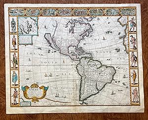
Speed map of: AMERICA WITH THOSE KNOWN PARTS IN THAT UNKNOWNE WORLDE, BOTH PEOPLE AND MANNER OF B...
Speed John.
1676
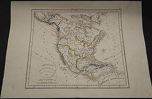
Amerique Septentrionale par F. Delamarche. 1854.
Delamarche (Felix).
1854
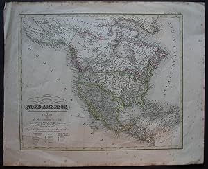
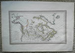
Nord-America nach den besten und neuesten Quellen entworfen und gezeichnet von C. Glaser 1837.
Glaser (Carl).
1837
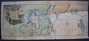
A New Chart of the parts where a North West Passage was sought in the Years 1746 and 1747. Exhibi...
Ellis (Henry).
1748
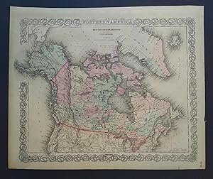
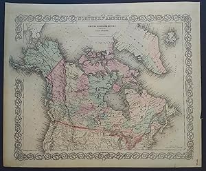
NORTH AMERICA BRITISH RUSSIAN AND DANISH IN NORTH AMERICA.
1866
British Possessions in North America. "From the Arrowsmith Map of North America."
Arrowsmith, John.
1814
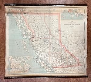
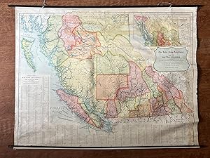
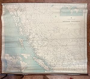
BRITISH COLUMBIA. Department of Lands.1912.
G.G. Aiken. (Chief Geographer).
1912
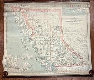
BRITISH COLUMBIA. Department of Lands. 1912.
G.G. Aiken. (Chief Geographer)
1912
North America British Russian and Danish in North America.
1866
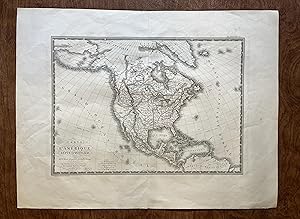
Carte de la partie Septentrionale du Nouveau Monde; ou sont Comprises Les Possessions Anglaises d...
Vivien de St. Martin (L.).
1825
Carte de L'Amerique Septentrionale, par A.H. Brue.Janvier 1820.Augmentee en Janvier 1821.
Brue (Adrien-Hubert).
1821
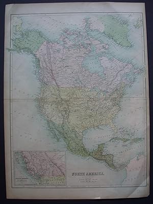
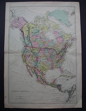
North America. By J. Bartholomew F.R.G.S.
Bartholomew (J.).
1860
NORTH AMERICA. By Ettling.
Ettling (Theodore).
1861
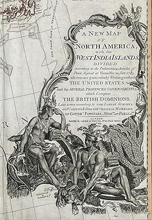
A New Map of North America, with the West India Islands. Divided according to the preliminary art...
Bowen, Emmanuel and John Gibson. [Governor Pownall].
1794
THE DAILY NEWS-ADVERTISERS' MAP OF BRITISH COLUMBIA. Showing Railways, Steamship Lines And Telegr...
1914
BRITISH COLUMBIA. Department of Lands. 1912.
G.G. Aiken. (Chief Geographer). G. Herbert Dawson, Survey...
1912
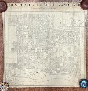
MUNICIPALITY OF SOUTH VANCOUVER.
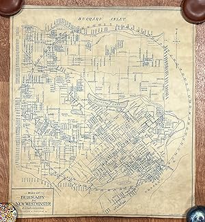
MAP OF BURNABY AND NEW WESTMINSTER, British Columbia. 1933.
1933
Carica altri