Al contenuto principale
abebooks.it
Cerca
Login
Mio Account
Carrello
Aiuto
Menu
Mio Account
Tracciare ordini
Ricerca Avanzata
Collezioni
Libri antichi e rari
Arte e Collezionismo
Venditori
Vendere con noi
Aiuto
Chiudere
Maps
Di
Michael S. Kemp, Bookseller
Più popolari
Aggiunti di recente
Prezzo crescente
Relief Map of the World.
PHILIP, George
The Imperial Atlas of Modern Geography; an extensive series of maps, embracing the most recent di...
W.G. BLACKIE
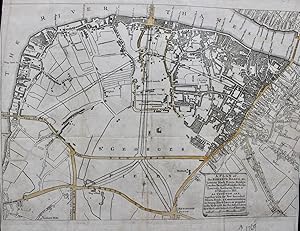
Hampstead Garden Suburb. London N.W.
BARRY PARKER and RAYMOND UNWIN
The Builder Map of the County of London; shewing the boundaries of the surveyors' districts under...
THE BUILDER
Willerby, East Yorkshire.
ORDNANCE SURVEY
prima edizione
The Eastern Hemisphere [and] The Western Hemisphere.
MAP
Map of Aden [with notes].
STANFORD'S
A Topographical Plan of Manchester and Salford, with the Adjacent Parts; Showing also the Differe...
C. LAURENT
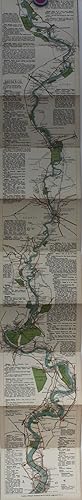
The Oarsman's and Angler's Map of the River Thames, From The Source to London Bridge. Scale One I...
EDWARD STANFORD
A Survey and Mapp of a Messuage, Farm and Lands, formerly called Stone Riddon Coppens, Collens an...
JOHN BOWRA
Plan of Estates; the Property of Thomas Chinnall Porter Esq. [In Essex and Worcestershire]
HOGG, Thomas surveyor
England and Wales.
EMBROIDERED MAP
A Valuable Archive containing a series of maps and documents charting the development of a partic...
DALSTON, LONDON
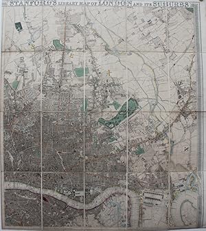
Stanford's Library Map of London and Its Suburbs.
EDWARD STANFORD
prima edizione
The British South Africa Company. Memorandum containing Notes concerning the Development of Estat...
H. WILSON FOX
Great Boston Fire. Map of the Burned District.
BOSTON
The Oarsman's and Angler's Map of the River Thames, From The Source to London Bridge. Scale One I...
EDWARD STANFORD
Cruchley's New Map of the World on Mercator's Projection, showing the discoveries at the North Po...
C.F. CRUCHLEY
Plan of the Town of Dunfermline.
JOHN WOOD
View in Cuper's Gardens, Lambeth.
HOWLETT, Bartholemew
Map of Naples [with notes].
STANFORD'S
Map of Adelaide [with notes].
STANFORD'S
Map of Gibraltar [with notes].
STANFORD'S
A Mapp of Ye Great Levell of ye Fens extending into ye Countyes of Northampton, Norfolk, Suffolke...
JONAS MOORE
[Letchworth] Plan of Present Development.
BARRY PARKER and RAYMOND UNWIN
A New Map of the Country Round Manchester.
JOHN STOCKDALE
Map of the City of Chicago. The Black Portion shows the Burnt District.
CHICAGO
Great Boston Fire. Map of the Burned District.
BOSTON
The British Colonies. Parts I, II and IV only.
R. MONTGOMERY MARTIN
Map of the Geographical Distribution of the Cerealla [sic] with the Isotheral [sic] and Isocheimo...
J. O'SHAUGHNESSY
A Plan of the City and Liberties of London after the dreadful Conflagration in the Year 1666. The...
LONDON
A New and Accurate Plan of the City of Westminster, the Dutchy of Lancaster and Places Adjacent.
LONDON
Plan of the Property on Each Side of the River Thames which May be Affected by the Approaches to ...
GEORGE RENNIE
China (Part of) French Indo China (Part of) Sheet L [with on reverse] China (Part of) French Indo...
ESCAPE MAP
The Environs of Sebastopol with the Batteries & Approaches.
JAMES WYLD
Stanford's Map of Turkey in Europe and Her Tributary States; Together with Such Parts of Russia, ...
Edward STANFORD
Map of Melbourne [with notes].
STANFORD'S
Map of Sydney [and] Map of Central Sydney [with notes].
STANFORD'S
Map of Brisbane [with notes].
STANFORD'S
Map of Perth [and] Map of Freemantle [with notes].
STANFORD'S
Daily Telegraph War Map No. 14 of the Western Front; Arras to Nancy.
ALEXANDER GROSS
Proposed Garden Suburb at Hampstead North London.
BARRY PARKER and RAYMOND UNWIN
Stanford's Map of the River Thames From Richmond to Lechlade. Scale 1½ inches to 1 mile.
CAPT. O.M. WATTS
The Grosvenor Estate; Strategy for Mayfair and Belgravia.
CHAPMAN TAYLOR PARTNERS
The Town of Inverness. 25 inches to the mile. 3 sheets.
ORDNANCE SURVEY
Commonwealth of Australia, constructed and engraved by W. & A.K. Johnston.
W. & A.K. JOHNSTON
[Place the County in the Country]
CARTOGRAPHIC GAME
Proposed Garden Suburb at Hampstead North London.
BARRY PARKER and RAYMOND UNWIN
A Series of 8 Maps Issued to Illustrate the Results of the Census.
CENSUS MAPS
Map of Godalming and Its Vicinity.
GODALMING
The Builder Map of the County of London; shewing the boundaries of the surveyors' districts under...
THE BUILDER
Ordnance Map and Tourists' Table of the Thames. For the Angler, Tourist, and Boating Man. [slipca...
FRANCIS I. PALMER
6 Large Plans of the Thames at London to accompany the second Report (1799) from the Select Commi...
THAMES
A Plan of the Street, Roads, &c. between Black Fryers Bridge, London Bridge, Westminster Bridge, ...
LONDON
Dà fense de Sà bastopol. Ouvrage Rà digà sous la Direction du Lieutenant-Gà neral E. de Todleben,...
E[DUARD] DE TODLEBEN
A Plan of the Parish of Croydon in the County of Surrey Shewing the Allotments in the Common and ...
BAINBRIDGE, Thomas
Plan of Westminster; From Norden's Survey, Taken in Queen Elizabeth's Reign, 1593.
WESTMINSTER
The Sluices and Weirs on the River Avon from Stratford to Tewksbury.
RIVER AVON
Plan of Roman, Medieval & Modern York, Drawn on the Basis of the Ordnance Survey.
ROBERT H. SKAIFE
Carica altri


![The Eastern Hemisphere [and] The Western Hemisphere.](http://pictures.abebooks.com/inventory/md/md30900590308.jpg)
![Map of Aden [with notes].](http://pictures.abebooks.com/inventory/md/md31004542116.jpg)


![Plan of Estates; the Property of Thomas Chinnall Porter Esq. [In Essex and Worcestershire]](http://pictures.abebooks.com/inventory/md/md30041565434.jpg)


![Map of Naples [with notes].](http://pictures.abebooks.com/inventory/md/md31004538319.jpg)
![Map of Adelaide [with notes].](http://pictures.abebooks.com/inventory/md/md31004541145.jpg)
![Map of Gibraltar [with notes].](http://pictures.abebooks.com/inventory/md/md31004542115.jpg)

![[Letchworth] Plan of Present Development.](http://pictures.abebooks.com/inventory/md/md31097222818.jpg)


![Map of the Geographical Distribution of the Cerealla [sic] with the Isotheral [sic] and Isocheimo...](http://pictures.abebooks.com/inventory/md/md31299326550.jpg)


![China (Part of) French Indo China (Part of) Sheet L [with on reverse] China (Part of) French Indo...](http://pictures.abebooks.com/inventory/md/md31487159520.jpg)


![Map of Melbourne [with notes].](http://pictures.abebooks.com/inventory/md/md31004540147.jpg)
![Map of Sydney [and] Map of Central Sydney [with notes].](http://pictures.abebooks.com/inventory/md/md31004542117.jpg)
![Map of Brisbane [with notes].](http://pictures.abebooks.com/inventory/md/md31004543118.jpg)
![Map of Perth [and] Map of Freemantle [with notes].](http://pictures.abebooks.com/inventory/md/md31004546061.jpg)


![[Place the County in the Country]](http://pictures.abebooks.com/inventory/md/md31097234562.jpg)