Articoli correlati a An Atlas of Geographical Wonders: From Mountaintops...
An Atlas of Geographical Wonders: From Mountaintops to Riverbeds: A Selection of Comparative Maps and Tableaux - Rilegato
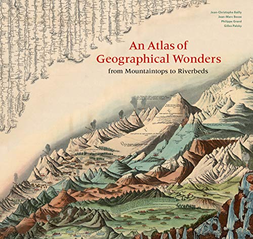

This is the first book to catalog comparative maps and tableaux that visualize the heights and lengths of the world's mountains and rivers. Produced predominantly in the nineteenth century, these beautifully rendered maps emerged out of the tide of exploration and scientific developments in measuring techniques. Beginning with the work of explorer Alexander von Humboldt, these historic drawings reveal a world of artistic and imaginative difference. Many of them give way—and with visible joy—to the power of fantasy in a mesmerizing array of realistic and imaginary forms. Most of the maps are from the David Rumsey Historical Map Collection at Stanford University.
Le informazioni nella sezione "Riassunto" possono far riferimento a edizioni diverse di questo titolo.
L'autore:
Jean-Christophe Bailly teaches the history of landscape formation at the �cole d'ing�nieurs paysagistes (School of Landscape Architecture), Blois, France.
Gilles Palsky is a professor of geography at the University of Paris. He has published a history of statistical cartography of the nineteenth century.
Jean-Marc Besse is director of research at the Centre national de la recherche scientifique (UMR G�ographie-cit�s).
Philippe Grand is the author of nine books of poetry and publisher of Fage editions of Lyon, France.
Le informazioni nella sezione "Su questo libro" possono far riferimento a edizioni diverse di questo titolo.
- EditorePrinceton Architectural Pr
- Data di pubblicazione2019
- ISBN 10 1616898232
- ISBN 13 9781616898236
- RilegaturaCopertina rigida
- Numero edizione1
- Numero di pagine208
- Valutazione libreria
Compra nuovo
Scopri di pi� su questo articolo
EUR 41,20
Spese di spedizione:
GRATIS
In U.S.A.
I migliori risultati di ricerca su AbeBooks
Foto dell'editore
An Atlas of Geographical Wonders From Mountaintops to Riverbeds
Editore:
Princeton Architectural Press
(2019)
ISBN 10: 1616898232
ISBN 13: 9781616898236
Nuovo
Rilegato
Quantit�: 10
Da:
Valutazione libreria
Descrizione libro HRD. Condizione: New. New Book. Shipped from UK. Established seller since 2000. Codice articolo FV-9781616898236
Compra nuovo
EUR 41,20
Convertire valuta
Foto dell'editore
An Atlas of Geographical Wonders: From Mountaintops to Riverbeds
Editore:
Princeton Architectural Press
(2019)
ISBN 10: 1616898232
ISBN 13: 9781616898236
Nuovo
Rilegato
Quantit�: 2
Da:
Valutazione libreria
Descrizione libro Hardcover. Condizione: New. BRAND NEW ** SUPER FAST SHIPPING FROM UK WAREHOUSE ** 30 DAY MONEY BACK GUARANTEE. Codice articolo 9781616898236-GDR
Compra nuovo
EUR 32,43
Convertire valuta
Foto dell'editore
An Atlas of Geographical Wonders: From Mountaintops to Riverbeds (historical maps and tableaux from the nineteenth century, includes maps by Alexander von Humboldt)
Editore:
Princeton Architectural Press
(2019)
ISBN 10: 1616898232
ISBN 13: 9781616898236
Nuovo
Rilegato
Quantit�: 3
Da:
Valutazione libreria
Descrizione libro Condizione: New. Codice articolo 385814801
Compra nuovo
EUR 37,52
Convertire valuta
Foto dell'editore
An Atlas of Geographical Wonders: From Mountaintops to Riverbeds (historical maps and tableaux from the nineteenth century, includes maps by Alexander von Humboldt)
Editore:
Princeton Architectural Press
(2019)
ISBN 10: 1616898232
ISBN 13: 9781616898236
Nuovo
Rilegato
Quantit�: 1
Da:
Valutazione libreria
Descrizione libro Condizione: New. Buy with confidence! Book is in new, never-used condition. Codice articolo bk1616898232xvz189zvxnew
Compra nuovo
EUR 45,17
Convertire valuta
Foto dell'editore
An Atlas of Geographical Wonders: From Mountaintops to Riverbeds: A Selection of Comparative Maps and Tableaux
Editore:
Princeton Architectural Pr
(2019)
ISBN 10: 1616898232
ISBN 13: 9781616898236
Nuovo
Rilegato
Quantit�: 1
Da:
Valutazione libreria
Descrizione libro Hardcover. Condizione: Brand New. 208 pages. 11.00x12.00x0.75 inches. In Stock. Codice articolo __1616898232
Compra nuovo
EUR 34,47
Convertire valuta
Foto dell'editore
An Atlas of Geographical Wonders: From Mountaintops to Riverbeds (historical maps and tableaux from the nineteenth century, includes maps by Alexander von Humboldt)
Editore:
Princeton Architectural Press
(2019)
ISBN 10: 1616898232
ISBN 13: 9781616898236
Nuovo
Rilegato
Quantit�: 1
Da:
Valutazione libreria
Descrizione libro Hardcover. Condizione: new. New. Fast Shipping and good customer service. Codice articolo Holz_New_1616898232
Compra nuovo
EUR 44,10
Convertire valuta
Foto dell'editore
An Atlas of Geographical Wonders: From Mountaintops to Riverbeds (historical maps and tableaux from the nineteenth century, includes maps by Alexander von Humboldt)
Editore:
Princeton Architectural Press
(2019)
ISBN 10: 1616898232
ISBN 13: 9781616898236
Nuovo
Rilegato
Quantit�: 1
Da:
Valutazione libreria
Descrizione libro Hardcover. Condizione: new. Buy for Great customer experience. Codice articolo GoldenDragon1616898232
Compra nuovo
EUR 46,37
Convertire valuta
Foto dell'editore
An Atlas of Geographical Wonders: From Mountaintops to Riverbeds (historical maps and tableaux from the nineteenth century, includes maps by Alexander von Humboldt)
Editore:
Princeton Architectural Press
(2019)
ISBN 10: 1616898232
ISBN 13: 9781616898236
Nuovo
Rilegato
Quantit�: 1
Da:
Valutazione libreria
Descrizione libro Condizione: new. Codice articolo FrontCover1616898232
Compra nuovo
EUR 54,90
Convertire valuta
Foto dell'editore
An Atlas of Geographical Wonders: From Mountaintops to Riverbeds (historical maps and tableaux from the nineteenth century, includes maps by Alexander von Humboldt)
Editore:
Princeton Architectural Press
(2019)
ISBN 10: 1616898232
ISBN 13: 9781616898236
Nuovo
Rilegato
Quantit�: 1
Da:
Valutazione libreria
Descrizione libro Condizione: New. New! This book is in the same immaculate condition as when it was published. Codice articolo 353-1616898232-new
Compra nuovo
EUR 59,01
Convertire valuta
Foto dell'editore
An Atlas of Geographical Wonders: From Mountaintops to Riverbeds (historical maps and tableaux from the nineteenth century, includes maps by Alexander von Humboldt)
Editore:
Princeton Architectural Press
(2019)
ISBN 10: 1616898232
ISBN 13: 9781616898236
Nuovo
Rilegato
Quantit�: 1
Da:
Valutazione libreria
Descrizione libro Hardcover. Condizione: new. New Copy. Customer Service Guaranteed. Codice articolo think1616898232
Compra nuovo
EUR 57,46
Convertire valuta