Articoli correlati a Worsborough Dale & Worsborough Bridge 1904: Yorkshire...

- EditoreAlan Godfrey Maps
- Data di pubblicazione2001
- ISBN 10 1841512680
- ISBN 13 9781841512686
- RilegaturaMappa
Compra nuovo
Scopri di pi� su questo articolo
EUR 3,28
Spese di spedizione:
EUR 35,30
Da: Regno Unito a: U.S.A.
I migliori risultati di ricerca su AbeBooks
Foto dell'editore
Worsborough Dale & Worsborough Bridge 1904: Yorkshire Sheet 274.16 (Old O.S. Maps of Yorkshire)
Da:
Valutazione libreria
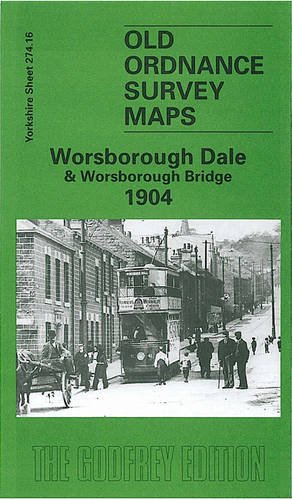
Descrizione libro No Binding. Condizione: New. No Jacket. ere are the details of maps for Worsborough Dale: Yorkshire Sheet 274.16 Worsborough Dale & Worsborough Bridge 1904 - published 2001; intro by Melvyn Jones. ISBN.978-1-84151-268-6 This detailed map covers the the villages of Worsborough Bridge and Worsborough Dale, just south of Barnsley. Coverage of the map goes from Darley Cliff southward to Worsborough Dale Mills, and from Vernon Road eastward to Swaithe. The GCR Worsborough Branch crosses the map, roughly parallel with the Sheffield & South Yorkshire Navigation which leads to the Dearne & Dove Canal; short stretches of other lines are in the SE corner including Dovecliffe station. Tramways to both Worsborough Bridge and Worsborough Dale are shown. Features include Worsborough Bridge, Worsborough Basin (with rail incline), Glass House Crossing, Marrow House, Dearne & Dove Saw Mills, Goose Hulls Bridge, St Thomas church, Yews Lane Quarry, Hollin Well, Lower Lewden, Lewden Hill. Directories of both villages are included. The map links up with sheets 274.08 Barnsley SE to the north, 275.13 Wombwell NW to the east. Codice articolo 005769
Compra nuovo
EUR 3,28
Convertire valuta