
Importo totale (1 articolo articoli):
Destinazione ordine:

VAN DER KROGT, P C J ; (28 risultati)
Vai alla pagina principale dei risultati di ricerca
Tipo di articolo
- Tutti gli articoli
- Libri (28)
- Riviste e Giornali
- Fumetti
- Spartiti
- Arte, Stampe e Poster
- Fotografie
- Mappe
-
Manoscritti e
Collezionismo cartaceo
Condizioni
Legatura
Ulteriori caratteristiche
- Prima edizione (4)
- Copia autografata
- Sovraccoperta (3)
- Con foto (8)
- No print on demand
Spedizione gratuita
Paese del venditore
Valutazione venditore
-
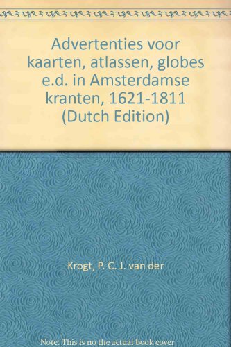
Advertenties voor kaarten, atlassen, globes e.d. in Amsterdamse kranten, 1621-1811.
Editore: Hes & De Graff Pub B V, 1985
ISBN 10: 9061940559ISBN 13: 9789061940555
Da: Kloof Booksellers & Scientia Verlag, Amsterdam, Paesi Bassi
Membro dell'associazione: ILAB NVVA
Valutazione venditore:

Libro
Condizione: very good. With an introduction in English & Dutch. Utrecht : H&S, 1985. Orig. cloth binding. xvi,472 pp. Lists 2093 advertisments for maps, atlasses, globes, etc in Amsterdam newspapers between 1621-1811. Condition : very good copy. ISBN 9789061940555. Keywords : ,
Ulteriori offerte da altri venditori AbeBooks
Usato - A partire da EUR 16,95
-
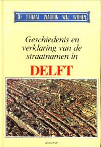
Geschiedenis en verklaring van de straatnamen in Delft
Editore: Kruseman's Uitg. Mij., Den Haag, 1985
ISBN 10: 9023305434ISBN 13: 9789023305439
Libro
Gebonden. Condizione: Boek goed. 142 pp. Met talrijke zwart-wit illustraties.
-

Geschiedenis en verklaring van de straatnamen in Delft.
Da: Rob Kok Old Books & Prints, Loosdrecht, NH, Paesi Bassi
Valutazione venditore:
Den Haag, Kruseman, 1985. 232 blz. Geďll. Gebonden. Fraai. #9023305434. (De straat waarin wij wonen - Deel 5). [64677].
-
Hollandse stam- en naamreeksen.
Editore: Delft-Rotterdam, Genealogische Vereniging Prometheus-TU-Ons Voorgeslacht. 1990, 1990
Da: Antiquariaat Schot, Hendrik-Ido-Ambacht, Paesi Bassi
Valutazione venditore:

Original publisher's sewn yellow paperback, black lettering spine and frontcover, coat-of-arms frontcover, large 8vo: VI, 274pp., illustrations, notes & references, abbreviations, addresses authors, index family names, index first names & patronyms. Very fine copy.
-
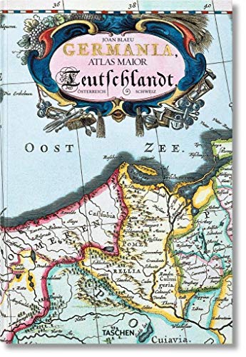
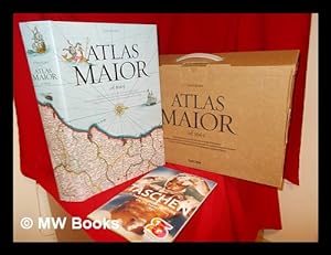
Germania : Atlas maior of 1665 ; 100 Tafeln mit Karten von Germanien, Österreich und der Schweiz, sowie Originaltexte von Joan Blaeu aus seinem Atlas Major von 1665, "dem grössten und prachtvollsten Atlas, der jemals veröffentlicht wurde" ; nach dem Original aus der Österreichischen Nationalbibliothek, Wien = Deutschland / Joan Blaeu ; Einführung und Texte von Peter van der Krogt ; directed and produced by Benedikt Taschen
Editore: Köln : Taschen, 2015
ISBN 10: 3836522926ISBN 13: 9783836522922
Libro
Broschur, 25,5 x 38 cm. Condizione: Gut. 4. 1 Atlas (235 Seiten) ; 39 cm Gebraucht; gut. Leichte Gebrauchsspuren. 200737556 Sprache: Deutsch Gewicht in Gramm: 1600.
-
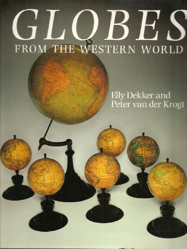
Globes from the Western World
Editore: Antique Collectors Club Limited, 1993
ISBN 10: 0302006184ISBN 13: 9780302006184
Libro
Hardcover. Condizione: Very Good. Condizione sovraccoperta: Very Good. This is a clean copy. There are no markings to the text. There is some very minor shelf and handling wear to the cover.
-
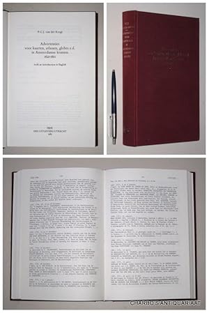
Advertenties voor kaarten, atlassen, globes e.d. in Amsterdamse kranten 1621-1811.
Editore: Utrecht, HES, 1985., 1985
Da: Charbo's Antiquariaat, Amsterdam, Paesi Bassi
Membro dell'associazione: ILAB NVVA
Valutazione venditore:
XV+473 pp. Regs. Gebonden. Linnen. Goed ex. (Spoortje van sticker onderop rug).
-
Hollandse Stam- en Naamreeksen. II.
Da: Antiquariaat A. Kok & Zn. B.V., Amsterdam, Paesi Bassi
Membro dell'associazione: ILAB NVVA
Valutazione venditore:
Rotterdam, 1990. 256 pp. B./w. ills. Softcover.
-
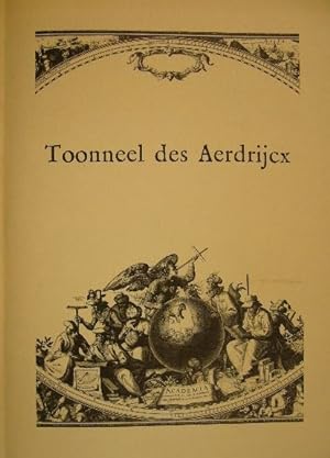
Tooneel des aerdrijcx. Catalogus bij de tentoonstelling oude kaarten in het Universiteitsmuseum ter gelegenheid van het 75-jarig bestaan van het Geografisch Instituut Rijksuniversiteit Utrecht.
Da: Gert Jan Bestebreurtje Rare Books (ILAB), Vianen, Paesi Bassi
Membro dell'associazione: ILAB NVVA
Valutazione venditore:
Utrecht, Universiteitsmuseum, 1983. Folio. Wrappers. With illustrations. 76 pp.
-
Advertenties Voor Kaarten, Atlassen Globes E. D. In Amsterdamse Kranten 1621 to 1811
Editore: Hes Uitgevers, Utrecht, 1985
Prima edizione
Hardcover. Condizione: Very Good. No Jacket. First Edition. Previous owner's book plate to front paste down. Text in Dutch.This book is heavy and will attract postal surcharges. A00011360.
-
Hollandse Stam- en Naamreeksen.
Da: Antiquariaat A. Kok & Zn. B.V., Amsterdam, Paesi Bassi
Membro dell'associazione: ILAB NVVA
Valutazione venditore:
Rotterdam, 1988-1990. 2 vols. 274,256 pp. B./w. ills. Ůniform softcover.
-
Het kartografische werk van de theoloog-historicus Franciscus Haraeus (ca. 1555 - 1631).
Da: Antiquariaat Wim de Goeij, Kalmthout, ANTW, Belgio
Membro dell'associazione: ILAB
Valutazione venditore:
2. Sint-Niklaas, 1984, in-8°, (51 pp), sewn, b/w ills, with 1 extra loose map. (seperate off-print from the periodical Annalen v.d. Kon. Oudh. Kring van het Land van Waas).
-
De stadsplattegronden van Jacob van Deventer. Map 3: Nederland / Noord-Holland.
Da: Antiquariaat A. Kok & Zn. B.V., Amsterdam, Paesi Bassi
Membro dell'associazione: ILAB NVVA
Valutazione venditore:
Weesp, Robas, [etc.], 1993. 2 parts in 1. [23] loose pages with text by C. Koeman, J,C, Visser & P.C.J van der Krogt. B./w. ills. In paper wrappers. + 24 loose col. plts (most double-page) in paper wrappers. Together in orig. hardcover portfolio (gilt lettered green cloth. Folio. Collection of coloured reproductions of manuscript maps by Jacob van Deventer. Each map with descriptions on seperate leaves by various authors. - The collection containes maps of Alkmaar, Beverwijk, Amsterdam, Edam, Enkhuizen, Grootebroek, Haarlem, Hoorn, Medemblik, Monnickendam, Naarden, Purmerend, Weesp & Muiden. - Text in Dutch.
-
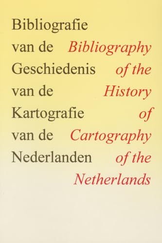
BIBLIOGRAPHY OF THE HISTORY OF CARTOGRAPHY OF THE NETHERLANDS
Editore: HES & DE GRAAF PUBLISHERS BV, 1993
ISBN 10: 906194158XISBN 13: 9789061941583
Libro Prima edizione
Encuadernación de tapa blanda. Condizione: Nuevo. 1Ş Edición. KROGT, P. VAN DER & AL., EDS.: BIBLIOGRAPHY OF THE HISTORY OF CARTOGRAPHY OF THE NETHERLANDS. UTRECHT, 1993, 418 p. , 740 gr. Encuadernacion original. Nuevo. (GG-1-6) 740 gr. Libro.
-
BIBLIOGRAFIE VAN DE GESCHIEDENIS VAN DE KARTOGRAFIE V/D NEDERLANDEN,
Editore: Antwerpen De Vries
Da: BOOKSELLER - ERIK TONEN BOOKS, Antwerpen, Belgio
Membro dell'associazione: ILAB
Valutazione venditore:
Paperback. ISBN 9789061941583. Nieuw. 0 g.
-

Atlas maior of 1665 / Joan Blaeu ; introduction and texts by Peter van der Krogt ; based on the copy in the Osterreichische Nationalbibliothek, Wien ; with a selection of original texts by Joan Blaeu ; directed and produced by Benedikt Taschen
Editore: Hong Kong ; London : Taschen, 2006
Prima edizione
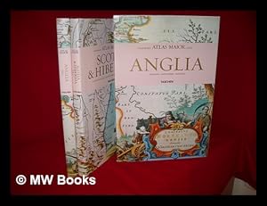
First Edition. Fine copy in the original gilt-blocked cloth boards in a slightly worn slip-case. Particularly and surprisingly well-preserved; tight, bright, clean and especially sharp-cornered. Physical description; 2 v. (392 p.) : ill. (chiefly col., col. maps, col. ports.) ; 39 cm. Notes; In slip case. "All 113 maps of England, Scotland and Ireland, and the original commentaries from Joan Blaeu's Atlas maior of 1665, 'the greatest and finest atlas ever published.'". Includes bibliographical references and index. Contents; Incomplete contents v. 1. Anglia = England -- v. 2. Scotia & Hibernia = Scotland and Ireland. Summary; This work contains maps of England, Ireland, and Scotland from Joan Blaeu's exquisite world atlas of 1665. "The Atlas Maior", the cartographical masterpiece of the Baroque period, was brought out between 1662 and 1665 by the Amsterdam publisher Joan Blaeu, one of Holland's leading cartographers. Originally appearing in Latin, the atlas comprised 594 maps in 11 volumes, which depicted the whole of the world as known to early modern Europe. It was the largest and most expensive book published during the 17th century. For more than 100 years, it remained the definitive atlas of the world, and today is among the most sought-after and valuable antiquarian rarities. This reprinted edition in six volumes is based on the hand-colored, gold-heightened copy in the "Osterreichische Nationalbibliothek" in Vienna, thus ensuring the best possible detail and quality. Alongside Joan Blaeu's original commentaries on the individual maps, a new text by Peter van der Krogt explains the historical and cultural associations and introduces the reader to the fascinating world of early modern cartography. This two-volume set features all 58 maps of England and 55 maps of Scotland and Ireland and the text is in English, French, and German. Subjects; Scales differ. England - Maps - Early works to 1800. Ireland - Maps - Early works to 1800. Scotland - Maps - Early works to 1800. Travel / road maps & atlases. Antiques & collectables: pictures, prints & maps. England ; Scotland ; Ireland. Reference / Atlases, Gazetteers & Maps. Technology & Engineering / Cartography. Technology & Engineering / History. 10 Kg.
-
Atlas maior of 1665 / Joan Blaeu ; introduction and texts by Peter van der Krogt ; based on the copy in the Osterreichische Nationalbibliothek, Wien ; with a selection of original texts by Joan Blaeu ; directed and produced by Benedikt Taschen
Editore: Hong Kong ; London : Taschen, 2006
Prima edizione
First Edition. Fine copy in the original gilt-blocked cloth boards in a slightly worn slip-case. Particularly and surprisingly well-preserved; tight, bright, clean and especially sharp-cornered. Physical description; 2 v. (392 p.) : ill. (chiefly col., col. maps, col. ports.) ; 39 cm. Notes; In slip case. "All 113 maps of England, Scotland and Ireland, and the original commentaries from Joan Blaeu's Atlas maior of 1665, 'the greatest and finest atlas ever published.'". Includes bibliographical references and index. Contents; Incomplete contents v. 1. Anglia = England -- v. 2. Scotia & Hibernia = Scotland and Ireland. Summary; This work contains maps of England, Ireland, and Scotland from Joan Blaeu's exquisite world atlas of 1665. "The Atlas Maior", the cartographical masterpiece of the Baroque period, was brought out between 1662 and 1665 by the Amsterdam publisher Joan Blaeu, one of Holland's leading cartographers. Originally appearing in Latin, the atlas comprised 594 maps in 11 volumes, which depicted the whole of the world as known to early modern Europe. It was the largest and most expensive book published during the 17th century. For more than 100 years, it remained the definitive atlas of the world, and today is among the most sought-after and valuable antiquarian rarities. This reprinted edition in six volumes is based on the hand-colored, gold-heightened copy in the "Osterreichische Nationalbibliothek" in Vienna, thus ensuring the best possible detail and quality. Alongside Joan Blaeu's original commentaries on the individual maps, a new text by Peter van der Krogt explains the historical and cultural associations and introduces the reader to the fascinating world of early modern cartography. This two-volume set features all 58 maps of England and 55 maps of Scotland and Ireland and the text is in English, French, and German. Subjects; Scales differ. England - Maps - Early works to 1800. Ireland - Maps - Early works to 1800. Scotland - Maps - Early works to 1800. Travel / road maps & atlases. Antiques & collectables: pictures, prints & maps. England ; Scotland ; Ireland. Reference / Atlases, Gazetteers & Maps. Technology & Engineering / Cartography. Technology & Engineering / History. 10 Kg.
-
De stadsplattegronden van Jacob van Deventer, ca. 1558-1570. Nederland: Noord-Brabant en Limburg [ = Map 8].
Editore: Alphen aan den Rijn, Canaletto 1998, 1998
Da: Antiquariaat Schot, Hendrik-Ido-Ambacht, Paesi Bassi
Valutazione venditore:
Original publisher's green cloth-covered board portfolio, gilt lettering spine & frontcover, folio: I: Kaartbeschrijvingen: [34] pages text with descriptions - notes & references & map depicted in miniature in black & white - all in cover. II: Reproduction: 21 maps in cover [Nood-Brabant: Bergen op Zoom - Eindhoven - Geertruidenberg [2X] - Helmond - 's Hertogenbosch - Heusden [2X] - Megen - Zevenbergen - Gorinchem [2X]. Limburg: Echt [2X] - Montfoort [2X] - Roermond - Valkenburg - Venlo [2X] - Weert] Very fine complete set., Volume 8: NEDERLAND: Noord Brabant en Limburg.
-
Testamenten verleden voor schepenen van Delft 1536-1691, 2e druk, Delft 1988, 123 pag.
Da: Antiquariaat Arine van der Steur / ILAB, Den Haag, Paesi Bassi
Membro dell'associazione: ILAB NVVA
Valutazione venditore:
Testamenten verleden voor schepenen van Delft 1536-1691, 2e druk, Delft 1988, 123 pag.
-
Hoofddirectie van de Dienst van het Kadaster en de Openbare Registers, 1981, soft cover, three volumes: deel 1, deel 2, Index (by Van der Krogt).
-
Hoofddirectie van de Dienst van het Kadaster en de Openbare Registers, 1981, soft cover, four volumes: deel 1, deel 2, Index (by Van der Krogt) and Landmeters van de Kadastrering van Nederland (by Teeling). Complete set.
-
Atlas maior of 1665 : "the greatest and finest atlas ever published" = "Der grösste und prachtvollste Atlas, der jemals veröffentlich wurde" = "L'atlas le plus grand et le plus admirable jamais publie" / Joan Blaeu ; introduction and texts by Peter van der Krogt ; based on the copy in the Österreichische Nationalbibliothek, Vienna ; with a selection of original texts by Joan Blaeu ; directed and produced by Benedikt Taschen
Editore: Köln : Taschen, 2005
ISBN 10: 3822831255ISBN 13: 9783822831250
Libro
Facsimile Edition. Fine cloth copy in a near fine, very slightly edge-nicked and dust-dulled dust wrapper, now mylar-sleeved. Includes the publisher's cardboard casing. Remains particularly and surprisingly well-preserved; tight, bright, clean and sharp-cornered. Also includes the Taschen Summer 2005 catalogue in the publisher's cardboard casing. Physical description; 1 atlas (593 p.) : col ill., many col. maps, folded plates ; 45 cm. Notes; Facsimile / reprint. Includes bibliographical references (p. 593) and index. Text in English, German and French; translated from the Dutch. Subjects; Atlases Netherlands ; Early works to 1800 ; Facsimiles. Cartography History. Atlases Netherlands ; Early works to 1800. Early maps ; Facsimiles. Atlases, Dutch ; Early works to 1800. World 1665 ; Atlases. Scales differ. Genre; Atlas. 6 Kg.
Ulteriori offerte da altri venditori AbeBooks
Usato - A partire da EUR 150,00
-
De stadsplattegronden van Jacob van Deventer. Map 1 t/m 8: 1: Zuid-Holland; 2: Utrecht; 3: Noord-Holland; 4: Friesland; 5: Overijssel, Drenthe & Groningen; 6: Gelderland; 7: Zeeland; 8: Noord-Brabant & Limburg
Editore: Canaletto, Alphen a/d Rijn
Da: Bij tij en ontij ..., Kloosterburen, NL, Paesi Bassi
Valutazione venditore:
Linnen band, 52 cm. Ills.: kaarten. Zeer fraaie kaarten en met begeleidende teksten. Cond.: goed / good.
-
GLOBI NEERLANDICI,
Editore: Antwerp De Vries
Da: BOOKSELLER - ERIK TONEN BOOKS, Antwerpen, Belgio
Membro dell'associazione: ILAB
Valutazione venditore:
Bound, 647pp. ISBN 9789061941385. The production of globes in the Low Countries. Globi Neerlandici is the first comprehensive study of globe production in the Netherlands. This work covers the early globemakers in the first half of the sixteenth century to the mass production in the nineteenth and twentieth centuries. Each globe is extensively described with over 572 illustrations. New. 0 g.
-
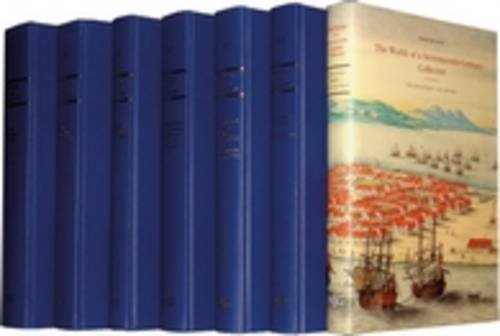
The Atlas Blaeu-Van der Hem of the Austrian National Library. History of the Atlas and the making of the facsimile [6 Volumes Complete Set]
Editore: t Goy-Houten-The Hague, HES & De Graaf Publishers-Brill. 1996-2006, 1996
ISBN 10: 9061942586ISBN 13: 9789061942580
Da: Antiquariaat Schot, Hendrik-Ido-Ambacht, Paesi Bassi
Valutazione venditore:
Libro
Original publisher's blue cloth hardback, gilt lettering spine & frontcover, 4to: Vol. I: Spain, Portugal and France: 582 illustrations. Vol. II: Italy, Malta, Switzerland and The Netherlands: 557 illustrations. Vol. III: The British Isles, northern & Southern Europe: 511 illustrations. Vol. IV: Holy Roman Empirte, Hungary, Greece, Constantinopel, Smyrna and Bible Maps: 708pp., 636 illustrations. Vol. V: Africa, Asia and America, including the 'Secret"Atlas of the VOC: 590 illustrations. Vol. VI: Descriptive catalogue of the atlas & general indices: 592pp., 303 illustrations. 6 Volumes, ca. 3400 illustrations, very richly illustrated, descriptions of maps, notes & references, index, colophon. Very fine complete set - as new.
