
Importo totale (1 articolo articoli):
Destinazione ordine:

krogt der taschen benedikt (6 risultati)
Vai alla pagina principale dei risultati di ricerca
Tipo di articolo
- Tutti gli articoli
- Libri (6)
- Riviste e Giornali
- Fumetti
- Spartiti
- Arte, Stampe e Poster
- Fotografie
- Mappe
-
Manoscritti e
Collezionismo cartaceo
Condizioni
- Tutte
- Nuovi
- Antichi o usati
Legatura
- Tutte
- Rilegato
- Brossura
Ulteriori caratteristiche
- Prima edizione (2)
- Copia autografata
- Sovraccoperta (3)
- Con foto (4)
- No print on demand
Spedizione gratuita
Paese del venditore
Valutazione venditore
-
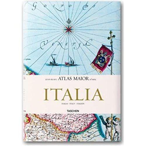
Atlas Maior of 1665 - Italia / Italy / Italien
Editore: TASCHEN, 2006
ISBN 10: 3822851078ISBN 13: 9783822851074
Da: Michener & Rutledge Booksellers, Inc., Baldwin City, KS, U.S.A.
Valutazione venditore:

Libro
Hardcover. Condizione: Very Good. Condizione sovraccoperta: Very Good. Text clean and solid; light wear to dust jacket; NOTE: additional postage may be necessary for international shipping; 8vo 8" - 9" tall; 208 pages.
-
hardcover. Condizione: Very Good.
-
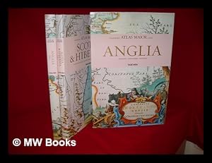
Atlas maior of 1665 / Joan Blaeu ; introduction and texts by Peter van der Krogt ; based on the copy in the Osterreichische Nationalbibliothek, Wien ; with a selection of original texts by Joan Blaeu ; directed and produced by Benedikt Taschen
Editore: Hong Kong ; London : Taschen, 2006
Prima edizione
First Edition. Fine copy in the original gilt-blocked cloth boards in a slightly worn slip-case. Particularly and surprisingly well-preserved; tight, bright, clean and especially sharp-cornered. Physical description; 2 v. (392 p.) : ill. (chiefly col., col. maps, col. ports.) ; 39 cm. Notes; In slip case. "All 113 maps of England, Scotland and Ireland, and the original commentaries from Joan Blaeu's Atlas maior of 1665, 'the greatest and finest atlas ever published.'". Includes bibliographical references and index. Contents; Incomplete contents v. 1. Anglia = England -- v. 2. Scotia & Hibernia = Scotland and Ireland. Summary; This work contains maps of England, Ireland, and Scotland from Joan Blaeu's exquisite world atlas of 1665. "The Atlas Maior", the cartographical masterpiece of the Baroque period, was brought out between 1662 and 1665 by the Amsterdam publisher Joan Blaeu, one of Holland's leading cartographers. Originally appearing in Latin, the atlas comprised 594 maps in 11 volumes, which depicted the whole of the world as known to early modern Europe. It was the largest and most expensive book published during the 17th century. For more than 100 years, it remained the definitive atlas of the world, and today is among the most sought-after and valuable antiquarian rarities. This reprinted edition in six volumes is based on the hand-colored, gold-heightened copy in the "Osterreichische Nationalbibliothek" in Vienna, thus ensuring the best possible detail and quality. Alongside Joan Blaeu's original commentaries on the individual maps, a new text by Peter van der Krogt explains the historical and cultural associations and introduces the reader to the fascinating world of early modern cartography. This two-volume set features all 58 maps of England and 55 maps of Scotland and Ireland and the text is in English, French, and German. Subjects; Scales differ. England - Maps - Early works to 1800. Ireland - Maps - Early works to 1800. Scotland - Maps - Early works to 1800. Travel / road maps & atlases. Antiques & collectables: pictures, prints & maps. England ; Scotland ; Ireland. Reference / Atlases, Gazetteers & Maps. Technology & Engineering / Cartography. Technology & Engineering / History. 10 Kg.
-
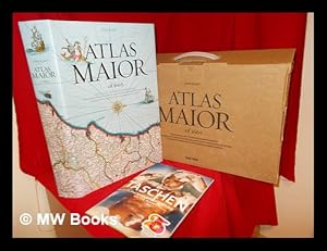
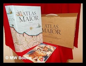
Atlas maior of 1665 : "the greatest and finest atlas ever published" = "Der grösste und prachtvollste Atlas, der jemals veröffentlich wurde" = "L'atlas le plus grand et le plus admirable jamais publie" / Joan Blaeu ; introduction and texts by Peter van der Krogt ; based on the copy in the Österreichische Nationalbibliothek, Vienna ; with a selection of original texts by Joan Blaeu ; directed and produced by Benedikt Taschen
Editore: Köln : Taschen, 2005
ISBN 10: 3822831255ISBN 13: 9783822831250
Libro
Facsimile Edition. Fine cloth copy in a near fine, very slightly edge-nicked and dust-dulled dust wrapper, now mylar-sleeved. Includes the publisher's cardboard casing. Remains particularly and surprisingly well-preserved; tight, bright, clean and sharp-cornered. Also includes the Taschen Summer 2005 catalogue in the publisher's cardboard casing. Physical description; 1 atlas (593 p.) : col ill., many col. maps, folded plates ; 45 cm. Notes; Facsimile / reprint. Includes bibliographical references (p. 593) and index. Text in English, German and French; translated from the Dutch. Subjects; Atlases Netherlands ; Early works to 1800 ; Facsimiles. Cartography History. Atlases Netherlands ; Early works to 1800. Early maps ; Facsimiles. Atlases, Dutch ; Early works to 1800. World 1665 ; Atlases. Scales differ. Genre; Atlas. 6 Kg.
-
Atlas maior of 1665 : "the greatest and finest atlas ever published" = "Der grösste und prachtvollste Atlas, der jemals veröffentlich wurde" = "L'atlas le plus grand et le plus admirable jamais publie" / Joan Blaeu ; introduction and texts by Peter van der Krogt ; based on the copy in the Österreichische Nationalbibliothek, Vienna ; with a selection of original texts by Joan Blaeu ; directed and produced by Benedikt Taschen
Editore: Köln : Taschen, 2005
ISBN 10: 3822831255ISBN 13: 9783822831250
Libro
Facsimile Edition. Fine cloth copy in a near fine, very slightly edge-nicked and dust-dulled dust wrapper, now mylar-sleeved. Includes the publisher's cardboard casing. Remains particularly and surprisingly well-preserved; tight, bright, clean and sharp-cornered. Also includes the Taschen Summer 2005 catalogue in the publisher's cardboard casing. Physical description; 1 atlas (593 p.) : col ill., many col. maps, folded plates ; 45 cm. Notes; Facsimile / reprint. Includes bibliographical references (p. 593) and index. Text in English, German and French; translated from the Dutch. Subjects; Atlases Netherlands ; Early works to 1800 ; Facsimiles. Cartography History. Atlases Netherlands ; Early works to 1800. Early maps ; Facsimiles. Atlases, Dutch ; Early works to 1800. World 1665 ; Atlases. Scales differ. Genre; Atlas. 6 Kg.