
Importo totale (1 articolo articoli):
Destinazione ordine:

g s c calgary (1 risultati)
Feedback
Vai alla pagina principale dei risultati di ricerca
Filtri di ricerca
Tipo di articolo
- Tutti i tipi di prodotto
- Libri (1)
- Riviste e Giornali (Nessun altro risultato corrispondente a questo perfezionamento)
- Fumetti (Nessun altro risultato corrispondente a questo perfezionamento)
- Spartiti (Nessun altro risultato corrispondente a questo perfezionamento)
- Arte, Stampe e Poster (Nessun altro risultato corrispondente a questo perfezionamento)
- Fotografie (Nessun altro risultato corrispondente a questo perfezionamento)
- Mappe (Nessun altro risultato corrispondente a questo perfezionamento)
- Manoscritti e Collezionismo cartaceo (Nessun altro risultato corrispondente a questo perfezionamento)
Condizioni
- Tutte
- Nuovi (Nessun altro risultato corrispondente a questo perfezionamento)
- Antichi o usati (1)
Legatura
- Tutte
- Rilegato (Nessun altro risultato corrispondente a questo perfezionamento)
- Brossura (1)
Ulteriori caratteristiche
- Prima ed. (Nessun altro risultato corrispondente a questo perfezionamento)
- Copia autograf. (Nessun altro risultato corrispondente a questo perfezionamento)
- Sovracoperta (Nessun altro risultato corrispondente a questo perfezionamento)
- Con foto (1)
- Non Print on Demand (1)
Spedizione gratuita
- Spedizione gratuita in Italia (Nessun altro risultato corrispondente a questo perfezionamento)
Valutazione venditore
-
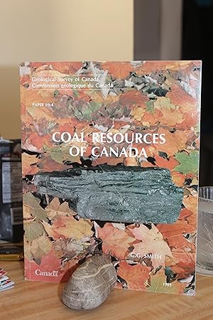
Coal Resources of Canada
Editore: G. S. C., Calgary, 1989
ISBN 10: 0660130858 ISBN 13: 9780660130859
Da: Wagon Tongue Books, Linden, AB, Canada
Valutazione del venditore 4 su 5 stelle

Soft cover. Condizione: Very Good ++. Maps (illustratore). Paper 89-4. 146 page technical document on the coal prospects of Canada from Vancouver Island to the Minas Basin. Large section of Supplemental Reading on page 143, index on page 133, glossary ahead of that . Illustrated largely by maps of the individual producing regions - see Bonnet Plume and Onakawana. A few colour photographs add flavour. Tabular data on such themes as chemical analyses and grindability. LEARN more about : Outer Foothills Belt, Comox Formation, peat forming, loadout, claystones, Tertiary, and calorific. Cond : Paper wrapper is black with white lettering. Front cover graphic is a chunk of sub-bituminous resting on a bed of autumn maple leaves. Very minor wear at lead edges and corners. No names nor marks nor tears. Tight, bright, square, and clean. Excellent reference ! Quote (p. 75) : " The Belly River Group, also referred to as the Judith River Formation, was deposited as an eastward-thinning clastic wedge in southern Alberta, in floodplains and several coalescing deltas between the shore of the regressing epicontinental Pakowki Sea and the newly elevated ._._._. ." Size: 4to.