
Importo totale (1 articolo articoli):
Destinazione ordine:

george philip and son limited london (375 risultati)
Vai alla pagina principale dei risultati di ricerca
Tipo di articolo
- Tutti gli articoli
- Libri (332)
- Riviste e Giornali
- Fumetti
- Spartiti
- Arte, Stampe e Poster
- Fotografie
- Mappe (42)
-
Manoscritti e
Collezionismo cartaceo (1)
Condizioni
Legatura
Ulteriori caratteristiche
- Prima edizione (91)
- Copia autografata (2)
- Sovraccoperta (46)
- Con foto (191)
- No print on demand
Spedizione gratuita
Paese del venditore
Valutazione venditore
-
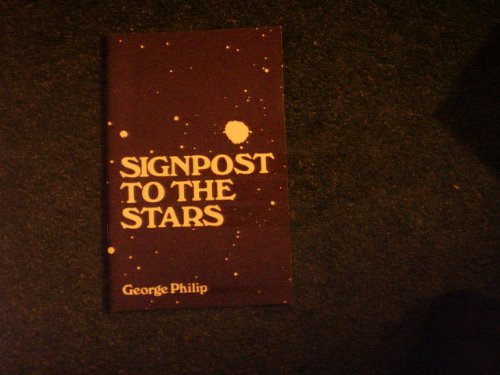
Signpost to the Stars
Editore: George Philip and Son Limited, London, 1980
ISBN 10: 0540002143ISBN 13: 9780540002146
Libro Prima edizione
Staple Bound Soft Cover. Condizione: Fair. Fourth Edition. Wraps are scuffed and rubbed moderate edgewear. Pages are clean & text is free from markings. Size: 12mo - over 6ľ" - 7ľ" tall.
-

Paperback. Condizione: Good. No Jacket. Soft cover, sewn binding as issued. 1960. Tanned wraps, small open tears at front corners. Small sticker scuff. Firmly bound. Clean, unmarked pages. Good condition.
-
Zodiac Road Atlas of Great Britain
Editore: George Philip & Son, Ltd. & Bemrose & Sons Ltd., London & Derby, 1975
Da: Charles Lewis Best Booksellers, San Diego, CA, U.S.A.
Valutazione venditore:

Hardcover. Royal octavo, [25cm/10in], fully bound sans dust jacket, pp. 120. 78 town plans, 18 maps of London and Approaches, Town Index, and London Street Index. All are colour maps. An advertising promotion for Protective Footwear Service, Ltd. , Kingswood, Bristol. Quite Nice In exceptionally good condition.
-
England, A Social and Economic History, 1485-1600 Book IV (4)
Editore: George Philip & Son Limited, London & Liverpool, 1948
Libro
Hardcover. Condizione: Very Good. pp.xi, 249 pages, a very good hardback, publisher's original green cloth binding with black lettering to the spine and front cover, ex-library.
-
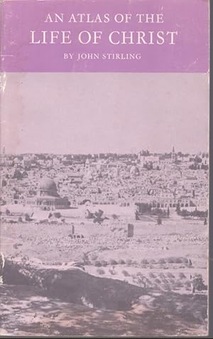
AN ATLAS OF THE LIFE OF CHRIST
Editore: George Philip & Son Limited, London, 1966
Da: Neil Shillington: Bookdealer/Booksearch, Hobe sound, FL, U.S.A.
Valutazione venditore:

Booklet. Condizione: Very Good-. Illustrated by Maps (illustratore). 4th printing. 27 pages.
-
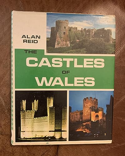
THE CASTLES OF WALES
Editore: George Philip & Son, Ltd., London, UK, 1973
ISBN 10: 0540070521ISBN 13: 9780540070527
Libro
Cloth. Condizione: Near Fine. Condizione sovraccoperta: Near Fine. In The Castles of Wales, Alan Reid describes, in alphabetical order, all the important castles of Welsh history, and many of the most obscure. the potential visitor will find brief directions for finding each site, and useful information on ownership, public access, main surviving features of interest, admission fees, and so forth. He also gives the story of each castle. In brief introductory chapters, the author outlines the main sequences of events which shaped Welsh history in the relevant period, to provide framework for the non-Welsh reader who may be confused by the constant recurrence of certain names and dates; and a simple description of the main features of castles of the day, with an explanation of the most frequently quoted terms. Included are many photographs, a glossary, and a chronology. This copy is clean and solid.
-
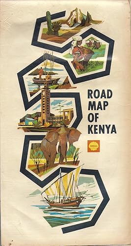
Shell Folded Road Map of Kenya 1968
Editore: George Philip & Son Ltd., London, 1968
Da: Charles Lewis Best Booksellers, San Diego, CA, U.S.A.
Valutazione venditore:
Copia autografata
Folded Map. Folded Road Map, (36 by 20.5 inches). Please feel free to inquire as to particulars and/or additional photographs. . The first direct elections for native Kenyans to the Legislative Council took place in 1957. Despite British hopes of handing power to "moderate" local rivals, it was the Kenya African National Union (KANU) of Jomo Kenyatta that formed a government. The Colony of Kenya and the Protectorate of Kenya each came to an end on 12 December 1963 with independence being conferred on all of Kenya. The United Kingdom ceded sovereignty over the Colony of Kenya. The Sultan of Zanzibar agreed that simultaneous with independence for the Colony of Kenya, the Sultan would cease to have sovereignty over the Protectorate of Kenya so that all of Kenya would be one sovereign, independent state.[54][55] In this way, Kenya became an independent country under the Kenya Independence Act 1963 of the United Kingdom. Exactly 12 months later on 12 December 1964, Kenya became a republic under the name "Republic of Kenya".[54] Concurrently, the Kenyan army fought the Shifta War against ethnic Somali rebels inhabiting the Northern Frontier District, who wanted to join their kin in the Somali Republic to the north.[56] A ceasefire was eventually reached with the signature of the Arusha Memorandum in October 1967, but relative insecurity prevailed through 1969.[57][58] To discourage further invasions, Kenya signed a defence pact with Ethiopia in 1969, which is still in effect.[ Please feel free to inquire as to particulars and/or additional photographs.
-
Elementry Atlas Western Edition of Scotland Edition
Editore: George Philip & Son Ltd., London, 1962
Da: Charles Lewis Best Booksellers, San Diego, CA, U.S.A.
Valutazione venditore:
Condizione: In quite good condition. 100th Edition. Demy folio, [27.75cm/11in], paperbound with pictorial covers, unpaginated. Fully illustrated with 40 color maps.
-
PHILIPS' SCRIPTURE ATLAS
Editore: George Philip and Son Limited, London, 1962
Da: Neil Shillington: Bookdealer/Booksearch, Hobe sound, FL, U.S.A.
Valutazione venditore:
Hardback. Condizione: Good. There is some light age wear on the cover.; B&W Photographs; 16 pages.
-
A Brief History of Our Own Times
Editore: George Philip & Son, LTD., London, 1934
Da: PsychoBabel & Skoob Books, Didcot, Oxfordshire, OXON, Regno Unito
Valutazione venditore:
Prima edizione
Hardcover. Condizione: Good. Condizione sovraccoperta: No Dust Jacket. First Edition. Hardcover. Clean Copy.
-
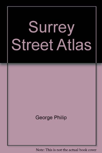
Surrey Street Atlas
Editore: George Philip & Son Ltd, London, 1986
ISBN 10: 0540055069ISBN 13: 9780540055067
Libro
Eleventh Edition. Decorated HrdCvr, no dj, new edition, VG, sm 4to.
-

Shell Touring Atlas of Great Britain
Editore: London: George Philip and Son Ltd. , 1981., 1981
ISBN 10: 054005383XISBN 13: 9780540053834
Libro
Hardcover. 4to, 128 p. Color and b/w illus. plus numerous color road maps. Color illus. on cl. binding. Rubbing to corners, bottom edges, and spine crown and heel. Very good- condition. DJ is good with wear and tears to edges and folds.
-
HARDCOVER. Condizione: Very GOOD. Condizione sovraccoperta: Acceptable. 11th edition. 176 pgs plus more color maps and large Index. Clipped jacket and handwritten price in ink on inside front flap next to a publisher sticker with English pounds. Unmarked pages except for previous owners name on first on first blank pg. Jacket is soiled from use, wrinkled and torn at top of spine with heavy wear at all corners. Cloth boards have bumped corners.
-
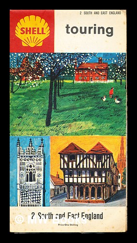
First Edition. Near fine folding map in the original stiff-card wrappers; edges very slightly dust-dulled and toned. Remains particularly and surprisingly well-preserved; tight, bright, clean and especially sharp-cornered. Physical description; 1 folding map. Notes; No clear publication date given. Subjects; South England. East England. Folding maps. Shell Touring Service. 1 Kg.
-
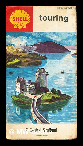
First Edition. Worn fine folding map in the original stiff-card wrappers; edges very slightly dust-dulled and toned. Remains particularly and surprisingly well-preserved; tight, bright, clean and especially sharp-cornered. Physical description; 1 folding map. Notes; No clear publication date given. Subjects; Central Scotland. Folding maps. Shell Touring Service. 1 Kg.
-
Cloth. Condizione: Good-. No Jacket. There is a 2 inch arc of a burn mark that is indented on the back cover near the upper right corner. The covers otherwise have moderate wear, the pages are clean and the binding is a bit loose. Size: 16mo - over 5ľ" - 6ľ" tall.
-

Mouldering Pearl: Hong Kong at the Crossroads.
Editore: George Philip & Son, LTD., London, 1989
ISBN 10: 0540011886ISBN 13: 9780540011889
Da: PsychoBabel & Skoob Books, Didcot, Oxfordshire, OXON, Regno Unito
Valutazione venditore:
Libro Prima edizione
Hardcover. Condizione: Very Good. Condizione sovraccoperta: Good. First Edition. 223pp., maps. closed tear to top of dust jacket. Clean Copy.
-
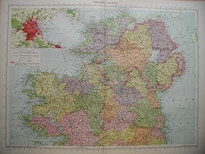
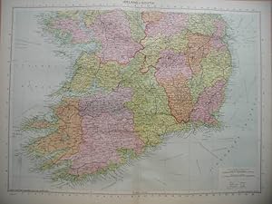
Condizione: Very Good. Colour Map from Philips' International Atlas. Measures approx 15 3/4 x 20 1/2 inches. Centre fold. With an inset map of the Environs of Dublin.
-
Condizione: Very Good. Colour Map from Philips' International Atlas. Measures approx 15 3/4 x 20 1/2 inches. Centre fold.
-
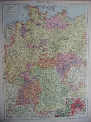
Condizione: Very Good. Colour Map from Philips' International Atlas. Measures approx 20 1/2 x 15 3/4 inches. Centre fold. With an inset map of Berlin.
-
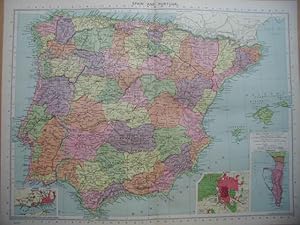
Condizione: Very Good. Colour Map from Philips' International Atlas. Measures approx 15 3/4 x 20 1/2 inches. Centre fold. With inset maps of Lisbon, Madrid & Gibraltar.
-
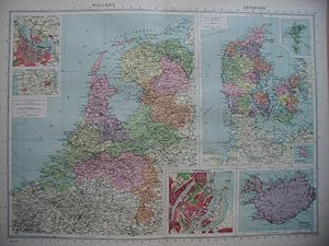
Condizione: Very Good. Colour Map from Philips' International Atlas. Measures approx 15 3/4 x 20 1/2 inches. Centre fold. With inset maps of Amsterdam, North Sea Canal & Copenhagen.
-
Condizione: Very Good. Colour Map from Philips' International Atlas. Measures approx 15 3/4 x 20 1/2 inches. Centre fold.
-
Condizione: Very Good. Colour Map from Philips' International Atlas. Measures approx 15 3/4 x 20 1/2 inches. Centre fold. With an inset map of the Environs of Paris.
-
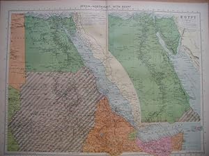
Condizione: Very Good. Colour Map from Philips' International Atlas. Measures approx 15 3/4 x 20 1/2 inches. Centre fold. With inset maps of the Algeria, Tunis and Morocco, & Marseilles.
-
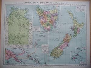
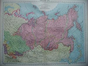
Northern Territory, Tasmania, New Guinea, New Zealand Etc
Editore: George Philip and Son Limited., London., 1940
Mappa
Condizione: Very Good. Colour Map from Philips' International Atlas. Measures approx 15 3/4 x 20 1/2 inches. Centre fold.
-
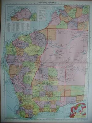
Condizione: Very Good. Colour Map from Philips' International Atlas. Measures approx 20 1/2 x 15 3/4 inches. Centre fold. With an inset map of Perth.
-
Condizione: Very Good. Colour Map from Philips' International Atlas. Measures approx 15 3/4 x 20 1/2 inches. Centre fold.
-
Condizione: Very Good. Colour Map from Philips' International Atlas. Measures approx 15 3/4 x 20 1/2 inches. Centre fold.
-
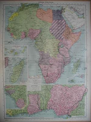
Condizione: Very Good. Colour Map from Philips' International Atlas. Measures approx 20 1/2 x 15 3/4 inches. Centre fold. With inset maps of Guinea, Madagascar, Canary Islands, Mauritius and Reunion.
