
Importo totale (1 articolo articoli):
Destinazione ordine:

trailblazer publications united kingdom hindhead surrey (26 risultati)
Hai cercato:
Casa editrice:
trailblazer publications united kingdom hindhead surrey
Modificare la ricerca
Vai alla pagina principale dei risultati di ricerca
Tipo di articolo
- Tutti gli articoli
- Libri (26)
- Riviste e Giornali
- Fumetti
- Spartiti
- Arte, Stampe e Poster
- Fotografie
- Mappe
-
Manoscritti e
Collezionismo cartaceo
Condizioni
- Tutte
- Nuovi
- Antichi o usati
Legatura
- Tutte
- Rilegato
- Brossura
Ulteriori caratteristiche
- Prima edizione
- Copia autografata
- Sovraccoperta
- Con foto
- No print on demand
Paese del venditore
Valutazione venditore
-
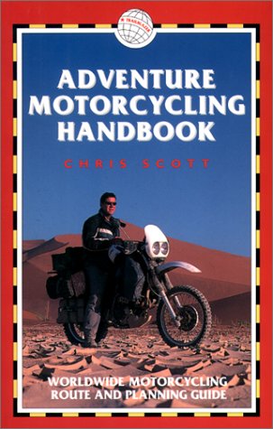
Adventure Motorcycling Handbook
Editore: Trailblazer Publications, United Kingdom, Hindhead, Surrey, 2000
ISBN 10: 1873756372ISBN 13: 9781873756379
Libro
Paperback. Condizione: Very Good. The book has been read, but is in excellent condition. Pages are intact and not marred by notes or highlighting. The spine remains undamaged.
-
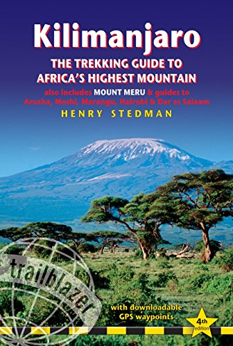
Kilimanjaro: The Trekking Guide to Africa's Highest Mountain (Trailblazer Guide) (Trailblazer Trekking Guides): (Includes Mt Meru and City Guides to Nairobi, Dar Es Salaam, Arusha, Mos
Editore: Trailblazer Publications, United Kingdom, Hindhead, Surrey, 2014
ISBN 10: 190586454XISBN 13: 9781905864546
Libro
Paperback. Condizione: Very Good. At 19,341ft Kilimanjaro is Africa's highest mountain. Yet with no mountaineering skills necessary to reach the summit, even non-climbers can experience the thrill of climbing one of the world's greatest peaks. Includes full practical details - getting to Tanzania and Kenya, town guides and maps to Nairobi, Dar es Salaam, Arusha, Moshi and Marangu. Routes covered on 35 detailed walking maps in the proven Trailblazer style; all walking times are indicated along with points of interest and gradients. This top selling guide from Trailblazer is now in its fourth edition. The book has been read, but is in excellent condition. Pages are intact and not marred by notes or highlighting. The spine remains undamaged.
-
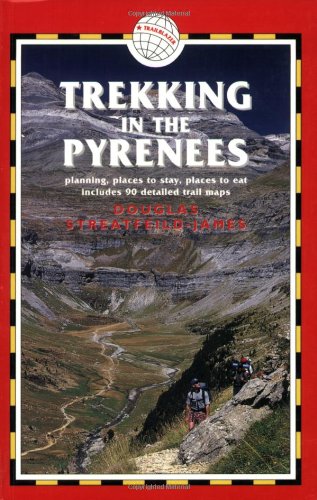
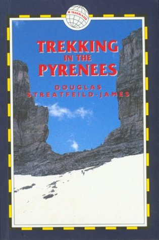
Trekking in the Pyrenees
Editore: Trailblazer Publications, United Kingdom, Hindhead, Surrey, 2005
ISBN 10: 1873756828ISBN 13: 9781873756829
Libro
Paperback. Condizione: Very Good. The book has been read, but is in excellent condition. Pages are intact and not marred by notes or highlighting. The spine remains undamaged.
-
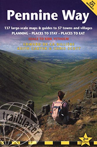
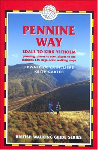
Pennine Way
Editore: Trailblazer Publications, United Kingdom, Hindhead, Surrey, 2008
ISBN 10: 1905864027ISBN 13: 9781905864027
Libro
Paperback. Condizione: Very Good. Hiking route guide to the 256 mile Pennine Way, Britain's best known National Trail. The book has been read, but is in excellent condition. Pages are intact and not marred by notes or highlighting. The spine remains undamaged.
Ulteriori offerte da altri venditori AbeBooks
Usato - A partire da EUR 3,48
-
The Pennine Way (British Walking Guide S.)
Editore: Trailblazer Publications, United Kingdom, Hindhead, Surrey, 2004
ISBN 10: 1873756577ISBN 13: 9781873756577
Libro
Paperback. Condizione: Very Good. The book has been read, but is in excellent condition. Pages are intact and not marred by notes or highlighting. The spine remains undamaged.
-
TRANS Canada Rail Guide
Editore: Trailblazer Publications, United Kingdom, Hindhead, Surrey, 2007
ISBN 10: 1905864019ISBN 13: 9781905864010
Libro
Paperback. Condizione: Very Good. The journey on Canadas transcontinental railway ranks as one of the greatest rail experiences in the world. This guide includes a mile by mile route guide with 25 maps and points of interest indicated along the way. The book has been read, but is in excellent condition. Pages are intact and not marred by notes or highlighting. The spine remains undamaged.
-
Trekking in the Pyrenees
Editore: Trailblazer Publications, United Kingdom, Hindhead, Surrey, 2001
ISBN 10: 187375650XISBN 13: 9781873756508
Libro
Paperback. Condizione: Very Good. The book has been read, but is in excellent condition. Pages are intact and not marred by notes or highlighting. The spine remains undamaged.
-

Japan by Rail
Editore: Trailblazer Publications, United Kingdom, Hindhead, Surrey, 2007
ISBN 10: 1873756976ISBN 13: 9781873756973
Libro
Paperback. Condizione: Very Good. Fully revised second edition, includes full historical background, cultural tips, getting to Japan, where to stay and eat, and timetables. The book has been read, but is in excellent condition. Pages are intact and not marred by notes or highlighting. The spine remains undamaged.
-
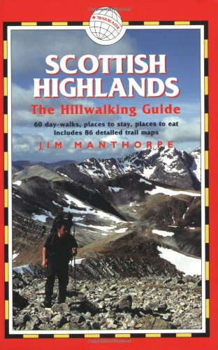
Scottish Highlands (Hillwalking Guide S.)
Editore: Trailblazer Publications, United Kingdom, Hindhead, Surrey, 2005
ISBN 10: 1873756844ISBN 13: 9781873756843
Libro
Paperback. Condizione: Very Good. This guide covers 81 hills and mountains in the Scottish Highlands. Detailed walking maps in the Trailblazer style including tricky trail junctions, walking times and points of interest written onto the maps themselves. It also details places to eat, local sights and a full-colour flora identification section. The book has been read, but is in excellent condition. Pages are intact and not marred by notes or highlighting. The spine remains undamaged.
-
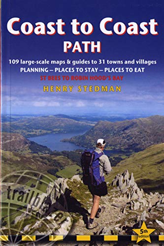
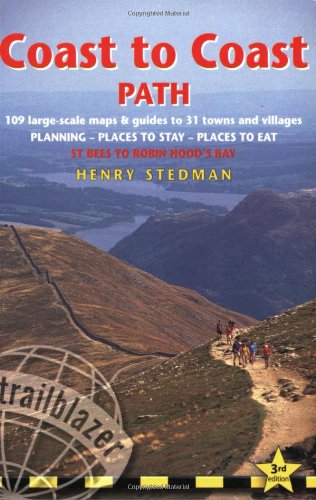
Coast to Coast Path: St Bees to Robin Hood's Bay planning, places to stay, places to eat (Trailblazer British Walking Guide)
Editore: Trailblazer Publications, United Kingdom, Hindhead, Surrey, 2012
ISBN 10: 1905864477ISBN 13: 9781905864478
Libro
Paperback. Condizione: Very Good. Fully revised 5th edition of this classic 191-mile walk across northern England from the Irish Sea to the North Sea, inspired by Alfred Wainwright. Crossing three fabulous national parks - the Lake District, the Yorkshire Dales, and the North York Moors - it samples the very best of the English countryside - rugged mountains and lakes, gentle dales and stone-built villages; wild moorland; sea cliffs and fishing villages. The book has been read, but is in excellent condition. Pages are intact and not marred by notes or highlighting. The spine remains undamaged.
-

Japan by Rail: Includes Rail Route Guide and 26 Town and City Guides (Trailblazer): Includes Rail Route Guide and 30 City Guides
Editore: Trailblazer Publications, United Kingdom, Hindhead, Surrey, 2016
ISBN 10: 1905864752ISBN 13: 9781905864751
Libro
Paperback. Condizione: Very Good. Japan is steeped inlegend and myth, perhaps the greatest of which is the popular misconceptionthat the country is simply too expensive to visit. The truth is that flights to Japan are cheaper than they've ever been, accommodation can be great value, while the warm hospitality which awaits every visitor costs nothing at all. The real secret to travelling around the country on a budget, however, is the Japan RailPass. Use this comprehensive guide in conjunction with a rail pass to get the most out of a trip to Japan. Practical information - planning your trip; when to go; suggested itineraries; what to take; festivals and events City guides and maps - where to stay, where to eat, what to see in 30 towns and cities; historical and cultural background Kilometre-by-kilometre route guides - covering train journeys from the coast into the mountains, from temple retreat to sprawling metropolis; 33 route maps Railway timetables and frequency charts - Bullet trains and main routes Customs, etiquette, Japanese words and phrases -with kanji This new edition also now includes: kanji/hiragana/katakana for all place names mentioned in the book so readers can point to the text when asking Japanese speakers for directions. The extension of the shinkansen route from Nagano toKanazawa. This is now called the Hokuriku shinkansen. Additional side trips from Tokyo including to Kawaguchi-ko for magnificent views of Mt Fuji, and to Mito for Kairakuen, the only one of the three great landscape gardens in Japan not currently mentioned in the book. Expanded coverage of Nikko, Nagasaki, the side trip to Asosan, Beppu, and many places in the Kansai region. The book has been read, but is in excellent condition. Pages are intact and not marred by notes or highlighting. The spine remains undamaged.
-
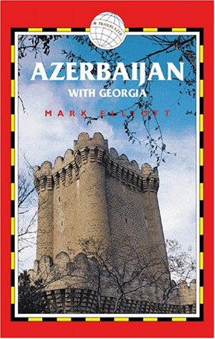
Azerbaijan with Georgia
Editore: Trailblazer Publications, United Kingdom, Hindhead, Surrey, 1999
ISBN 10: 187375633XISBN 13: 9781873756331
Libro
Paperback. Condizione: Very Good. The book has been read, but is in excellent condition. Pages are intact and not marred by notes or highlighting. The spine remains undamaged.
-
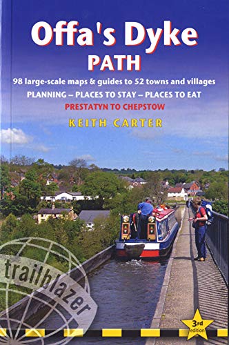
Offa's Dyke Path: Prestatyn to Chepstow, Planning, Places to Stay, Places to Eat (British Walking Guides) (Trailblazer)
Editore: Trailblazer Publications, United Kingdom, Hindhead, Surrey, 2011
ISBN 10: 1905864353ISBN 13: 9781905864355
Libro
Paperback. Condizione: Very Good. Practical guide to walking the whole of Offa's Dyke Path National Trail. The Path runs from the North Wales coast to the Severn Estuary following the line of Offa's Dyke, an impressive 8th century earthwork along the English/Welsh border, 177 miles long. Guide includes: Offa's Dyke Path map, 98 large-scale walking maps, guides to 52 towns and villages. Detailed accommodation: campsites, B&Bs, hotels, hostels, bunkhouses. Places to eat: cafes, teashops, pubs, restaurants. Detailed public transport information. Itineraries for all walkers, including one day Offa's Dyke walking; Walking times for Offa's Dyke Path north and Offa's Dyke Path south. Downloadable GPS waypoints. Colour pictures including 4 page colour flower and butterfly guide. The book has been read, but is in excellent condition. Pages are intact and not marred by notes or highlighting. The spine remains undamaged.
-
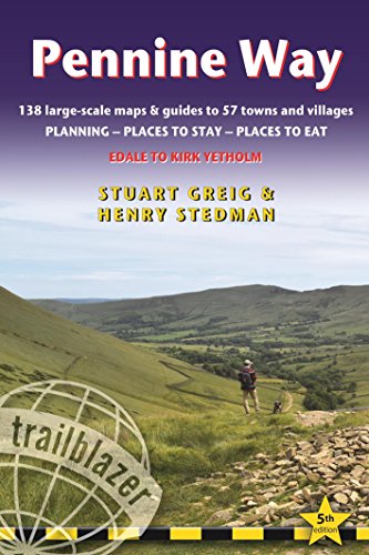
Pennine Way: Trailblazer British Walking Guide from Edale to Kirk Yetholm with 138 Large-Scale Maps & Guides to 57 Towns and Villages (British Walking . Guide with Planning, Places to Stay, Places
Editore: Trailblazer Publications, United Kingdom, Hindhead, Surrey, 2014
ISBN 10: 1905864612ISBN 13: 9781905864614
Libro
Paperback. Condizione: Good. Britain's best-known National Trail winds for 256 miles through three National Parks - the Peak District, Yorkshire Dales and Northumberland. This superb footpath showcases Britain's finest upland scenery, while touching the literary landscape of the Bronte family and Roman history along Hadrian's Wall. *138 large-scale walking maps - at just under 1:20,000 - showing route times, gradients, where to stay, interesting features.*Guides to 57 towns and villages - along the way*Itineraries for all walkers - whether walking the route in its entirety or sampling the highlights on day walks and short breaks.*Practical information for all budgets - Edale to Kirk Yetholm: where to stay (B&Bs, hostels, campsites, pubs and hotels), where to eat, what to see, plus detailed town plans*Public transport information - all access points on the path.*GPS waypoints. These are also downloadable from the Trailblazer website.*Now includes extra color sections: 16pp color introduction and 16pp of color mapping for stage sections (one stage per page) with trail profiles. The book has been read but remains in clean condition. All pages are intact and the cover is intact. Some minor wear to the spine.
-
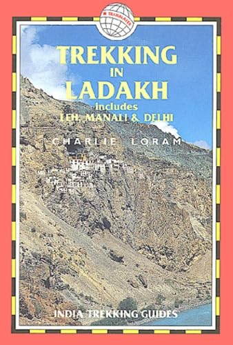
Trekking in Ladakh: includes Leh, Manali and Delhi (India Trekking Guide S.)
Editore: Trailblazer Publications, United Kingdom, Hindhead, Surrey, 1999
ISBN 10: 1873756305ISBN 13: 9781873756300
Libro
Paperback. Condizione: Very Good. Fully revised and extended 2nd edition of Charlie Loram's guide originally published as LEH AND TREKKING IN LADAKH. Includes 70 detailed walking maps plus information on getting to Ladakh. The book has been read, but is in excellent condition. Pages are intact and not marred by notes or highlighting. The spine remains undamaged.
-
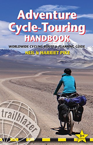
Adventure Cycle-Touring Handbook: Worldwide Cycling Route & Planning Guide (Trailblazer): Worldwide Route & Planning Guide
Editore: Trailblazer Publications, United Kingdom, Hindhead, Surrey, 2015
ISBN 10: 190586468XISBN 13: 9781905864683
Libro
Paperback. Condizione: Very Good. '.the definitive guide to how, where, why and what to do on a cycle expedition.' Adventure Travel Magazine (UK) Every cyclist dreams of making the Big Trip, the Grand Cycle Tour abroad. Whether that's a two-week trip or a year-long journey, the Adventure Cycle-Touring Handbook is the comprehensive manual that will make that dream a reality. Riding across Asia, cycling in Africa or pedaling from Patagonia to Alaska, whether you're planning your own Big Trip or just enjoy reading about other people's adventures, the Handbook is guaranteed to illuminate, entertain and above all, inspire. This fully revised 3rd edition includes: PART 1 - Practical information *How to prepare for a long-distance trip*What to look for in a new bike with reviews of some of the world's best touring- and trekking-bikes*Adapting a standard bike for the Big Ride*Choosing components, equipment for the road and reviews of camping gear*Health precautions, inoculations, visas, money and safety PART 2 - Worldwide route outlines Across Europe, Asia, Australasia, North and South America and Africa; recommended routes within countries and overland. Everything from popular routes eg India's Leh-Manali Highway to lesser-known cycle-touring areas such as Mongolia. PART 3 - Tales from the Saddle Ten first-hand accounts of spoke-bending biking adventures worldwide. Introduction Why are so many people going bike touring these days? A minority pastime during the heyday of the car, cycling has once again become a popular choice for travellingespecially for long overseas trips. The first cycle-touring craze began in the 1870s. Then, as now, the bicycle offered a revolutionary way of touring: you go exactly where you want, when you want, and all under your own steam. This was before the age of the car and walking or riding a horse were the only other options until the bicycle. In 1885 the Rover Safety Bicycle came along, and for all the innovation since then, most modern touring bicycles would be recognizable to a Victorian, as would their derailleur gears. Bike touring is undergoing a boom at the moment but it is really one of many periodic rediscoveries. Bicycle design, components and gear are evolving to suit the changing needs and tastes of people. It's a combination of experimentation and using tried and tested designs, such as the 'diamond' frame of the Rover Safety Bicycle. The Adventure Cycle-Touring Handbook is all about looking at what people are choosing and using: what kind of bikes, what gear and what destinations are being chosen by today's bike tourers. There are many reasons for taking a bike on your next long trip. My own guess as to why bike touring is back in fashion is that many travellers get burned out by backpacking, which really amounts to travelling by bus and train for most of the time. Buses are certainly fast but they go from one noisy town to another, leaving little possibility of exploring the spaces in between, the places where the bus doesn't stop. Others use bikes to go even further off the beaten track: they want to go where buses don't go at all and perhaps where other vehicles cannot get to either. Paul Woloshansky built his own racks to carry extra gear after being told all too often: 'There's a prettier way to go but there's nothing out there at all.' Other adventurers, such as Sweden's Janne Corax (see p122), have said the same thing: there were times when there was no other way of getting to where they wanted to go. You couldn't get there on foot and you couldn't get there in a truck. It was possible only on a bicycle. Half the adventure, though, is in the riding itself. Being out in the fresh air and seeing much more than is possible from a bus or train window is always a good feeling, whether you are wandering around France or riding across India. A lot of today's cycle tourists are interested in the riding but not that interested in bikes. It's a means of transport and a way to carry bags comfortably, while sitting down and enjoying the view. Not everyone is drawn to the high passes of the Andes or the Himalaya but they are all enjoying that same sense of freedom and all that comes with itunexpected discoveries, off-route detours or an impromptu day off when you find a great place to stay. Trips like these are not as arduous as some expeditions but they are every bit as satisfyingand they are still adventures, for they allow for spontaneity. And if you are carrying a tent and camping gear, you're prepared for just about any eventuality because you've always got a place to spend the night. This book looks at the possibilities out there, the different styles of travelling and the basic gear and know-how that you need. We also look at some of the more exciting cycling destinations around the world, complete with suggestions as to which routes to take and what you need to plan a trip in that region. The Adventure Cycle-Touring Handbook does not set out to tell you exactly where to go: it's your adventure, after all. But it's good to have a general idea of a destination and what you're likely to find when you're there and this is what this book aims to do. In the final part of this book we include stories from all around the world, not just about the biking but also about the adventures cyclists had on their journeys. It's the old idea that a bike ride isn't just about the riding but also about the places you were able to get to and the people you got to meetand all because you decided to travel by bicycle. The book has been read, but is in excellent condition. Pages are intact and not marred by notes or highlighting. The spine remains undamaged.
-
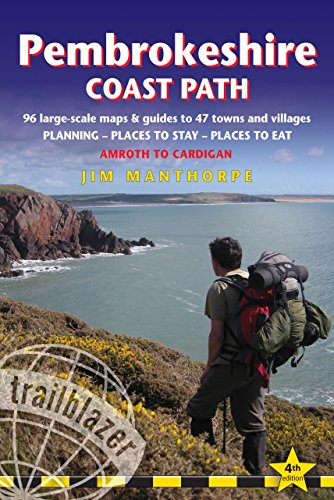
Pembrokeshire Coast Path: Amroth to Cardigan: Route Guide with 96 Maps, Places to Stay, Places to Eat (British Walking Guides)
Editore: Trailblazer Publications, United Kingdom, Hindhead, Surrey, 2013
ISBN 10: 1905864515ISBN 13: 9781905864515
Libro
Paperback. Condizione: Very Good. Practical guidebook to walking the Pembrokeshire Coast Path. The walk follows a National Trail around the coastline in south-west Wales. Includes maps, accommodation, pubs and restaurants, and what to see along the coastal path. 102 maps: 96 large-scale walking maps, 6 town plans, 10 stage with trail profiles and 2 overview. Detailed accommodation: B&Bs, campsites, pubs, hotels, bunkhouses. Where to eat: cafes, pubs and restaurants. Detailed public transport information with frequency of services. Downloadable GPS waypoints. Itineraries for all walkers, whether hiking the entire route or sampling highlights on day walks, weekends or short breaks. The book has been read, but is in excellent condition. Pages are intact and not marred by notes or highlighting. The spine remains undamaged.
-
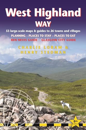
West Highland Way Trailblazer walking guide: 53 large-scale maps & guides to 26 towns and villages; Planning, Places to Stay, Places to Eat; Ben Nevis . to Eat; Ben Nevis Guide. Glasgow City Guide
Editore: Trailblazer Publications, United Kingdom, Hindhead, Surrey, 2022
ISBN 10: 1912716291ISBN 13: 9781912716296
Libro
Paperback. Condizione: Very Good. All the information you need to enjoy your hiking adventure along the West Highland Way in this fully revised 8th edition. The West Highland Way passes through some of the most spectacular scenery in all of Britain. From the outskirts of Glasgow it winds for 96 miles (154.5km) along the wooded banks of Loch Lomond, across the wilderness of Rannoch Moor, over the mountains above Glencoe to a dramatic finish passing Ben Nevis - Britain's highest mountain - into the centre of Fort William. 4 large-scale town plans, 8 overview maps and 53 large-scale walking maps- at just under 1:20,000 - showing route times, places to stay, places to eat, points of interest and much more. These are not general-purpose maps but fully-edited maps drawn by walkers for walkers. Itineraries for all walkers- whether walking the route in its entirety over a week to 10 days or sampling the highlights on day walks and short break. Practical information for all budgets- camping, bunkhouses, hostels, B&Bs, pubs and hotels; Glasgow through to Fort William - where to stay, where to eat, what to see, plus detailed street plans. Comprehensive public transport information- for all access points on the West Highland Way. Climb Ben Nevis- route descriptions to the top of Britain's highest mountain and other peaks. Flora and fauna - four page full colour flower guide,plus an illustrated section on local wildlife. Green hiking- understanding the local environment and minimizing our impact on it. Includes GPS waypoints.- also downloadable from the Trailblazer website. Plus extra colour sections: 16pp colour introduction and 10pp of colour mapping for stage sections (one stage per page) with trail profiles. The book has been read, but is in excellent condition. Pages are intact and not marred by notes or highlighting. The spine remains undamaged.
-
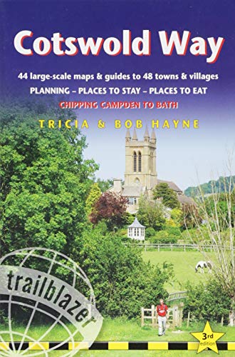
Cotswold Way: Trailblazer British Walking Guide: Practical Walking Guide from Chipping Campden to Bath with 44 Large-Scale Maps & Guides to 48 Towns . to Bath (Trailblazer British Walking Guides)
Editore: Trailblazer Publications, United Kingdom, Hindhead, Surrey, 2016
ISBN 10: 1905864701ISBN 13: 9781905864706
Libro
Paperback. Condizione: Very Good. All-in-one hiking route guide and maps to the Cotswold Way, a 102-mile National Trail that runs from Chipping Campden to Bath, following the beautiful Cotswold escarpment for most of its course. The trail leads through quintessentially English countryside with little villages of honey-coloured stone to the well-known town of Bath. Includes 44 large-scale maps (3 1/8 inches to 1 mile); 9 town plans and 8 overview maps. Full details of all accommodations and campsites, restaurants and pubs; plus full public transport information. Plus day-walks. Fully revised and rewalked 3rd edition. 44 large-scale walking maps - at just under 1:20,000 -showing route times, places to stay, points of interest and much more 9 town plans - Chipping Campden, Broadway, Winchcombe, Cheltenham, Painswick, Dursley, Wotton-under-Edge, and the city of Bath 8 area maps and trail profiles Itineraries for all walkers - whether walking the route in its entiretyover seven to eight days or sampling the highlights on day walks and shortbreaks Practical information for all budgets - camping, bunkhouses, hostels,B&Bs, pubs and hotels; Chipping Campden to Bath - where to stay, where toeat, what to see, plus detailed street plans Comprehensive public transport information - for all access points onthe Cotswold Way. Flora and fauna - four page full color flower guide, plus an illustratedsection on local wildlife Green hiking - understanding the local environment and minimizing ourimpact on it Bath city guide Includes downloadable gps waypoints. The book has been read, but is in excellent condition. Pages are intact and not marred by notes or highlighting. The spine remains undamaged.
-
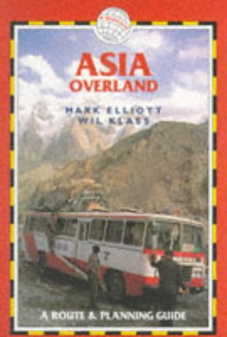
Asia Overland: A Route and Planning Guide (Trekking Guides)
Editore: Trailblazer Publications, United Kingdom, Hindhead, Surrey, 1998
ISBN 10: 1873756100ISBN 13: 9781873756102
Libro
Paperback. Condizione: Very Good. A survival guide for independent budget travellers in 34 Asian countries. With 452 maps and town plans, this guide gives all the basic information for a long-haul trip: visas, local transport, cheapest beds, the most interesting sights and best stopping off points. Includes the Caucasus. The book has been read, but is in excellent condition. Pages are intact and not marred by notes or highlighting. The spine remains undamaged.
-
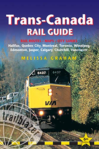
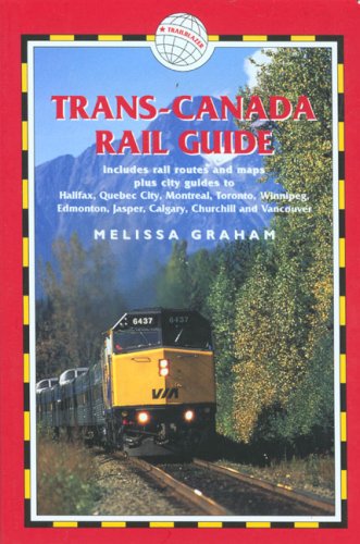
Trans-Canada Rail Guide: Includes Rail Routes and Maps Plus Guides to 10 Cities (Trailblazer): Practical Guide with 28 Maps to the Rail Route from . 10 Detailed City Guides (Trailblazer Guides)
Editore: Trailblazer Publications, United Kingdom, Hindhead, Surrey, 2010
ISBN 10: 1905864337ISBN 13: 9781905864331
Libro
Paperback. Condizione: Very Good. The world's most scenic rail ride. A journey on Canada's transcontinental railroad ranks as one of the greatest rail experiences in the world. Stretching from the Atlantic to the Pacific, the lines span 3974 miles, taking in not only several of North America's finest cities but also some of the most dramatic scenery on earth, including the spectacular Rocky Mountains. Rail travel for all budgets - This comprehensive guidebook gives information for all budgets, from the cheapest rail tickets with shoestring accommodation in the cities along the route to the most luxurious guided tours. Fully revised 5th edition - entirely re-researched Rail travel for all budgets - where to get the best deals Mile-by-mile route guide - what to see along the route; with 25 rail route maps Railway history - the rail link that created modern Canada City guides and maps - the best sights, recommended hotels and restaurants in 10 major stops along the lines: Halifax, Quebec City, Montreal, Toronto, Winnipeg, Edmonton, Jasper, Calgary, Churchill and Vancouver. The book has been read, but is in excellent condition. Pages are intact and not marred by notes or highlighting. The spine remains undamaged.
-
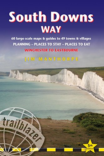
South Downs Way: Trailblazer British Walking Guide: Practical Guide to Walking the Whole Path, with 60 Large-Scale Maps, Guides to 49 Towns & . . to Eastbourne (Trailblazer Guidebooks)
Editore: Trailblazer Publications, United Kingdom, Hindhead, Surrey, 2015
ISBN 10: 1905864663ISBN 13: 9781905864669
Libro
Paperback. Condizione: Very Good. Fully revised and rewalked fifth edition of this popular guidebook.This 100-mile footpath follows the line of chalk hills stretching from Winchester to Eastbourne. Walking the length of the Downs is the best way to experience this beautiful landscape with its mixture of rolling hills, steep hanging woodland and windswept fields. You'll also pass through picture-postcard villages with welcoming pubs, thatched cottages and quintessentially English country gardens. *5 town plans and 60 large-scale walking maps - at just under 1:20,000 - showing route times, places to stay, places to eat, points of interest and much more. These are not general-purpose maps but fully-edited maps drawn by walkers for walkers. *Itineraries for all walkers - whether walking the route in its entirety over a week to 10 days or sampling the highlights on day walks and short breaks *Practical information for all budgets - camping, bunkhouses, hostels, B&Bs, pubs and hotels; Winchester through to Eastbourne - where to stay, where to eat, what to see, plus detailed street plans *Comprehensive public transport information - for all access points on the South Downs Way *Guides to 49 towns and villages - along the way *Flora and fauna - four page full color flower guide, plus an illustrated section on local wildlife *Full information on the newly-created South Downs National Park *Green hiking - understanding the local environment and minimizing our impact on it *GPS waypoints. These are also downloadable from the Trailblazer website. *Plus - extra color sections: 16pp color introduction and 16pp of color mapping for stage sections (one stage per page) with trail profiles. The book has been read, but is in excellent condition. Pages are intact and not marred by notes or highlighting. The spine remains undamaged.
-
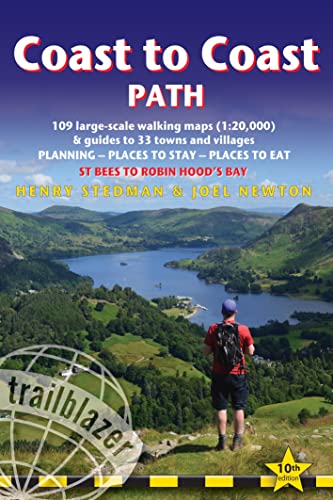
Coast to Coast Path: British Walking Guide: - St Bees to Robin Hood's Bay includes 109 Large-Scale Walking Maps (1:20,000) & Guides to 33 Towns and Villages - Planning, Places to Stay, Places to Eat
Editore: Trailblazer Publications, United Kingdom, Hindhead, Surrey, 2023
ISBN 10: 1912716259ISBN 13: 9781912716258
Libro
Paperback. Condizione: Very Good. All the information you need to enjoy your hiking adventure from Coast to Coast in this updated 10th edition. Fully re-walked and revised10th editionof this classic 191-mile walk from the Irish Sea to the North Sea. Crossing three national parks - the Lake District, the Yorkshire Dales, and the North York Moors - it samples the very best of the English countryside - rugged mountains and lakes, gentle dales and stone-built villages; wild moorland; sea cliffs and fishing villages. The guide includes: 109 large-scale walking maps- at just under 1:20,000 - showing route times, places to stay, places to eat, points of interest, and9 town plans 14 colour stage maps to help plan your walk,including hills and descents Places to stay with reviews- campsites, bunkhouses, hostels, B&Bs, pubs and hotels Places to eat with reviews- cafes, teashops, pubs, takeaways, restaurants What to see from the path- history, culture, natural history Comprehensive public transport information- for all access points on the path Flora and fauna- four page full colour flower guide, plus an illustrated section on local wildlife Itineraries for all walkers- whether walking the route in its entirety over two weeks or sampling the highlights on day walks and short breaks Green hiking- understanding the local environment and minimizing our impact on it GPS waypoints- also downloadable from the Trailblazer website page. The book has been read, but is in excellent condition. Pages are intact and not marred by notes or highlighting. The spine remains undamaged.
-
Coast to Coast Path (British Walking Guides)
Editore: Trailblazer Publications, United Kingdom, Hindhead, Surrey, 2008
ISBN 10: 1905864094ISBN 13: 9781905864096
Libro
Paperback. Condizione: Very Good. The book has been read, but is in excellent condition. Pages are intact and not marred by notes or highlighting. The spine remains undamaged.
-
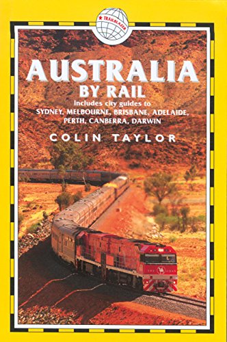
Australia by Rail (Trailblazer)
Editore: Trailblazer Publications, United Kingdom, Hindhead, Surrey, 2005
ISBN 10: 187375681XISBN 13: 9781873756812
Libro
Paperback. Condizione: Very Good. From the vast emptiness of the Nullarbor Plain, on the longest straight rail line in the world, to the twisting tracks of outback Queensland and the rainforests of the north, Australia's railways offer a rich variety of contrasting experiences. Taking the train is an ideal way to explore the continent in comfort and style. Features include:. The book has been read, but is in excellent condition. Pages are intact and not marred by notes or highlighting. The spine remains undamaged.