
Importo totale (1 articolo articoli):
Destinazione ordine:

9781782570547 - 50 Miles around Bristol A-Z Road Map di A-Z Maps (19 risultati)
Vai alla pagina principale dei risultati di ricerca
Tipo di articolo
- Tutti gli articoli
- Libri (18)
- Riviste e Giornali
- Fumetti
- Spartiti
- Arte, Stampe e Poster
- Fotografie
- Mappe (1)
-
Manoscritti e
Collezionismo cartaceo
Condizioni
Legatura
- Tutte
- Rilegato
- Brossura (4)
Ulteriori caratteristiche
- Prima edizione
- Copia autografata
- Sovraccoperta
- Con foto (10)
- No print on demand
Paese del venditore
Valutazione venditore
-

50 Miles Around Bristol Road Map
Editore: Geographers? A-Z Map Co Ltd, 2018
ISBN 10: 1782570543ISBN 13: 9781782570547
Libro
Condizione: New.
-

50 Miles Around Bristol Road Map
Editore: Geographers? A-Z Map Co Ltd, 2018
ISBN 10: 1782570543ISBN 13: 9781782570547
Libro
Condizione: As New. Unread book in perfect condition.
-
![Immagine del venditore per 50 Miles Around Bristol Road Map [Map ] venduto da booksXpress](https://pictures.abebooks.com/inventory/md/md31165808270.jpg)
50 Miles Around Bristol Road Map [Map ]
Editore: Geographers' A-Z Map Co Ltd, 1624
ISBN 10: 1782570543ISBN 13: 9781782570547
Libro
No Binding. Condizione: new.
-

50 Miles around Bristol A-Z Road Map (Folded)
Editore: HarperCollins Publishers, 2018
ISBN 10: 1782570543ISBN 13: 9781782570547
Libro
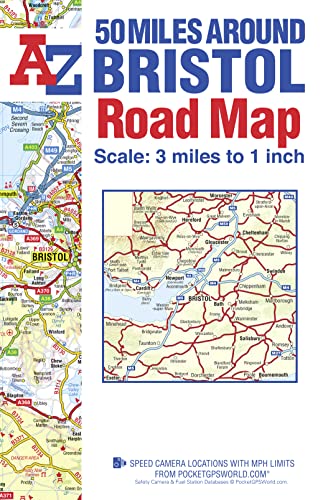
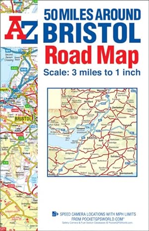
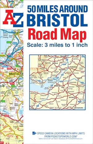
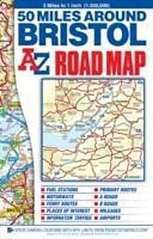
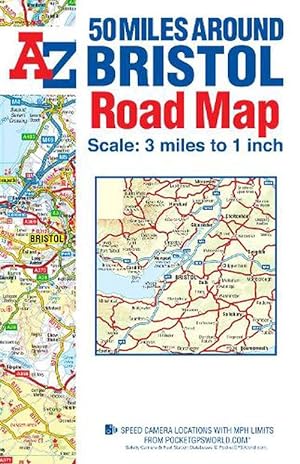
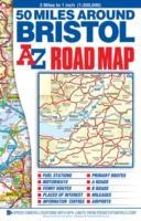
Folded. Condizione: new. Folded. This A-Z 50 Miles around Bristol map is a full colour, single sided, fold-out road map featuring continuous mapping extending to include Worcester and Stratford-upon-Avon to the north, Witney and Andover to the east, Bournemouth and Lyme Regis to the south and Minehead and Bridgend to the west.Published at a clear 3 miles to 1 inch the following features are shown on the road mapping:Motorways open with full junction detail, motorways under construction and proposed, service areas, primary routes and destinations, A & B roads, selected minor roads, gradients 1:5 and steeper, tolls, mileages, national and county boundaries, spot heights and hill shading.Selected safety camera locations with maximum speed limits.Selected fuel stations.A wide range of ancillary and tourist information.Brecon Beacons, New Forest and Exmoor National Park boundaries.The index to cities, towns, villages, hamlets and locations is adjacent to the map. This A-Z 50 Miles around Bristol map is a full colour, single sided, fold-out road map featuring continuous mapping extending to include Worcester and Stratford-upon-Avon to the north, Witney and Andover to the east, Bournemouth and Lyme Regis to the south and Minehead and Bridgend to the west. Shipping may be from multiple locations in the US or from the UK, depending on stock availability.
-
50 MILES AROUND BRISTOL A-Z ROAD MAP [New 24th edition]
Editore: HarperCollins Publishers, United Kingdom, 2018
ISBN 10: 1782570543ISBN 13: 9781782570547
Libro
Paperback. Condizione: Very Good. This A-Z 50 Miles around Bristol map is a full colour, single sided, fold-out road map featuring continuous mapping extending to include Worcester and Stratford-upon-Avon to the north, Witney and Andover to the east, Bournemouth and Lyme Regis to the south and Minehead and Bridgend to the west. Published at a clear 3 miles to 1 inch the following features are shown on the road mapping: Motorways open with full junction detail, motorways under construction and proposed, service areas, primary routes and destinations, A & B roads, selected minor roads, gradients 1:5 and steeper, tolls, mileages, national and county boundaries, spot heights and hill shading. Selected safety camera locations with maximum speed limits. Selected fuel stations. A wide range of ancillary and tourist information. Brecon Beacons, New Forest and Exmoor National Park boundaries. The index to cities, towns, villages, hamlets and locations is adjacent to the map. The book has been read, but is in excellent condition. Pages are intact and not marred by notes or highlighting. The spine remains undamaged.
-
50 MILES AROUND BRISTOL A-Z ROAD MAP [New 24th edition]
Editore: HarperCollins Publishers, United Kingdom, 2018
ISBN 10: 1782570543ISBN 13: 9781782570547
Libro
Paperback. Condizione: Good. This A-Z 50 Miles around Bristol map is a full colour, single sided, fold-out road map featuring continuous mapping extending to include Worcester and Stratford-upon-Avon to the north, Witney and Andover to the east, Bournemouth and Lyme Regis to the south and Minehead and Bridgend to the west. Published at a clear 3 miles to 1 inch the following features are shown on the road mapping: Motorways open with full junction detail, motorways under construction and proposed, service areas, primary routes and destinations, A & B roads, selected minor roads, gradients 1:5 and steeper, tolls, mileages, national and county boundaries, spot heights and hill shading. Selected safety camera locations with maximum speed limits. Selected fuel stations. A wide range of ancillary and tourist information. Brecon Beacons, New Forest and Exmoor National Park boundaries. The index to cities, towns, villages, hamlets and locations is adjacent to the map. The book has been read but remains in clean condition. All pages are intact and the cover is intact. Some minor wear to the spine.
-
50 Miles Around Bristol Road Map
Editore: HarperCollins Publishers, 2018
ISBN 10: 1782570543ISBN 13: 9781782570547
Libro
UNK. Condizione: New. New Book. Shipped from UK. Established seller since 2000.
-
50 Miles Around Bristol A-Z Road Map
Editore: HarperCollins Publishers 2018-01-03, London, 2018
ISBN 10: 1782570543ISBN 13: 9781782570547
Libro
sheet map (folded). Condizione: New. Language: ENG.
-
50 Miles Around Bristol Road Map
Editore: Geographers' A-Z Map Co Ltd, 2018
ISBN 10: 1782570543ISBN 13: 9781782570547
Mappa
Map. Condizione: Brand New. In Stock.
-
50 Miles Around Bristol Road Map
Editore: HarperCollins Publishers, 2018
ISBN 10: 1782570543ISBN 13: 9781782570547
Libro
Sheet map. Condizione: New. New copy - Usually dispatched within 4 working days.
-
50 Miles Around Bristol Road Map
Editore: Geographers' A-Z Map Co Ltd, 2014
ISBN 10: 1782570543ISBN 13: 9781782570547
Libro
Map. Condizione: New. BRAND NEW ** SUPER FAST SHIPPING FROM UK WAREHOUSE ** 30 DAY MONEY BACK GUARANTEE.
-
50 Miles around Bristol A-Z Road Map
Editore: Geographers? A-Z Map Co Ltd, 2018
ISBN 10: 1782570543ISBN 13: 9781782570547
Libro
Condizione: New. In.
-
50 Miles Around Bristol Road Map
Editore: Geographers? A-Z Map Co Ltd, 2018
ISBN 10: 1782570543ISBN 13: 9781782570547
Da: GreatBookPricesUK, Castle Donington, DERBY, Regno Unito
Valutazione venditore:

Libro
Condizione: New.
-
50 Miles Around Bristol Road Map
Editore: Geographers? A-Z Map Co Ltd, 2018
ISBN 10: 1782570543ISBN 13: 9781782570547
Da: GreatBookPricesUK, Castle Donington, DERBY, Regno Unito
Valutazione venditore:
Libro
Condizione: As New. Unread book in perfect condition.
-
50 Miles Around Bristol Road Map
Editore: HarperCollins Publishers, 2018
ISBN 10: 1782570543ISBN 13: 9781782570547
Libro
UNK. Condizione: New. New Book. Shipped from UK. Established seller since 2000.
-
50 Miles Around Bristol Road Map
Editore: GEOGRAPHERS Dez 2014, 2014
ISBN 10: 1782570543ISBN 13: 9781782570547
Libro
Taschenbuch. Condizione: Neu. Neuware Englisch.
-
50 Miles around Bristol A-Z Road Map (Folded)
Editore: HarperCollins Publishers, 2018
ISBN 10: 1782570543ISBN 13: 9781782570547
Libro
Folded. Condizione: new. Folded. This A-Z 50 Miles around Bristol map is a full colour, single sided, fold-out road map featuring continuous mapping extending to include Worcester and Stratford-upon-Avon to the north, Witney and Andover to the east, Bournemouth and Lyme Regis to the south and Minehead and Bridgend to the west.Published at a clear 3 miles to 1 inch the following features are shown on the road mapping:Motorways open with full junction detail, motorways under construction and proposed, service areas, primary routes and destinations, A & B roads, selected minor roads, gradients 1:5 and steeper, tolls, mileages, national and county boundaries, spot heights and hill shading.Selected safety camera locations with maximum speed limits.Selected fuel stations.A wide range of ancillary and tourist information.Brecon Beacons, New Forest and Exmoor National Park boundaries.The index to cities, towns, villages, hamlets and locations is adjacent to the map. This A-Z 50 Miles around Bristol map is a full colour, single sided, fold-out road map featuring continuous mapping extending to include Worcester and Stratford-upon-Avon to the north, Witney and Andover to the east, Bournemouth and Lyme Regis to the south and Minehead and Bridgend to the west. Shipping may be from our Sydney, NSW warehouse or from our UK or US warehouse, depending on stock availability.
-

50 Miles around Bristol A-Z Road Map (Folded)
Editore: HarperCollins Publishers, 2018
ISBN 10: 1782570543ISBN 13: 9781782570547
Libro
Folded. Condizione: new. Folded. This A-Z 50 Miles around Bristol map is a full colour, single sided, fold-out road map featuring continuous mapping extending to include Worcester and Stratford-upon-Avon to the north, Witney and Andover to the east, Bournemouth and Lyme Regis to the south and Minehead and Bridgend to the west.Published at a clear 3 miles to 1 inch the following features are shown on the road mapping:Motorways open with full junction detail, motorways under construction and proposed, service areas, primary routes and destinations, A & B roads, selected minor roads, gradients 1:5 and steeper, tolls, mileages, national and county boundaries, spot heights and hill shading.Selected safety camera locations with maximum speed limits.Selected fuel stations.A wide range of ancillary and tourist information.Brecon Beacons, New Forest and Exmoor National Park boundaries.The index to cities, towns, villages, hamlets and locations is adjacent to the map. This A-Z 50 Miles around Bristol map is a full colour, single sided, fold-out road map featuring continuous mapping extending to include Worcester and Stratford-upon-Avon to the north, Witney and Andover to the east, Bournemouth and Lyme Regis to the south and Minehead and Bridgend to the west. Shipping may be from our UK warehouse or from our Australian or US warehouses, depending on stock availability.
-
Geographers A-Z Map Co. Limited : 50 Miles Around Bristol Road M
Editore: Geographers\' A-Z Map Co Ltd, 2014
ISBN 10: 1782570543ISBN 13: 9781782570547
Libro
Condizione: New. This A-Z 50 Miles around Bristol map is a full colour, single sided, fold-out road map featuring continuous mapping extending to include Worcester and Stratford-upon-Avon to the north, Witney and Andover to the east, Bournemouth and Lyme Regis to the south .