
Importo totale (1 articolo articoli):
Destinazione ordine:

2016 map scotland di collins maps (3 risultati)
Vai alla pagina principale dei risultati di ricerca
Tipo di articolo
- Tutti gli articoli
- Libri (2)
- Riviste e Giornali
- Fumetti
- Spartiti
- Arte, Stampe e Poster
- Fotografie
- Mappe (1)
-
Manoscritti e
Collezionismo cartaceo
Condizioni
Legatura
- Tutte
- Rilegato
- Brossura (1)
Ulteriori caratteristiche
- Prima edizione
- Copia autografata
- Sovraccoperta
- Con foto
- No print on demand
Paese del venditore
Valutazione venditore
-
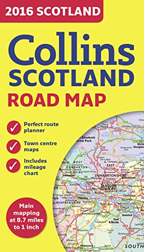
2016 Collins Map of Scotland
Editore: HarperCollins Publishers, United Kingdom, London, 2015
ISBN 10: 0008102341ISBN 13: 9780008102340
Libro
Paperback. Condizione: Good. Full colour map of Scotland at 8.7 miles to 1 inch (1:550,000) with clear, detailed road network and administrative areas shown in colour. The map covers the whole of Scotland and part of Northern England conveniently on one side, and is ideal for reference or route planning. The map shows the road network in detail for easy route planning. It is ideal for business users also, with its political colouring of local council areas. MAIN FEATURES Fully updated for 2016. Administrative areas shown in colour. Clear, detailed road network and road distances. Town and city names, rivers, railway lines and canals are clearly shown. 7 city/town centre street plans showing places of interest. Index to place names. Mileage chart. Car ferry routes. Key in English, French and German. The book has been read but remains in clean condition. All pages are intact and the cover is intact. Some minor wear to the spine.
-
2016 Collins Scotland Road Map
Editore: HarperCollins UK, 2015
ISBN 10: 0008102341ISBN 13: 9780008102340
Mappa
Map. Condizione: Like New. As new clean tight and bright folding map. Please email for photos. Larger books or sets may require additional shipping charges. Books sent via US Postal.
-
2016 Collins Scotland Road Map
Editore: Collins Educational, 2015
ISBN 10: 0008102341ISBN 13: 9780008102340
Libro
Map. Condizione: New. Brand New!.