
Importo totale (1 articolo articoli):
Destinazione ordine:

new relief world atlas (3 risultati)
Vai alla pagina principale dei risultati di ricerca
Tipo di articolo
- Tutti gli articoli
- Libri (3)
- Riviste e Giornali
- Fumetti
- Spartiti
- Arte, Stampe e Poster
- Fotografie
- Mappe
-
Manoscritti e
Collezionismo cartaceo
Condizioni
- Tutte
- Nuovi
- Antichi o usati
Legatura
- Tutte
- Rilegato
- Brossura
Ulteriori caratteristiche
- Prima edizione
- Copia autografata
- Sovraccoperta
- Con foto (2)
- No print on demand
Paese del venditore
Valutazione venditore
-

Hardcover. Condizione: Very Good. Condizione sovraccoperta: No dj. 205 pages.
-
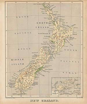
A scarce and interesting map of Africa, printed in an innovative technique of embossed style on "plasticised" card to illustrate the physical relief of continent. The map appeared in the scarce "Royal Relief Atlas Of All Parts Of The World" in which the physical relief of an area could be seen. This map is a fascinating tactile creation that allow us to feel the river valleys, plateaus, hills and mountains of the world, well detailed for place names, borders and even land quality, as it was?˙ known in the 1885.?˙ The map itself is composed of a sturdy pressed paper with a?˙ card border to protect the raised embossed detail.?˙?˙ The lithographic color amplifies the map visually, and has remained strong. An amazing early "raised-relief" map. This map measures 8.5 inches by 10.75.
-
Sonnenschein & Allen's royal relief atlas of all parts of the world, consisting of 31 maps, with physical, political, and statistical description facing each map. [The New Relief Maps]
Editore: London, Sonnenschein and Allen, 1880
Libro
Hardcover. Condizione: Very Good. Fine binding. 1/2 leather over green boards. Gold lettering and seals on front cover. "31 coloured maps, including 25 relief maps with raised surface to indicate mountains or hills, all with accompanying text, all but one mounted back-to-back on a thick card frame, preface leaf dated October 1, 1880, modern tan morocco-backed cloth by David Stevens, with cloth fragment from original binding bearing title in gilt on upper cover." - Sotheby's, Wardington Library Part 210 Oct. 2006, Lot 482. (This book was the volume sold in that sale). 31 cm.

![Immagine del venditore per Sonnenschein & Allen's royal relief atlas of all parts of the world, consisting of 31 maps, with physical, political, and statistical description facing each map. [The New Relief Maps] venduto da Sequitur Books](https://pictures.abebooks.com/inventory/md/md19757454067.jpg)