
Importo totale (1 articolo articoli):
Destinazione ordine:

canterbury 1906 kent sheet di trinder barrie (2 risultati)
Vai alla pagina principale dei risultati di ricerca
Tipo di articolo
- Tutti gli articoli
- Libri (1)
- Riviste e Giornali
- Fumetti
- Spartiti
- Arte, Stampe e Poster
- Fotografie
- Mappe (1)
-
Manoscritti e
Collezionismo cartaceo
Condizioni
Legatura
- Tutte
- Rilegato
- Brossura (1)
Ulteriori caratteristiche
- Prima edizione
- Copia autografata
- Sovraccoperta
- Con foto
- No print on demand
Paese del venditore
Valutazione venditore
-
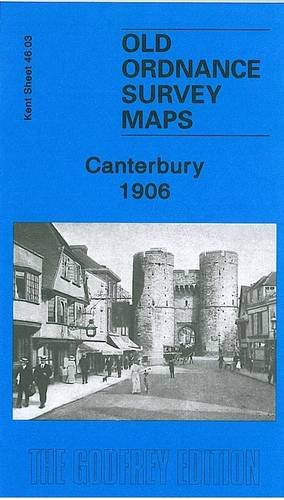
Canterbury 1906: Kent Sheet 46.03 (Old Ordnance Survey Maps of Kent)
Editore: GARDNERS VI BOOKS AMS006, 2010
ISBN 10: 1847843980ISBN 13: 9781847843982
Libro
Paperback. Condizione: Good. The book has been read but remains in clean condition. All pages are intact and the cover is intact. Some minor wear to the spine.
-
Canterbury 1906: Kent Sheet 46.03 (Old Ordnance Survey Maps of Kent)
Editore: Alan Godfrey Maps, 2010
ISBN 10: 1847843980ISBN 13: 9781847843982
Mappa
No Binding. Condizione: New. No Jacket. Here are the details of maps for Canterbury: Kent Sheet 46.03 Canterbury 1906 - published 2010; intro by Barrie Trinder. ISBN.978-1-84784-398-2 This detailed and busy map covers most of central Canterbury, with coverage stretching from the Cemetery and London Road eastward to Longport Street and the Barracks, and from Hanover Road southward to Gordon Road. Features include city centre with individual buildings neatly shown, Cathedral, both railway stations with approaches, Harbledown Junction, Danejohn Mound, City Wall, St Gregory's church, St Mildred's church, remains of St Augustine's Abbey, Missionary College, Infantry Barracks, Artillery Barracks, Holy Cross church, St Dunstan's church, brewery, St Peter's church, Dean's Mill, Agricultural Hall, St Mildred's Tannery, Simon Langton Schools, Ersham House, Kent & Canterbury Hospital, St George the Martyr's church, etc. On the reverse we include a directory of city and cathedral officials.