2020 Collins Map of Britain
Collins Maps
ISBN 10: 0008318727 ISBN 13: 9780008318727
Editore: Collins, 2019
Usato
Brossura
Da
WeBuyBooks, Rossendale, LANCS, Regno Unito
Valutazione del venditore 5 su 5 stelle
![]()
Venditore AbeBooks dal 14 novembre 2005
Questo articolo specifico non � pi� disponibile.
Riguardo questo articolo
Descrizione:
Most items will be dispatched the same or the next working day. An apparently unread copy in perfect condition. Dust cover is intact with no nicks or tears. Spine has no signs of creasing. Pages are clean and not marred by notes or folds of any kind. Codice articolo wbs7582325328
Riassunto:
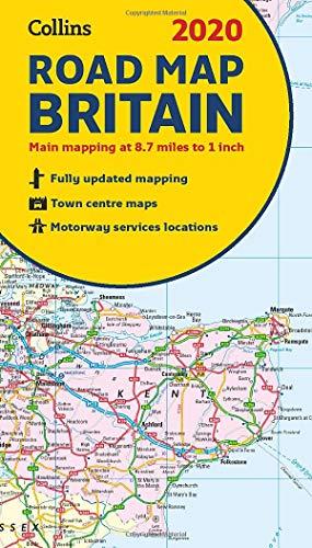
Full colour double-sided map of Great Britain at 8.7 miles to 1 inch (1:550,000), with clear, detailed road network and administrative areas shown in colour.
With its political colouring of counties and unitary authorities it is ideal for business users but it is also perfect for tourists as a route planning map.
Main features
• Fully updated
• Counties and local council areas shown in colour
• Clear, detailed road network
• Town and city names, rivers, railway lines and canals are clearly shown
• 16 city/town centre street plans
• Index to place names
• Mileage chart
• Car ferry routes
• Key in English, French and German
Area of coverage
Double-sided road map covering the whole of Britain. Northern England, Scotland and the Isle of Man are on one side with Southern England and Wales on the other.
Informazioni sull?autore:
Explore the world through accurate and up-to-date mapping.
Le informazioni nella sezione "Su questo libro" possono far riferimento a edizioni diverse di questo titolo.
Dati bibliografici
Titolo: 2020 Collins Map of Britain
Casa editrice: Collins
Data di pubblicazione: 2019
Legatura: Brossura
Condizione: Like New
I migliori risultati di ricerca su AbeBooks

Foto dell'editore
2020 Collins Map of Britain
Editore:
HarperCollins Publishers, United Kingdom, London, 2019
ISBN 10: 0008318727
ISBN 13: 9780008318727
Antico o usato
Paperback
Da: WorldofBooks, Goring-By-Sea, WS, Regno Unito
Valutazione del venditore 5 su 5 stelle
![]()
Paperback. Condizione: Very Good. Full colour double-sided map of Great Britain at 8.7 miles to 1 inch (1:550,000), with clear, detailed road network and administrative areas shown in colour. With its political colouring of counties and unitary authorities it is ideal for business users but it is also perfect for tourists as a route planning map. Main features Fully updated Counties and local council areas shown in colour Clear, detailed road network Town and city names, rivers, railway lines and canals are clearly shown 16 city/town centre street plans Index to place names Mileage chart Car ferry routes Key in English, French and German Area of coverage Double-sided road map covering the whole of Britain. Northern England, Scotland and the Isle of Man are on one side with Southern England and Wales on the other. The book has been read, but is in excellent condition. Pages are intact and not marred by notes or highlighting. The spine remains undamaged. Codice articolo GOR010163507
Compra usato
EUR 10,01
Spedizione EUR 6,42
Spedito da Regno Unito a U.S.A.
Spedito da Regno Unito a U.S.A.
Quantit�: 3 disponibili