Sinossi
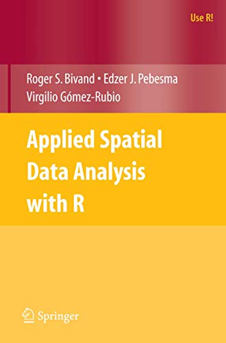
This book addresses the needs of researchers and students using R to analyze spatial data across a range of disciplines and professions. The book is co-authored by a group involved in the Comprehensive R Archive Network.
Le informazioni nella sezione "Riassunto" possono far riferimento a edizioni diverse di questo titolo.
Dalla quarta di copertina
Applied Spatial Data Analysis with R is divided into two basic parts, the first presenting R packages, functions, classes and methods for handling spatial data. This part is of interest to users who need to access and visualise spatial data. Data import and export for many file formats for spatial data are covered in detail, as is the interface between R and the open source GRASS GIS. The second part showcases more specialised kinds of spatial data analysis, including spatial point pattern analysis, interpolation and geostatistics, areal data analysis and disease mapping. The coverage of methods of spatial data analysis ranges from standard techniques to new developments, and the examples used are largely taken from the spatial statistics literature. All the examples can be run using R contributed packages available from the CRAN website, with code and additional data sets from the book's own website.
This book will be of interest to researchers who intend to use R to handle, visualise, and analyse spatial data. It will also be of interest to spatial data analysts who do not use R, but who are interested in practical aspects of implementing software for spatial data analysis. It is a suitable companion book for introductory spatial statistics courses and for applied methods courses in a wide range of subjects using spatial data, including human and physical geography, geographical information systems, the environmental sciences, ecology, public health and disease control, economics, public administration and political science.
The book has a website where coloured figures, complete code examples, data sets, and other support material may be found: http://www.asdar-book.org.
The authors have taken part in writing and maintaining software for spatial data handling and analysis with R in concert since 2003.
Roger Bivand is Professor of Geography in the Department of Economics at Norges Handelsh°yskole, Bergen, Norway. Edzer Pebesma is Professor of Geoinformatics at Westfńlische Wilhelms-Universitńt, MŘnster, Germany. Virgilio Gˇmez-Rubio is Research Associate in the Department of Epidemiology and Public Health, Imperial College London, London, United Kingdom.
Le informazioni nella sezione "Su questo libro" possono far riferimento a edizioni diverse di questo titolo.
Altre edizioni note dello stesso titolo
Risultati della ricerca per Applied Spatial Data Analysis with R
Applied Spatial Data Analysis with R (Use R!)
Da: Half Price Books Inc., Dallas, TX, U.S.A.
Paperback. Condizione: Very Good. Connecting readers with great books since 1972! Used books may not include companion materials, and may have some shelf wear or limited writing. We ship orders daily and Customer Service is our top priority! Codice articolo S_433414176
Compra usato
Spedito in U.S.A.
QuantitÓ: 1 disponibili
Applied Spatial Data Analysis with R (Use R!)
Da: Reader's Corner, Inc., Raleigh, NC, U.S.A.
Soft cover. Condizione: Fine. This is a fine paperback first edition copy, yellow spine. Codice articolo 101251
Compra usato
Spedito in U.S.A.
QuantitÓ: 1 disponibili
Applied Spatial Data Analysis with R (Use R!)
Da: Toscana Books, AUSTIN, TX, U.S.A.
Paperback. Condizione: new. Excellent Condition.Excels in customer satisfaction, prompt replies, and quality checks. Codice articolo Scanned0387781706
Compra nuovo
Spedito in U.S.A.
QuantitÓ: 1 disponibili
Applied Spatial Data Analysis with R
Da: Good Reading Secondhand Books, Benalla, VIC, Australia
Soft cover. Condizione: As New. xiv 374 pages, indexed. Apart from light shelf wear, the book appears untouched. ""'Applied Spatial Data Analysis with R' is divided into two basic parts, the first presenting R packages, functions, classes and methods for handling spatial data. This part is of interest to users who need to access and visualise spatial data. Data import and export for many file formats for spatial data are covered in detail, as is the interface between R and the open source GRASS GIS. The second part showcases more specialised kinds of spatial data analysis, including spatial point pattern analysis, interpolation and geostatistics, areal data analysis and disease mapping. The coverage of methods of spatial data analysis ranges from standard techniques to new developments, and the examples used are largely taken from the spatial statistics literature." (Trove). Codice articolo 019458
Compra usato
Spedito da Australia a U.S.A.
QuantitÓ: 1 disponibili
Applied Spatial Data Analysis with R (Use R!)
Da: Books & Bobs, Deeside, FLINT, Regno Unito
Soft cover. Condizione: As New. As new copy. A tight, bright, and clean copy with no inscriptions and no annotations/notes. No creasing to spine/cover or foxing to pages. Excellent condition book. 374pp. (15.5x23.5cm). Please contact us for any more information. Codice articolo 8674
Compra usato
Spedito da Regno Unito a U.S.A.
QuantitÓ: 1 disponibili

