Articoli correlati a Falcon Guide Using Gps

Sinossi
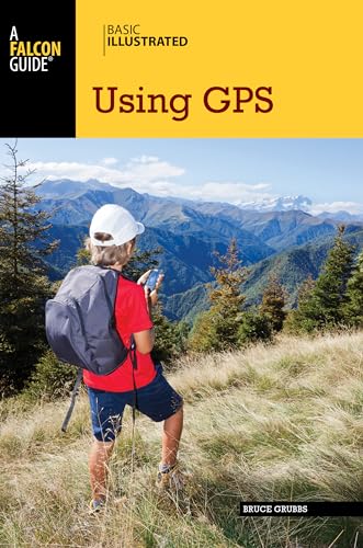
Richly illustrated and information-packed tools for anyone whose play or work takes them to remote areas. Basic Illustrated Using GPS, 3rd is a guide to practical field use of the Global Positioning System, written in simple language, with each new term explained as it's used. This book is a wealth of useful backcountry navigation advice for beginners and experts alike. It also includes information on using GPS with the latest mapping software.
Disocver how to:
- Pick the best GPS receiver for your specific needs
- Read and pregrid topographic maps
- Identify waypoints with various coordinate systems
- Use GPS to navigate on land and water
- Create your own maps with GPS software
Le informazioni nella sezione "Riassunto" possono far riferimento a edizioni diverse di questo titolo.
Informazioni sugli autori
Dalla quarta di copertina
Richly illustrated and information-packed tools for anyone whose play or work takes them to remote areas. Basic Illustrated Using GPS, 3rd is a guide to practical field use of the Global Positioning System, written in simple language, with each new term explained as it's used. This book is a wealth of useful backcountry navigation advice for beginners and experts alike. It also includes information on using GPS with the latest mapping software.
Discover how to:
- Pick the best GPS receiver for your specific needs
- Read and pregrid topographic maps
- Identify waypoints with various coordinate systems
- Use GPS to navigate on land and water
- Create your own maps with GPS software
Le informazioni nella sezione "Su questo libro" possono far riferimento a edizioni diverse di questo titolo.
- EditoreFalcon Pr Pub Co
- Data di pubblicazione2014
- ISBN 10 0762750812
- ISBN 13 9780762750818
- RilegaturaCopertina flessibile
- LinguaInglese
- Numero edizione3
- Numero di pagine87
- Contatto del produttorenon disponibile
Compra usato
Condizioni: molto buonoEUR 2,97 per la spedizione da U.S.A. a Italia
Destinazione, tempi e costiCompra nuovo
Visualizza questo articoloEUR 2,00 per la spedizione da Irlanda a Italia
Destinazione, tempi e costiRisultati della ricerca per Falcon Guide Using Gps
Basic Illustrated Using GPS
Da: ThriftBooks-Atlanta, AUSTELL, GA, U.S.A.
Paperback. Condizione: Very Good. No Jacket. May have limited writing in cover pages. Pages are unmarked. ~ ThriftBooks: Read More, Spend Less 0.45. Codice articolo G0762750812I4N00
Quantità: 1 disponibili
Basic Illustrated Using GPS
Da: Kennys Bookshop and Art Galleries Ltd., Galway, GY, Irlanda
Condizione: New. A guide to practical field use of the Global Positioning System, including information on using GPS with the latest mapping software. Series: Basic Illustrated Series. Num Pages: 96 pages, illustrations. BIC Classification: UDH; WSZ; WT. Category: (G) General (US: Trade). Dimension: 155 x 228 x 6. Weight in Grams: 190. . 2014. 3rd Edition. paperback. . . . . Codice articolo V9780762750818
Quantità: 15 disponibili
Basic Illustrated Using GPS (Basic Illustrated Series)
Da: BookShop4U, Fenton, MO, U.S.A.
Condizione: New. . Codice articolo 5AUZZZ000PMA_ns
Quantità: 1 disponibili
Basic Illustrated Using GPS
Da: Kennys Bookstore, Olney, MD, U.S.A.
Condizione: New. A guide to practical field use of the Global Positioning System, including information on using GPS with the latest mapping software. Series: Basic Illustrated Series. Num Pages: 96 pages, illustrations. BIC Classification: UDH; WSZ; WT. Category: (G) General (US: Trade). Dimension: 155 x 228 x 6. Weight in Grams: 190. . 2014. 3rd Edition. paperback. . . . . Books ship from the US and Ireland. Codice articolo V9780762750818
Quantità: 15 disponibili
Basic Illustrated Using Gps
Da: Revaluation Books, Exeter, Regno Unito
Paperback. Condizione: Brand New. 3rd edition. 87 pages. 9.00x6.00x0.25 inches. In Stock. Codice articolo x-0762750812
Quantità: 1 disponibili
Basic Illustrated Using GPS
Da: moluna, Greven, Germania
Condizione: New. Über den AutorBruce Grubbs is an avid camper, backpacker, hiker, mountain biker, and cross-country skier who has been exploring the American desert for over thirty years. A professional outdoor writer and photographer, he has writte. Codice articolo 898611391
Quantità: 5 disponibili
Falcon Guide Using Gps
Da: GreatBookPrices, Columbia, MD, U.S.A.
Condizione: As New. Unread book in perfect condition. Codice articolo 21726076
Quantità: 1 disponibili
Falcon Guide Using Gps
Da: GreatBookPrices, Columbia, MD, U.S.A.
Condizione: New. Codice articolo 21726076-n
Quantità: 1 disponibili
Basic Illustrated Using GPS (Basic Illustrated Series)
Da: SecondSale, Montgomery, IL, U.S.A.
Condizione: Very Good. Item in very good condition! Textbooks may not include supplemental items i.e. CDs, access codes etc. Codice articolo 00085228881
Quantità: 1 disponibili
Basic Illustrated Using GPS
Da: AHA-BUCH GmbH, Einbeck, Germania
Taschenbuch. Condizione: Neu. Neuware - Richly illustrated and information-packed tools for anyone whose play or work takes them to remote areas. Basic Illustrated Using GPS, 3rd is a guide to practical field use of the Global Positioning System, written in simple language, with each new term explained as it's used. This book is a wealth of useful backcountry navigation advice for beginners and experts alike. It also includes information on using GPS with the latest mapping software.Discover how to: ¿ Pick the best GPS receiver for your specific needs ¿ Read and pregrid topographic maps ¿ Identify waypoints with various coordinate systems ¿ Use GPS to navigate on land and water ¿ Create your own maps with GPS software. Codice articolo 9780762750818
Quantità: 2 disponibili
