Articoli correlati a Degrees of Latitude: Mapping Colonial America
Sinossi
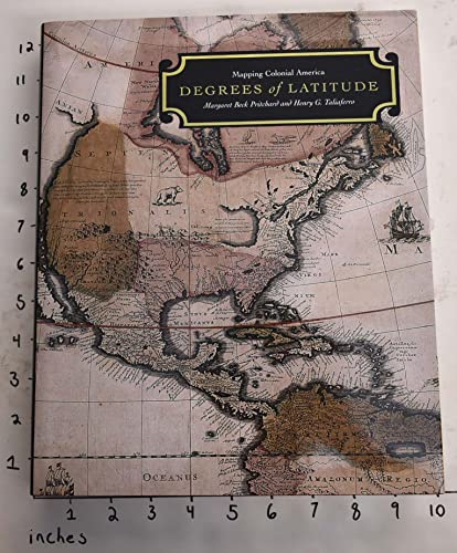
Book by Pritchard Margaret Beck Taliaferro Henry G
Le informazioni nella sezione "Riassunto" possono far riferimento a edizioni diverse di questo titolo.
Compra nuovo
Visualizza questo articolo
EUR 103,08
EUR 25,65 per la spedizione da U.S.A. a Italia
Destinazione, tempi e costi
Risultati della ricerca per Degrees of Latitude: Mapping Colonial America
Foto dell'editore
Degrees of Latitude: Mapping Colonial America
Editore:
Colonial Williamsburg Foundation, 2002
ISBN 10: 0879352140
ISBN 13: 9780879352141
Antico o usato
Rilegato
Da: ThriftBooks-Atlanta, AUSTELL, GA, U.S.A.
Valutazione del venditore 5 su 5 stelle
![]()
Hardcover. Condizione: Good. No Jacket. Former library book; Pages can have notes/highlighting. Spine may show signs of wear. ~ ThriftBooks: Read More, Spend Less 5.3. Codice articolo G0879352140I3N10
Quantit�: 1 disponibili
Foto dell'editore
Degrees of Latitude: Mapping Colonial America
ISBN 10: 0879352140
ISBN 13: 9780879352141
Antico o usato
Rilegato
Prima edizione
Da: First Landing Books & Arts, Virginia Beach, VA, U.S.A.
Valutazione del venditore 5 su 5 stelle
![]()
Hardcover. Condizione: Near Fine. Condizione sovraccoperta: Near Fine. First Edition. 434 Pages, With Index, Near Fine Condition, Colorful Black And White Maps And Illustrations, Margaret Beck Pritchard, Claiming The Land, Maps As Symbolic Objects, Selection Of Mapps From The Colonial Williamsburg Collection, Henry G. Taliaferro, The Atlas Of John Custis, 1698, Philip Lea And The Seventeenth-Century Map Trade Size: Folio - over 12 - 15" tall. Book. Codice articolo 50699
Quantit�: 1 disponibili
Immagini fornite dal venditore
Degrees of Latitude Mapping Colonial America
Editore:
Colonial Williamsburg Foundation, Williamsburg, VA, 2002
ISBN 10: 0879352140
ISBN 13: 9780879352141
Antico o usato
Rilegato
Da: Elder's Bookstore, Nashville, TN, U.S.A.
Valutazione del venditore 2 su 5 stelle
![]()
Hardcover. Condizione: Very Good. Condizione sovraccoperta: Very Good. As new book in DJ as new ; 9.25 X 1.25 X 11.25 inches; 434 pages. Codice articolo 42522
Quantit�: 1 disponibili
Foto dell'editore
Degrees of Latitude: Mapping Colonial America
Editore:
Colonial Williamsburg Foundation, 2002
ISBN 10: 0879352140
ISBN 13: 9780879352141
Antico o usato
Rilegato
Prima edizione
Da: The Way We Were Bookshop, Hampton, VA, U.S.A.
Valutazione del venditore 4 su 5 stelle
![]()
Hardcover. Condizione: Fine. Condizione sovraccoperta: Fine. 1st Edition. 434 pps, hardbound, 1st printing, 4to, F/F, like new -- no folds, no markings, no creasing, no soiling -- NOT EXLIB, mylar protected. Codice articolo 12953
Quantit�: 1 disponibili
Foto dell'editore
Degrees of Latitude: Mapping Colonial America
Editore:
Colonial Williamsburg Foundation, 2002
ISBN 10: 0879352140
ISBN 13: 9780879352141
Antico o usato
Rilegato
Da: Sunshine State Books, Lithia, FL, U.S.A.
Valutazione del venditore 4 su 5 stelle
![]()
hardcover. Condizione: Very Good. Hardback--excellent condition. Codice articolo CL250108088G146
Quantit�: 1 disponibili
Immagini fornite dal venditore
Degrees of Latitude: Mapping Colonial America
Editore:
Harry N. Abrams, New York, 2004
ISBN 10: 0879352140
ISBN 13: 9780879352141
Antico o usato
Rilegato
Da: Bookshelf of Maine, Franklin, ME, U.S.A.
Valutazione del venditore 5 su 5 stelle
![]()
Hardcover. Condizione: Fine. Condizione sovraccoperta: Fine. 2nd Impression. Both book and dustjacket are in Fine condition. This monumental work "goes beyond a standard cartobibliographical analysis to provide a cultural context for the production and use of these objects that represented both functionality and symbolically, the expanding world view of the enlighteded colonial celite. The majority of works selected are among the best and most beautiful maps of English and European holdings in America produced during the 17th and 18th centuries. A few are rare or unique examples." ; Colonial Williamsburg Decorative Arts Series; Color Maps; 4to 11" - 13" tall; 434 pages; Codice articolo 5620
Quantit�: 1 disponibili
Foto dell'editore
Degrees of Latitude: Mapping Colonial America
Editore:
Colonial Williamsburg Foundation, 2002
ISBN 10: 0879352140
ISBN 13: 9780879352141
Antico o usato
Rilegato
Da: Vintage Books and Fine Art, Oxford, MD, U.S.A.
Valutazione del venditore 4 su 5 stelle
![]()
Hardcover. Condizione: Like New. 4to - over 9. Burgundy cloth gilt. Square Tight Binding.Clean interior. Jacket with light sunning. Presents handsomely in archival mylar. Codice articolo 12203
Quantit�: 1 disponibili
Foto dell'editore
Degrees of Latitude: Mapping Colonial America
Editore:
Colonial Williamsburg Foundation, 2002
ISBN 10: 0879352140
ISBN 13: 9780879352141
Nuovo
Rilegato
Da: Toscana Books, AUSTIN, TX, U.S.A.
Valutazione del venditore 5 su 5 stelle
![]()
Hardcover. Condizione: new. Excellent Condition.Excels in customer satisfaction, prompt replies, and quality checks. Codice articolo Scanned0879352140
Quantit�: 1 disponibili
Foto dell'editore
Degrees of Latitude: Mapping Colonial America
Editore:
Colonial Williamsburg Foundation, 2002
ISBN 10: 0879352140
ISBN 13: 9780879352141
Nuovo
Rilegato
Da: DeckleEdge LLC, Albuquerque, NM, U.S.A.
Valutazione del venditore 5 su 5 stelle
![]()
Condizione: New. Codice articolo Shelfdream0879352140
Quantit�: 1 disponibili
Immagini fornite dal venditore
Degrees of Latitude: Mapping Colonial America
Editore:
Colonial Williamsburg Foundation, Williamsburg, VA, 2002
ISBN 10: 0879352140
ISBN 13: 9780879352141
Antico o usato
Rilegato
Da: Mullen Books, ABAA, Marietta, PA, U.S.A.
Valutazione del venditore 4 su 5 stelle
![]()
Hardcover. Condizione: VG/VG. Burgundy cloth boards with gilt lettering on spine. Glossy dust jacket with color-illustrated map and white and gilt lettering. 434 pp. 283 illustrations, 159 in full-color. This handsomely illustrated collection of maps of Colonial America takes readers on a spectacular voyage across the continent, and into the geographic imaginations of the first European settlers in America. -Amazon. Codice articolo 165475
Quantit�: 1 disponibili