Sinossi
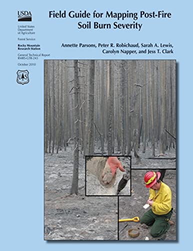
Following wildfires in the United States, the U.S. Department of Agriculture and U.S. Department of the Interior mobilize Burned Area Emergency Response (BAER) teams to assess immediate post-fire watershed conditions. BAER teams must determine threats from flooding, soil erosion, and instability. Developing a postfire soil burn severity map is an important first step in the rapid assessment process. It enables BAER teams to prioritize field reviews and locate burned areas that may pose a risk to critical values within or downstream of the burned area. By helping to identify indicators of soil conditions that differentiate soil burn severity classes, this field guide will help BAER teams to consistently interpret, field validate, and map soil burn severity.
Le informazioni nella sezione "Riassunto" possono far riferimento a edizioni diverse di questo titolo.
Altre edizioni note dello stesso titolo

Risultati della ricerca per Field Guide for Mapping Post-Fire Soil Burn Severity

Immagini fornite dal venditore
Field Guide for Mapping Post-fire Soil Burn Severity
Editore:
CreateSpace Independent Publishing Platform, 2015
ISBN 10: 1505877458
ISBN 13: 9781505877458
Antico o usato
Brossura
Da: GreatBookPrices, Columbia, MD, U.S.A.
Valutazione del venditore 5 su 5 stelle
![]()
Condizione: As New. Unread book in perfect condition. Codice articolo 23239321
Compra usato
EUR 15,66
Spedizione EUR 2,31
Spedito in U.S.A.
Spedito in U.S.A.
Quantit�: Pi� di 20 disponibili
Foto dell'editore
Field Guide for Mapping Post-Fire Soil Burn Severity
Editore:
Createspace Independent Publishing Platform, 2015
ISBN 10: 1505877458
ISBN 13: 9781505877458
Nuovo
Paperback / softback
Da: THE SAINT BOOKSTORE, Southport, Regno Unito
Valutazione del venditore 5 su 5 stelle
![]()
Paperback / softback. Condizione: New. This item is printed on demand. New copy - Usually dispatched within 5-9 working days. Codice articolo C9781505877458
Compra nuovo
EUR 22,00
Spedizione EUR 14,30
Spedito da Regno Unito a U.S.A.
Spedito da Regno Unito a U.S.A.
Quantit�: Pi� di 20 disponibili
Immagini fornite dal venditore
Field Guide for Mapping Post-fire Soil Burn Severity
Editore:
CreateSpace Independent Publishing Platform, 2015
ISBN 10: 1505877458
ISBN 13: 9781505877458
Nuovo
Brossura
Da: GreatBookPrices, Columbia, MD, U.S.A.
Valutazione del venditore 5 su 5 stelle
![]()
Condizione: New. Codice articolo 23239321-n
Compra nuovo
EUR 35,01
Spedizione EUR 2,31
Spedito in U.S.A.
Spedito in U.S.A.
Quantit�: Pi� di 20 disponibili
Immagini fornite dal venditore
Field Guide for Mapping Post-fire Soil Burn Severity
Editore:
CreateSpace Independent Publishing Platform, 2015
ISBN 10: 1505877458
ISBN 13: 9781505877458
Antico o usato
Brossura
Da: GreatBookPricesUK, Woodford Green, Regno Unito
Valutazione del venditore 5 su 5 stelle
![]()
Condizione: As New. Unread book in perfect condition. Codice articolo 23239321
Compra usato
EUR 21,36
Spedizione EUR 17,51
Spedito da Regno Unito a U.S.A.
Spedito da Regno Unito a U.S.A.
Quantit�: Pi� di 20 disponibili
Immagini fornite dal venditore
Field Guide for Mapping Post-fire Soil Burn Severity
Editore:
CreateSpace Independent Publishing Platform, 2015
ISBN 10: 1505877458
ISBN 13: 9781505877458
Nuovo
Brossura
Da: GreatBookPricesUK, Woodford Green, Regno Unito
Valutazione del venditore 5 su 5 stelle
![]()
Condizione: New. Codice articolo 23239321-n
Compra nuovo
EUR 21,99
Spedizione EUR 17,51
Spedito da Regno Unito a U.S.A.
Spedito da Regno Unito a U.S.A.
Quantit�: Pi� di 20 disponibili
Foto dell'editore
Field Guide for Mapping Post-Fire Soil Burn Severity (Paperback)
Editore:
Createspace Independent Publishing Platform, 2015
ISBN 10: 1505877458
ISBN 13: 9781505877458
Nuovo
Paperback
Da: CitiRetail, Stevenage, Regno Unito
Valutazione del venditore 5 su 5 stelle
![]()
Paperback. Condizione: new. Paperback. Following wildfires in the United States, the U.S. Department of Agriculture and U.S. Department of the Interior mobilize Burned Area Emergency Response (BAER) teams to assess immediate post-fire watershed conditions. BAER teams must determine threats from flooding, soil erosion, and instability. Developing a postfire soil burn severity map is an important first step in the rapid assessment process. It enables BAER teams to prioritize field reviews and locate burned areas that may pose a risk to critical values within or downstream of the burned area. By helping to identify indicators of soil conditions that differentiate soil burn severity classes, this field guide will help BAER teams to consistently interpret, field validate, and map soil burn severity. This item is printed on demand. Shipping may be from our UK warehouse or from our Australian or US warehouses, depending on stock availability. Codice articolo 9781505877458
Compra nuovo
EUR 25,24
Spedizione EUR 43,19
Spedito da Regno Unito a U.S.A.
Spedito da Regno Unito a U.S.A.
Quantit�: 1 disponibili