Sinossi
GIS for Science presents a collection of real-world stories about modern science and a cadre of scientists who use mapping and spatial analytics to expand their understanding of the world.
The accounts in this book are written for a broad audience including professional scientists, the swelling ranks of citizen scientists, and people generally interested in science and geography. Scientific data are brought to life with GIS technology to study a range of issues relevant to the functioning of planet Earth in a natural sense as well as the impacts of human activity. In a race against the clock, the scientists profiled in this volume are using remote sensing, web maps within a geospatial cloud, Esri StoryMaps, and spatial analysis to document and solve an array of issues with a geographic dimension, ranging from climate change, natural disasters, and loss of biodiversity, to homelessness, loss of green infrastructure, and resource shortages.
These stories present geospatial ideas and inspiration that readers can apply across many disciplines, making this volume relevant to a diverse scientific audience.
See how scientists working on the world's most pressing problems apply geographic information systems—GIS.
Le informazioni nella sezione "Riassunto" possono far riferimento a edizioni diverse di questo titolo.
Dalla quarta di copertina
GIS for Science brings to life a collection of real-world examples of scientists using geographic information systems (GIS) to expand our understanding of the world. They are part of a global effort to find ways to sustain a livable environment for all life on the planet. At Esri, we call this The Science of Where�, a concept that merges our impulse to dream, discover, and understand with the rigor and discipline of the scientific process and the foundation of geography. As such, GIS provides a framework for applying science to almost every human endeavor as we aspire to transform the world through mapping and analytics.
The stories in this book are written for professional scientists, the swelling ranks of citizen scientists, and anyone interested in science and geography. The contributors represent a cross section of scientists who employ data gathered from satellites, aircraft, ships, drones, and myriad other remote-sensing technologies. This data is brought to life with GIS to study a range of issues relevant to our understanding of planet Earth and beyond. Scientists are documenting an array of geographically oriented issues ranging from climate change, natural disasters, and loss of biodiversity to political strife, disease outbreaks, and resource shortages.
The examples in this collection show how ArcGIS� software and the ArcGIS� Online cloud-based system work as a comprehensive geospatial platform to support research, collaboration, spatial analysis, and communication across many settings and communities. In these chapters, you’ll learn about research on the effects of climate change on glaciers, advances in drone-based archaeological methods, the creation of a data-derived map of the world’s ecosystems, efforts to preserve iconic avian habitats, and much more. These stories present GIS ideas and inspiration that users can apply across many disciplines, making this volume relevant to diverse scientific audiences.
Le informazioni nella sezione "Su questo libro" possono far riferimento a edizioni diverse di questo titolo.
Risultati della ricerca per GIS for Science: Applying Mapping and Spatial Analytics

Foto dell'editore
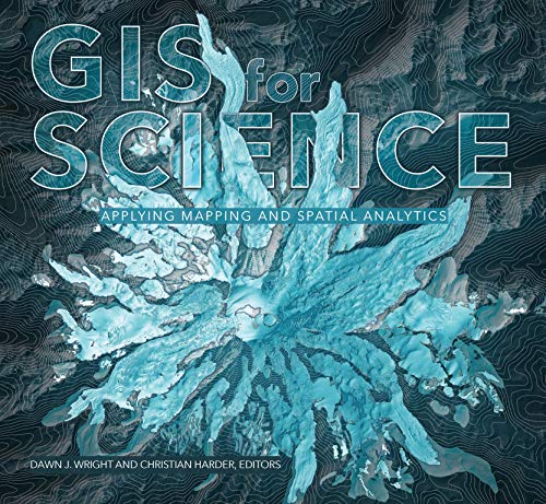
GIS for Science, Volume 1: Applying Mapping and Spatial Analytics (GIS for Science, 1)
Da: World of Books (was SecondSale), Montgomery, IL, U.S.A.
Valutazione del venditore 5 su 5 stelle
![]()
Condizione: Very Good. Item in very good condition! Textbooks may not include supplemental items i.e. CDs, access codes etc. Codice articolo 00099907274
Compra usato
EUR 5,95
Spedizione gratuita
Spedito in U.S.A.
Spedito in U.S.A.
Quantit�: 1 disponibili
Foto dell'editore
GIS for Science, Volume 1: Applying Mapping and Spatial Analytics
Da: ThriftBooks-Dallas, Dallas, TX, U.S.A.
Valutazione del venditore 5 su 5 stelle
![]()
Paperback. Condizione: Good. No Jacket. Pages can have notes/highlighting. Spine may show signs of wear. ~ ThriftBooks: Read More, Spend Less. Codice articolo G1589485300I3N00
Compra usato
EUR 5,96
Spedizione gratuita
Spedito in U.S.A.
Spedito in U.S.A.
Quantit�: 1 disponibili
Foto dell'editore
GIS for Science, Volume 1: Applying Mapping and Spatial Analytics
Da: ThriftBooks-Dallas, Dallas, TX, U.S.A.
Valutazione del venditore 5 su 5 stelle
![]()
Paperback. Condizione: Very Good. No Jacket. May have limited writing in cover pages. Pages are unmarked. ~ ThriftBooks: Read More, Spend Less. Codice articolo G1589485300I4N00
Compra usato
EUR 5,96
Spedizione gratuita
Spedito in U.S.A.
Spedito in U.S.A.
Quantit�: 1 disponibili
Foto dell'editore
GIS for Science, Volume 1: Applying Mapping and Spatial Analytics (GIS for Science, 1)
Da: HPB-Red, Dallas, TX, U.S.A.
Valutazione del venditore 5 su 5 stelle
![]()
paperback. Condizione: Good. Connecting readers with great books since 1972! Used textbooks may not include companion materials such as access codes, etc. May have some wear or writing/highlighting. We ship orders daily and Customer Service is our top priority! Codice articolo S_408196067
Compra usato
EUR 4,51
Spedizione EUR 3,28
Spedito in U.S.A.
Spedito in U.S.A.
Quantit�: 1 disponibili
Immagini fornite dal venditore
GIS for Science, Volume 1: Applying Mapping and Spatial Analytics
Da: Goodwill Southern California, Los Angeles, CA, U.S.A.
Valutazione del venditore 5 su 5 stelle
![]()
Condizione: good. Paperback Book. Codice articolo LACV.1589485300.G
Compra usato
EUR 6,31
Spedizione EUR 2,63
Spedito in U.S.A.
Spedito in U.S.A.
Quantit�: 1 disponibili
Foto dell'editore
GIS for Science, Volume 1: Applying Mapping and Spatial Analytics
Da: HPB-Diamond, Dallas, TX, U.S.A.
Valutazione del venditore 5 su 5 stelle
![]()
paperback. Condizione: Very Good. Connecting readers with great books since 1972! Used books may not include companion materials, and may have some shelf wear or limited writing. We ship orders daily and Customer Service is our top priority! Codice articolo S_467423113
Compra usato
EUR 9,01
Spedizione EUR 3,28
Spedito in U.S.A.
Spedito in U.S.A.
Quantit�: 1 disponibili
Foto dell'editore
GIS for Science: Applying Mapping and Spatial Analytics (GIS for Science, 1)
Da: medimops, Berlin, Germania
Valutazione del venditore 5 su 5 stelle
![]()
Condizione: very good. Gut/Very good: Buch bzw. Schutzumschlag mit wenigen Gebrauchsspuren an Einband, Schutzumschlag oder Seiten. / Describes a book or dust jacket that does show some signs of wear on either the binding, dust jacket or pages. Codice articolo M01589485300-V
Compra usato
EUR 11,94
Spedizione EUR 10,00
Spedito da Germania a U.S.A.
Spedito da Germania a U.S.A.
Quantit�: 1 disponibili
Foto dell'editore
GIS for Science, Volume 1 Applying Mapping and Spatial Analytics
Da: Skoob-ebooks, Pontiac, QC, Canada
Valutazione del venditore 5 su 5 stelle
![]()
Paperback. Condizione: Good. No highlighting, writing or other marks on pages. Moderate wear. Cover may have corners that are slightly scuffed, frayed and/or curled. ; 11 X 0.5 X 9.75 inches; 252 pages. Codice articolo 2S-UBPQ-BA7P
Compra usato
EUR 16,07
Spedizione EUR 11,37
Spedito da Canada a U.S.A.
Spedito da Canada a U.S.A.
Quantit�: 1 disponibili
Immagini fornite dal venditore
GIS for Science : Applying Mapping and Spatial Analytics
Da: GreatBookPrices, Columbia, MD, U.S.A.
Valutazione del venditore 5 su 5 stelle
![]()
Condizione: New. Codice articolo 35380326-n
Compra nuovo
EUR 35,77
Spedizione EUR 2,31
Spedito in U.S.A.
Spedito in U.S.A.
Quantit�: 10 disponibili
Immagini fornite dal venditore
GIS for Science : Applying Mapping and Spatial Analytics
Da: GreatBookPrices, Columbia, MD, U.S.A.
Valutazione del venditore 5 su 5 stelle
![]()
Condizione: As New. Unread book in perfect condition. Codice articolo 35380326
Compra usato
EUR 35,78
Spedizione EUR 2,31
Spedito in U.S.A.
Spedito in U.S.A.
Quantit�: 10 disponibili