Sinossi
Concerning the history and making of pictorial maps, a graphic form found increasingly in today's newspapers, magazines and television reporting, this book includes new Robinson projections that have solved many distortion problems, the computer's role in mapmaking and pictorial symbols. It begins with a history of pictorial maps through the ages, the use of pictorial maps in America, in the world, in war and news coverage and in weather reporting. The second half of the book concetrates on the mapmaking process itself in which Holmes shows how to achieve the various kinds of map projections in the age-old struggle to find a satisfactory way to show the entire surface of a 3-dimensional sphere on a a flat piece of paper. Included are the new Robinson projections that have solved many distortional problems, the computer's role in mapmaking, how to represent mountainous terrain convincingly, pictorial symbols used in maps and how to draw maps for friends.
Le informazioni nella sezione "Riassunto" possono far riferimento a edizioni diverse di questo titolo.
Product Description
Unusual book
Le informazioni nella sezione "Su questo libro" possono far riferimento a edizioni diverse di questo titolo.
Altre edizioni note dello stesso titolo

Risultati della ricerca per Pictorial Maps

Foto dell'editore
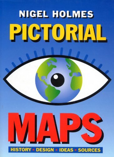
Pictorial Maps
Editore:
The Herbert Press, 1992
ISBN 10: 1871569435
ISBN 13: 9781871569438
Antico o usato
Rilegato
Prima edizione
Da: Vashon Island Books, Vashon, WA, U.S.A.
Valutazione del venditore 5 su 5 stelle
![]()
Hardcover. Condizione: Very Good. Condizione sovraccoperta: Very Good. Color and b/w Illustrations (illustratore). First Edition. In color pictorial jacket, 4to, 191pp. illustrated profusely. Size: 4to - over 9�" - 12" tall. Book. Codice articolo 0830618
Compra usato
EUR 8,80
Spese di spedizione:
EUR 4,29
In U.S.A.
Quantit�: 1 disponibili
Foto dell'editore
Pictorial Maps (Art Reference)
Da: WorldofBooks, Goring-By-Sea, WS, Regno Unito
Valutazione del venditore 5 su 5 stelle
![]()
Hardback. Condizione: Fair. Color And B/w Illustrations (illustratore). A readable copy of the book which may include some defects such as highlighting and notes. Cover and pages may be creased and show discolouration. Codice articolo GOR006841754
Compra usato
EUR 11,67
Spese di spedizione:
EUR 6,41
Da: Regno Unito a: U.S.A.
Quantit�: 1 disponibili
Foto dell'editore
Pictorial Maps (Art Reference)
Da: WorldofBooks, Goring-By-Sea, WS, Regno Unito
Valutazione del venditore 5 su 5 stelle
![]()
Hardback. Condizione: Very Good. Color And B/w Illustrations (illustratore). The book has been read, but is in excellent condition. Pages are intact and not marred by notes or highlighting. The spine remains undamaged. Codice articolo GOR003737121
Compra usato
EUR 11,67
Spese di spedizione:
EUR 6,41
Da: Regno Unito a: U.S.A.
Quantit�: 2 disponibili
Immagini fornite dal venditore
Pictorial Maps (Art Reference)
Da: WeBuyBooks, Rossendale, LANCS, Regno Unito
Valutazione del venditore 5 su 5 stelle
![]()
Condizione: Like New. Color And B/w Illustrations (illustratore). Most items will be dispatched the same or the next working day. An apparently unread copy in perfect condition. Dust cover is intact with no nicks or tears. Spine has no signs of creasing. Pages are clean and not marred by notes or folds of any kind. Codice articolo wbs1614743128
Compra usato
EUR 8,74
Spese di spedizione:
EUR 10,76
Da: Regno Unito a: U.S.A.
Quantit�: 1 disponibili
Immagini fornite dal venditore
Pictorial Maps
Da: Oopalba Books, Sale, MANCH, Regno Unito
Valutazione del venditore 5 su 5 stelle
![]()
Hardcover. Condizione: Very Good. Condizione sovraccoperta: Very Good. Color And B/w Illustrations (illustratore). VG/VG. This book is for graphic artists especially infographics artists and for anyone with an interest in maps and mapmaking. Full colour illustrations . History, Design, Ideas and Sources. UK Delivery only due to weight. Book. Codice articolo ab93yaz
Compra usato
EUR 14,15
Spese di spedizione:
EUR 13,73
Da: Regno Unito a: U.S.A.
Quantit�: 1 disponibili
Foto dell'editore
Pictorial Maps (Art Reference)
Da: Greener Books, London, Regno Unito
Valutazione del venditore 4 su 5 stelle
![]()
Hardcover. Condizione: Used; Very Good. Color And B/w Illustrations (illustratore). **SHIPPED FROM UK** We believe you will be completely satisfied with our quick and reliable service. All orders are dispatched as swiftly as possible! Buy with confidence! Greener Books. Codice articolo 5017289
Compra usato
EUR 11,44
Spese di spedizione:
EUR 18,30
Da: Regno Unito a: U.S.A.
Quantit�: 1 disponibili
Foto dell'editore
PICTORIAL MAPS
Da: GfB, the Colchester Bookshop, Colchester, Regno Unito
Valutazione del venditore 5 su 5 stelle
![]()
Hardcover. Condizione: Good. Condizione sovraccoperta: Good. Color And B/w Illustrations (illustratore). The Herbert Press, 1992. Hardback, d/j, 4to, 191pp, illust. A good copy. 1871569435/1.1uk. Codice articolo 382948
Compra usato
EUR 17,68
Spese di spedizione:
EUR 18,37
Da: Regno Unito a: U.S.A.
Quantit�: 1 disponibili
Immagini fornite dal venditore
Pictorial Maps
Editore:
Herbert Press Ltd, London, 1992
ISBN 10: 1871569435
ISBN 13: 9781871569438
Antico o usato
Rilegato
Prima edizione
Da: Linda Corrigan, Knutsford, Regno Unito
Valutazione del venditore 4 su 5 stelle
![]()
Board. Condizione: Near Fine. Condizione sovraccoperta: Near Fine. Holmes, Nigel (illustratore). 1st Edition. A near fine copy in a near fine dust jacket of this lavishly illustrated study of pictorial maps. Dust Jacket: pictorial, laminated, with colour map of Europe and black lettering to all faces, all on a white ground; in excellent condition; very clean and bright; no fading; no visible sign of shelf wear not price clipped (now protected). Cover: blue laminated boards with silver lettering to spine; in excellent condition; very clean and bright, no visible signs of shelf wear. Internally: very clean and tightly bound; no inscriptions or book plates; looks unread. Illustrated throughout in colour and black and white. 192 pp. Codice articolo 002459
Compra usato
EUR 23,58
Spese di spedizione:
EUR 36,79
Da: Regno Unito a: U.S.A.
Quantit�: 1 disponibili