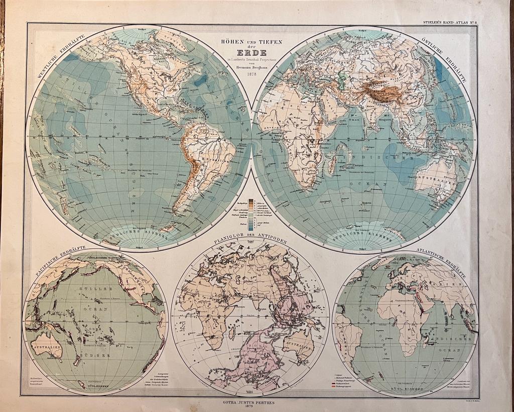
Cartography World 1879 | Coloured world map: Höhen und tiefen der Erde in Lambert's Zenithal Projection von Hermann Berghaus 1879, 1 p.
Berghaus, Hermann.
Condizione: Usato
Venduto da Antiquariaat Arine van der Steur / ILAB, Den Haag, Paesi Bassi
Membro dell'associazione:
Venditore AbeBooks dal 15 ottobre 2014
Valutazione del venditore 5 su 5 stelle
![]()
Usato
Prezzo:
EUR 72,60
Convertire valuta
EUR 30,00
per la spedizione da Paesi Bassi a U.S.A.
Destinazione, tempi e costi
Quantitŕ: 1 disponibili
Aggiungere al carrello