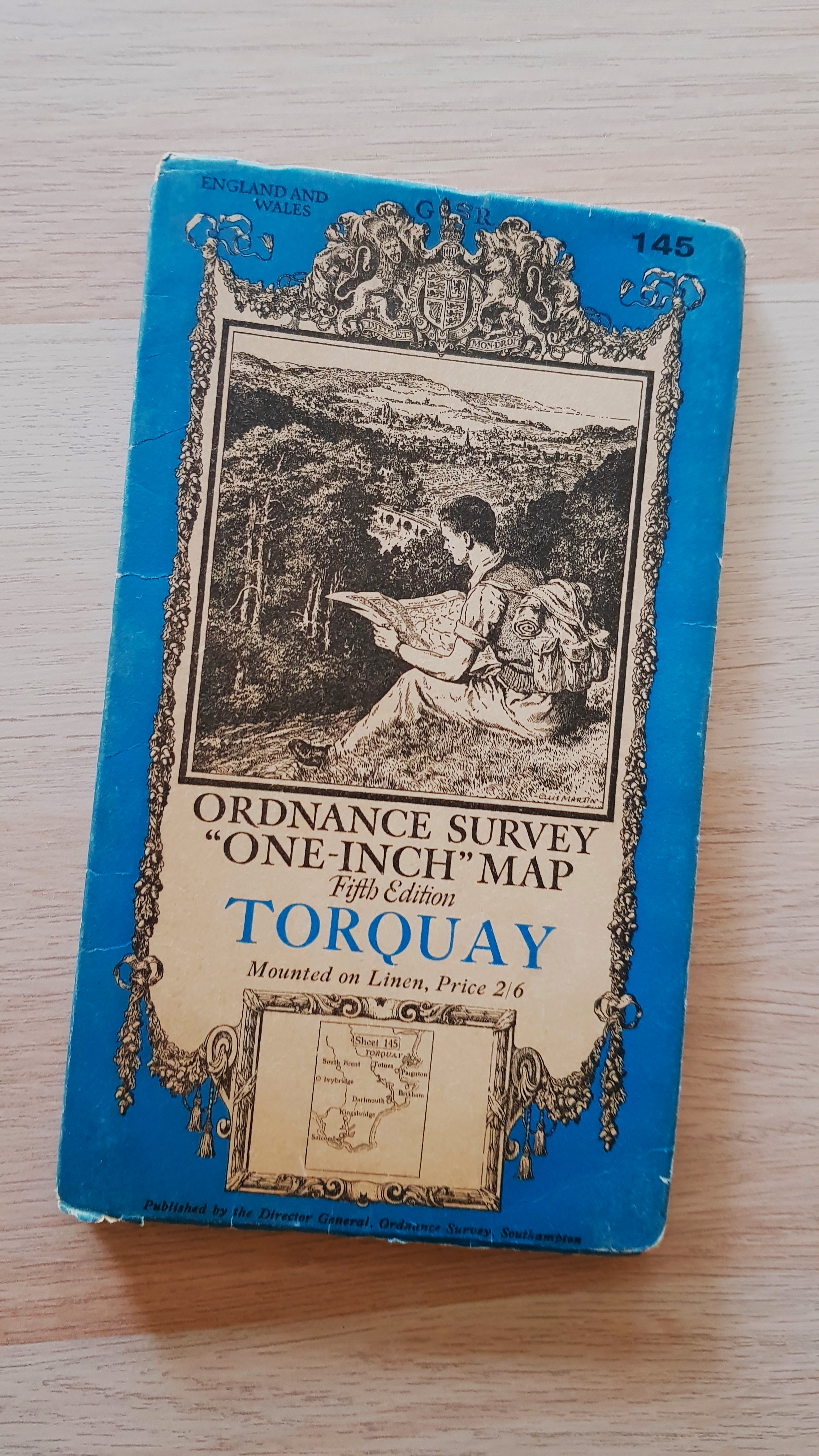
Ordnance Survey 'One-Inch' Map, Fifth Edition, Sheet 145 Torquay
Ordnance Survey
Editore: Ordnance Survey, 1932
Usato
Soft cover
Da
Old Shelves, Woking, SURRE, Regno Unito
Valutazione del venditore 5 su 5 stelle
![]()
Venditore AbeBooks dal 27 maggio 2024
Questa copia non � pi� disponibile. Ecco le corrispondenze migliori per Ordnance Survey 'One-Inch' Map, Fifth Edition, Sheet 145 Torquay di Ordnance Survey.
Riguardo questo articolo
Descrizione:
Published by the Director General of the Ordnance Survey, Southampton, 1932 with periodical corrected reprint. Imprint no 5036. Cover is clean and unmarked. Cloth map is clean, crisp and unmarked. Reduced postage for multiple orders. Codice articolo M121
Dati bibliografici
Titolo: Ordnance Survey 'One-Inch' Map, Fifth ...
Casa editrice: Ordnance Survey
Data di pubblicazione: 1932
Legatura: Soft cover
Condizione: Very Good
Condizione sovraccoperta: Very Good
Edizione: 5th or later Edition
I migliori risultati di ricerca su AbeBooks

Immagini fornite dal venditore
Ordnance Survey one-inch map, fifth edition, sheet 145, Torquay.
Editore:
Southampton: Ordnance Survey, 1938., 1938
Antico o usato
Rilegato
Da: Cornell Books Limited, Tewkesbury, Regno Unito
Valutazione del venditore 5 su 5 stelle
![]()
Condizione: Good. First published in 1932, this is a reprint from 1938 (print code 6038). Mounted on cloth and folded in the original blue card covers, with a front cover illustration by Ellis Martin. The map is in good condition (some ink annotation near Dartmouth, some creasing of the map). The covers are in good to very good condition (lightly rubbed and chafed). Also covers Salcombe, Kingsbridge, Dartmouth, Brixham, Paignton, Totnes, Ivybridge, South Brent, Buckfastleigh, Ashburton, Newton Abbot and Teignmouth. Codice articolo 30929
Compra usato
EUR 11,81
EUR 17,14 shipping
Spedito da Regno Unito a U.S.A.
Spedito da Regno Unito a U.S.A.
Quantit�: 1 disponibili
Immagini fornite dal venditore
Ordnance Survey 'One-Inch' Map Fifth Relief Edition, Sheet 145 Torquay
Editore:
Ordnance Survey, 1932
Antico o usato
Soft cover
Da: Old Shelves, Woking, SURRE, Regno Unito
Valutazione del venditore 5 su 5 stelle
![]()
Soft cover. Condizione: Very Good. Condizione sovraccoperta: Good. 5th or later Edition. Published by the Director General of the Ordnance Survey, Southampton, 1932. Cover is clean and unmarked, just a little worn around the edges. Cloth map is clean and unmarked. A nice copy of this less common and very attractive edition! Reduced postage for multiple orders. Codice articolo M119
Compra usato
EUR 17,71
EUR 16,62 shipping
Spedito da Regno Unito a U.S.A.
Spedito da Regno Unito a U.S.A.
Quantit�: 1 disponibili