Importo totale (1 articolo articoli):
Destinazione ordine:

blaeu joan krogt (118 risultati)
Vai alla pagina principale dei risultati di ricerca
Tipo di articolo
- Tutti gli articoli
- Libri (117)
- Riviste e Giornali
- Fumetti
- Spartiti
- Arte, Stampe e Poster
- Fotografie
- Mappe (1)
-
Manoscritti e
Collezionismo cartaceo
Condizioni
Legatura
Ulteriori caratteristiche
- Prima edizione (16)
- Copia autografata
- Sovraccoperta (41)
- Con foto (35)
- No print on demand
Spedizione gratuita
Paese del venditore
Valutazione venditore
-
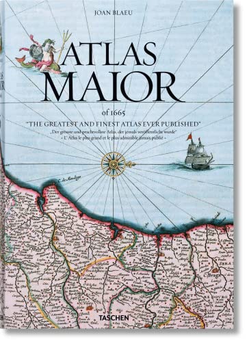
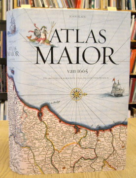
Atlas Maior, Germany
Editore: Taschen Deutschland GmbH+, 2015
ISBN 10: 3836522926ISBN 13: 9783836522922
Libro
Gut/Very good: Buch bzw. Schutzumschlag mit wenigen Gebrauchsspuren an Einband, Schutzumschlag oder Seiten. / Describes a book or dust jacket that does show some signs of wear on either the binding, dust jacket or pages.
Ulteriori offerte da altri venditori AbeBooks
Nuovo - A partire da EUR 19,90
Usato - A partire da EUR 13,50
Scopri anche Rilegato Brossura Prima edizione
-
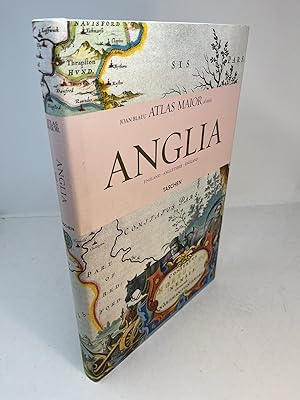
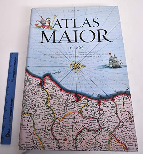
ATLAS MAIOR OF 1665. England. Volume I.
Editore: Taschen, Hong Kong, 2006
ISBN 10: 0760782067ISBN 13: 9780760782064
Libro
Hardcover. Condizione: Fine. Condizione sovraccoperta: Fine. Volume 1 only (Anglia/England). A Fine copy in Fine dust jacket. Folio, 223 pp., chiefly illustrated with full page color maps, usually opposite accompanying text. White boards in pictorial dust jacket. The dj is now protected in a mylar sleeve.
Ulteriori offerte da altri venditori AbeBooks
Nuovo - A partire da EUR 47,27
Usato - A partire da EUR 23,18
Scopri anche Rilegato Prima edizione
-
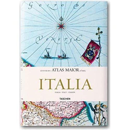
Atlas Maior of 1665 - Italia / Italy / Italien
Editore: TASCHEN, 2006
ISBN 10: 3822851078ISBN 13: 9783822851074
Da: Michener & Rutledge Booksellers, Inc., Baldwin City, KS, U.S.A.
Valutazione venditore:

Libro
Hardcover. Condizione: Very Good. Condizione sovraccoperta: Very Good. Text clean and solid; light wear to dust jacket; NOTE: additional postage may be necessary for international shipping; 8vo 8" - 9" tall; 208 pages.
Ulteriori offerte da altri venditori AbeBooks
Usato - A partire da EUR 26,56
-
Condizione: Very Good. Item in good condition. Textbooks may not include supplemental items i.e. CDs, access codes etc.
Ulteriori offerte da altri venditori AbeBooks
Nuovo - A partire da EUR 85,91
Usato - A partire da EUR 32,76
Scopri anche Rilegato
-
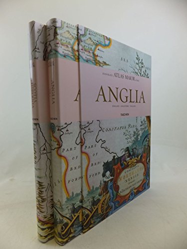
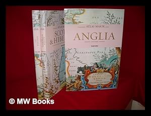
Atlas Maior - Anglia, Scotia Et Hibernia (Multilingual) (JUMBO)
Editore: TASCHEN, 2006
ISBN 10: 3822851043ISBN 13: 9783822851043
Libro
Hardcover. Condizione: Good. Bumped and creased book with tears to the extremities, but not affecting the text block and a remainder mark to one edge - Good Jumbo-sized.
Ulteriori offerte da altri venditori AbeBooks
Nuovo - A partire da EUR 48,24
Usato - A partire da EUR 29,46
Scopri anche Rilegato Brossura Prima edizione
-
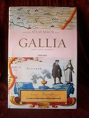
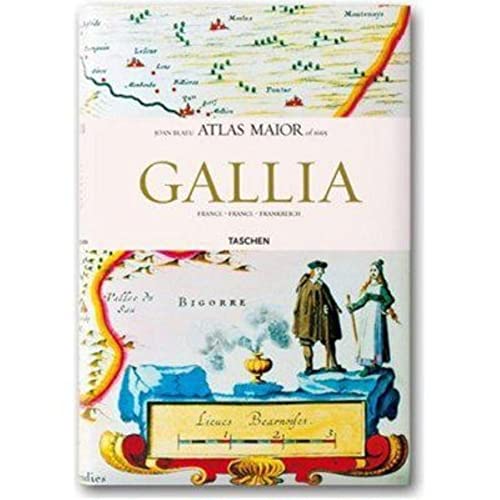
Atlas Maior of 1665. Gallia. France, France, Frankreich. La totalité des 64 cartes de la France et des textes originaux de Joan Blaeu, extraits de son Atlas Maior de 1665, "l'Atlas le plus grand et le plus admirable jamais publié".
Da: Librairie-Bouquinerie Le Pčre Pénard, Lyon, Francia
Valutazione venditore:

Editions Taschen - 2006 - In-folio, cartonnage blanc illustré en couleurs sous jaquette illustrée en couleurs, dans son emboîtage cartonné toilé rose de l'éditeur - 207 p. - Trčs riche iconographie in, hors texte et pleine page en couleurs - Ouvrage trilingue français / anglais / allemand Bon état.
-
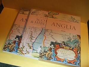
ANGLIA: TWO BOOKS in SLIPCASE: ATLAS MAIOR of 1665: England / Angleterre (volume 1 ) -with Scotia & Hibernia ( Scotland & Ireland / L'Ecosses et L'Irlande / Schottland Und Irland )(vol. 2 / Taschen Books (Text in German French / English )( All 113 Maps)
Editore: Cologne / Koln ( Germany ): Taschen Books, 2006, 1st Taschen Edition, First Printing, Cologne, Germany, 2006
ISBN 10: 3822851043ISBN 13: 9783822851043
Libro Prima edizione
Hardcovers. Condizione: Fine (see description). Condizione sovraccoperta: Fine (see description). Map Cover Art (illustratore). First Edition. ------------TWO VOLUMES in SLIPCASE (ONE SHIPPING CHARGE), hardcovers, both are Fine examples, in Fine dustjackets, as NEW, obviously unread, ---both volumes are housed in a lightly rubbed near Fine matching slipcase ---unpaginated (likely about 200-250 pages in the two volumes) colour maps throughout, all text is in English, German and French, extra shipping might be required depending upon destination ---if an issue please inquire before ordering, ---"Maps of England, Ireland, and Scotland from Joan Blaeu's exquisite world atlas of 1665 The finest and most comprehensive baroque atlas was Joan Blaeu's exceptional Atlas Maior, completed in 1665. The original eleven-volume Latin edition, containing 594 maps, put Blaeu ahead of his staunch competitor, mapmaker Joanes Janssonius, whose rivalry inspired Blaeu to produce a grandiose edition of the largest and most complete atlas to date. Covering Arctica, Europe, Africa, Asia, and America, Blaeu's Atlas Maior was a remarkable achievement and remains to this day one of history's finest examples of mapmaking. This reprint, including all 58 maps of England and 55 maps of Scotland and Ireland, is made from the National Library of Vienna's colored, gold-heightened copy, thus assuring the best possible detail and quality. Alongside original quotes from Joan Blaeu relating to the individual maps, the new text by Peter van der Krogt explains the historical and cultural associations and introduces the reader into the fascinating world of early modern cartography. The text is in English, French and German. The author: Peter van der Krogt, the leading expert in the field of Dutch atlases, is a collaborator on the Explokart Research Program for the History of Cartography at the University of Utrecht's Faculty of Geosciences. Since 1990 he has been working on Koeman's Atlantes Neerlandici, the carto-bibliography of atlases published in the Netherlands. His second project is the compilation, in co-operation with the Nijmegen University, of an illustrated and annotated catalogue of the Atlas Blaeu-Van der Hem, the most important multi-volume atlas preserved in the Austrian National Library"---, any image directly beside this listing is the actual book and not a generic photo ///NOT SIGNED --GUARANTEED to be AVAILABLE/// ---sizes are approximate (generally within 1/8 inch)--- Size: 10.25w x 15.5h Inches. Not Signed. Flaps Not Clipped.
-

Atlas Maior - Germania, Austria Et Helvetia
Editore: TASCHEN, 2006
ISBN 10: 3822851027ISBN 13: 9783822851029
Libro
Hardcover. Condizione: Fine. Condizione sovraccoperta: Fine Dust Jacket. 4to. 416 pp. Two volumes in slipcase. We specialize in fine books in collectible condition. Orders are professionaly packaged and shipped promptly. P40.
Ulteriori offerte da altri venditori AbeBooks
Usato - A partire da EUR 38,63
-
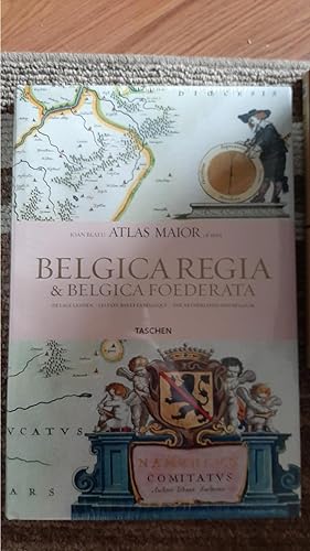
![Immagine del venditore per De Lage Landen. Belgica Regia & Belgica Foedereta. Les Pays-Bas et la Belgique - The Netherlands and Belgium. [ Joan Blaeu Atlas Maior of 1665. Alle 63 kaarten van Nederland en België met originele citaten uit Joan Blaeus Atlas Maior van 1665 ]. isbn 9789089980410 venduto da Frans Melk Antiquariaat](https://pictures.abebooks.com/inventory/md/md31323049071.jpg)
De Lage Landen. Belgica Regia & Belgica Foedereta. Les Pays-Bas et la Belgique - The Netherlands and Belgium. [ Joan Blaeu Atlas Maior of 1665. Alle 63 kaarten van Nederland en België met originele citaten uit Joan Blaeus Atlas Maior van 1665 ]. isbn 9789089980410
ISBN 10: 9089980415ISBN 13: 9789089980410
Libro
Librero, 2010. 38 x 25 cm. Paperback / Softcover. Richly illustrated in color and b/w. Text in Dutch, French and English. 207 pages. NEAR FINE COPY [ Cartography / cartografie ].
-
Joan Blaeu. Atlas Maior of 1665
Editore: TASCHEN, 2016
ISBN 10: 3836538032ISBN 13: 9783836538039
Libro
Condizione: Good. Item in good condition. Textbooks may not include supplemental items i.e. CDs, access codes etc.
Ulteriori offerte da altri venditori AbeBooks
Nuovo - A partire da EUR 53,76
Usato - A partire da EUR 43,07
Scopri anche Rilegato
-
Atlas Maior - Belgica Regia & Belgiaca Foederata (JUMBO) (French Edition)
Editore: TASCHEN, 2006
ISBN 10: 3822851035ISBN 13: 9783822851036
Libro
Hardcover. Condizione: New. NEW SEALED UNOPENED.
Ulteriori offerte da altri venditori AbeBooks
Nuovo - A partire da EUR 43,40
Usato - A partire da EUR 33,00
Scopri anche Rilegato Prima edizione
-
Hardcover. Condizione: Fine. Condizione sovraccoperta: Near Fine. FINE condition!.
Ulteriori offerte da altri venditori AbeBooks
Usato - A partire da EUR 48,27
-

Atlas Maior of 1665. Belgica Regia & Belgica Foederata. De Lage Landen - Les Pays-Bas et La Belgique - The Netherlands and Belgium [title on front cover: Joan Blaeu Atlas Maior of 1665. De Lage Landen].
Da: Antiquariaat A. Kok & Zn. B.V., Amsterdam, Paesi Bassi
Membro dell'associazione: ILAB NVVA
Valutazione venditore:
Hongkong, Köln, [etc.], Taschen Verlag, [2006]. 207 pp. Num. col. ills. Hardcover, d/j. Sm. folio. Depicting all the 63 maps of the Netherlands and Belgium as published in Joan Blaeu's Atlas maior of 1665. - Text in English, French and Dutch language.
-
John Blaeu Atlas Maior of 1665 - Gallia: Francia, France, Frankreich
Editore: Taschen America, 2006
Da: Edmonton Book Store, Edmonton, AB, Canada
Membro dell'associazione: ABAC ILAB
Valutazione venditore:
Libro
Condizione: Very Good. Condizione sovraccoperta: Very Good. Larger 8vo pp.307.This reprint, including all 64 maps of France, is made from the National Library of Vienna's colored, gold-heightened copy, thus assuring the best possible detail and quality. Alongside original quotes from Joan Blaeu relating to the individual maps, the new text by Peter van der Krogt explains the historical and cultural associations and introduces the?. book.
-
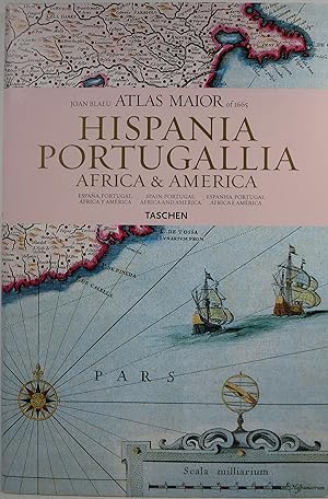
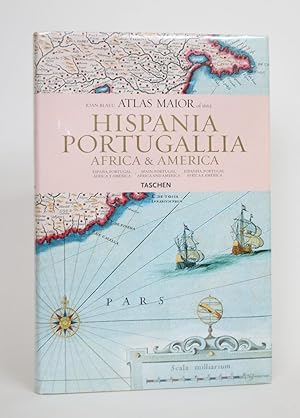
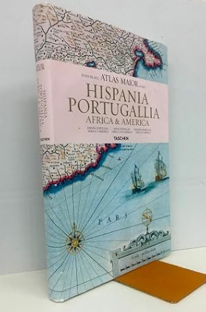
Joan Blaeu Atlas Maior of 1665: Hispania, Portugallia, Africa & America
Editore: Taschen, Koln, 2006
ISBN 10: 382285106XISBN 13: 9783822851067
Libro
Hardcover. Condizione: Very Good. Condizione sovraccoperta: Very Good. small indents on back cover. Dust jacket in clear protector. Reproduces all 64 maps of Spain, Portugal, Africa and America and the original commentaries from John Blaeu's Atlas Major of 1665, "the greatest and finest atlas ever published." Text in Spanish, English, and Portuguese. 232pp 4.66lb 15.3x10.3x1.2in.
-
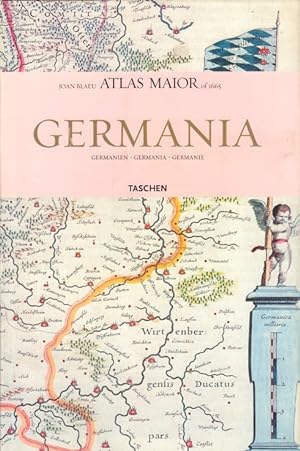
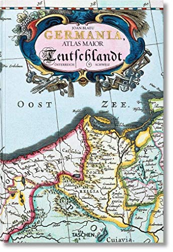
Germania, Volgo Deutschlandt, Band 1 Germanien, Germania, Germanie
Editore: Köln: Taschen Verlag, 2015
Libro
Condizione: Sehr gut. 215 Seiten Zustand: Schutzumschlag mit Randläsuren und leicht berieben, , Einband minimal berieben, Schnitt leicht angeschmutzt // Mit Umschlaggestaltung und zahlreichen farbigen Illustrationen, sämtiche 124 Karten von Germanien. Atlas Maior Nr. 1. Germania : Atlas maior of 1665 ; 124 Tafeln mit Karten von Germanien, Österreich und der Schweiz, sowie Originaltexte von Joan Blaeu aus seinem Atlas Major von 1665, "dem grössten und prachtvollsten Atlas, der jemals veröffentlicht wurde" Altersfreigabe FSK ab 0 Jahre Sprache: Deutsch Gewicht in Gramm: 2000 gr.4°, 39,0 x 26,5 cm, Hardcover in Pappband, mit Schutzumschlag.
-
Atlas Maior of 1665: Hispania, Portugallia, Africa & America
Editore: Taschen, Hong Kong, 2006
Da: Minotavros Books, ABAC ILAB, Whitby, ON, Canada
Membro dell'associazione: ABAC ILAB
Valutazione venditore:
Hardcover. Condizione: Near Fine. Condizione sovraccoperta: Near Fine. 4to. White paper pictorial boards. 231 p.p. Map endpapers. In Spanish, English, and Portuguese. With 64 maps of Spain, Portugal, Africa and America, and the original commentaries of Joan Blaue's Atlas Maior of 1665, "The greatest and finest atlas ever published." Bumping to edges of boards and spine ends, some soiling to boards. Dust jacket near fine overall. The Atlas Maior was a cartographical masterpiece of the Baroque period.
-
ATLAS MAIOR OF 1665 VOL. 1: ANGLIA AND VOL. 2: SCOTIA & HIBERNIA.
Editore: Koln: Taschen, 2006., 2006
Da: Grant's Bookshop, Cheltenham, VIC, Australia
Membro dell'associazione: ANZAAB ILAB
Valutazione venditore:

Two volumes 58 color maps in Vol. 1, 55 in Vol. 2. Folio, original boards in colour illus dustwrappers, in colour illus slipcase. A fine set. . Reproductions of 17th century maps, text in English, French and German (translated form the original Latin). Part of the influential 11-volume Atlas ("Theatrum Orbis Terrarum") by the Dutch printer and mapmaker Joan Blaeu (1596-1673).
-
Joan Blaeu Atlas Maior of 1665: Hispania, Portugallia, Africa & America (English, espańol, portugués)
Editore: Taschen, Koln, 2006
Prima edizione
1Ş edición. 39x26 cm.231 pp. Cartoné editorial con sobrecubierta. Profusamente ilustrado. Textos en Espańol-Inglés-Portugués. Muy buen estado. IMPORTANTE. Lea Nuestras Condiciones de Venta y Gastos de Envío.
-
Atlas Maior of 1665. Germania, Austria & Helvetia. / Germanien, Österreich und Schweiz. / Germania, Austria and Switzerland. / Germanie, Autriche et Suisse. Introduction and texts by Peter van der Krogt.
Da: Antiquariaat A. Kok & Zn. B.V., Amsterdam, Paesi Bassi
Membro dell'associazione: ILAB NVVA
Valutazione venditore:
Köln, [etc.], Taschen, 2006. 2 vols. 404 pp. Col. maps. Orig. uniform hardcovers, d/j. Sm. folio. Including all the 124 maps of Germany, Austrai and Switzerland, and the original commentaries from Joan Blaeu's Atlas maior of 1665. Text in English, German & French. - Based on the copy in the Österrechische Nationalbibliothek, Vienna.
-
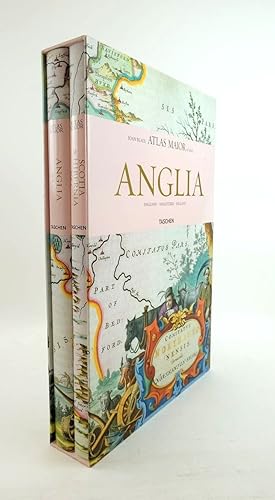
ATLAS MAIOR ANGLIA, SCOTIA & HIBERNIA (2 VOLUMES)
Editore: Taschen, 2006
ISBN 10: 3822851043ISBN 13: 9783822851043
Da: Stella & Rose's Books, PBFA, Tintern, MON, Regno Unito
Membro dell'associazione: PBFA
Valutazione venditore:
Libro Prima edizione
Hardback. Condizione: Fine. Condizione sovraccoperta: Fine. First edition. 1st thus 2006. Nearly fine condition in a nearly fine dustwrapper. The ATLAS MAIOR, the cartographical masterpiece of the Baroque, was brought out in 1662 and 1665 by the Amsterdam publisher Joan Blaeu, one of Holland's leading cartographers. Originally appearing in Latin, the atlas comprised 594 maps in 11 volumes, which depicted the whole of the world as known to early modern Europe. It was the largest and most expensive book to be published during the seventeenth century. For more than 100 years it remained the definitive atlas of the world, and today is one of the most sought-after and valuable antiquarian rarities. TASCHEN's bibliophile reprint of this costly atlas is based on the hand-colored copy with gilt highlights now in the Austrian National Library in Vienna. Alongside original quotes from Joan Blaeu relating to the individual maps, the new text by Peter van der Krogt explains the historical and cultural associations and introduces the reader to the fascinating world of early modern cartography. Large format. Two volumes. Colour maps, 58 of England, 55 of Scotland and Ireland. The text is in English, French and German. Contained in pictorial slipcase. Light bumping to top & tail of spines and light scuffing to boards. Dustwrappers have minor rubbing to corners. A lovely set contained in publisher's slipcase in almost fine condition. Packaged with care and promptly dispatched!.
-
Atlas Maior of 1665. Band 1: Germania und Band 2: Germania, Austria und Helvetia. Sämtliche 124 Karten von Germanien, Österreich und der Schweiz sowie Originaltexte von Joan Blaeu aus seinem Atlas Maior von 1665, dem größten und prachtvollsten Atlas, der jemals veröffentlicht wurde. Einführung und Texte von Peter van der Krogt. Mit einer Auswahl der Originaltexte von Joan Blaeu.
Editore: Benedikt Taschen Verlag., Köln., 2006
403 Seiten. Gr.-4to. Gut erhalten. Illustrierte O-Pappbände mit O-schutzumschlägen im illustrierten O-Pappschuber.
-
Atlas Maior 1665 - Germania, Austria & Helvetia: Germania, Austria Et Helvetia: 2 Bände (Joan Blaeu Atlas Maior 1665)
Editore: Taschen Verlag, 2006
Libro
Condizione: Gut. 416 Seiten Gebundene Ausgabe 2 Bände im Schuber - - ISBN: 3822851027 Sprache: Deutsch.
-
GALLIA - ATLAS MAJOR of 1665 - FRANCE - FRANKREICH
Da: LA FRANCE GALANTE, Saint MARTIN sur LAVEZON, Francia
Valutazione venditore:
Libro
Couverture rigide. Condizione: Trčs bon. Paris / Cologne . Taschen .2006 . Un trés grand cartonnage sous jaquette illustrée , 26,5 x 39 pages , de 207 pages couleurs . Excellent état . Poids : 2,200 Kg .
-
Atlas Maior "The Greatest and Finest Ever Published" Based on the Copy in the Osterreichische Nationalbiliothek, Vienna . Etc.
Editore: Barnes & Noble/Taschen GmbH, USA, 2006
Prima edizione
Glossy Hardback. Condizione: Fine - as New. Condizione sovraccoperta: Fine Dj. #1 in line/First By Arrangement. 415 pages. Full-color fancy maps through-out. Includes maps from all over the world and the original preface with a selection of original texts. Also has the new introduction. The maps are made on stiff very light cardstock or premium paper. In full color with English Language text. A more comprehensive look at the Atlas's than the other reprint editions. A fascinating edition and probably the best (besides the originals) to date. Size: Atlas Folio - over 23" - 25" tall.
-
Atlas maior of 1665 / Joan Blaeu ; introduction and texts by Peter van der Krogt ; based on the copy in the Osterreichische Nationalbibliothek, Wien ; with a selection of original texts by Joan Blaeu ; directed and produced by Benedikt Taschen
Editore: Hong Kong ; London : Taschen, 2006
Prima edizione
First Edition. Fine copy in the original gilt-blocked cloth boards in a slightly worn slip-case. Particularly and surprisingly well-preserved; tight, bright, clean and especially sharp-cornered. Physical description; 2 v. (392 p.) : ill. (chiefly col., col. maps, col. ports.) ; 39 cm. Notes; In slip case. "All 113 maps of England, Scotland and Ireland, and the original commentaries from Joan Blaeu's Atlas maior of 1665, 'the greatest and finest atlas ever published.'". Includes bibliographical references and index. Contents; Incomplete contents v. 1. Anglia = England -- v. 2. Scotia & Hibernia = Scotland and Ireland. Summary; This work contains maps of England, Ireland, and Scotland from Joan Blaeu's exquisite world atlas of 1665. "The Atlas Maior", the cartographical masterpiece of the Baroque period, was brought out between 1662 and 1665 by the Amsterdam publisher Joan Blaeu, one of Holland's leading cartographers. Originally appearing in Latin, the atlas comprised 594 maps in 11 volumes, which depicted the whole of the world as known to early modern Europe. It was the largest and most expensive book published during the 17th century. For more than 100 years, it remained the definitive atlas of the world, and today is among the most sought-after and valuable antiquarian rarities. This reprinted edition in six volumes is based on the hand-colored, gold-heightened copy in the "Osterreichische Nationalbibliothek" in Vienna, thus ensuring the best possible detail and quality. Alongside Joan Blaeu's original commentaries on the individual maps, a new text by Peter van der Krogt explains the historical and cultural associations and introduces the reader to the fascinating world of early modern cartography. This two-volume set features all 58 maps of England and 55 maps of Scotland and Ireland and the text is in English, French, and German. Subjects; Scales differ. England - Maps - Early works to 1800. Ireland - Maps - Early works to 1800. Scotland - Maps - Early works to 1800. Travel / road maps & atlases. Antiques & collectables: pictures, prints & maps. England ; Scotland ; Ireland. Reference / Atlases, Gazetteers & Maps. Technology & Engineering / Cartography. Technology & Engineering / History. 10 Kg.
-
Joan Blaeu Atlas Maior de 1665: GALLIA. France. Frankreich. Texte auf Französisch, Englisch und Deutsch. Inhalt: Einführung in die Geografie von Joan Blaeu. Der Atlas Maior von Joan Blaeu (Einleitung von Peter de Krogt). Katalog der Karten (mit einer Auswahl der Originaltexte von Joan Blaeu).
Editore: Hongkong u.a. / Taschen, 2006
Da: ACADEMIA Antiquariat an der Universität, Freiburg, Germania
Membro dell'associazione: BOEV
Valutazione venditore:
Libro
26 x 40 cm. Condizione: Sehr gut. Gebunden mit Schutzumschlag. Sehr gut erhalten. Reproduktionen der Karten in guter Qualität. Großes Format. Sprache: Deutsch Gewicht in Gramm: 1990.
-
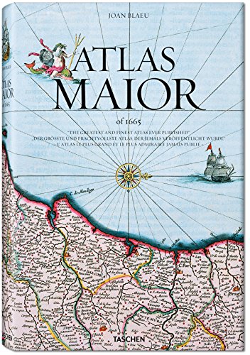
Atlas Maior of 1665
Editore: TASCHEN, 2010
ISBN 10: 3836524112ISBN 13: 9783836524117
Libro Prima edizione
Hardcover. Condizione: Near Fine. Condizione sovraccoperta: Very Good. 1st Edition. Book is in near fine condition with colour illustrations. Pictorial slipcase in very good condition with crack.
-
Taschen, 2005. 45 x 30 cm. Gebonden met stofomslag. Hardcover with dustjacket. Rijk geďllustreerd in kleur en z/w. , ook vouwkaarten. 593 pag. ALS NIEUW / AS NEW * ** Text in Dutch, French and English [ Cartography / cartografie ].