Importo totale (1 articolo articoli):
Destinazione ordine:

henry francis walling ormando willis (23 risultati)
Vai alla pagina principale dei risultati di ricerca
Filtri di ricerca
Tipo di articolo
- Tutti i tipi di prodotto
- Libri (4)
- Riviste e Giornali (Nessun altro risultato corrispondente a questo perfezionamento)
- Fumetti (Nessun altro risultato corrispondente a questo perfezionamento)
- Spartiti (Nessun altro risultato corrispondente a questo perfezionamento)
- Arte, Stampe e Poster (Nessun altro risultato corrispondente a questo perfezionamento)
- Fotografie (Nessun altro risultato corrispondente a questo perfezionamento)
- Mappe (19)
- Manoscritti e Collezionismo cartaceo (Nessun altro risultato corrispondente a questo perfezionamento)
Condizioni Maggiori informazioni
- Nuovo (Nessun altro risultato corrispondente a questo perfezionamento)
- Come nuovo, Ottimo o Quasi ottimo (Nessun altro risultato corrispondente a questo perfezionamento)
- Molto buono o Buono (16)
- Discreto o Mediocre (7)
- Come descritto (Nessun altro risultato corrispondente a questo perfezionamento)
Legatura
- Tutte
- Rilegato (4)
- Brossura (Nessun altro risultato corrispondente a questo perfezionamento)
Ulteriori caratteristiche
- Prima ed. (2)
- Copia autograf. (Nessun altro risultato corrispondente a questo perfezionamento)
- Sovracoperta (Nessun altro risultato corrispondente a questo perfezionamento)
- Con foto (22)
- Non Print on Demand (23)
Lingua (1)
Prezzo
- Qualsiasi prezzo
- Inferiore a EUR 20 (Nessun altro risultato corrispondente a questo perfezionamento)
- EUR 20 a EUR 45
- Superiore a EUR 45
Spedizione gratuita
- Spedizione gratuita in U.S.A. (Nessun altro risultato corrispondente a questo perfezionamento)
Paese del venditore
Valutazione venditore
-
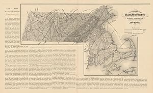
Climatological map of Massachusetts showing the average temperature, amount of rain fall &c. by Lorin Blodgett 1860
Data di pubblicazione: 1871
Da: Antiqua Print Gallery, London, Regno Unito
Valutazione del venditore 4 su 5 stelle

Mappa
EUR 28,36
EUR 11,47 shipping
Spedito da Regno Unito a U.S.A.Quantit�: 1 disponibili
Aggiungi al carrelloCondizione: Good. Climatological map of Massachusetts average temperature. BLODGETT 1871. Antique map; Map by Lorin Blodgett, published by Henry Francis Walling & Ormando Willis Gray (1871). 37.5 x 62.0cm, 14.75 x 24.5 inches; this is a folding map. Condition: Good. There is text printed on the reverse side.
-
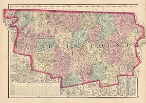
Franklin County
Data di pubblicazione: 1871
Da: Antiqua Print Gallery, London, Regno Unito
Valutazione del venditore 4 su 5 stelle
Mappa
EUR 28,36
EUR 11,47 shipping
Spedito da Regno Unito a U.S.A.Quantit�: 1 disponibili
Aggiungi al carrelloCondizione: Good. Franklin County, Massachusetts. WALLING & GRAY 1871 old antique map plan chart. Antique hand coloured county map; Henry Francis Walling & Ormando Willis Gray (1871). 30.0 x 42.5cm, 11.75 x 16.75 inches. Condition: Good. Light spotting in margin. There is nothing printed on the reverse side, which is plain.
-
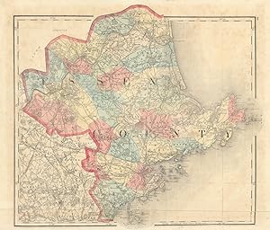
Essex County
Data di pubblicazione: 1871
Da: Antiqua Print Gallery, London, Regno Unito
Valutazione del venditore 4 su 5 stelle
Mappa
EUR 33,09
EUR 11,47 shipping
Spedito da Regno Unito a U.S.A.Quantit�: 1 disponibili
Aggiungi al carrelloCondizione: Good. Essex County, Massachusetts. WALLING & GRAY 1871 old antique map plan chart. Antique hand coloured county map; Henry Francis Walling & Ormando Willis Gray (1871). 34.5 x 40.5cm, 13.5 x 16 inches; this is a folding map. Condition: Good. Tight bottom margin below caption; Light spotting. There is nothing printed on the reverse side, which is plain.
-
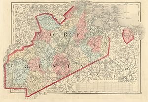
Norfolk County
Data di pubblicazione: 1871
Da: Antiqua Print Gallery, London, Regno Unito
Valutazione del venditore 4 su 5 stelle
Mappa
EUR 33,09
EUR 11,47 shipping
Spedito da Regno Unito a U.S.A.Quantit�: 1 disponibili
Aggiungi al carrelloCondizione: Good. Norfolk County, Massachusetts. WALLING & GRAY 1871 old antique map plan chart. Antique hand coloured county map; Henry Francis Walling & Ormando Willis Gray (1871). 28.5 x 41.5cm, 11.25 x 16.5 inches. Condition: Good. Tight top margin. Repaired marginal tear. There is nothing printed on the reverse side, which is plain.
-

Bristol County
Data di pubblicazione: 1871
Da: Antiqua Print Gallery, London, Regno Unito
Valutazione del venditore 4 su 5 stelle
Mappa
EUR 39,00
EUR 11,47 shipping
Spedito da Regno Unito a U.S.A.Quantit�: 1 disponibili
Aggiungi al carrelloCondizione: Good. Bristol County, Massachusetts. WALLING & GRAY 1871 old antique map plan chart. Antique hand coloured county map; Henry Francis Walling & Ormando Willis Gray (1871). 61.0 x 41.0cm, 24 x 16 inches; this is a folding map. Condition: Good. Light spotting. There is nothing printed on the reverse side, which is plain.
-
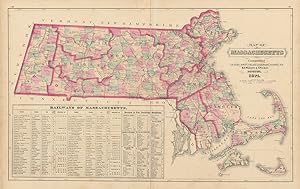
Map of Massachusetts comprising counties, towns, villages, railroads, stations, etc. H.F. Walling & O.W. Gray, Boston, 1871
Data di pubblicazione: 1871
Da: Antiqua Print Gallery, London, Regno Unito
Valutazione del venditore 4 su 5 stelle
Mappa
EUR 44,91
EUR 11,47 shipping
Spedito da Regno Unito a U.S.A.Quantit�: 1 disponibili
Aggiungi al carrelloCondizione: Good. Map of Massachusetts comprising counties, towns WALLING & GRAY 1871 old. Antique hand coloured state map; Henry Francis Walling & Ormando Willis Gray (1871). 40.5 x 64.0cm, 15.75 x 25.25 inches; this is a folding map. Condition: Good. Light spotting. Split along fold repaired verso. There is nothing printed on the reverse side, which is plain.
-

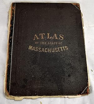
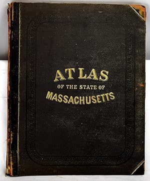
Official Topographical Atlas of Massachusetts,: From astronomical, trigonomical and various local surveys;
Editore: Stedman, Brown & Lyon, 1871
Da: Schoen Books, South Deerfield, MA, U.S.A.
Membro dell'associazione: SNEAB
Valutazione del venditore 3 su 5 stelle

Condizione: Good. Location:96 Folio spine repaired with new spine, new hinges also 100, [22] pages: 27 maps (26 color, some double); 45 cm. 17 1/4" x 14" "List of cities, towns, villages, post-offices, railways, and telegraph stations in Massachusetts": pages 95-100. Lists of "patrons" in Boston and vicinity and in Berkshire, Franklin, Hampshire, and Hampden counties 96.
-
Official Topographical Atlas of Massachusetts: From Astronomical, Trigonometrical and Various Local Surveys
Editore: Stedman, Brown & Lyon, 1871
Da: Sequitur Books, Boonsboro, MD, U.S.A.
Membro dell'associazione: IOBA
Valutazione del venditore 5 su 5 stelle

Prima edizione
Hardcover. Condizione: Fair. First Edition. Folio, 45 cm. Bound in publisher's cloth. 19, xx-xxi, [1], 22-23, xxiv-xxxi, 2-49 pages including 16 color maps (part double) tables. Hardcover. Poor binding. Refs: Phillips, 14399; Phillips. Maps of America, p. 401; LeGear. Atlases of the United States, L1551.
-
Official topographical atlas of Massachusetts,: From astronomical, trigonomical and various local surveys;
Editore: Stedman, Brown & Lyon, 1871
Da: Sequitur Books, Boonsboro, MD, U.S.A.
Membro dell'associazione: IOBA
Valutazione del venditore 5 su 5 stelle
Hardcover. Condizione: Good. Folio, 44 x 35 cm. Bound in publisher's cloth, rebacked. 19, xx-xxi, [1], 22-23, xxiv-xxxi, 2-49 pages including 16 color maps (most double page) tables. Hardcover. Good binding and cover. Clean, unmarked pages. Phillips, 14399; Phillips. Maps of America, p. 401; LeGear. Atlases of the United States, L1551. This is an oversized or heavy book, that requires additional postage for international delivery outside the US.
-
Official topographical atlas of Massachusetts / Atlas of the state of Massachusetts
Editore: Boston : Stedman, Brown & Lyon, 1871
Da: Sequitur Books, Boonsboro, MD, U.S.A.
Membro dell'associazione: IOBA
Valutazione del venditore 5 su 5 stelle
Prima edizione
Hardcover. Condizione: Good. First Edition. Bound in publisher's leather backed, brown cloth. Spine leather worn, partially split. 100, [22] pages: 27 maps (26 color, some double); 45 cm. 17 1/4" x 14" "List of cities, towns, villages, post-offices, railways, and telegraph stations in Massachusetts": pages 95-100. Lists of "patrons" in Boston and vicinity and in Berkshire, Franklin, Hampshire, and Hampden counties, arranged by business or occupation, p. [101]-[122]. Includes a business directory; census statistics for 1870; and a brief history of Massachusetts. Contents: General description: Topography / by H.F. Walling --History / by A.H. Hoyt --Railways / by Edward Appleton --Geology / by C.H. Hitchcock --Climatology / by Lorin Blodget --General maps --County maps --City maps --Statistics. Phillips, 14399; Phillips. Maps of America, p. 401; LeGear. Atlases of the United States, L1551.
-
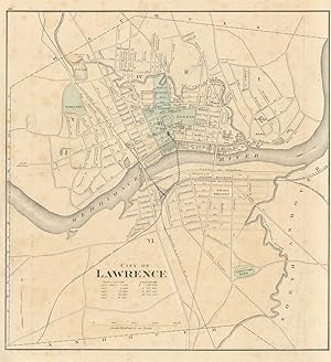
City of Lawrence
Data di pubblicazione: 1871
Da: Antiqua Print Gallery, London, Regno Unito
Valutazione del venditore 4 su 5 stelle
Mappa
EUR 50,82
EUR 11,47 shipping
Spedito da Regno Unito a U.S.A.Quantit�: 1 disponibili
Aggiungi al carrelloCondizione: Fair. City of Lawrence, Massachusetts. Town plan. WALLING & GRAY 1871 old map. Antique hand coloured city plan; Henry Francis Walling & Ormando Willis Gray (1871). 36.0 x 33.0cm, 14.25 x 13 inches. Condition: Fair: No right margin (image incomplete: a small part of the print may be missing compared to that shown in the scan); Pencil marks. There is another map printed on the reverse side.
-
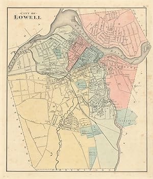
City of Lowell. Reduced by permission from the large Map by R.W. Baker
Data di pubblicazione: 1871
Da: Antiqua Print Gallery, London, Regno Unito
Valutazione del venditore 4 su 5 stelle
Mappa
EUR 50,82
EUR 11,47 shipping
Spedito da Regno Unito a U.S.A.Quantit�: 1 disponibili
Aggiungi al carrelloCondizione: Good. City of Lowell, Massachusetts. Town plan. BAKER, WALLING & GRAY 1871 old map. Antique hand coloured city plan; Henry Francis Walling & Ormando Willis Gray (1871). 38.0 x 32.5cm, 14.75 x 12.75 inches. Condition: Good. Light spotting. There is another map printed on the reverse side.
-
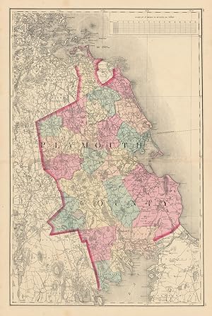
Plymouth County
Data di pubblicazione: 1871
Da: Antiqua Print Gallery, London, Regno Unito
Valutazione del venditore 4 su 5 stelle
Mappa
EUR 50,82
EUR 11,47 shipping
Spedito da Regno Unito a U.S.A.Quantit�: 1 disponibili
Aggiungi al carrelloCondizione: Good. Plymouth County, Massachusetts. WALLING & GRAY 1871 old antique map plan chart. Antique hand coloured county map; Henry Francis Walling & Ormando Willis Gray (1871). 61.5 x 41.5cm, 24.25 x 16.25 inches; this is a folding map. Condition: Good. Spot. There is nothing printed on the reverse side, which is plain.
-
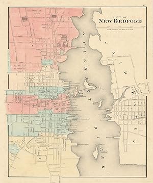
City of New Bedford
Data di pubblicazione: 1871
Da: Antiqua Print Gallery, London, Regno Unito
Valutazione del venditore 4 su 5 stelle
Mappa
EUR 50,82
EUR 11,47 shipping
Spedito da Regno Unito a U.S.A.Quantit�: 1 disponibili
Aggiungi al carrelloCondizione: Good. City of New Bedford, Massachusetts. Town plan. WALLING & GRAY 1871 old map. Antique hand coloured city plan; Henry Francis Walling & Ormando Willis Gray (1871). 39.5 x 33.0cm, 15.5 x 13 inches. Condition: Good. Repaired marginal tear. There is another map printed on the reverse side.
-
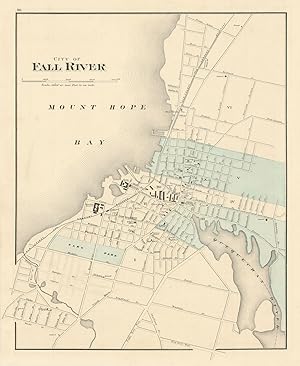
City of Fall River
Data di pubblicazione: 1871
Da: Antiqua Print Gallery, London, Regno Unito
Valutazione del venditore 4 su 5 stelle
Mappa
EUR 54,36
EUR 11,47 shipping
Spedito da Regno Unito a U.S.A.Quantit�: 1 disponibili
Aggiungi al carrelloCondizione: Good. City of Fall River, Massachusetts. Town plan. WALLING & GRAY 1871 old map. Antique hand coloured city plan; Henry Francis Walling & Ormando Willis Gray (1871). 39.0 x 32.0cm, 15.25 x 12.5 inches. Condition: Good. There is another map printed on the reverse side.
-
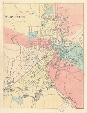
City of Worcester
Data di pubblicazione: 1871
Da: Antiqua Print Gallery, London, Regno Unito
Valutazione del venditore 4 su 5 stelle
Mappa
EUR 55,55
EUR 11,47 shipping
Spedito da Regno Unito a U.S.A.Quantit�: 1 disponibili
Aggiungi al carrelloCondizione: Good. City of Worcester, Massachusetts. Town plan. WALLING & GRAY 1871 old map. Antique hand coloured city plan; Henry Francis Walling & Ormando Willis Gray (1871). 42.5 x 32.5cm, 16.5 x 12.75 inches. Condition: Good. Light spotting. There is another map printed on the reverse side.
-
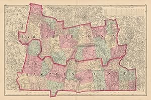
Hampshire County & Hampden County
Data di pubblicazione: 1871
Da: Antiqua Print Gallery, London, Regno Unito
Valutazione del venditore 4 su 5 stelle
Mappa
EUR 55,55
EUR 11,47 shipping
Spedito da Regno Unito a U.S.A.Quantit�: 1 disponibili
Aggiungi al carrelloCondizione: Good. Hampshire County & Hampden County, Massachusetts. WALLING & GRAY 1871 old map. Antique hand coloured county map; Henry Francis Walling & Ormando Willis Gray (1871). 41.0 x 62.0cm, 16.25 x 24.25 inches; this is a folding map. Condition: Good. There is nothing printed on the reverse side, which is plain.
-
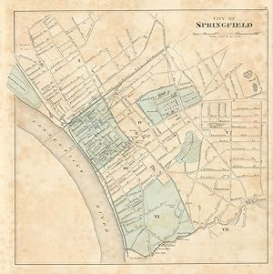
City of Springfield
Data di pubblicazione: 1871
Da: Antiqua Print Gallery, London, Regno Unito
Valutazione del venditore 4 su 5 stelle
Mappa
EUR 55,55
EUR 11,47 shipping
Spedito da Regno Unito a U.S.A.Quantit�: 1 disponibili
Aggiungi al carrelloCondizione: Fair. City of Springfield, Massachusetts. Town plan. WALLING & GRAY 1871 old map. Antique hand coloured city plan; Henry Francis Walling & Ormando Willis Gray (1871). 32.0 x 32.0cm, 12.75 x 12.5 inches. Condition: Fair: Spotting. There is another map printed on the reverse side.
-
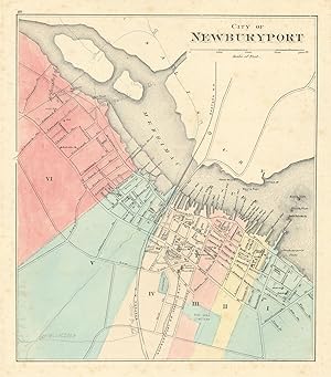
City of Newburyport
Data di pubblicazione: 1871
Da: Antiqua Print Gallery, London, Regno Unito
Valutazione del venditore 4 su 5 stelle
Mappa
EUR 57,91
EUR 11,47 shipping
Spedito da Regno Unito a U.S.A.Quantit�: 1 disponibili
Aggiungi al carrelloCondizione: Fair. City of Newburyport, Massachusetts. Town plan. WALLING & GRAY 1871 old map. Antique hand coloured city plan; Henry Francis Walling & Ormando Willis Gray (1871). 31.0 x 27.5cm, 12.25 x 10.75 inches. Condition: Fair: Pencil marks. Light spotting. There is another map printed on the reverse side.
-
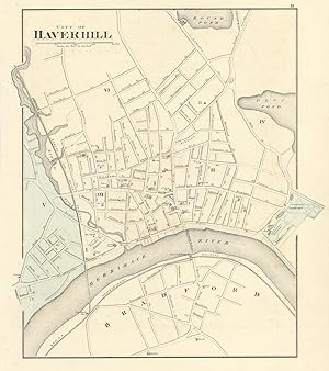
City of Haverhill
Data di pubblicazione: 1871
Da: Antiqua Print Gallery, London, Regno Unito
Valutazione del venditore 4 su 5 stelle
Mappa
EUR 57,91
EUR 11,47 shipping
Spedito da Regno Unito a U.S.A.Quantit�: 1 disponibili
Aggiungi al carrelloCondizione: Fair. City of Haverhill, Massachusetts. Town plan. WALLING & GRAY 1871 old map. Antique hand coloured city plan; Henry Francis Walling & Ormando Willis Gray (1871). 36.5 x 32.5cm, 14.5 x 12.75 inches. Condition: Fair: Pencil marks. There is another map printed on the reverse side.
-
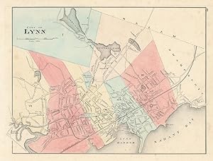
City of Lynn
Data di pubblicazione: 1871
Da: Antiqua Print Gallery, London, Regno Unito
Valutazione del venditore 4 su 5 stelle
Mappa
EUR 57,91
EUR 11,47 shipping
Spedito da Regno Unito a U.S.A.Quantit�: 1 disponibili
Aggiungi al carrelloCondizione: Fair. City of Lynn, Massachusetts. Town plan. WALLING & GRAY 1871 old antique map. Antique hand coloured city plan; Henry Francis Walling & Ormando Willis Gray (1871). 30.0 x 39.5cm, 11.75 x 15.5 inches. Condition: Fair: Pencil marks. Light spotting. There is another map printed on the reverse side.
-
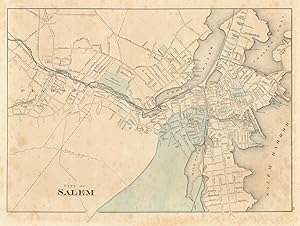
City of Salem
Data di pubblicazione: 1871
Da: Antiqua Print Gallery, London, Regno Unito
Valutazione del venditore 4 su 5 stelle
Mappa
EUR 57,91
EUR 11,47 shipping
Spedito da Regno Unito a U.S.A.Quantit�: 1 disponibili
Aggiungi al carrelloCondizione: Fair. City of Salem, Massachusetts. Town plan. WALLING & GRAY 1871 old antique map. Antique hand coloured city plan; Henry Francis Walling & Ormando Willis Gray (1871). 30.5 x 41.0cm, 12 x 16 inches. Condition: Fair: Spotting; Pencil marks. There is another map printed on the reverse side.
-
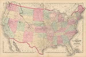
Map of the United States and territories. H.F. Walling & O.W. Gray, Boston, 1871.
Data di pubblicazione: 1871
Da: Antiqua Print Gallery, London, Regno Unito
Valutazione del venditore 4 su 5 stelle
Mappa
EUR 57,91
EUR 11,47 shipping
Spedito da Regno Unito a U.S.A.Quantit�: 1 disponibili
Aggiungi al carrelloCondizione: Good. Map of the United States and territories by Walling & Gray 1871 old. Antique hand coloured map; Henry Francis Walling & Ormando Willis Gray (1871). 43.0 x 64.5cm, 17 x 25.25 inches; this is a folding map. Condition: Good. Repaired marginal tear. There is nothing printed on the reverse side, which is plain.