
Importo totale (1 articolo articoli):
Destinazione ordine:

national geographic maps trails illustrated (525 risultati)
Feedback
Vai alla pagina principale dei risultati di ricerca
Filtri di ricerca
Tipo di articolo
- Tutti i tipi di prodotto
- Libri (456)
- Riviste e Giornali (Nessun altro risultato corrispondente a questo perfezionamento)
- Fumetti (Nessun altro risultato corrispondente a questo perfezionamento)
- Spartiti (Nessun altro risultato corrispondente a questo perfezionamento)
- Arte, Stampe e Poster (Nessun altro risultato corrispondente a questo perfezionamento)
- Fotografie (Nessun altro risultato corrispondente a questo perfezionamento)
- Mappe (69)
- Manoscritti e Collezionismo cartaceo (Nessun altro risultato corrispondente a questo perfezionamento)
Condizioni Maggiori informazioni
- Nuovo (403)
- Come nuovo, Ottimo o Quasi ottimo (4)
- Molto buono o Buono (109)
- Discreto o Mediocre (9)
- Come descritto (Nessun altro risultato corrispondente a questo perfezionamento)
Legatura
- Tutte
- Rilegato (Nessun altro risultato corrispondente a questo perfezionamento)
- Brossura (58)
Ulteriori caratteristiche
- Prima ed. (1)
- Copia autograf. (Nessun altro risultato corrispondente a questo perfezionamento)
- Sovracoperta (1)
- Con foto (183)
- Non Print on Demand (525)
Lingua (2)
Spedizione gratuita
Paese del venditore
Valutazione venditore
-

EUR 9,19
Convertire valutaEUR 4,50 per la spedizione da Germania a ItaliaQuantit�: 1 disponibili
Aggiungi al carrelloCondizione: good. Befriedigend/Good: Durchschnittlich erhaltenes Buch bzw. Schutzumschlag mit Gebrauchsspuren, aber vollst�ndigen Seiten. / Describes the average WORN book or dust jacket that has all the pages present.
-

EUR 14,16
Convertire valutaEUR 3,41 per la spedizione da U.S.A. a ItaliaQuantit�: 2 disponibili
Aggiungi al carrelloMap. Condizione: New. 2025th ed. America's most visited national park straddles Tennessee and North Carolina with its seemingly endless forest. The map includes the park in its entirety; the Appalachian Trail; Twentymile Trail; Lakeshore Trail; Chasteen Creek Trail; the Great Smoky Mountains; Chilowee Mountain; Little Mountain; the Blue Ridge Parkway; Cataloochee Divide; Cherokee National Forest; Nantahala National Forest; Little Tennessee River; Chilhowee Lake; Fontana Lake; the cities of Maryville and Gatlinburg Tennessee, and Waynesville, North Carolina; and more. UTM grids for use with GPS.
Ulteriori offerte da altri venditori AbeBooks
Nuovo - A partire da EUR 17,57
Usato - A partire da EUR 98,76
-

EUR 14,16
Convertire valutaEUR 3,41 per la spedizione da U.S.A. a ItaliaQuantit�: 2 disponibili
Aggiungi al carrelloMap. Condizione: New. 2020th ed. Trails Illustrated topographic maps are the most detailed and up-to-date recreation maps available for these national parks, national forests and popular outdoor recreation areas. This map includes: the island of St. John; the entire Virgin Islands National Park; Virgin Islands Coral Reef National Monument; Mount Sage National Park; Tortola Island; Great Thatch Island; Little Thatch Island; Frenchmans Cay; Lovango Cay; Congo Cay; Mingo Cay; Dog Island; Hawksnest Bay; Durloe Cays; Durloe Channel; Cinnamon Bay; Trunk Bay; Mary Point; Francis Bay; and UTM grids for GPS.
Ulteriori offerte da altri venditori AbeBooks
Nuovo - A partire da EUR 17,57
-

EUR 14,16
Convertire valutaEUR 3,41 per la spedizione da U.S.A. a ItaliaQuantit�: 2 disponibili
Aggiungi al carrelloMap. Condizione: New. 2020th ed. National Geographic's Trails Illustrated Maps are the most detailed and up-to-date topographic recreation maps available for US National Parks, National Forests and other popular outdoor recreation areas. A necessity for exploring the outdoors, each map is printed on waterproof, tear-resistant material. They also contain key safety and contact information, GPS and compass coordinates, Leave No Trace ethical guidelines and hundreds of points-of-interest, including scenic viewpoints, campgrounds, boat launches, swimming areas, marine sanctuaries and wildlife refuges.
-

Flat Tops North Map (National Geographic Trails Illustrated Map, 150)
Editore: Natl Geographic Society Maps, 2019
ISBN 10: 1566956900 ISBN 13: 9781566956901
Lingua: Inglese
Da: California Books, Miami, FL, U.S.A.
Valutazione del venditore 5 su 5 stelle

EUR 14,07
Convertire valutaEUR 7,68 per la spedizione da U.S.A. a ItaliaQuantit�: 13 disponibili
Aggiungi al carrelloCondizione: New.
Ulteriori offerte da altri venditori AbeBooks
Nuovo - A partire da EUR 21,75
Usato - A partire da EUR 32,71
Scopri anche Brossura
-

Appalachian Trail, Hanover To Mount Carlo, New Hampshire
Editore: National Geographic Maps, US, 2022
ISBN 10: 1597756482 ISBN 13: 9781597756488
Lingua: Inglese
Da: Rarewaves.com UK, London, Regno Unito
Valutazione del venditore 5 su 5 stelle
EUR 17,44
Convertire valutaEUR 2,31 per la spedizione da Regno Unito a ItaliaQuantit�: 4 disponibili
Aggiungi al carrelloMap. Condizione: New. 2022nd ed. Waterproof, tear-resistant topographic map guide. The Hanover to Mount Carlo Topographic Map Guide makes a perfect traveling companion when traversing the New Hampshire section of the Appalachian Trail. Each A.T. Topographic Map Guide includes detailed topographic maps at a detail of 1 inch equals 1 mile. Each page is centered on the A.T. and overlaps with the adjacent pages so there is little chance of getting lost. Along the bottom of each page is a trail profile that shows the distance between shelters, camping areas, and trail access points.
-

Mogollon Rim and Munds Mountain Wilderness Areas, Apache-sitgreaves, Coconino and Tonto National Forests
Da: Rarewaves.com UK, London, Regno Unito
Valutazione del venditore 5 su 5 stelle
EUR 17,44
Convertire valutaEUR 2,31 per la spedizione da Regno Unito a ItaliaQuantit�: 3 disponibili
Aggiungi al carrelloMap. Condizione: New. 2020th ed. National Geographic's Trails Illustrated Maps are the most detailed and up-to-date topographic recreation maps available for US National Parks, National Forests and other popular outdoor recreation areas. A necessity for exploring the outdoors, each map is printed on waterproof, tear-resistant material. They also contain key safety and contact information, GPS and compass coordinates, Leave No Trace ethical guidelines and hundreds of points-of-interest, including scenic viewpoints, campgrounds, boat launches, swimming areas, marine sanctuaries and wildlife refuges.
-

Colorado Trail South, Durango To Monarch
Editore: National Geographic Maps, US, 2017
ISBN 10: 1566956943 ISBN 13: 9781566956949
Lingua: Inglese
Da: Rarewaves.com UK, London, Regno Unito
Valutazione del venditore 5 su 5 stelle
EUR 17,44
Convertire valutaEUR 2,31 per la spedizione da Regno Unito a ItaliaQuantit�: 3 disponibili
Aggiungi al carrelloMap. Condizione: New. 2018th ed. Waterproof, Tear-Resistant Topographic Map. The Colorado Trail, South Topographic Map Guide has been designed as the perfect traveling companion when navigating the southern section of The Colorado Trail. In a state known for its trails, The Colorado Trail is Colorado's premier long distance trail. Conceived in 1973 and completed in 1987, the trail runs 486 miles between Denver and Durango, traversing some of the most spectacular scenery in the state. When The Colorado Trail is traversed from its southern terminus outside of Durango it climbs steeply into the San Juan Mountains where it stays above 10,000 feet for almost 150 miles with only a single steep decent to the Animas River near Silverton. The highest point on the trail is found in the San Juan Mountains at 13,271 feet. After leaving the San Juan Mountains, the trail travels for a short time below 10,000 feet before once again climbing into the Sawatch Range and joining The Colorado Trail North and Collegiate Loop. Each page i.
Ulteriori offerte da altri venditori AbeBooks
Nuovo - A partire da EUR 19,75
Usato - A partire da EUR 101,37
-

Mount St. Helens/mount Adams (gifford-pinchot National Forest)
Da: Rarewaves.com UK, London, Regno Unito
Valutazione del venditore 5 su 5 stelle
EUR 17,44
Convertire valutaEUR 2,31 per la spedizione da Regno Unito a ItaliaQuantit�: 4 disponibili
Aggiungi al carrelloMap. Condizione: New. 2019th ed. National Geographic's Trails Illustrated Maps are the most detailed and up-to-date topographic recreation maps available for US National Parks, National Forests and other popular outdoor recreation areas. A necessity for exploring the outdoors, each map is printed on waterproof, tear-resistant material. They also contain key safety and contact information, GPS and compass coordinates, Leave No Trace ethical guidelines and hundreds of points-of-interest, including scenic viewpoints, campgrounds, boat launches, swimming areas, marine sanctuaries and wildlife refuges.
-

Crater Lake National Park
Da: Rarewaves.com UK, London, Regno Unito
Valutazione del venditore 5 su 5 stelle
EUR 17,44
Convertire valutaEUR 2,31 per la spedizione da Regno Unito a ItaliaQuantit�: 1 disponibili
Aggiungi al carrelloMap. Condizione: New. 2019th ed. National Geographic's Trails Illustrated Maps are the most detailed and up-to-date topographic recreation maps available for US National Parks, National Forests and other popular outdoor recreation areas. A necessity for exploring the outdoors, each map is printed on waterproof, tear-resistant material. They also contain key safety and contact information, GPS and compass coordinates, Leave No Trace ethical guidelines and hundreds of points-of-interest, including scenic viewpoints, campgrounds, boat launches, swimming areas, marine sanctuaries and wildlife refuges.
-

Colorado Trail North, Monarch To Denver
Editore: National Geographic Maps, US, 2017
ISBN 10: 1566956951 ISBN 13: 9781566956956
Lingua: Inglese
Da: Rarewaves.com UK, London, Regno Unito
Valutazione del venditore 5 su 5 stelle
EUR 17,44
Convertire valutaEUR 2,31 per la spedizione da Regno Unito a ItaliaQuantit�: 6 disponibili
Aggiungi al carrelloMap. Condizione: New. 2018th ed. Waterproof, Tear-Resistant Topographic Map. The Colorado Trail North Topographic Map Guide has been designed as the perfect traveling companion when navigating the north section of The Colorado Trail. In a state known for its trails, The Colorado Trail is Colorado's premier long distance trail. Conceived in 1973 and completed in 1987, the trail runs 486 miles between Denver and Durango, traversing some of the most spectacular scenery in the state. The Colorado Trail is often started at its north terminus in Waterton Canyon just outside of Denver. When traveling from north to south the trail follows the South Platte River and quickly climbs into the Lost Creek Wilderness. From here the trail crosses into Holy Cross Wilderness near Leadville. The trail then skirts the eastern slope of the Sawatch Range and passes beneath Mount Elbert, the highest mountain in Colorado. Next comes the Collegiate Peaks Wilderness with its multiple 14ers before finally joining with the Collegiate Loop near.
-

Mount Baker and Boulder River Wilderness Areas, Mount Baker-snoqualmie National Forest
Da: Rarewaves.com UK, London, Regno Unito
Valutazione del venditore 5 su 5 stelle
EUR 17,44
Convertire valutaEUR 2,31 per la spedizione da Regno Unito a ItaliaQuantit�: 5 disponibili
Aggiungi al carrelloMap. Condizione: New. 2020th ed. National Geographic's Trails Illustrated Maps are the most detailed and up-to-date topographic recreation maps available for US National Parks, National Forests and other popular outdoor recreation areas. A necessity for exploring the outdoors, each map is printed on waterproof, tear-resistant material. They also contain key safety and contact information, GPS and compass coordinates, Leave No Trace ethical guidelines and hundreds of points-of-interest, including scenic viewpoints, campgrounds, boat launches, swimming areas, marine sanctuaries and wildlife refuges.
-

EUR 17,44
Convertire valutaEUR 2,31 per la spedizione da Regno Unito a ItaliaQuantit�: 1 disponibili
Aggiungi al carrelloMap. Condizione: New. 2023rd ed. National Geographic's Trails Illustrated Maps are the most detailed and up-to-date topographic recreation maps available for US National Parks, National Forests and other popular outdoor recreation areas. A necessity for exploring the outdoors, each map is printed on waterproof, tear-resistant material. They also contain key safety and contact information, GPS and compass coordinates, Leave No Trace ethical guidelines and hundreds of points-of-interest, including scenic viewpoints, campgrounds, boat launches, swimming areas, marine sanctuaries and wildlife refuges.
Ulteriori offerte da altri venditori AbeBooks
Nuovo - A partire da EUR 19,75
Usato - A partire da EUR 73,00
-

Nantahala And Cullasaja Gorges, Nantahala National Forest
Da: Rarewaves.com UK, London, Regno Unito
Valutazione del venditore 5 su 5 stelle
EUR 17,44
Convertire valutaEUR 2,31 per la spedizione da Regno Unito a ItaliaQuantit�: 4 disponibili
Aggiungi al carrelloMap. Condizione: New. 2020th ed. National Geographic's Trails Illustrated Maps are the most detailed and up-to-date topographic recreation maps available for US National Parks, National Forests and other popular outdoor recreation areas. A necessity for exploring the outdoors, each map is printed on waterproof, tear-resistant material. They also contain key safety and contact information, GPS and compass coordinates, Leave No Trace ethical guidelines and hundreds of points-of-interest, including scenic viewpoints, campgrounds, boat launches, swimming areas, marine sanctuaries and wildlife refuges.
-

Winter Park/central City/rollins Pass
Da: Rarewaves.com UK, London, Regno Unito
Valutazione del venditore 5 su 5 stelle
EUR 17,44
Convertire valutaEUR 2,31 per la spedizione da Regno Unito a ItaliaQuantit�: 8 disponibili
Aggiungi al carrelloMap. Condizione: New. 2019th ed. National Geographic's Trails Illustrated Maps are the most detailed and up-to-date topographic recreation maps available for US National Parks, National Forests and other popular outdoor recreation areas. A necessity for exploring the outdoors, each map is printed on waterproof, tear-resistant material. They also contain key safety and contact information, GPS and compass coordinates, Leave No Trace ethical guidelines and hundreds of points-of-interest, including scenic viewpoints, campgrounds, boat launches, swimming areas, marine sanctuaries and wildlife refuges.
-
![Immagine dell'editore per Camino de Santiago 4 of 4 Map [Ponferrada to Santiago de Compostela] venduto da Kennys Bookshop and Art Galleries Ltd.](https://pictures.abebooks.com/isbn/9781566959223-it-300.jpg)
Camino de Santiago 4 of 4 Map [Ponferrada to Santiago de Compostela]
Da: Kennys Bookshop and Art Galleries Ltd., Galway, GY, Irlanda
Valutazione del venditore 5 su 5 stelle
EUR 17,90
Convertire valutaEUR 2,00 per la spedizione da Irlanda a ItaliaQuantit�: 2 disponibili
Aggiungi al carrelloCondizione: New. 2024. 2024th ed. map. . . . . .
Ulteriori offerte da altri venditori AbeBooks
Nuovo - A partire da EUR 19,90
-
![Immagine dell'editore per Camino de Santiago 2 of 4 Map [Santo Domingo de la Calzada to Terradillos de Los Templarios] venduto da Kennys Bookshop and Art Galleries Ltd.](https://pictures.abebooks.com/isbn/9781566959209-it-300.jpg)
Camino de Santiago 2 of 4 Map [Santo Domingo de la Calzada to Terradillos de Los Templarios]
Da: Kennys Bookshop and Art Galleries Ltd., Galway, GY, Irlanda
Valutazione del venditore 5 su 5 stelle
EUR 17,84
Convertire valutaEUR 2,00 per la spedizione da Irlanda a ItaliaQuantit�: 4 disponibili
Aggiungi al carrelloCondizione: New.
-
![Immagine dell'editore per Camino de Santiago 3 of 4 Map [Terradillos de Los Templarios to Ponferrada] Map venduto da Kennys Bookshop and Art Galleries Ltd.](https://pictures.abebooks.com/isbn/9781566959216-it-300.jpg)
Camino de Santiago 3 of 4 Map [Terradillos de Los Templarios to Ponferrada] Map
Da: Kennys Bookshop and Art Galleries Ltd., Galway, GY, Irlanda
Valutazione del venditore 5 su 5 stelle
EUR 17,87
Convertire valutaEUR 2,00 per la spedizione da Irlanda a ItaliaQuantit�: 4 disponibili
Aggiungi al carrelloCondizione: New.
Ulteriori offerte da altri venditori AbeBooks
Nuovo - A partire da EUR 19,87
-
![Immagine dell'editore per Camino de Santiago 1 of 4 Map [Saint-Jean-Pied-De-Port to Santo Domingo de la Calzada] venduto da Kennys Bookshop and Art Galleries Ltd.](https://pictures.abebooks.com/isbn/9781566959193-it-300.jpg)
Camino de Santiago 1 of 4 Map [Saint-Jean-Pied-De-Port to Santo Domingo de la Calzada]
Da: Kennys Bookshop and Art Galleries Ltd., Galway, GY, Irlanda
Valutazione del venditore 5 su 5 stelle
EUR 18,06
Convertire valutaEUR 2,00 per la spedizione da Irlanda a ItaliaQuantit�: 3 disponibili
Aggiungi al carrelloCondizione: New. 2024. 2024th ed. map. . . . . .
-

EUR 17,87
Convertire valutaEUR 9,70 per la spedizione da Germania a ItaliaQuantit�: 1 disponibili
Aggiungi al carrelloKarte/Landkarte. Condizione: New. Klappentext- Waterproof - Tear-Resistant - Topographic MapThe largest national park in the contiguous United States, Death Valley protects more than 5,000 square miles of the Mojave Desert--93% of which is federally desi.
-

EUR 17,87
Convertire valutaEUR 9,70 per la spedizione da Germania a ItaliaQuantit�: 2 disponibili
Aggiungi al carrelloKarte/Landkarte. Condizione: New.
-

Carbondale, Basalt Map (National Geographic Trails Illustrated Map, 143)
Editore: Natl Geographic Society Maps, 2019
ISBN 10: 1566953995 ISBN 13: 9781566953993
Lingua: Inglese
Da: California Books, Miami, FL, U.S.A.
Valutazione del venditore 5 su 5 stelle
EUR 14,07
Convertire valutaEUR 7,68 per la spedizione da U.S.A. a ItaliaQuantit�: 8 disponibili
Aggiungi al carrelloCondizione: New.
Ulteriori offerte da altri venditori AbeBooks
Nuovo - A partire da EUR 21,75
Usato - A partire da EUR 34,59
-
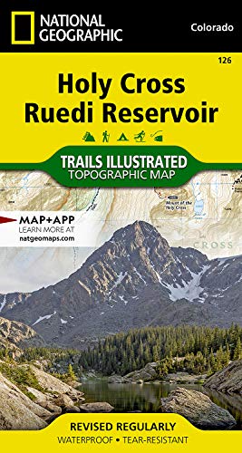
Holy Cross, Ruedi Reservoir Map (National Geographic Trails Illustrated Map, 126)
Editore: Natl Geographic Society Maps, 2019
ISBN 10: 1566952921 ISBN 13: 9781566952927
Lingua: Inglese
Da: California Books, Miami, FL, U.S.A.
Valutazione del venditore 5 su 5 stelle
EUR 14,07
Convertire valutaEUR 7,68 per la spedizione da U.S.A. a ItaliaQuantit�: 5 disponibili
Aggiungi al carrelloCondizione: New.
-
![Immagine dell'editore per Colorado National Monument Map [McInnis Canyons National Conservation Area] (National Geographic Trails Illustrated Map, 208) venduto da California Books](https://pictures.abebooks.com/isbn/9781566954013-it-300.jpg)
Colorado National Monument Map [McInnis Canyons National Conservation Area] (National Geographic Trails Illustrated Map, 208)
Da: California Books, Miami, FL, U.S.A.
Valutazione del venditore 5 su 5 stelle
EUR 14,07
Convertire valutaEUR 7,68 per la spedizione da U.S.A. a ItaliaQuantit�: 10 disponibili
Aggiungi al carrelloCondizione: New.
-

Grand Junction, Fruita Map (National Geographic Trails Illustrated Map, 502)
Editore: Natl Geographic Society Maps, 2023
ISBN 10: 1566954886 ISBN 13: 9781566954884
Lingua: Inglese
Da: California Books, Miami, FL, U.S.A.
Valutazione del venditore 5 su 5 stelle
EUR 14,07
Convertire valutaEUR 7,68 per la spedizione da U.S.A. a ItaliaQuantit�: 7 disponibili
Aggiungi al carrelloCondizione: New.
-

Grand Mesa Map (National Geographic Trails Illustrated Map, 136)
Editore: Natl Geographic Society Maps, 2019
ISBN 10: 1566953847 ISBN 13: 9781566953849
Lingua: Inglese
Da: California Books, Miami, FL, U.S.A.
Valutazione del venditore 5 su 5 stelle
EUR 14,07
Convertire valutaEUR 7,68 per la spedizione da U.S.A. a ItaliaQuantit�: 11 disponibili
Aggiungi al carrelloCondizione: New.
-
![Immagine dell'editore per San Rafael Swell Map [BLM - Price Field Office] (National Geographic Trails Illustrated Map, 712) venduto da California Books](https://pictures.abebooks.com/isbn/9781566953313-it-300.jpg)
San Rafael Swell Map [BLM - Price Field Office] (National Geographic Trails Illustrated Map, 712)
Editore: Natl Geographic Society Maps, 2019
ISBN 10: 1566953316 ISBN 13: 9781566953313
Lingua: Inglese
Da: California Books, Miami, FL, U.S.A.
Valutazione del venditore 5 su 5 stelle
EUR 14,07
Convertire valutaEUR 7,68 per la spedizione da U.S.A. a ItaliaQuantit�: 6 disponibili
Aggiungi al carrelloCondizione: New.
Ulteriori offerte da altri venditori AbeBooks
Nuovo - A partire da EUR 21,75
-

Santa Monica Mountains National Recreation Area Map (National Geographic Trails Illustrated Map, 253)
Editore: Natl Geographic Society Maps, 2023
ISBN 10: 1566954479 ISBN 13: 9781566954471
Lingua: Inglese
Da: California Books, Miami, FL, U.S.A.
Valutazione del venditore 5 su 5 stelle
EUR 14,07
Convertire valutaEUR 7,68 per la spedizione da U.S.A. a ItaliaQuantit�: 6 disponibili
Aggiungi al carrelloCondizione: New.
Ulteriori offerte da altri venditori AbeBooks
Nuovo - A partire da EUR 21,75
Usato - A partire da EUR 53,92
-

Hawaii Volcanoes National Park Map (National Geographic Trails Illustrated Map, 230)
Da: California Books, Miami, FL, U.S.A.
Valutazione del venditore 5 su 5 stelle
EUR 14,07
Convertire valutaEUR 7,68 per la spedizione da U.S.A. a ItaliaQuantit�: 9 disponibili
Aggiungi al carrelloCondizione: New.
Ulteriori offerte da altri venditori AbeBooks
Nuovo - A partire da EUR 21,75
-
![Immagine dell'editore per Flagstaff, Sedona Map [Coconino and Kaibab National Forests] (National Geographic Trails Illustrated Map, 856) venduto da California Books](https://pictures.abebooks.com/isbn/9781566955157-it-300.jpg)
Flagstaff, Sedona Map [Coconino and Kaibab National Forests] (National Geographic Trails Illustrated Map, 856)
Da: California Books, Miami, FL, U.S.A.
Valutazione del venditore 5 su 5 stelle
EUR 14,07
Convertire valutaEUR 7,68 per la spedizione da U.S.A. a ItaliaQuantit�: 5 disponibili
Aggiungi al carrelloCondizione: New.
Ulteriori offerte da altri venditori AbeBooks
Nuovo - A partire da EUR 21,75