
Importo totale (1 articolo articoli):
Destinazione ordine:

cicerone press kendal (Oltre 1.500 risultati)
Casa editrice:
cicerone press kendal
Perfeziona con la Ricerca avanzata
Vai alla pagina principale dei risultati di ricerca
Filtri di ricerca
Tipo di articolo
- Tutti i tipi di prodotto
- Libri (1.532)
- Riviste e Giornali (Nessun altro risultato corrispondente a questo perfezionamento)
- Fumetti (Nessun altro risultato corrispondente a questo perfezionamento)
- Spartiti (Nessun altro risultato corrispondente a questo perfezionamento)
- Arte, Stampe e Poster (Nessun altro risultato corrispondente a questo perfezionamento)
- Fotografie (Nessun altro risultato corrispondente a questo perfezionamento)
- Mappe (Nessun altro risultato corrispondente a questo perfezionamento)
- Manoscritti e Collezionismo cartaceo (Nessun altro risultato corrispondente a questo perfezionamento)
Condizioni Maggiori informazioni
- Nuovo (1.386)
- Come nuovo, Ottimo o Quasi ottimo (Nessun altro risultato corrispondente a questo perfezionamento)
- Molto buono o Buono (140)
- Discreto o Mediocre (5)
- Come descritto (1)
Legatura
Ulteriori caratteristiche
- Prima ed. (Nessun altro risultato corrispondente a questo perfezionamento)
- Copia autograf. (Nessun altro risultato corrispondente a questo perfezionamento)
- Sovracoperta (Nessun altro risultato corrispondente a questo perfezionamento)
- Con foto (991)
- Non Print on Demand (1.532)
Lingua (1)
Spedizione gratuita
Paese del venditore
Valutazione venditore
-

North to the Cape: A trek from Fort William to Cape Wrath
Lingua: Inglese
Editore: Cicerone Press, United Kingdom, Kendal, 2011
ISBN 10: 1852842857 ISBN 13: 9781852842857
Da: WorldofBooks, Goring-By-Sea, WS, Regno Unito
Valutazione del venditore 5 su 5 stelle

EUR 2,06
Spedizione EUR 6,59
Spedito da Regno Unito a U.S.A.Quantit�: 8 disponibili
Aggiungi al carrelloPaperback. Condizione: Very Good. A guide to Scotland's 200-mile, 326km backpacking trekking route through the West Highlands from Fort William to Cape Wrath, for the experienced walker. This is a glorious long-distance walk. Described as a quintessential backpacking walk it is a challenging route for the experienced walker. The authors had six main criteria in mind: a variety of scenery, no long hauls over featureless terrain, use of designated paths, interesting geography, no high peaks to climb and a good day's walk every day with accommodation at the end. The route is split into 21 stages, many with an easier bad-weather alternative. The guide includes full information, including details of accommodation and advice on where to purchase provisions as you go along. The book has been read, but is in excellent condition. Pages are intact and not marred by notes or highlighting. The spine remains undamaged.
-

Indoor Climbing: Skills for climbing wall users and instructors
Lingua: Inglese
Editore: Cicerone Press, United Kingdom, Kendal, 2011
ISBN 10: 1852845848 ISBN 13: 9781852845841
Da: WorldofBooks, Goring-By-Sea, WS, Regno Unito
Valutazione del venditore 5 su 5 stelle
EUR 2,31
Spedizione EUR 6,59
Spedito da Regno Unito a U.S.A.Quantit�: 5 disponibili
Aggiungi al carrelloPaperback. Condizione: Very Good. An instructional guidebook to all the skills and equipment for indoor climbing, dry tooling and bouldering, this book is invaluable for beginners and instructors on CWA, CWLA and NICAS schemes, and also for climbers wanting to increase their technical knowledge to enjoy their climbing wall experience to the max, written by one of the UK's top mountain instructors. Indoor climbing, in all of its forms, has a huge following. Whether it is being used for training, teaching or fun, it is here to stay. This book covers all aspects with full coverage of the basics alongside detailed information and suggestions for supervisors and instructors. Equipment, warming up, bouldering, bottom roping, leading, top roping and abseiling are all included. Dry tooling has also begun to find a niche in the repertoire of many climbing centres. Having the right equipment and knowing the basic techniques for a successful session are essential, and this book will tell you all you need to do so. The author has drawn on many years' climbing, route setting and teaching experience and used the skills and experience of many of the UK's top climbing facilities and their staff to produce an indispensable book for any indoor climber. The book has been read, but is in excellent condition. Pages are intact and not marred by notes or highlighting. The spine remains undamaged.
-
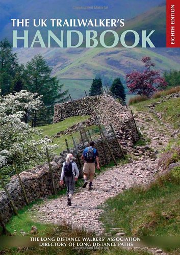
The UK Trailwalker's Handbook (Cicerone guides)
Lingua: Inglese
Editore: Cicerone Press, United Kingdom, Kendal, 2013
ISBN 10: 1852845791 ISBN 13: 9781852845797
Da: WorldofBooks, Goring-By-Sea, WS, Regno Unito
Valutazione del venditore 5 su 5 stelle
EUR 2,31
Spedizione EUR 6,59
Spedito da Regno Unito a U.S.A.Quantit�: 7 disponibili
Aggiungi al carrelloPaperback. Condizione: Very Good. The UK Trailwalker's Handbook is a directory of long-distance paths (LDPs) in England, Scotland, Wales and Northern Ireland compiled by the Long Distance Walkers Association (LDWA), covering 730 national trails, long-distance paths and anytime challenges, with regional overview maps and an index of walking guide publishers and support companies. The UK has a network of long-distance trails unrivalled anywhere in the world, currently covering 60,000 miles of footpath and growing steadily. Millions of people walk along them every year - some walking a complete route, some just walking a stretch on holiday, at weekends or even as part of their daily commute. Combining exercise, challenge and exploration with minimal impact on the environment, little cost and a real benefit to local communities, trailwalking is hard to beat. But where are all these trails and what are they like? How do you find one that suits you and matches your timescale? What maps, guidebooks or websites do you need and where can you find them? Does anyone run a 'sherpa' service? These questions and many more are answered by this eighth edition of The UK Trailwalker's Handbook giving you all the information you need to select the best route. The book has been read, but is in excellent condition. Pages are intact and not marred by notes or highlighting. The spine remains undamaged.
-

The Tarns of Lakeland Vol 1: West
Lingua: Inglese
Editore: Cicerone Press, United Kingdom, Kendal, 1995
ISBN 10: 1852841710 ISBN 13: 9781852841713
Da: WorldofBooks, Goring-By-Sea, WS, Regno Unito
Valutazione del venditore 5 su 5 stelle
EUR 2,31
Spedizione EUR 6,59
Spedito da Regno Unito a U.S.A.Quantit�: 1 disponibili
Aggiungi al carrelloPaperback. Condizione: Very Good. The western part of this two-volume guidebook gives 42 walking routes to all the 140 or so tarns in the western English Lake District, Cumbria, UK. Scattered across the Lake District National Park are hundreds of tarns and small pools waiting to be discovered by the unhurried fell-walker. With their small tent and immense enthusiasm, the authors have investigated every little speck of blue on the map in their efforts to compile these detailed mountain tarn walks of western Lakeland. From huge Devoke Water to the tiny Lang Tarn on the Heathwaite Fells, they reveal that every tarn is unique in its appeal and that the seasonal changes ensure that no two visits are ever the same. Each of the 42 walks is accompanied by a hand-drawn 1:25,000 scale route map, plus beautiful pen-line drawings and details on distances, ascents, starting points and precise routes, including historical and environmental snippets to tempt the reader further. This is the companion volume to The Tarns of Lakeland Volume 2 East. The book has been read, but is in excellent condition. Pages are intact and not marred by notes or highlighting. The spine remains undamaged.
-

Short Walks in Lakeland North Lakeland
Lingua: Inglese
Editore: Cicerone Press, United Kingdom, Kendal, 2015
ISBN 10: 1852842326 ISBN 13: 9781852842321
Da: WorldofBooks, Goring-By-Sea, WS, Regno Unito
Valutazione del venditore 5 su 5 stelle
EUR 2,31
Spedizione EUR 6,59
Spedito da Regno Unito a U.S.A.Quantit�: 6 disponibili
Aggiungi al carrelloPaperback. Condizione: Very Good. This guidebook of 57 short walks in the Lake District is the second in the Short Walks in Lakeland trilogy, covering the entire Lake District. This guidebook divides the north Lakeland region into six sections: Borrowdale, the Northern Fells, Thirlmere, Newlands and the northwest, Patterdale and Ullswater, and the Eastern Fells and Dales. The guide comprises 57 walks, generally between 4 and 8 miles, enough to fill a good half day or provide a leisurely full day, and ideal for day visitors or family walkers. It is not a high fell walking guide, although many worthwhile summits are included. Priority is given to the lower fells and dales. Interesting features are pointed out along the way, and the hand-drawn maps include relevant walk details. The combination of detailed description and clear, easy-to-follow maps and evocative sketches makes this book ideal for anyone who wants to explore Lakeland. The book has been read, but is in excellent condition. Pages are intact and not marred by notes or highlighting. The spine remains undamaged.
-
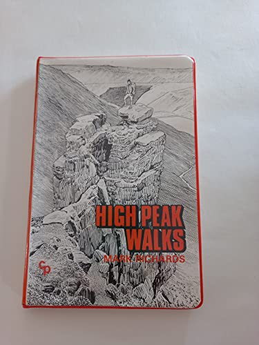
High Peak Walks
Lingua: Inglese
Editore: Cicerone Press, United Kingdom, Kendal, 2009
ISBN 10: 0902363433 ISBN 13: 9780902363434
Da: WorldofBooks, Goring-By-Sea, WS, Regno Unito
Valutazione del venditore 5 su 5 stelle
EUR 2,31
Spedizione EUR 6,59
Spedito da Regno Unito a U.S.A.Quantit�: 14 disponibili
Aggiungi al carrelloPaperback. Condizione: Very Good. Guidebook of high peak walks in the Peak District, England, UK. This guide is the first part of a two-volume survey designed to balance the marvellous diversity and wealth of walking country contained in the Peak District National Park. These high peak walks encompass the Dark Peak moors of Black Hill, Bleaklow, Kinder Scout, the higher eastern edges and the annexed western gritstone uplands from Windgather to The Roaches. The present area is characterised by great swelling moorland composed of sandstones and shales capped by a coarse gritstone, known as Millstone Grit, outcropping along plateau edges and scarps. Gritstone is pervious but a climatic quirk caused a thin impervious sedimentation to stop water penetration and triggered the formation of a thick blanket of peat over the Pennine uplands. 22 day-long walks and one linear challenge walk, carefully researched and described, offer walkers a practical and entertaining means of acquainting themselves with this popular moorland region. Each walk is designed to embrace particular localities, drawing on the contrasting qualities of each to sustain interest and develop an appreciation of the wild, dramatic and often shy beauty peculiar to this northern sector of Peakland. The book has been read, but is in excellent condition. Pages are intact and not marred by notes or highlighting. The spine remains undamaged.
-

Eden Tapestry
Lingua: Inglese
Editore: Cicerone Press, United Kingdom, Kendal, 1995
ISBN 10: 1852841745 ISBN 13: 9781852841744
Da: WorldofBooks, Goring-By-Sea, WS, Regno Unito
Valutazione del venditore 5 su 5 stelle
EUR 2,54
Spedizione EUR 6,59
Spedito da Regno Unito a U.S.A.Quantit�: 1 disponibili
Aggiungi al carrelloPaperback. Condizione: Very Good. The book has been read, but is in excellent condition. Pages are intact and not marred by notes or highlighting. The spine remains undamaged.
-

Backpacker's Britain: Wales
Lingua: Inglese
Editore: Cicerone Press, United Kingdom, Kendal, 2009
ISBN 10: 1852844086 ISBN 13: 9781852844080
Da: WorldofBooks, Goring-By-Sea, WS, Regno Unito
Valutazione del venditore 5 su 5 stelle
EUR 2,54
Spedizione EUR 6,59
Spedito da Regno Unito a U.S.A.Quantit�: 4 disponibili
Aggiungi al carrelloPaperback. Condizione: Very Good. The mountains of Wales are a great place to get away from it all for a few days, and this book describes the very best backpacking routes throughout the principality. A total of 25 two- or three-day walks take you into the most scenic, beautiful and wild parts of Wales, each one with a night or more out among the mountains at wild camp sites, bothies or hostels. The routes cover all the main mountain ranges, from Snowdon, the Glyderau and Carneddau in the north, down to the Black Mountains, Brecon Beacons and Fforest Fawr ranges in the south. Everything in between is included too, such as the superb ridges of the Arans, Arenigs, Berwyns and Cadair Idris, and the bleak moorland vastness of the Cwmdeuddwr hills and Plynlimon. Details of equipment, mountain safety and navigation as well as a bibliography make this a complete guide to backpacking in Wales. The book has been read, but is in excellent condition. Pages are intact and not marred by notes or highlighting. The spine remains undamaged.
-

Reivers Way
Lingua: Inglese
Editore: Cicerone Press, United Kingdom, Kendal, 1993
ISBN 10: 1852841303 ISBN 13: 9781852841300
Da: WorldofBooks, Goring-By-Sea, WS, Regno Unito
Valutazione del venditore 5 su 5 stelle
EUR 2,54
Spedizione EUR 6,59
Spedito da Regno Unito a U.S.A.Quantit�: 3 disponibili
Aggiungi al carrelloPaperback. Condizione: Very Good. The Reivers Way runs 150 miles through some of the finest landscapes in Northumberland. It starts at Corbridge station, on the main Newcastle to Carlisle railway line, and finishes at Alnmouth station, on the Edinburgh to London main line. It can be walked in nine day-stages, staying in bed and breakfasts, or camping if you prefer. There are also a number of pubs and hotels to stay in en route. It takes in some of the most delightful small towns and villages in the county - Corbridge, Alnwick, Rothbury, Wooler, Holystone, Craster and many more. It finishes by walking the finest stretch of Northumbria's lordly strand, from Budle Bay to the mouth of the Aln. The terrain walked includes high moorland of the Cheviots and the Allendale Moors as well as some fine wooded denes around the tributaries of the upper Tyne and the best stretch of Hadrian's Wall from Housesteads to Sewingshields. It passes, or rather pauses, in a number of delightful pubs along the way. This guide directs the walker along the way and explains much of the historical background to the region. The book has been read, but is in excellent condition. Pages are intact and not marred by notes or highlighting. The spine remains undamaged.
-
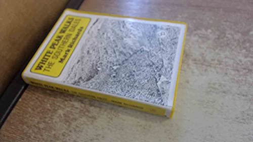
White Peak Walks: The Southern Dales
Lingua: Inglese
Editore: Cicerone Press, United Kingdom, Kendal, 2004
ISBN 10: 0902363883 ISBN 13: 9780902363885
Da: WorldofBooks, Goring-By-Sea, WS, Regno Unito
Valutazione del venditore 5 su 5 stelle
EUR 2,67
Spedizione EUR 6,59
Spedito da Regno Unito a U.S.A.Quantit�: 3 disponibili
Aggiungi al carrelloPaperback. Condizione: Fair. Even though increased mobility has extended the diversity (in terms of sights and sites) of beautiful countryside within range of the millions who inhabit middle England, the White Peak remains tremendously popular among casual walking visitors. The area offers an amiable landscape despite the vagaries of its climate, dissected by countless walls, abundant in pastures and woodland, its limestone outcrops completing the interplay of green and white. It also offers a well-maintained footpath network. The 'net' effect ensures that walkers feel at ease and relaxed in their wanderings as in few other places in England. The boundaries of this guide are defined on the east by the long spine of Axe Edge and Morridge, to the south by the Weaver Hills and Ashbourne, continuing north-eastward with the B5035 to Cromford and Matlock, cutting west via Youlgreave to Parsley Hay and Earl Sterndale back to the source of the Dove. This is predominantly limestone country, with only the shale uplands west of the upper Dove and lower Manifold and the gritstone of Harthill and Stanton Moors to lend contrast. To strong walkers, the selection of outings may seem of modest ambition, but for the majority of casual visitors they will be found to be of perfect length for refreshing exercise and a gentle introduction to this truly beautiful walking region. A readable copy of the book which may include some defects such as highlighting and notes. Cover and pages may be creased and show discolouration.
-

Walking In Kent
Lingua: Inglese
Editore: Cicerone Press, United Kingdom, Kendal, 2024
ISBN 10: 1852848626 ISBN 13: 9781852848620
Da: WorldofBooks, Goring-By-Sea, WS, Regno Unito
Valutazione del venditore 5 su 5 stelle
EUR 2,79
Spedizione EUR 6,59
Spedito da Regno Unito a U.S.A.Quantit�: 2 disponibili
Aggiungi al carrelloPaperback. Condizione: Very Good. A guidebook to 40 day walks in the county of Kent. With routes distributed across the county, from the chalky North Downs to the fertile hills and vales that give the region its name of the Garden of England, theres all-year-round walking for beginners and experienced walkers alike. The day walks range from 715km (59 miles) in length, and are all circular. Also included are details of Kents long-distance trails, including the Saxon Shore Way and the North Downs Way National Trail. 1:50,000 OS maps included for each walkSized to easily fit in a jacket pocketThe day walks are divided into 2 areas: west Kent and The Weald, and north and east KentInformation given on local geology and wildlifeEasy access from London, Maidstone, Canterbury and Folkestone. The book has been read, but is in excellent condition. Pages are intact and not marred by notes or highlighting. The spine remains undamaged.
-

The Bernese Alps - Switzerland: A walker's guide (Cicerone)
Lingua: Inglese
Editore: Cicerone Press, United Kingdom, Kendal, 2011
ISBN 10: 1852844515 ISBN 13: 9781852844516
Da: WorldofBooks, Goring-By-Sea, WS, Regno Unito
Valutazione del venditore 5 su 5 stelle
EUR 2,79
Spedizione EUR 6,59
Spedito da Regno Unito a U.S.A.Quantit�: 1 disponibili
Aggiungi al carrelloPaperback. Condizione: Very Good. Over 100 routes in the Bernese Alps are described in this fully updated third edition of Kev Reynolds' popular guide. It is an indispensable companion to the Bernese Oberland region that boasts famous peaks such as the Eiger, Monch and Jungfrau. But there are lesser-known mountains, too, that are just as scenically dramatic, and in their shadow peaceful villages and seemingly forgotten hamlets are lodged in spectacular locations. Add to that the romantic valleys, lakes, flower-filled meadows and a network of mountain huts and rustic inns for those who want to experience the Alps of the Victorian pioneers, and you'll understand why the Bernese Alps seduce the connoisseur back year after year. All this, and more, is available to the mountain walker, and this indispensable guide will enable you to explore the very best of the Bernese mountain wonderland. The book has been read, but is in excellent condition. Pages are intact and not marred by notes or highlighting. The spine remains undamaged.
-
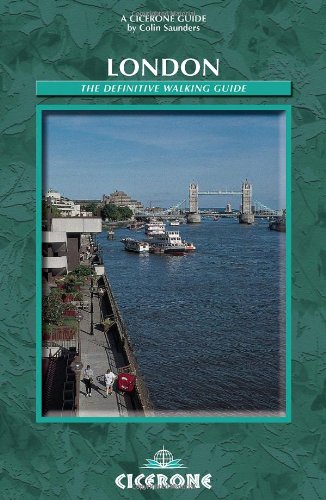
London - The Definitive Walking Guide
Lingua: Inglese
Editore: Cicerone Press, United Kingdom, Kendal, 2002
ISBN 10: 185284339X ISBN 13: 9781852843397
Da: WorldofBooks, Goring-By-Sea, WS, Regno Unito
Valutazione del venditore 5 su 5 stelle
EUR 2,79
Spedizione EUR 6,59
Spedito da Regno Unito a U.S.A.Quantit�: 2 disponibili
Aggiungi al carrelloPaperback. Condizione: Good. A comprehensive guidebook to the leisure walking opportunities in Greater London, compiled by one of the leading authorities on the subject. Details of nearly 300 self-guided trails are included, covering over 2300km, as well as information on guided walks and challenge walks on the fringes of London. The 80 named trails of the Strategic Network of the London Walking Forum are covered along with over 200 shorter routes, mainly heritage and nature trails. Readers are provided with information to help them decide which routes to try, including detailed statistics and requirements for all routes. All routes are coded for countryside or waterside. Also included are summary descriptions of all the organisations supporting walking in London and key pointers on how to get started: guidance on walking, groups to join, health matters, challenge walks and how to find the right maps and use them. The book has been read but remains in clean condition. All pages are intact and the cover is intact. Some minor wear to the spine.
-
London: The Definitive Walking Guide
Lingua: Inglese
Editore: Cicerone Press, United Kingdom, Kendal, 2002
ISBN 10: 185284339X ISBN 13: 9781852843397
Da: WorldofBooks, Goring-By-Sea, WS, Regno Unito
Valutazione del venditore 5 su 5 stelle
EUR 2,79
Spedizione EUR 6,59
Spedito da Regno Unito a U.S.A.Quantit�: 5 disponibili
Aggiungi al carrelloPaperback. Condizione: Very Good. A comprehensive guidebook to the leisure walking opportunities in Greater London, compiled by one of the leading authorities on the subject. Details of nearly 300 self-guided trails are included, covering over 2300km, as well as information on guided walks and challenge walks on the fringes of London. The 80 named trails of the Strategic Network of the London Walking Forum are covered along with over 200 shorter routes, mainly heritage and nature trails. Readers are provided with information to help them decide which routes to try, including detailed statistics and requirements for all routes. All routes are coded for countryside or waterside. Also included are summary descriptions of all the organisations supporting walking in London and key pointers on how to get started: guidance on walking, groups to join, health matters, challenge walks and how to find the right maps and use them. The book has been read, but is in excellent condition. Pages are intact and not marred by notes or highlighting. The spine remains undamaged.
-

Historic Walks in Cheshire: A collection of 20 scenic walks (Cicerone guides)
Lingua: Inglese
Editore: Cicerone Press, United Kingdom, Kendal, 2010
ISBN 10: 1852843918 ISBN 13: 9781852843915
Da: WorldofBooks, Goring-By-Sea, WS, Regno Unito
Valutazione del venditore 5 su 5 stelle
EUR 2,91
Spedizione EUR 6,59
Spedito da Regno Unito a U.S.A.Quantit�: 1 disponibili
Aggiungi al carrelloPaperback. Condizione: Fair. Guidebook to 20 walks around some of the countryside and historical heritage of Cheshire. In a little over 2000 sq km, Cheshire offers much of what is best about traditional England with over 3500km of fine walking on public rights of way that range from the wild, upland landscape of the Peak District to lush riverside pastures and meadows of the plain. It also offers charming villages, friendly towns, famous stately homes, glorious gardens, fascinating museums and one of Europe's most historic and popular cities, Chester itself. The routes, described and illustrated with OS mapping and colour photographs, attempt to reveal some of the splendours of this land of the 'brindled cat'. A readable copy of the book which may include some defects such as highlighting and notes. Cover and pages may be creased and show discolouration.
-

Joss Naylor's Lakes, Meres and Waters of the Lake District: Loweswater to Over Water: 105 miles in the footsteps of a legend (Cicerone Trail Running Guides)
Lingua: Inglese
Editore: Cicerone Press, United Kingdom, Kendal, 2021
ISBN 10: 1786310872 ISBN 13: 9781786310873
Da: WorldofBooks, Goring-By-Sea, WS, Regno Unito
Valutazione del venditore 5 su 5 stelle
EUR 2,91
Spedizione EUR 6,59
Spedito da Regno Unito a U.S.A.Quantit�: 4 disponibili
Aggiungi al carrelloPaperback. Condizione: Very Good. In 1983, Lake District fell running legend Joss Naylor completed the 105-mile Lakes, Meres and Waters route in a staggering 19 hours and 14 minutes, visiting all 27 of the Lake District's lakes, meres, and waters from Loweswater to Over Water. He described it as one of the best routes he ever ran. Part guidebook, part memoir, this unique Cicerone book by award-winning author Vivienne Crow interweaves Naylor's first-hand stories of that legendary 1983 run with practical route notes for walkers and runners who want to follow in his footsteps. The 105-mile route is divided into 10 stages of 9 to 14 miles, making it achievable on a more relaxed schedule. Follow in the footsteps of the King of the Fells on the 105-mile Lakes, Meres and Waters route from Loweswater to Over Water, visiting all 27 of the Lake District's lakes, meres, and waters across 10 stages of 9 to 14 milesExperience the story behind the route through Joss Naylor's first-hand accounts of his 1983 run, his memories of the fell running scene of the 1980s, his working life, and his upbringing in the Wasdale ValleyPlan your Lakes, Meres and Waters adventure with practical stage-by-stage route notes, GPX files to download, and a full route summary table to help organise your journeyDiscover all 27 lakes, meres, and waters of the Lake District along the route, from Loweswater, Crummock Water, Buttermere, and Ennerdale Water in the west to Ullswater, Derwentwater, Bassenthwaite Lake, and Over Water in the northBe inspired by breathtaking photography throughout the book, capturing the wild fells and shimmering waters of the Lake District in all their beauty, alongside Naylor's stories and anecdotes from one of British fell running's most remarkable careers A book to inspire, move, and motivate, Joss Naylor's Lakes, Meres and Waters is an essential addition to the shelf of any Lake District walker, runner, or fell enthusiast. Follow the King of the Fells across some of the most beautiful 105 miles in England. . The book has been read, but is in excellent condition. Pages are intact and not marred by notes or highlighting. The spine remains undamaged.
-

Walks in the Cathar Region: Cathar Castles of south-west France
Lingua: Inglese
Editore: Cicerone Press, United Kingdom, Kendal, 2014
ISBN 10: 185284423X ISBN 13: 9781852844233
Da: WorldofBooks, Goring-By-Sea, WS, Regno Unito
Valutazione del venditore 5 su 5 stelle
EUR 3,04
Spedizione EUR 6,59
Spedito da Regno Unito a U.S.A.Quantit�: 4 disponibili
Aggiungi al carrelloPaperback. Condizione: Very Good. The guide offers 30 day walks based on the once strategically important castles that dominate the foothills of the Pyrenees. Routes from 16 centres, including Beziers, Minerve, Lastours, Foix, Roquefixade, Lordat, Montailloe, Puivert, Montsegur, Usson, Puilaurens, and Rennes. Each walk has as its focal point a castle or other location associated with Cathar history (mostly the 13th century). Summaries of the historical connections of each location with the Cathar period are given, and together these relate the story of the downfall of the Cathar Church, from the massacre in Beziers in 1209 to the siege at Montsegur in 1244, which ended with the burning alive of over 200 believers who refused to renounce their Cathar faith. Reprinted with updates in 2014. The book has been read, but is in excellent condition. Pages are intact and not marred by notes or highlighting. The spine remains undamaged.
-
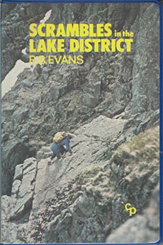
Scrambles in the Lake District
Lingua: Inglese
Editore: Cicerone Press, United Kingdom, Kendal, 1998
ISBN 10: 0902363395 ISBN 13: 9780902363397
Da: WorldofBooks, Goring-By-Sea, WS, Regno Unito
Valutazione del venditore 5 su 5 stelle
EUR 3,04
Spedizione EUR 6,59
Spedito da Regno Unito a U.S.A.Quantit�: 14 disponibili
Aggiungi al carrelloPaperback. Condizione: Very Good. The first of a two-volume set of guides to scrambles in the Lake District. The original scrambling guides to the Lake District, continually reprinted for 20 years, now fully updated Merges 'Scrambles' and 'More Scrambles' into two definitive guides, for southern and northern routes. One of Britain's most popular early scrambling guides, by one of Britain's best-known climbers - and it is still going strong. The Lake Districtis rich mix of rocks, gills and crags offers the scrambler a complex variety of routes, often well removed from the beaten track. Scrambling - ascending rock that is not usually difficult or steep enough to warrant the term 'rock climbing' means you often hardly touch a path and rarely see other people at close quarters. This is a way of getting back to a wilder Lakeland and enjoying the freedom of rough mountain country. This guide covers Langdale, Coniston, Duddon, Eskdale, Longsleddale and Kentmere. It also includes 120 scramble routes graded 1 to 3s and advice on how to approach scrambling safely and with confidence. It also features overview maps as well as sketch diagrams of the crags and routes and introductions to each area mentioned, indicating the type of rock and any recommendations. Information on the approach, character, grade and route of each scramble is also included. Ascending rock that is not usually difficult or steep enough to warrant the term 'rock climbing'. Many of the routes are in exciting places, often well removed from the beaten path. You can go into a popular area and, by combining several scrambles, hardly touch a path and rarely see other people at close quarters. This is a way of getting back to a wilder Lakeland; to enjoy the freedom of rough mountain country. A good long scramble with interesting route finding, uncluttered with the paraphernalia of modern rock climbing, gives a very satisfying way. The book has been read, but is in excellent condition. Pages are intact and not marred by notes or highlighting. The spine remains undamaged.
-

Mountain Walking in Austria: a guide to 25 mountain groups in the Eastern Alps with 98 walks fully described (Cicerone guides)
Lingua: Inglese
Editore: Cicerone Press, United Kingdom, Kendal, 1998
ISBN 10: 1852842393 ISBN 13: 9781852842390
Da: WorldofBooks, Goring-By-Sea, WS, Regno Unito
Valutazione del venditore 5 su 5 stelle
EUR 3,18
Spedizione EUR 6,59
Spedito da Regno Unito a U.S.A.Quantit�: 4 disponibili
Aggiungi al carrelloPaperback. Condizione: Very Good. Austria is the ideal country for the mountain walker. There are many hundreds of mountain huts linked by waymarked paths. Numerous summits over 2000m and even 3000m, can be reached by walkers, many by simply walking, others by easy scrambling or on easy snow. Suitably equipped parties of three can include some glaciers as described in this book. This is a revised edition of Cecil Davies' classic book. It is an introduction to 25 mountain groups with detailed descriptions of 98 walks varying from half a day to a good week. Using this guide as a starting point you could soon work out additional walks in each group. The huts of the Alpine Clubs are mostly wardened and meals are usually provided, thus it is not necessary to carry a heavy pack. The German and Austrian Alpine Clubs have over 500 mountain huts in Austria, linked by an incomparable system of hundreds of miles of footpaths. There are as many more mountain huts run by other clubs or privately. The vast majority of the walks can be undertaken by anyone competent to walk on British hills. The book has been read, but is in excellent condition. Pages are intact and not marred by notes or highlighting. The spine remains undamaged.
-

Lakeland Villages
Lingua: Inglese
Editore: Cicerone Press, United Kingdom, Kendal, 1988
ISBN 10: 1852840242 ISBN 13: 9781852840242
Da: WorldofBooks, Goring-By-Sea, WS, Regno Unito
Valutazione del venditore 5 su 5 stelle
EUR 3,27
Spedizione EUR 6,59
Spedito da Regno Unito a U.S.A.Quantit�: 1 disponibili
Aggiungi al carrelloPaperback. Condizione: Fair. A portrayal of 34 Lakeland villages in words and drawings. Although every village is provided with a map, this is not a guidebook filled with pre-planned walks, but a celbration of the author's favourite bits of the Lake District, giving information but allowing for personal discovery too. A readable copy of the book which may include some defects such as highlighting and notes. Cover and pages may be creased and show discolouration.
-

The End to End Cycle Route: Land's End to John o' Groats
Lingua: Inglese
Editore: Cicerone Press, United Kingdom, Kendal, 2019
ISBN 10: 1852848588 ISBN 13: 9781852848583
Da: WorldofBooks, Goring-By-Sea, WS, Regno Unito
Valutazione del venditore 5 su 5 stelle
EUR 3,27
Spedizione EUR 6,59
Spedito da Regno Unito a U.S.A.Quantit�: 1 disponibili
Aggiungi al carrelloPaperback. Condizione: Very Good. A guidebook describing Britain's famous Land's End to John o Groats (LEJOG) or 'End to End' cycle route, a journey of almost 1000 miles from the very tip of southwest England - Land's End - to the northernmost point of mainland Scotland - John o' Groats. Divided into 14 day stages, with each stage covering between 53 and 85 miles, the route features some of the best cycling the UK has to offer. Grid references are provided at every significant junction, along with notes on the many points of interest and the best places to stop for refreshments and repairs The route outlined in the book is designed to take in some of the finest cycling that the UK has to offer, along the quieter A roads, B roads, lanes and cycle paths. Step-by-step route descriptions are accompanied by 1:250,000 mapping and stage profiles. There are links to GPX mapping of the route for simple GPS navigation as well as a handy equipment list, route summary table, tourist office and cycle shop listings, together with information on health and safety, training and fitness. A listing of accommodation en route is also given. The book has been read, but is in excellent condition. Pages are intact and not marred by notes or highlighting. The spine remains undamaged.
-
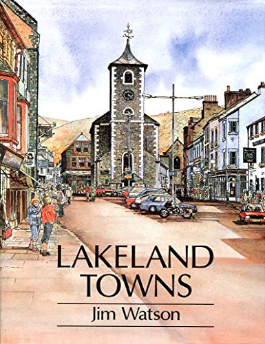
Lakeland Towns
Lingua: Inglese
Editore: Cicerone Press, United Kingdom, Kendal, 1992
ISBN 10: 185284096X ISBN 13: 9781852840969
Da: WorldofBooks, Goring-By-Sea, WS, Regno Unito
Valutazione del venditore 5 su 5 stelle
EUR 3,27
Spedizione EUR 6,59
Spedito da Regno Unito a U.S.A.Quantit�: 3 disponibili
Aggiungi al carrelloPaperback. Condizione: Very Good. The book has been read, but is in excellent condition. Pages are intact and not marred by notes or highlighting. The spine remains undamaged.
-
Lakeland Villages
Lingua: Inglese
Editore: Cicerone Press, United Kingdom, Kendal, 1988
ISBN 10: 1852840242 ISBN 13: 9781852840242
Da: WorldofBooks, Goring-By-Sea, WS, Regno Unito
Valutazione del venditore 5 su 5 stelle
EUR 3,27
Spedizione EUR 6,59
Spedito da Regno Unito a U.S.A.Quantit�: 4 disponibili
Aggiungi al carrelloPaperback. Condizione: Very Good. A portrayal of 34 Lakeland villages in words and drawings. Although every village is provided with a map, this is not a guidebook filled with pre-planned walks, but a celbration of the author's favourite bits of the Lake District, giving information but allowing for personal discovery too. The book has been read, but is in excellent condition. Pages are intact and not marred by notes or highlighting. The spine remains undamaged.
-

Mountain Weather: A Practical Guide for Hillwalkers and Climbers in the British Isles: 6 (Outdoor pursuits & techniques)
Lingua: Inglese
Editore: Cicerone Press, United Kingdom, Kendal, 1998
ISBN 10: 1852842563 ISBN 13: 9781852842567
Da: WorldofBooks, Goring-By-Sea, WS, Regno Unito
Valutazione del venditore 5 su 5 stelle
EUR 3,27
Spedizione EUR 6,59
Spedito da Regno Unito a U.S.A.Quantit�: 5 disponibili
Aggiungi al carrelloPaperback. Condizione: Very Good. Our British mountains have plenty of weather. They are almost always windier, colder, cloudier and wetter than low country. What is more, the weather mood can change bewilderingly quickly, from gloomy, lowering skies and driving rain to shafts of sunlight and breath-taking patterns of colour. The weather can delight or endanger. It can create a mental picture never to be forgotten or thrust the unwary into a fight for life. Whether it is to avoid danger or to add to enjoyment of the mountain scene, before starting a day outdoors among the hills it is wise to know what the weather is likely to be. This book helps hillwalkers and climbers to get the weather forecast most suited to their needs, to understand them, and to modify them in the light of experience of mountain weather. The book is in three parts. PART ONE describes the kinds of forecasts available and how they can be found, PART TWO helps you to understand the forecast through using weather maps and PART THREE describes and explains some of the ways our mountains make their own weather. The book has been read, but is in excellent condition. Pages are intact and not marred by notes or highlighting. The spine remains undamaged.
-

The Thames Path: From London to Source
Lingua: Inglese
Editore: Cicerone Press, United Kingdom, Kendal, 2013
ISBN 10: 1852844361 ISBN 13: 9781852844363
Da: WorldofBooks, Goring-By-Sea, WS, Regno Unito
Valutazione del venditore 5 su 5 stelle
EUR 3,27
Spedizione EUR 6,59
Spedito da Regno Unito a U.S.A.Quantit�: 3 disponibili
Aggiungi al carrelloPaperback. Condizione: Very Good. A guidebook to the Thames Path National Trail following the popular route from the Thames Barrier in London to the source of the Thames 180 miles away in rural Gloucestershire. The Thames Path towpath route, opened as a National Trail in 1996, has been improved by the addition of new footbridges and the creation of 20 miles of new riverside path. More than 90% of the Thames Path is either public footpath or bridleway. The Thames, once an important water highway, links a string of historic sites. In the capital there is Greenwich, the Houses of Parliament and Lambeth Palace. Hampton Court Palace lies just outside London, and before reaching Windsor there is riverside Runneymede where King John agreed to the Magna Carta. The water and towpath in the Upper Reaches can be both beautiful and lonely, with cormorants, herons and swans, as appreciated by Shelley and William Morris. The climax is the 22 miles of the infant Thames leading to a field with its often dry spring situated just below the Roman Fosse Way. The book has been read, but is in excellent condition. Pages are intact and not marred by notes or highlighting. The spine remains undamaged.
-

Walks in the Yorkshire Dales: v. 1 (Jack Keighley's Northern England S.)
Lingua: Inglese
Editore: Cicerone Press, United Kingdom, Kendal, 1998
ISBN 10: 185284034X ISBN 13: 9781852840341
Da: WorldofBooks, Goring-By-Sea, WS, Regno Unito
Valutazione del venditore 5 su 5 stelle
EUR 3,27
Spedizione EUR 6,59
Spedito da Regno Unito a U.S.A.Quantit�: 4 disponibili
Aggiungi al carrelloPaperback. Condizione: Very Good. The area known as the Yorkshire Dales is many things to many people, but above all it is magnificent walking country. Walking has traditionally been the favourite pursuit of those visiting a region which offers a range of attractions perhaps unrivalled anywhere else in the whole of Britain: wild, desolate fells; extensive tracts of heather moorland; rugged limestone scars, pavements and spectacular cliffs; awe-inspiring caves and potholes; deep river gorges and sparkling mountain streams; exquisitely beautiful waterfalls; green fertile valleys and flowery meadows; outstanding view; a vast network of public footpaths and bridleways; remote, picturesque villages and bustling market towns; ancient abbeys, churches and castles; and relics of ancient civilizations. All the walks described in this book are circular and begin at a place where a car may be parked without causing an obstruction. They are fairly uniform in length, an average of 6 1/2 miles making them half-day rather than full-day excursions. The routes are almost entirely public rights of way, with an occasional recourse to commonly-used tracks in open country. They should be free from serious difficulty, and well within the capability of reasonably fit and agile walkers. The book has been read, but is in excellent condition. Pages are intact and not marred by notes or highlighting. The spine remains undamaged.
-

Walking in County Durham: Land of the Prince-Bishops
Lingua: Inglese
Editore: Cicerone Press, United Kingdom, Kendal, 2008
ISBN 10: 1852845376 ISBN 13: 9781852845377
Da: WorldofBooks, Goring-By-Sea, WS, Regno Unito
Valutazione del venditore 5 su 5 stelle
EUR 3,27
Spedizione EUR 6,59
Spedito da Regno Unito a U.S.A.Quantit�: 5 disponibili
Aggiungi al carrelloPaperback. Condizione: Very Good. This second edition of this popular guidebook to County Durham, in the north east of England, describes 450 miles of walking routes and cycleways. County Durham - the Land of the Prince-Bishops - lies between two mighty rivers - the Tyne to the north and the Tees to the south, stretching from the high Pennines in the west to the cliffs of the east coast. The routes explore all corners of this varied and historic landscape - wild moorlands, gentle countryside, riverside walks, nature reserves, heritage sites, railway paths and the low cliff coast, passing Roman forts, ancient churches and castles. And, on the high Pennines, vast tracts of wild moorland are now 'open access'. The guide is illustrated with OS mapping and colour photographs and packed with local information on the wildlife, geology, history and industrial heritage of the county. The book has been read, but is in excellent condition. Pages are intact and not marred by notes or highlighting. The spine remains undamaged.
-
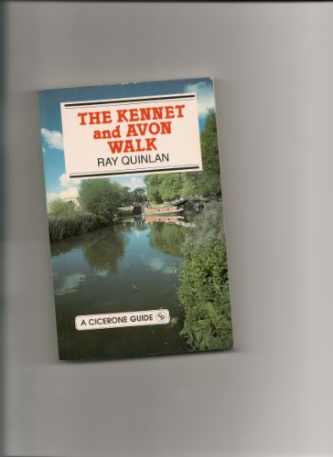
The Kennet and Avon Walk
Lingua: Inglese
Editore: Cicerone Press, United Kingdom, Kendal, 1991
ISBN 10: 1852840900 ISBN 13: 9781852840907
Da: WorldofBooks, Goring-By-Sea, WS, Regno Unito
Valutazione del venditore 5 su 5 stelle
EUR 3,39
Spedizione EUR 6,59
Spedito da Regno Unito a U.S.A.Quantit�: 1 disponibili
Aggiungi al carrelloPaperback. Condizione: Very Good. The book has been read, but is in excellent condition. Pages are intact and not marred by notes or highlighting. The spine remains undamaged.
-

Glyndwr's Way: From Knighton to Welshpool
Lingua: Inglese
Editore: Cicerone Press, United Kingdom, Kendal, 2005
ISBN 10: 1852842997 ISBN 13: 9781852842994
Da: WorldofBooks, Goring-By-Sea, WS, Regno Unito
Valutazione del venditore 5 su 5 stelle
EUR 3,39
Spedizione EUR 6,59
Spedito da Regno Unito a U.S.A.Quantit�: 3 disponibili
Aggiungi al carrelloPaperback. Condizione: Very Good. A guidebook to walking Glyndwr's Way from Knighton to Welshpool in mid-Wales. Glyndwr's Way, named after Owain Glyndwr who led the Welsh in a rebellion against the English in the 15th century, is the third National Trail in Wales and a fitting tribute to Wales's greatest hero. The 132-mile (212km) Glyndwr's Way links with Offa's Dyke at Welshpool to create a 172.5-mile (277.5km) circular walk back to Knighton. The Way passes through farmland, forestry and open hill-land, following old Roman roads, drovers' roads and modern public rights of way. The route is full of interest, with varied flora and fauna and many historical sites relating to Owain Glyndwr. The book describes the route in 12 sections, providing information on places of interest, as well as the practical facilities walkers need. The route is illustrated with OS maps. The guide also provides the historic background to Owain Glyndwr and the Welsh Revolt, and details a number of the prophecies, myths, legends and traditions surrounding him. The book has been read, but is in excellent condition. Pages are intact and not marred by notes or highlighting. The spine remains undamaged.
-

The Isle of Skye: over 80 walks and scrambles (Cicerone Guide)
Lingua: Inglese
Editore: Cicerone Press, United Kingdom, Kendal, 2012
ISBN 10: 1852845600 ISBN 13: 9781852845605
Da: WorldofBooks, Goring-By-Sea, WS, Regno Unito
Valutazione del venditore 5 su 5 stelle
EUR 3,39
Spedizione EUR 6,59
Spedito da Regno Unito a U.S.A.Quantit�: 7 disponibili
Aggiungi al carrelloPaperback. Condizione: Very Good. Guidebook to walks and scrambles on the Isle of Skye, in the Hebrides, just off the northwest Scottish mainland visits all corners of the island as well as the renowned Cuillin. Updated using digital mapping and GPS technology, and taking account of changes brought about by recent forestry work, it includes demanding days as tough as anything in Britain in wonderfully isolated situations over high mountains and strange pinnacles, past lonely lochans, along cliffs and through forests. Skye has some of the most awe-inspiring scenery of Scotland's many islands - a place of whose surface man has barely scratched, with almost supernatural charisma. Covered here are 87 walks and scrambles in Sleat and South-East Skye, Strath, Minginish, Duirinish, Waternish and Trotternish with a selection of routes for all abilities, from novice walker to experienced scrambler. Each route description highlights local historical and geological points of interest along the routes and is illustrated with OS mapping and colour photographs. The book has been read, but is in excellent condition. Pages are intact and not marred by notes or highlighting. The spine remains undamaged.