
Importo totale (1 articolo articoli):
Destinazione ordine:

rivers publishing uk (130 risultati)
Casa editrice:
rivers publishing uk
Perfeziona con la Ricerca avanzata
Vai alla pagina principale dei risultati di ricerca
Filtri di ricerca
Tipo di articolo
- Tutti i tipi di prodotto
- Libri (123)
- Riviste e Giornali (Nessun altro risultato corrispondente a questo perfezionamento)
- Fumetti (Nessun altro risultato corrispondente a questo perfezionamento)
- Spartiti (Nessun altro risultato corrispondente a questo perfezionamento)
- Arte, Stampe e Poster (Nessun altro risultato corrispondente a questo perfezionamento)
- Fotografie (Nessun altro risultato corrispondente a questo perfezionamento)
- Mappe (7)
- Manoscritti e Collezionismo cartaceo (Nessun altro risultato corrispondente a questo perfezionamento)
Condizioni Maggiori informazioni
- Nuovo (102)
- Come nuovo, Ottimo o Quasi ottimo (4)
- Molto buono o Buono (23)
- Discreto o Mediocre (1)
- Come descritto (Nessun altro risultato corrispondente a questo perfezionamento)
Legatura
- Tutte
- Rilegato (Nessun altro risultato corrispondente a questo perfezionamento)
- Brossura (80)
Ulteriori caratteristiche
- Prima ed. (Nessun altro risultato corrispondente a questo perfezionamento)
- Copia autograf. (Nessun altro risultato corrispondente a questo perfezionamento)
- Sovracoperta (Nessun altro risultato corrispondente a questo perfezionamento)
- Con foto (37)
- Non Print on Demand (130)
Lingua (1)
Spedizione gratuita
Paese del venditore
Valutazione venditore
-

White Water Massif Central
Da: WeBuyBooks, Rossendale, LANCS, Regno Unito
Valutazione del venditore 5 su 5 stelle

EUR 2,33
Spedizione EUR 6,87
Spedito da Regno Unito a U.S.A.Quantit�: 1 disponibili
Aggiungi al carrelloCondizione: Good. Most items will be dispatched the same or the next working day. A copy that has been read but remains in clean condition. All of the pages are intact and the cover is intact and the spine may show signs of wear. The book may have minor markings which are not specifically mentioned.
-
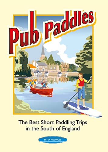
Pub Paddles - The Best Short Canoe Trips in the South of England
Da: AwesomeBooks, Wallingford, Regno Unito
Valutazione del venditore 5 su 5 stelle
EUR 5,08
Spedizione EUR 4,78
Spedito da Regno Unito a U.S.A.Quantit�: 1 disponibili
Aggiungi al carrelloPaperback. Condizione: Very Good. Pub Paddles - The Best Short Canoe Trips in the South of England This book is in very good condition and will be shipped within 24 hours of ordering. The cover may have some limited signs of wear but the pages are clean, intact and the spine remains undamaged. This book has clearly been well maintained and looked after thus far. Money back guarantee if you are not satisfied. See all our books here, order more than 1 book and get discounted shipping. .
-

Pub Paddles - The Best Short Paddling Trips in the South of England
Da: WeBuyBooks, Rossendale, LANCS, Regno Unito
Valutazione del venditore 5 su 5 stelle
EUR 1,88
Spedizione EUR 9,38
Spedito da Regno Unito a U.S.A.Quantit�: 3 disponibili
Aggiungi al carrelloCondizione: Like New. Most items will be dispatched the same or the next working day. An apparently unread copy in perfect condition. Dust cover is intact with no nicks or tears. Spine has no signs of creasing. Pages are clean and not marred by notes or folds of any kind.
-
Pub Paddles - The Best Short Paddling Trips in the South of England
Lingua: Inglese
Editore: Rivers Publishing UK; edition (2010-05-01), 1600
ISBN 10: 0955061415 ISBN 13: 9780955061417
Da: WorldofBooks, Goring-By-Sea, WS, Regno Unito
Valutazione del venditore 5 su 5 stelle
EUR 5,17
Spedizione EUR 6,50
Spedito da Regno Unito a U.S.A.Quantit�: 18 disponibili
Aggiungi al carrelloPaperback. Condizione: Very Good. The book has been read, but is in excellent condition. Pages are intact and not marred by notes or highlighting. The spine remains undamaged.
-

EUR 5,25
Spedizione EUR 7,43
Spedito da Regno Unito a U.S.A.Quantit�: 1 disponibili
Aggiungi al carrelloCondizione: Very Good. Most items will be dispatched the same or the next working day. A copy that has been read, but is in excellent condition. Pages are intact and not marred by notes or highlighting. The spine remains undamaged.
-
Pub Paddles - The Best Short Canoe Trips in the South of England
Lingua: Inglese
Editore: Rivers Publishing UK 01/05/2010, 2010
ISBN 10: 0955061415 ISBN 13: 9780955061417
Da: Bahamut Media, Reading, Regno Unito
Valutazione del venditore 5 su 5 stelle
EUR 5,08
Spedizione EUR 8,10
Spedito da Regno Unito a U.S.A.Quantit�: 1 disponibili
Aggiungi al carrelloPaperback. Condizione: Very Good. Shipped within 24 hours from our UK warehouse. Clean, undamaged book with no damage to pages and minimal wear to the cover. Spine still tight, in very good condition. Remember if you are not happy, you are covered by our 100% money back guarantee.
-

Canoe & Kayak Map of Britain
Da: WorldofBooks, Goring-By-Sea, WS, Regno Unito
Valutazione del venditore 5 su 5 stelle
EUR 9,00
Spedizione EUR 6,50
Spedito da Regno Unito a U.S.A.Quantit�: 2 disponibili
Aggiungi al carrelloPaperback. Condizione: Very Good. The book has been read, but is in excellent condition. Pages are intact and not marred by notes or highlighting. The spine remains undamaged.
-

White Water Massif Central
Da: Reuseabook, Gloucester, GLOS, Regno Unito
Valutazione del venditore 5 su 5 stelle
EUR 4,63
Spedizione EUR 11,61
Spedito da Regno Unito a U.S.A.Quantit�: 1 disponibili
Aggiungi al carrelloPaperback. Condizione: Used; Very Good. Dispatched, from the UK, within 48 hours of ordering. Though second-hand, the book is still in very good shape. Minimal signs of usage may include very minor creasing on the cover or on the spine.
-
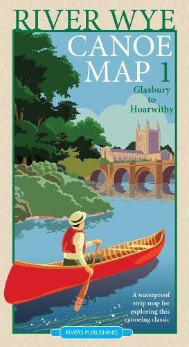
River Wye Canoe Map 1: Glasbury to Hoarwithy
Da: WorldofBooks, Goring-By-Sea, WS, Regno Unito
Valutazione del venditore 5 su 5 stelle
EUR 10,21
Spedizione EUR 6,50
Spedito da Regno Unito a U.S.A.Quantit�: 1 disponibili
Aggiungi al carrelloPaperback. Condizione: Very Good. The book has been read, but is in excellent condition. Pages are intact and not marred by notes or highlighting. The spine remains undamaged.
-
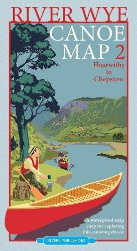
River Wye Canoe Map 2: Hoarwithy to Chepstow
Da: WorldofBooks, Goring-By-Sea, WS, Regno Unito
Valutazione del venditore 5 su 5 stelle
EUR 10,24
Spedizione EUR 6,50
Spedito da Regno Unito a U.S.A.Quantit�: 1 disponibili
Aggiungi al carrelloPaperback. Condizione: Very Good. The book has been read, but is in excellent condition. Pages are intact and not marred by notes or highlighting. The spine remains undamaged.
-

Topographical Map of the Lake District Wainwright Fells
Da: WorldofBooks, Goring-By-Sea, WS, Regno Unito
Valutazione del venditore 5 su 5 stelle
EUR 11,05
Spedizione EUR 6,50
Spedito da Regno Unito a U.S.A.Quantit�: 1 disponibili
Aggiungi al carrelloPaperback. Condizione: Very Good. The book has been read, but is in excellent condition. Pages are intact and not marred by notes or highlighting. The spine remains undamaged.
-

White Water Nepal (Second Edition)
Da: WeBuyBooks, Rossendale, LANCS, Regno Unito
Valutazione del venditore 5 su 5 stelle
EUR 9,82
Spedizione EUR 7,78
Spedito da Regno Unito a U.S.A.Quantit�: 1 disponibili
Aggiungi al carrelloCondizione: Good. Most items will be dispatched the same or the next working day. A copy that has been read but remains in clean condition. All of the pages are intact and the cover is intact and the spine may show signs of wear. The book may have minor markings which are not specifically mentioned.
-

Canoe and Kayak Games
Da: Rarewaves.com USA, London, LONDO, Regno Unito
Valutazione del venditore 5 su 5 stelle
EUR 19,32
Spedizione gratuita
Spedito da Regno Unito a U.S.A.Quantit�: 19 disponibili
Aggiungi al carrelloPaperback. Condizione: New. Contains 250 paddle sports games for serious training, fun paddling, various types of canoes and kayaks, various levels of skill, and many different types of water. This book is produced in association with the British Canoe Union and the Plas Brenin National Mountaineering Centre.
-
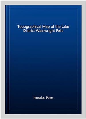
Topographical Map of the Lake District Wainwright Fells
Da: GreatBookPrices, Columbia, MD, U.S.A.
Valutazione del venditore 5 su 5 stelle
Condizione: As New. Unread book in perfect condition.
-

Canoe & Kayak Map of Britain
Da: WeBuyBooks, Rossendale, LANCS, Regno Unito
Valutazione del venditore 5 su 5 stelle
EUR 8,36
Spedizione EUR 5,34
Spedito da Regno Unito a U.S.A.Quantit�: 1 disponibili
Aggiungi al carrelloCondizione: Good. Most items will be dispatched the same or the next working day. A copy that has been read but remains in clean condition. All of the pages are intact and the cover is intact and the spine may show signs of wear. The book may have minor markings which are not specifically mentioned.
-
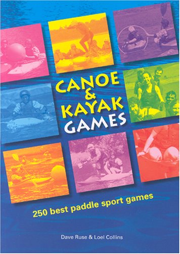
Canoe and Kayak Games
Da: PBShop.store US, Wood Dale, IL, U.S.A.
Valutazione del venditore 5 su 5 stelle
PAP. Condizione: New. New Book. Shipped from UK. Established seller since 2000.
-
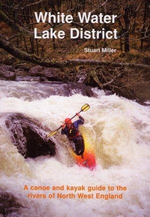
White Water Lake District : A Canoe and Kayak Guide to the Rivers of North West England
Da: WorldofBooks, Goring-By-Sea, WS, Regno Unito
Valutazione del venditore 5 su 5 stelle
EUR 14,37
Spedizione EUR 6,50
Spedito da Regno Unito a U.S.A.Quantit�: 1 disponibili
Aggiungi al carrelloPaperback. Condizione: Very Good. The book has been read, but is in excellent condition. Pages are intact and not marred by notes or highlighting. The spine remains undamaged.
-
River Wye Canoe Map 1 (Folded)
Lingua: Inglese
Editore: Rivers Publishing UK, Surrey, 2017
ISBN 10: 0995751307 ISBN 13: 9780995751309
Da: Grand Eagle Retail, Bensenville, IL, U.S.A.
Valutazione del venditore 5 su 5 stelle
Folded. Condizione: new. Folded. This is one of two strip maps for anyone wanting to explore the river Wye by canoe. Designed by canoeists for canoeists, it is very much a 'hands on' map - waterproof and easy to use whilst paddling down the river - it even floats! It shows all the essential paddling information as clearly as possible at a large scale - 1:36,000. There are two maps in the series - this map covers the section from Glasbury to Hoarwithy (the section from Hoarwithy to Chepstow is a separate map - 9780995751316). This map includes Glasbury, Hay on Wye, Hereford and Hoarwithy. This is one of two strip maps for anyone wanting to explore the river Wye by canoe. Designed by canoeists for canoeists, it is very much a 'hands on' map - waterproof and easy to use whilst paddling down the river - it even floats! It shows all the essential paddling information as clearly as possible at a large scale - 1:36,000. Shipping may be from multiple locations in the US or from the UK, depending on stock availability.
-

River Wye Canoe Map 1
Da: Rarewaves.com USA, London, LONDO, Regno Unito
Valutazione del venditore 5 su 5 stelle
EUR 15,57
Spedizione gratuita
Spedito da Regno Unito a U.S.A.Quantit�: Pi� di 20 disponibili
Aggiungi al carrelloMap. Condizione: New. This is one of two strip maps for anyone wanting to explore the river Wye by canoe. Designed by canoeists for canoeists, it is very much a 'hands on' map - waterproof and easy to use whilst paddling down the river - it even floats! It shows all the essential paddling information as clearly as possible at a large scale - 1:36,000. There are two maps in the series - this map covers the section from Glasbury to Hoarwithy (the section from Hoarwithy to Chepstow is a separate map - 9780995751316). This map includes Glasbury, Hay on Wye, Hereford and Hoarwithy.
-
River Wye Canoe Map 2 (Folded)
Lingua: Inglese
Editore: Rivers Publishing UK, Surrey, 2017
ISBN 10: 0995751315 ISBN 13: 9780995751316
Da: Grand Eagle Retail, Bensenville, IL, U.S.A.
Valutazione del venditore 5 su 5 stelle
Folded. Condizione: new. Folded. This is one of two strip maps for anyone wanting to explore the river Wye by canoe. Designed by canoeists for canoeists, it is very much a 'hands on' map - waterproof and easy to use whilst paddling down the river - it even floats! It shows all the essential paddling information as clearly as possible at a large scale - 1:36,000. There are two maps in the series - this map covers the section from Hoarwithy to Chepstow (the section from Glasbury to Hoarwithy is a separate map - 9780995751309). This map includes Hoarwithy, Ross on Wye, Symonds Yat, Monmouth and Chepstow.The two maps cover all 161 km of the most popular canoeing stretch of the river from Glasbury to Chepstow. These are 'strip maps' - with 4 convenient sections on each map showing the river and the countryside on each side of the river. The base mapping uses O.S. geodata which has been edited and enhanced to show essential information as clearly as possible. The maps show roads, towns, villages, footpaths, rivers, streams, lakes, churches, farms, houses, woods and hills. Physical relief is shown with a contour interval of 10m.Canoeing information is highlighted with colour boxes and symbols to show recommended launch sites, rapids, campsites, pubs, cafes and canoe hire bases.There are brief guidance notes on paddling the river Wye and essential information for key sections. There are also up to date notes on other information sources - websites, books, etc. It should be invaluable for anyone planning a single or multi-day trip. Printed on polyart waterproof paper. This is one of two strip maps for anyone wanting to explore the river Wye by canoe. Designed by canoeists for canoeists, it is very much a 'hands on' map - waterproof and easy to use whilst paddling down the river - it even floats! It shows all the essential paddling information as clearly as possible at a large scale - 1:36,000. Shipping may be from multiple locations in the US or from the UK, depending on stock availability.
-

Canoe & Kayak Guide to North West England: Of White Water Lake District
Da: WorldofBooks, Goring-By-Sea, WS, Regno Unito
Valutazione del venditore 5 su 5 stelle
EUR 15,92
Spedizione EUR 6,50
Spedito da Regno Unito a U.S.A.Quantit�: 1 disponibili
Aggiungi al carrelloPaperback. Condizione: Very Good. The book has been read, but is in excellent condition. Pages are intact and not marred by notes or highlighting. The spine remains undamaged.
-

Paperback. Condizione: New. Contains 250 paddle sports games for serious training, fun paddling, various types of canoes and kayaks, various levels of skill, and many different types of water. This book is produced in association with the British Canoe Union and the Plas Brenin National Mountaineering Centre.
-

Topographical Map of the Lake District Wainwright Fells
Da: GreatBookPrices, Columbia, MD, U.S.A.
Valutazione del venditore 5 su 5 stelle
Condizione: New.
-
Topographical Map of the Lake District Wainwright Fells (Folded)
Lingua: Inglese
Editore: Rivers Publishing UK, Surrey, 2014
ISBN 10: 0955061474 ISBN 13: 9780955061479
Da: Grand Eagle Retail, Bensenville, IL, U.S.A.
Valutazione del venditore 5 su 5 stelle
Folded. Condizione: new. Folded. This map shows all of the 214 Wainwright Fells of the Lake District very clearly on a high quality topographical base map. It will especially appeal to those walkers who are aiming to climb all the Wainwright Fells and want a clear, user-friendly aid to plan their trips and to mark off the fells as they do them. The map has been carefully designed to show essential detail as clearly as possible, whilst leaving off the things of less relevance (including footpaths) that would otherwise clutter the map. The result is a map of the Lake District that is one of the clearest, most legible and elegant maps available today. The base map is a detailed topographical map (based on O.S. geodata) that shows - towns, villages, roads, railways, stations, ferry crossings, youth hostels, campsites, rivers, lakes and mountains. Topographical relief is shown by graduated colour layers with a 50m contour interval. Each Wainwright summit is clearly labeled with the fell name together with a small circle so that you can mark off a peak when you have done it. Popular starting and parking places are shown with a small blue dot to further aid planning routes. Place and fell names are easily legible.The map is a convenient size so that it is easy to use - either opened out on a table, in the car, or when displayed on the wall. The map is printed on high quality paper. On the reverse of the map are tables and lists of the 214 Fells, with their heights with a wide column so the user can record the date climbed and personal notes. There is also helpful information on recommended books, web sites, etc. Rivers Publishing is a well established, specialist publisher based in the Lake District. Over the last twenty years they have built up a reputation for best-selling, quality guide books and maps. This map shows all of the 214 Wainwright Fells of the Lake District very clearly on a high quality topographical base map. It will especially appeal to those walkers who are aiming to climb all the Wainwright Fells and want a clear, user-friendly aid to plan their trips and to mark off the fells as they do them. Shipping may be from multiple locations in the US or from the UK, depending on stock availability.
-
Ruse, D: Canoe and Kayak Games
Da: PBShop.store UK, Fairford, GLOS, Regno Unito
Valutazione del venditore 5 su 5 stelle
EUR 18,06
Spedizione EUR 4,83
Spedito da Regno Unito a U.S.A.Quantit�: 15 disponibili
Aggiungi al carrelloPAP. Condizione: New. New Book. Shipped from UK. Established seller since 2000.
-
River Wye Canoe Map 1
Da: PBShop.store UK, Fairford, GLOS, Regno Unito
Valutazione del venditore 5 su 5 stelle
EUR 12,90
Spedizione EUR 3,82
Spedito da Regno Unito a U.S.A.Quantit�: 15 disponibili
Aggiungi al carrelloUNK. Condizione: New. New Book. Shipped from UK. Established seller since 2000.
-
River Wye Canoe Map 1
Da: PBShop.store US, Wood Dale, IL, U.S.A.
Valutazione del venditore 5 su 5 stelle
UNK. Condizione: New. New Book. Shipped from UK. Established seller since 2000.
-
River Wye Canoe Map 2
Da: PBShop.store US, Wood Dale, IL, U.S.A.
Valutazione del venditore 5 su 5 stelle
UNK. Condizione: New. New Book. Shipped from UK. Established seller since 2000.
-
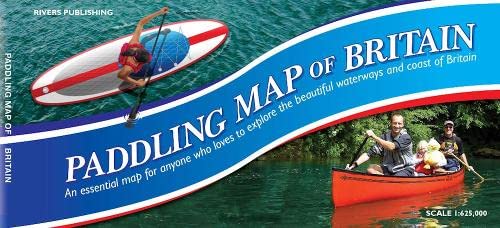
Paddling Map of Britain - Third Edition 2022 (Map)
Lingua: Inglese
Editore: Rivers Publishing UK, Surrey, 2022
ISBN 10: 099575134X ISBN 13: 9780995751347
Da: Grand Eagle Retail, Bensenville, IL, U.S.A.
Valutazione del venditore 5 su 5 stelle
Map. Condizione: new. Map. This map of mainland Britain that shows the huge extent of paddling possibilities on rivers, lochs, canals and coast - some 37,000km of paddling!Enthusiasts buy this map to plan and dream, whilst for the newcomer to the sport it answers that question "where can I go paddling? It is colour coded to clearly show the nature of these waterways.Southern England and Wales is on one side of the large B1 sheet - Scotland and the North of England on the reverse. The base is provided by a map of Britain at 1:625,000 (ten miles to the inch) that shows roads, towns, villages, rivers, streams and lakes with this detail in pastel colours. Brighter colours show some 540 rivers graded by difficulty - also canals and waterways used by motorized craft. Popular paddling trips are highlighted, as are white water centres. The map also shows locations for selected loch and coastal trips.Information panels give guidance, recommended websites and guidebooks - all designed to 'open the doors' to the world of paddling - for canoes, kayaks and SUPs. This map of mainland Britain that shows the huge extent of paddling possibilities on rivers, lochs, canals and coast - some 37,000km of paddling! Shipping may be from multiple locations in the US or from the UK, depending on stock availability.
-

Best Canoe Trips in the South of France: A paddling guide to the friendly rivers of the Massif Central
Da: ThriftBooks-Atlanta, AUSTELL, GA, U.S.A.
Valutazione del venditore 5 su 5 stelle
Paperback. Condizione: Very Good. No Jacket. May have limited writing in cover pages. Pages are unmarked. ~ ThriftBooks: Read More, Spend Less.