
Importo totale (1 articolo articoli):
Destinazione ordine:

arcgis geographic information system (22 risultati)
Vai alla pagina principale dei risultati di ricerca
Filtri di ricerca
Tipo di articolo
- Tutti i tipi di prodotto
- Libri (22)
- Riviste e Giornali (Nessun altro risultato corrispondente a questo perfezionamento)
- Fumetti (Nessun altro risultato corrispondente a questo perfezionamento)
- Spartiti (Nessun altro risultato corrispondente a questo perfezionamento)
- Arte, Stampe e Poster (Nessun altro risultato corrispondente a questo perfezionamento)
- Fotografie (Nessun altro risultato corrispondente a questo perfezionamento)
- Mappe (Nessun altro risultato corrispondente a questo perfezionamento)
- Manoscritti e Collezionismo cartaceo (Nessun altro risultato corrispondente a questo perfezionamento)
Condizioni Maggiori informazioni
- Nuovo (21)
- Come nuovo, Ottimo o Quasi ottimo (1)
- Molto buono o Buono (Nessun altro risultato corrispondente a questo perfezionamento)
- Discreto o Mediocre (Nessun altro risultato corrispondente a questo perfezionamento)
- Come descritto (Nessun altro risultato corrispondente a questo perfezionamento)
Legatura
- Tutte
- Rilegato (Nessun altro risultato corrispondente a questo perfezionamento)
- Brossura (22)
Ulteriori caratteristiche
- Prima ed. (Nessun altro risultato corrispondente a questo perfezionamento)
- Copia autograf. (Nessun altro risultato corrispondente a questo perfezionamento)
- Sovracoperta (Nessun altro risultato corrispondente a questo perfezionamento)
- Con foto (16)
- Non Print on Demand (22)
Lingua (3)
Spedizione gratuita
- Spedizione gratuita in U.S.A. (Nessun altro risultato corrispondente a questo perfezionamento)
Paese del venditore
Valutazione venditore
-

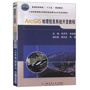
ArcGIS geographic information system space Analysis of Experimental Course (with CD-ROM) (Paperback)
Editore: Science Press; 1 (April 27. 2010), 1991
ISBN 10: 7030169042 ISBN 13: 9787030169044
Lingua: Cinese
EUR 3,55
Convertire valutaEUR 22,50 per la spedizione da Francia a U.S.A.Quantit�: 1 disponibili
Aggiungi al carrelloSoftcover. Condizione: Bon. Ammareal reverse jusqu'� 15% du prix net de cet article � des organisations caritatives. ENGLISH DESCRIPTION Book Condition: Used, Good. Ammareal gives back up to 15% of this item's net price to charity organizations.
-

ArcGIS 10.8 geographic information system software and applications(Chinese Edition)
Editore: China Environmental Science Press, 2021
ISBN 10: 7511147844 ISBN 13: 9787511147844
Lingua: Inglese
EUR 76,58
Convertire valutaEUR 15,56 per la spedizione da Cina a U.S.A.Quantit�: 3 disponibili
Aggiungi al carrellopaperback. Condizione: New. Paperback. Pub Date: 2021-09-01 Pages: 170 Language: Chinese Publisher: China Environmental Publishing Group ArcGIS 10.8 Geographic Information System Software and Applications keeps pace with the times and adopts a newer software version. namely ArcGIS 10.8 English version.?This book is suitable for use as a textbook for undergraduates and graduate students majoring in geographic information science. surveying and mapping science and technology. geography. tourism management. urban planning.
-

ArcGIS Geographic Information System Practice Guide (Paperback)(Chinese Edition)
Editore: Meteorological Press; 1 (July 1. 2009), 1991
ISBN 10: 7502947868 ISBN 13: 9787502947866
EUR 51,33
Convertire valutaEUR 15,56 per la spedizione da Cina a U.S.A.Quantit�: 3 disponibili
Aggiungi al carrelloSoft cover. Condizione: New. Language:Chinese.Author:LIU YONG ZHAO JUN.Binding:Soft cover.Publisher:Meteorological Press; 1 (July 1. 2009).
-

ArcGIS Geographic Information System Basic Experimental Tutorial(Chinese Edition)
ISBN 10: 7513674450 ISBN 13: 9787513674454
Lingua: Inglese
EUR 141,89
Convertire valutaEUR 15,56 per la spedizione da Cina a U.S.A.Quantit�: 3 disponibili
Aggiungi al carrellopaperback. Condizione: New. Language:Chinese.Paperback. Pub Date: 2023-09 Publisher: China Economic Publishing House This book is divided into 14 chapters. of which Chapter 1 to Chapter 7 are about the basic operations of geographic data. mainly introducing the creation. editing. organization and management of relevant data. Chapters 8 to 13 introduce the geographic analysis tools in the ArcGIS software platform. including spatial analysis. three-dimensional analysis. hydrological analysis. geostatistical analysis. netw.
-

EUR 68,41
Convertire valutaEUR 15,56 per la spedizione da Cina a U.S.A.Quantit�: 3 disponibili
Aggiungi al carrellopaperback. Condizione: New. Paperback. Pub Date: 2022-12-01 Pages: 154 Language: Chinese Publisher: People's Communications Publishing House This book is based on actual cases in China and Japan. combined with geographic information system research methods. introduces the application and practice of ArcGIS. and allows readers to master geography Principles of operation of information systems software. The book consists of nine chapters. including the basic operation and comprehensive application of attribute tables in A.
-

ArcGIS geographic information system space Analysis of Experimental Course (with CD-ROM) (Paperback)(Chinese Edition)
Editore: Science Press; 1 (April 27. 2010), 1991
ISBN 10: 7030169042 ISBN 13: 9787030169044
Lingua: Cinese
EUR 73,66
Convertire valutaEUR 15,56 per la spedizione da Cina a U.S.A.Quantit�: 3 disponibili
Aggiungi al carrelloSoft cover. Condizione: New. Language:Chinese.Author:TANG GUO AN.Binding:Soft cover.Publisher:Science Press; 1 (April 27. 2010).
-

EUR 76,07
Convertire valutaEUR 15,56 per la spedizione da Cina a U.S.A.Quantit�: 3 disponibili
Aggiungi al carrellopaperback. Condizione: New. Pub Date: 2014-05-01 Pages: 390 Language: Chinese Publisher: Beijing Hope Electronic Press ArcGIS Geographic Information System Detailed (10.1 version) through a large number of instances. comprehensive and systematic introduction to the use of ArcGIS 10.1 desktop software methods. operating skills and specific applications. The book five. The first one is ArcGIS entry describes composition. architecture and new features. ArcGIS10.1 main function menu ArcGIS 10.1 software and its basic operat.
-

EUR 80,86
Convertire valutaEUR 15,56 per la spedizione da Cina a U.S.A.Quantit�: 1 disponibili
Aggiungi al carrellopaperback. Condizione: New. Ship out in 2 business day, And Fast shipping, Free Tracking number will be provided after the shipment.Paperback. Pages Number: 579 Language: Chinese. Publisher: Science Press. ArcGIS geographic information system spatial analysis of the experimental tutorial (with CD-ROM version 2) The authors summarize years of teaching and research experience. and analyzed and summarized on a written application of the version of the textbook and the basis of the new features of ArcGIS 10 software. The book introduces the ArcGIS application basis. ArcGIS spatial analysis tools. and analysis of examples. Include Introduction to ArcGIS. ArcGIS application infrastructure. spatial data collection and organization of spatial data conversion and processing. and visualization of spatial data expression. Introduction to GIS spatial analysis. spatial analysis of vector data. raster data. spatial analysis. three-dimensional analysis. geostatistical analysis. hydrological analysis. spatial analysis modeling. and comprehensive analysis of practice. In addition. the book is also equipped with the instance of the typical meaning. and a lot of practice with the book information. and supplemented by the corresponding data in the CD-ROM. in order to practice in the reference. ArcGIS geographic information system spatial analysis version 2 of the experimental tutorial (CD) and stressed that a combination of scientific. systematic. practical and legibility. as institutions of higher learning geographic information systems. geography. mapping and other related professional the students' materials. but also as a reference book of scientific and technical personnel of the department of scientific research. engineering design. planning and management. The book is responsible for the overall design of the book by TANG Guo. Yang Xin. organization. revision and finalization.Four Satisfaction guaranteed,or money back.
-

Proficient in ArcGIS geographic information system (with CD-ROM)(Chinese Edition)
Editore: Tsinghua University Press; 1st edition (February 1, 2000
ISBN 10: 7302243662 ISBN 13: 9787302243663
Lingua: Cinese
EUR 81,11
Convertire valutaEUR 15,56 per la spedizione da Cina a U.S.A.Quantit�: 1 disponibili
Aggiungi al carrellopaperback. Condizione: New. Paperback. Pub Date: 2011 02 Pages: 457 Publisher: Tsinghua University Press proficient in ArcGIS geographic information system (with CD-ROM) from the the gis software application development perspective. comprehensive system. easy-to-digest introduction arcgis software the structure and function of the software operation. data processing and application development. The book provides a large number of examples for the reader to understand the function and operation of the software. The book .
-

ArcGIS geographic information system experiment tutorial(Chinese Edition)
ISBN 10: 7519800598 ISBN 13: 9787519800598
EUR 63,82
Convertire valutaEUR 15,56 per la spedizione da Cina a U.S.A.Quantit�: 3 disponibili
Aggiungi al carrellopaperback. Condizione: New. Paperback. the Pub Date: 2017-02-01 Pages: 276 Language: Chinese Publisher: China power press. much starker choices-and graver consequences-in planning of undergraduate course of common higher education teaching material ArcGIS geographic information system experiment course for much starker choices-and graver consequences-in for teaching of undergraduate course of common higher education.The book is divided into ten chapters. the main contents include data edit operation. build.
-
ArcGIS Geographic Information System Development Tutorial Bi Tianping(Chinese Edition)
ISBN 10: 7565522155 ISBN 13: 9787565522154
EUR 66,79
Convertire valutaEUR 15,56 per la spedizione da Cina a U.S.A.Quantit�: 5 disponibili
Aggiungi al carrellopaperback. Condizione: New. Paperback. Pub Date: 173 Language: Chinese Publisher: China Agricultural University Press ArcGIS Geographic Information System Development Tutorial is limited by the special teacher and ESRI (China) information technology of Shenyang Building University Land Resources Management Department The company's Shenyang Branch technicians jointly prepared. Arcg .
-

EUR 97,44
Convertire valutaEUR 15,56 per la spedizione da Cina a U.S.A.Quantit�: 1 disponibili
Aggiungi al carrellopaperback. Condizione: New. Paperback. Pub Date: 2011. Pages: 571 Publisher: Tsinghua University Press ArcGIS geographic information system infrastructure and training (2) as an innovative two-in-one textbook. is a user-friendly GIS portal textbooks. can also act as ArcGIS training manual. ArcGIS geographic information system infrastructure and training (2nd edition) readable. informative. writings way fun. covering GIS Fundamentals and software applications. The book is 10 chapters. comprehensive coverage of GIS practi.
-

ArcGIS Geographic Information System Analysis and Application(Chinese Edition)
ISBN 10: 7121342138 ISBN 13: 9787121342134
EUR 71,90
Convertire valutaEUR 15,56 per la spedizione da Cina a U.S.A.Quantit�: 5 disponibili
Aggiungi al carrellopaperback. Condizione: New. Paperback. Pub Date: 2018-06-01 Pages: 276 Language: Chinese Publisher: Electronic Industry Press This book briefly introduces the development of GIS software ArcGIS. the basic components of ArcGIS 10.3 and the main functions of several important modules. And the scope of application is introduced. Input and process with GIS data.
-
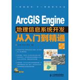
ArcGIS Engine geographic information system development from entry to the master ( 2nd edition ) ( with CD-ROM 1 )(Chinese Edition)
ISBN 10: 7115304629 ISBN 13: 9787115304629
EUR 76,07
Convertire valutaEUR 15,56 per la spedizione da Cina a U.S.A.Quantit�: 1 disponibili
Aggiungi al carrellopaperback. Condizione: New. Ship out in 2 business day, And Fast shipping, Free Tracking number will be provided after the shipment.Paperback. Pub Date :2013-04-01 Pages: 269 Publisher: People Post Press ArcGIS Engine geographic information system development from entry to the master ( 2nd Edition ) to explain the development platform based on ArcGIS Engine 10 . describes the development of related technologies and engineering applications. and programming using C # language engineering examples. ArcGIS Engine geographic information system development from entry to the master ( 2nd Edition ) sub- four of 16 chapters. the .Four Satisfaction guaranteed,or money back.
-

Based on ArcGIS Engine geographic information system development technology and practice(Chinese Edition)
ISBN 10: 7307166119 ISBN 13: 9787307166110
EUR 78,05
Convertire valutaEUR 15,56 per la spedizione da Cina a U.S.A.Quantit�: 5 disponibili
Aggiungi al carrellopaperback. Condizione: New. Language:Chinese.Paperback. Pub Date: 2017-11-01 Pages: 346 Publisher: wuhan university press. this book is the author in GIS software development and teaching experience for many years. on the basis of comprehensive consideration of undergraduate and graduate students knowledge structure. technical level and practical skills to write.Contents include: ArcGIS Engine application framework. thematic mapping. vector.
-

ArcGIS 9 geographic information system application and practice (Set 2 Volumes) (Paperback)(Chinese Edition)
Editore: Tsinghua University; 1 edition (June 1. 2007), 1991
ISBN 10: 7302151342 ISBN 13: 9787302151340
Lingua: Cinese
EUR 117,59
Convertire valutaEUR 15,56 per la spedizione da Cina a U.S.A.Quantit�: 3 disponibili
Aggiungi al carrelloSoft cover. Condizione: New. Language:Chinese.Author:WU XIU QIN.Binding:Soft cover.Publisher:Tsinghua University; 1 edition (June 1. 2007).
-
![Immagine dell'editore per [ New Genuine ] College Books : ArcGIS geographic information system tutorial ( Fifth Edition ) ( including DVD118(Chinese Edition) venduto da liu xing](https://pictures.abebooks.com/isbn/9787121158582-it-300.jpg)
[ New Genuine ] College Books : ArcGIS geographic information system tutorial ( Fifth Edition ) ( including DVD118(Chinese Edition)
ISBN 10: 7121158582 ISBN 13: 9787121158582
EUR 81,89
Convertire valutaEUR 15,56 per la spedizione da Cina a U.S.A.Quantit�: 3 disponibili
Aggiungi al carrellopaperback. Condizione: New. Ship out in 2 business day, And Fast shipping, Free Tracking number will be provided after the shipment.Paperback. Pub Date :2012-05-01 Language: Chinese Publisher: Electronic Industry Press Information Title: College Books : ArcGIS geographic information system tutorial ( Fifth Edition ) ( DVD disc containing a ) List Price: 69.00 yuan author : Price Publisher: Electronic industry Press Publication Date : 2012-05-01 ISBN: 9787121158582 words: Page: Revision: 1 Binding: Paperback Format: other commodities ID: 1200254099 Editor no Summary h2 Maribeth Price by significant ArcGIS geographic inform.Four Satisfaction guaranteed,or money back.
-
GIS application development Books ArcGIS 10 geographic information system tutorial: from beginner to proficient (with DVD-ROM disc 1)(Chinese Edition)
ISBN 10: 7503025026 ISBN 13: 9787503025020
EUR 87,08
Convertire valutaEUR 15,56 per la spedizione da Cina a U.S.A.Quantit�: 1 disponibili
Aggiungi al carrellopaperback. Condizione: New. Ship out in 2 business day, And Fast shipping, Free Tracking number will be provided after the shipment.Paperback. Pub Date: 2012 Pages: 555 Language: English Publisher: Surveying and Mapping Press GIS application development Books ArcGIS 10 geographic information system tutorial: from beginner to proficient full detailed description of ArcGIS 10 software operating and tips. the book is divided into three 16-chapter. The main contents include: ArcGIS 10 Overview ArcGIS Getting Started. the geodatabase spatial data acquisition. editing and topological processing. spatial reference and transform spatial data visualization. cartography. spatial analysis of vector and raster data. network analysis three-dimensional analysis. hydrological analysis. geostatistical analysis. Model Builder and spatial modeling. GIS application development Books ArcGIS 10 geographic information system tutorial: from beginner to proficient Peiyoudaliang actual background application instance and gives detailed steps. CD-ROM with the book contains all instances of data for readers to use. GIS application development Books ArcGIS 10 geographic information system tutorial: from beginner to proficient emphasized that the novelty. practicality. skill. comprehensive and practical. focusing on the combination of theory and practice. not only as the Geographic Information System of Higher Education Engineering of Surveying and Mapping. remote sensing science and technology. geography and science. urban planning. land resource management. municipal engineering. transportation. environmental protection. geological engineering undergraduate. graduate theory teaching materials and experimental guide book. also available researchers. managers and technical staff of relevant departments reference. Contents: 10 Overview 1.1 ArcGIS 10 Overview 1.1.1 ArcGIS 10 functionality of a basic operation of Chapter 1 ArcGIS positioning the 1.1.2 ArcGIS product development history 1.2 ArcGIS 10 infrastructure 1.3 ArcGIS 10 products constitute 1.3.1 desktop GIS1.3.2 the server GIS1.3.3 mobile online GIS1.3.4 GIS1.4 ArcGIS 10 the five major leap 1.4.1 collaborative GIS1.4.2 Chapter 2 of the three-dimensional GIS1.4.3 time and space GIS1.4.4 the integration GIS1.4.5 cloud GIS ArcGIS Quick Start 2.1 ArcMap Basic 2.1. operation of a map document 2.1.2 ArcMap window pop-up menu in the 2.1.3 ArcMap basic operation 2.1.4 ArcMap 2.2 ArcCatalog the foundation 2.2.1 ArcCatalog Introduction 2.2.2 ArcCatalog basic operations 2.3 ArcToolbox based Introduction 2.3.2 2.3.1 ArcToolbox ArcToolbox application 2.3.3 ArcToolbox functionality and environmental data processing 2.4 ArcScene and ArcGlobe Overview 2 Chapter 3 3.1.2 Geodatabase Geodatabase 3.1 Geodatabase Overview 3.1.1 Geodatabase data model type 3.2 Geodatabase Data Management 3.2.1 Shapefile file 3.3.3 to create geodatabase annotation 3.3.4 create create create 3.2.2 Coverage 3.2.3 Geodatabase creation 3.2.4 Geodatabase data import 3.3 Geodatabase intelligent operation 3.3.1 attribute domain operation 3.3.2 Sub-type relationship Class 3.4 version 3.4.1 version of the registration the creation and management of the 3.4.2 version of Chapter 4 Spatial Data Collection 4.1 space data acquisition the basics of 4.2 data collection methods 4.2.1 hand tracking vectorization 4.2.2 Scan tracking vectorization 4.3 vector step 4.3.1 of the scan 4.3.2 image preprocessing 4.3.3 Geographic tiered registration 4.3.4 Data 4.3.5 graphical data tracking 4.3.6 attribute entry 4.4 Georeference 4.4.1 The georeferencing toolbar Introduction 4.4 .2 georeferenced Step 4.5 ArcScan the vectorization of 4.5.1 ArcScan Introduction 4.5.2 ArcScan automatic vectorization 4.6 space correction 4.6.1 space correction tool bar . 3 analysis modelingFour Satisfaction guaranteed,or money back.
-

ArcGIS geographic information system Daquan (with CD-ROM 1)(Chinese Edition)
ISBN 10: 7302307423 ISBN 13: 9787302307426
EUR 87,50
Convertire valutaEUR 15,56 per la spedizione da Cina a U.S.A.Quantit�: 1 disponibili
Aggiungi al carrellopaperback. Condizione: New. Paperback. Pub Date: 2013 Publisher: Tsinghua University Press ArcGIS geographic information system Daquan based on actual. explain the basic method of operation of the latest ArcGIS 10 Desktop system. from the display of geographic data. edit. query and management perspective desktop application. and describes the expansion module and actual cases. The book is interspersed with a large number of application examples. and a summary of various application techniques accumulated in the process .
-
ArcGIS geographic information system course (the original book version 7)(Chinese Edition)
ISBN 10: 7121300893 ISBN 13: 9787121300899
EUR 88,14
Convertire valutaEUR 15,56 per la spedizione da Cina a U.S.A.Quantit�: 3 disponibili
Aggiungi al carrellopaperback. Condizione: New. Paperback. Pub Date: 2017-01-01 Pages: 492 Language: Chinese Publisher: electronic industry press Book in GIS and ArcGIS 10. for two main line. this paper expounds the basic concepts of GIS and related theory. wrote a step-by-step instructions. combined with the proper application of actual case. the system introduced the ArcGIS 10 is.
-

Web GIS development - ArcGIS Server and. NET (geographic information system development experts guide)(Chinese Edition)
ISBN 10: 7302197377 ISBN 13: 9787302197379
Lingua: Cinese
EUR 66,46
Convertire valutaEUR 15,56 per la spedizione da Cina a U.S.A.Quantit�: 10 disponibili
Aggiungi al carrellopaperback. Condizione: New. Ship out in 2 business day, And Fast shipping, Free Tracking number will be provided after the shipment.Pages Number: 394 Publisher: Tsinghua University. Pub. Date :2009-04-01 version 1. ArcGIS Server is a powerful server-based geographic information system products. the book in a progressive manner. through a large number of examples how the Visual Studio. using C # language development based on the ArcGIS Server WebGIS. The book covers developing Web GIS with ArcGIS Server. all levels. including ArcGIS Server 9.2 features. architecture and installation instructions. ArcGIS Server management. service release and use of configuration files. custom tools and commands to create the data source. graphic object classes. custom tasks and operations. ArcGIS server. the expansion. and how to use ArcGIS Server to provide direct Web service development process and its re-packaged. Finally the security of Web GIS. deployment and tuning key issues to be considered. This book is for government. business-related GIS research and development department staff. also applies to institutions of higher learning geography. geographic information systems. real estate. environmental science. resource management and urban planning. regional economics. and other professional students for reference and learning . This book is also suitable for a variety of GIS trainees learning materials and reference books. Contents: Chapter 1. the development of geographic information systems and Web services 1.1 geographic information system and its development trend 1.1.1 Geographical Information Systems 1.1.2 lack of traditional Web GIS 1.1.3 Web services as services and solutions 1.2Web Features 1.2.1Web Services Overview 1.2.2Web spatial information services 1.3 features a Web service 1.3.1 from the perspective of spatial data sharing information Web Service 1.3.2 from the perspective of software reuse. Web Services 1.3.3 from spatial information systems integration the perspective of spatial information Web Service 1.3.4 Web services space information superiority 1.4GIS Web services specifications 1.4.1OWS spatial information service system 1.4.2 Web services division of roles and functions 1.4.3 Spatial Information System Framework 1.4 Web Services .4 spatial information based services. Web services Web services implementation 1.5GIS version 1.5.1 Rules 1.5.3 and circulation response to a request for example 1.5.2 Chapter 2 Introduction to ArcGIS Server 9.2 installation 2.1ArcGlS Servei 9.2 and 2.2 the main features ArcGIS Server product level classification according to functional class 2.2.1 2.2.2 2.2.3 Classification according to the size of the optional expansion module 2.3ArcGIS Server 9.2 system components 2.3.1GIS server 2.3.2Web server 2.3.3 client 2.3.4 data server management tools 2.3.5 2.3.6 map content creation tools 2.4ArcGIS Server contains the main technical 2.4.1ArcSDE2.4.2Web map application 2.4.3ArcGIS Mobile2.5ArcGIS Server 9.2 installation 2.5.1ArcGIS Server Installation Overview Install ArcGIS Server 2.5.2 for. NET Chapter 3 released ArcGIS Server Manager and Service Manager 3.1 management ArcGIS Server3.1.1 management using ArcGIS Server3.1.2 use ArcCatalog to manage ArcGIS Setver3.2 services and distribution services function 3.2.1 3.2.2 3.2.3 release and management services Map cache configuration file configured to use 3.3 3.3.1 3.3.2 server configuration file service configuration file Chapter 4 simple Web GIS Application Development 4.1 Web GIS applications create several ways to use Manager 4.1.1 4.1.2 using Visual Studio tools to create 4.1.3 use the Web controls to create a template to create 4.2 on Web GIS application framework 4.2.1Web architecture 4.2.2 application framework Web application framework associated with the installation of the contents of a page refresh to achieve 4.3 - Ajax4 .3.1 Aiax Technology 4.3 .2 Ajax and XMLHtttpRequest object principle 4.3.3 with XMI. HttpRequest to achieve AjaX4.3.4.NET built AjaX4.3.5Ar.
-

ArcGIS geographic information system: from basics to practice(Chinese Edition)
ISBN 10: 7517091859 ISBN 13: 9787517091851
EUR 110,05
Convertire valutaEUR 15,56 per la spedizione da Cina a U.S.A.Quantit�: 3 disponibili
Aggiungi al carrellopaperback. Condizione: New. Language:Chinese.Paperback. Pub Date: 2021-01-01 Pages: 400 Publisher: China Water Resources and Hydropower Press This book is mainly based on ArcGIS 10.7 version. About 90% of the content is suitable for users above ArcGIS 10.0.?The content is divided into 16 chapters. including introduction to ArcGIS. database management. coordinate system. data conversion. data processing. data modeling. map printing to DEM production. 3D production and analysis. etc.?A large number of practical applicatio.