
Importo totale (1 articolo articoli):
Destinazione ordine:

distributed gis federation performance di sayar ahmet (4 risultati)
Feedback
Vai alla pagina principale dei risultati di ricerca
Filtri di ricerca
Tipo di articolo
- Tutti i tipi di prodotto
- Libri (4)
- Riviste e Giornali (Nessun altro risultato corrispondente a questo perfezionamento)
- Fumetti (Nessun altro risultato corrispondente a questo perfezionamento)
- Spartiti (Nessun altro risultato corrispondente a questo perfezionamento)
- Arte, Stampe e Poster (Nessun altro risultato corrispondente a questo perfezionamento)
- Fotografie (Nessun altro risultato corrispondente a questo perfezionamento)
- Mappe (Nessun altro risultato corrispondente a questo perfezionamento)
- Manoscritti e Collezionismo cartaceo (Nessun altro risultato corrispondente a questo perfezionamento)
Condizioni
Legatura
- Tutte
- Rilegato (Nessun altro risultato corrispondente a questo perfezionamento)
- Brossura (4)
Ulteriori caratteristiche
- Prima ed. (Nessun altro risultato corrispondente a questo perfezionamento)
- Copia autograf. (Nessun altro risultato corrispondente a questo perfezionamento)
- Sovracoperta (Nessun altro risultato corrispondente a questo perfezionamento)
- Con foto (4)
- Non Print on Demand (1)
Lingua (1)
Prezzo
- Qualsiasi prezzo
- Inferiore a EUR 20 (Nessun altro risultato corrispondente a questo perfezionamento)
- EUR 20 a EUR 45 (Nessun altro risultato corrispondente a questo perfezionamento)
- Superiore a EUR 45
Spedizione gratuita
- Spedizione gratuita in Italia (Nessun altro risultato corrispondente a questo perfezionamento)
Paese del venditore
Valutazione venditore
-

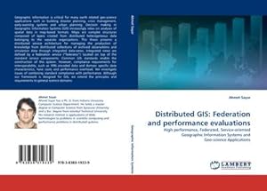
Distributed GIS: Federation and performance evaluations
Editore: LAP LAMBERT Academic Publishing Okt 2009, 2009
ISBN 10: 3838319338 ISBN 13: 9783838319339
Lingua: Inglese
Da: buchversandmimpf2000, Emtmannsberg, BAYE, Germania
Valutazione del venditore 5 su 5 stelle

EUR 68,00
Convertire valutaEUR 15,00 per la spedizione da Germania a ItaliaQuantit�: 2 disponibili
Aggiungi al carrelloTaschenbuch. Condizione: Neu. Neuware -Geographic information is critical for many earth related geo-science applications such as building disaster planning, crisis management, early-warning systems and urban planning. Decision making in Geographic Information Systems (GIS) increasingly relies on analyses of spatial data in map-based formats. Maps are complex structures composed of layers created from distributed heterogeneous data belonging to the separate organizations. This thesis presents a distributed service architecture for managing the production of knowledge from distributed collections of archived observations and simulation data through integrated data-views. Integrated views are defined by a federation service (�federator�) located on top of the standard service components. Common GIS standards enable the construction of this system. However, compliance requirements for interoperability, such as XML-encoded data and domain specific data characteristics, have costs and performance overhead. We investigate issues of combining standard compliance with performance. Although our framework is designed for GIS, we extend the principles and requirements to general science domains.Books on Demand GmbH, �berseering 33, 22297 Hamburg 192 pp. Englisch.
-

Distributed GIS: Federation and performance evaluations
Editore: LAP Lambert Academic Publishing, 2009
ISBN 10: 3838319338 ISBN 13: 9783838319339
Lingua: Inglese
EUR 55,21
Convertire valutaEUR 9,70 per la spedizione da Germania a ItaliaQuantit�: Pi� di 20 disponibili
Aggiungi al carrelloCondizione: New. Dieser Artikel ist ein Print on Demand Artikel und wird nach Ihrer Bestellung fuer Sie gedruckt. Geographic information is critical for many earth related geo-science applications such as building disaster planning, crisis management, early-warning systems and urban planning. Decision making in Geographic Information Systems (GIS) increasingly relies o.
-

Distributed GIS: Federation and performance evaluations
Editore: LAP LAMBERT Academic Publishing Okt 2009, 2009
ISBN 10: 3838319338 ISBN 13: 9783838319339
Lingua: Inglese
Da: BuchWeltWeit Ludwig Meier e.K., Bergisch Gladbach, Germania
Valutazione del venditore 5 su 5 stelle
EUR 68,00
Convertire valutaEUR 11,00 per la spedizione da Germania a ItaliaQuantit�: 2 disponibili
Aggiungi al carrelloTaschenbuch. Condizione: Neu. This item is printed on demand - it takes 3-4 days longer - Neuware -Geographic information is critical for many earth related geo-science applications such as building disaster planning, crisis management, early-warning systems and urban planning. Decision making in Geographic Information Systems (GIS) increasingly relies on analyses of spatial data in map-based formats. Maps are complex structures composed of layers created from distributed heterogeneous data belonging to the separate organizations. This thesis presents a distributed service architecture for managing the production of knowledge from distributed collections of archived observations and simulation data through integrated data-views. Integrated views are defined by a federation service ( federator ) located on top of the standard service components. Common GIS standards enable the construction of this system. However, compliance requirements for interoperability, such as XML-encoded data and domain specific data characteristics, have costs and performance overhead. We investigate issues of combining standard compliance with performance. Although our framework is designed for GIS, we extend the principles and requirements to general science domains. 192 pp. Englisch.
-
Distributed GIS: Federation and performance evaluations : High performance, Federated, Service-oriented Geographic Information Systems and Geo-science Applications
Editore: LAP LAMBERT Academic Publishing, 2009
ISBN 10: 3838319338 ISBN 13: 9783838319339
Lingua: Inglese
EUR 68,00
Convertire valutaEUR 14,99 per la spedizione da Germania a ItaliaQuantit�: 1 disponibili
Aggiungi al carrelloTaschenbuch. Condizione: Neu. nach der Bestellung gedruckt Neuware - Printed after ordering - Geographic information is critical for many earth related geo-science applications such as building disaster planning, crisis management, early-warning systems and urban planning. Decision making in Geographic Information Systems (GIS) increasingly relies on analyses of spatial data in map-based formats. Maps are complex structures composed of layers created from distributed heterogeneous data belonging to the separate organizations. This thesis presents a distributed service architecture for managing the production of knowledge from distributed collections of archived observations and simulation data through integrated data-views. Integrated views are defined by a federation service ( federator ) located on top of the standard service components. Common GIS standards enable the construction of this system. However, compliance requirements for interoperability, such as XML-encoded data and domain specific data characteristics, have costs and performance overhead. We investigate issues of combining standard compliance with performance. Although our framework is designed for GIS, we extend the principles and requirements to general science domains.