essential image processing gis di liu jian guo (25 risultati)
Filtri di ricerca
Tipo di articolo
- Tutti i tipi di prodotto
- Libri (25)
- Riviste e Giornali (Nessun altro risultato corrispondente a questo perfezionamento)
- Fumetti (Nessun altro risultato corrispondente a questo perfezionamento)
- Spartiti (Nessun altro risultato corrispondente a questo perfezionamento)
- Arte, Stampe e Poster (Nessun altro risultato corrispondente a questo perfezionamento)
- Fotografie (Nessun altro risultato corrispondente a questo perfezionamento)
- Mappe (Nessun altro risultato corrispondente a questo perfezionamento)
- Manoscritti e Collezionismo cartaceo (Nessun altro risultato corrispondente a questo perfezionamento)
Condizioni Maggiori informazioni
- Nuovo (19)
- Come nuovo, Ottimo o Quasi ottimo (2)
- Molto buono o Buono (4)
- Discreto o Mediocre (Nessun altro risultato corrispondente a questo perfezionamento)
- Come descritto (Nessun altro risultato corrispondente a questo perfezionamento)
Legatura
- Tutte
- Rilegato (Nessun altro risultato corrispondente a questo perfezionamento)
- Brossura (25)
Ulteriori caratteristiche
- Prima ed. (4)
- Copia autograf. (Nessun altro risultato corrispondente a questo perfezionamento)
- Sovracoperta (Nessun altro risultato corrispondente a questo perfezionamento)
- Con foto (8)
- Non Print on Demand (23)
Lingua (1)
Spedizione gratuita
Paese del venditore
Valutazione venditore
-
Essential Image Processing and GIS for Remote Sensing (Essential (John Wiley & Sons))
Da: WeBuyBooks, Rossendale, LANCS, Regno Unito
EUR 4,23
Convertire valutaEUR 11,06 per la spedizione da Regno Unito a U.S.A.Quantità: 1 disponibili
Aggiungi al carrelloCondizione: Good. Most items will be dispatched the same or the next working day. A copy that has been read but remains in clean condition. All of the pages are intact and the cover is intact and the spine may show signs of wear. The book may have minor markings which are not specifically mentioned.
-
Essential Image Processing and GIS for Remote Sensing
Editore: Wiley & Sons, Incorporated, John, 2009
ISBN 10: 0470510315 ISBN 13: 9780470510315
Lingua: Inglese
Da: Better World Books Ltd, Dunfermline, Regno Unito
EUR 6,97
Convertire valutaEUR 9,21 per la spedizione da Regno Unito a U.S.A.Quantità: 1 disponibili
Aggiungi al carrelloCondizione: Good. Ships from the UK. Former library book; may include library markings. Used book that is in clean, average condition without any missing pages.
-
Essential Image Processing and GIS for Remote Sensing
Editore: Wiley & Sons, Incorporated, John, 2009
ISBN 10: 0470510315 ISBN 13: 9780470510315
Lingua: Inglese
Da: Better World Books Ltd, Dunfermline, Regno Unito
EUR 6,97
Convertire valutaEUR 9,21 per la spedizione da Regno Unito a U.S.A.Quantità: 2 disponibili
Aggiungi al carrelloCondizione: Very Good. Ships from the UK. Former library book; may include library markings. Used book that is in excellent condition. May show signs of wear or have minor defects.
-
Essential Image Processing and GIS for Remote Sensing
Editore: Wiley & Sons, Incorporated, John, 2009
ISBN 10: 0470510315 ISBN 13: 9780470510315
Lingua: Inglese
Da: Better World Books, Mishawaka, IN, U.S.A.
EUR 17,32
Convertire valutaGratis per la spedizione in U.S.A.Quantità: 1 disponibili
Aggiungi al carrelloCondizione: Very Good. Former library book; may include library markings. Used book that is in excellent condition. May show signs of wear or have minor defects.
-
EUR 73,79
Convertire valutaEUR 2,26 per la spedizione in U.S.A.Quantità: Più di 20 disponibili
Aggiungi al carrelloCondizione: New.
-
Essential Image Processing and GIS for Remote Sensing (Paperback)
Editore: John Wiley & Sons Inc, New York, 2009
ISBN 10: 0470510315 ISBN 13: 9780470510315
Lingua: Inglese
Da: Grand Eagle Retail, Bensenville, IL, U.S.A.
Prima edizione
EUR 76,14
Convertire valutaGratis per la spedizione in U.S.A.Quantità: 1 disponibili
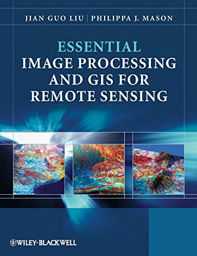
Aggiungi al carrelloPaperback. Condizione: new. Paperback. Essential Image Processing and GIS for Remote Sensing is an accessible overview of the subject and successfully draws together these three key areas in a balanced and comprehensive manner. The book provides an overview of essential techniques and a selection of key case studies in a variety of application areas. Key concepts and ideas are introduced in a clear and logical manner and described through the provision of numerous relevant conceptual illustrations. Mathematical detail is kept to a minimum and only referred to where necessary for ease of understanding. Such concepts are explained through common sense terms rather than in rigorous mathematical detail when explaining image processing and GIS techniques, to enable students to grasp the essentials of a notoriously challenging subject area. The book is clearly divided into three parts, with the first part introducing essential image processing techniques for remote sensing. The second part looks at GIS and begins with an overview of the concepts, structures and mechanisms by which GIS operates. Finally the third part introduces Remote Sensing Applications. Throughout the book the relationships between GIS, Image Processing and Remote Sensing are clearly identified to ensure that students are able to apply the various techniques that have been covered appropriately. The latter chapters use numerous relevant case studies to illustrate various remote sensing, image processing and GIS applications in practice. Essential Image Processing and GIS for Remote Sensing is an accessible overview of the subject and successfully draws together these three key areas in a balanced and comprehensive manner. The book provides an overview of essential techniques and a selection of key case studies in a variety of application areas. Shipping may be from multiple locations in the US or from the UK, depending on stock availability.
-
EUR 77,33
Convertire valutaEUR 2,26 per la spedizione in U.S.A.Quantità: Più di 20 disponibili
Aggiungi al carrelloCondizione: As New. Unread book in perfect condition.
-
Essential Image Processing and GIS for Remote Sensing
Da: Ria Christie Collections, Uxbridge, Regno Unito
EUR 68,18
Convertire valutaEUR 13,80 per la spedizione da Regno Unito a U.S.A.Quantità: Più di 20 disponibili
Aggiungi al carrelloCondizione: New. In.
-
EUR 79,53
Convertire valutaEUR 3,42 per la spedizione in U.S.A.Quantità: Più di 20 disponibili
Aggiungi al carrelloCondizione: New.
-
Essential Image Processing and GIS for Remote Sensing
Da: GreatBookPricesUK, Woodford Green, Regno Unito
EUR 66,85
Convertire valutaEUR 17,27 per la spedizione da Regno Unito a U.S.A.Quantità: Più di 20 disponibili
Aggiungi al carrelloCondizione: New.
-
EUR 67,27
Convertire valutaEUR 17,84 per la spedizione da Regno Unito a U.S.A.Quantità: 10 disponibili
Aggiungi al carrelloPF. Condizione: New.
-
Essential Image Processing and GIS for Remote Sensing
Da: GreatBookPricesUK, Woodford Green, Regno Unito
EUR 77,09
Convertire valutaEUR 17,27 per la spedizione da Regno Unito a U.S.A.Quantità: Più di 20 disponibili
Aggiungi al carrelloCondizione: As New. Unread book in perfect condition.
-
EUR 87,96
Convertire valutaEUR 7,49 per la spedizione da Regno Unito a U.S.A.Quantità: 3 disponibili
Aggiungi al carrelloCondizione: New. pp. 460.
-
Essential Image Processing and GIS for Remote Sensing
Da: Kennys Bookshop and Art Galleries Ltd., Galway, GY, Irlanda
Prima edizione
EUR 87,68
Convertire valutaEUR 10,50 per la spedizione da Irlanda a U.S.A.Quantità: Più di 20 disponibili
Aggiungi al carrelloCondizione: New. Essential Image Processing and GIS for Remote Sensing is an accessible overview of the subject and successfully draws together these three key areas in a balanced and comprehensive manner. The book provides an overview of essential techniques and a selection of key case studies in a variety of application areas. Num Pages: 460 pages, black & white illustrations, colour illustrations, black & white line drawings, colour li. BIC Classification: RGW. Category: (P) Professional & Vocational. Dimension: 247 x 189 x 23. Weight in Grams: 898. . 2009. 1st Edition. Paperback. . . . .
-
Essential Image Processing and GIS for Remote Sensing
Da: THE SAINT BOOKSTORE, Southport, Regno Unito
EUR 77,01
Convertire valutaEUR 25,62 per la spedizione da Regno Unito a U.S.A.Quantità: Più di 20 disponibili
Aggiungi al carrelloPaperback / softback. Condizione: New. New copy - Usually dispatched within 4 working days. 1150.
-
Essential Image Processing and GIS for Remote Sensing (Paperback)
Editore: John Wiley & Sons Inc, New York, 2009
ISBN 10: 0470510315 ISBN 13: 9780470510315
Lingua: Inglese
Da: AussieBookSeller, Truganina, VIC, Australia
Prima edizione
EUR 72,92
Convertire valutaEUR 31,74 per la spedizione da Australia a U.S.A.Quantità: 1 disponibili
Aggiungi al carrelloPaperback. Condizione: new. Paperback. Essential Image Processing and GIS for Remote Sensing is an accessible overview of the subject and successfully draws together these three key areas in a balanced and comprehensive manner. The book provides an overview of essential techniques and a selection of key case studies in a variety of application areas. Key concepts and ideas are introduced in a clear and logical manner and described through the provision of numerous relevant conceptual illustrations. Mathematical detail is kept to a minimum and only referred to where necessary for ease of understanding. Such concepts are explained through common sense terms rather than in rigorous mathematical detail when explaining image processing and GIS techniques, to enable students to grasp the essentials of a notoriously challenging subject area. The book is clearly divided into three parts, with the first part introducing essential image processing techniques for remote sensing. The second part looks at GIS and begins with an overview of the concepts, structures and mechanisms by which GIS operates. Finally the third part introduces Remote Sensing Applications. Throughout the book the relationships between GIS, Image Processing and Remote Sensing are clearly identified to ensure that students are able to apply the various techniques that have been covered appropriately. The latter chapters use numerous relevant case studies to illustrate various remote sensing, image processing and GIS applications in practice. Essential Image Processing and GIS for Remote Sensing is an accessible overview of the subject and successfully draws together these three key areas in a balanced and comprehensive manner. The book provides an overview of essential techniques and a selection of key case studies in a variety of application areas. Shipping may be from our Sydney, NSW warehouse or from our UK or US warehouse, depending on stock availability.
-
EUR 102,44
Convertire valutaEUR 3,42 per la spedizione in U.S.A.Quantità: 3 disponibili
Aggiungi al carrelloCondizione: New. pp. 460.
-
EUR 106,02
Convertire valutaEUR 8,57 per la spedizione in U.S.A.Quantità: 1 disponibili
Aggiungi al carrelloPaperback. Condizione: New. Brand new, US edition, ship within 24 hours with tracking No. book.
-
EUR 109,22
Convertire valutaEUR 9,01 per la spedizione in U.S.A.Quantità: Più di 20 disponibili
Aggiungi al carrelloCondizione: New. Essential Image Processing and GIS for Remote Sensing is an accessible overview of the subject and successfully draws together these three key areas in a balanced and comprehensive manner. The book provides an overview of essential techniques and a selection of key case studies in a variety of application areas. Num Pages: 460 pages, black & white illustrations, colour illustrations, black & white line drawings, colour li. BIC Classification: RGW. Category: (P) Professional & Vocational. Dimension: 247 x 189 x 23. Weight in Grams: 898. . 2009. 1st Edition. Paperback. . . . . Books ship from the US and Ireland.
-
Essential Image Processing and GIS for Remote Sensing (Paperback)
Editore: John Wiley & Sons Inc, New York, 2009
ISBN 10: 0470510315 ISBN 13: 9780470510315
Lingua: Inglese
Da: CitiRetail, Stevenage, Regno Unito
Prima edizione
EUR 75,30
Convertire valutaEUR 42,61 per la spedizione da Regno Unito a U.S.A.Quantità: 1 disponibili
Aggiungi al carrelloPaperback. Condizione: new. Paperback. Essential Image Processing and GIS for Remote Sensing is an accessible overview of the subject and successfully draws together these three key areas in a balanced and comprehensive manner. The book provides an overview of essential techniques and a selection of key case studies in a variety of application areas. Key concepts and ideas are introduced in a clear and logical manner and described through the provision of numerous relevant conceptual illustrations. Mathematical detail is kept to a minimum and only referred to where necessary for ease of understanding. Such concepts are explained through common sense terms rather than in rigorous mathematical detail when explaining image processing and GIS techniques, to enable students to grasp the essentials of a notoriously challenging subject area. The book is clearly divided into three parts, with the first part introducing essential image processing techniques for remote sensing. The second part looks at GIS and begins with an overview of the concepts, structures and mechanisms by which GIS operates. Finally the third part introduces Remote Sensing Applications. Throughout the book the relationships between GIS, Image Processing and Remote Sensing are clearly identified to ensure that students are able to apply the various techniques that have been covered appropriately. The latter chapters use numerous relevant case studies to illustrate various remote sensing, image processing and GIS applications in practice. Essential Image Processing and GIS for Remote Sensing is an accessible overview of the subject and successfully draws together these three key areas in a balanced and comprehensive manner. The book provides an overview of essential techniques and a selection of key case studies in a variety of application areas. Shipping may be from our UK warehouse or from our Australian or US warehouses, depending on stock availability.
-
EUR 73,99
Convertire valutaEUR 48,99 per la spedizione da Germania a U.S.A.Quantità: Più di 20 disponibili
Aggiungi al carrelloCondizione: New. Essential Image Processing and GIS for Remote Sensing is an accessible overview of the subject and successfully draws together these three key areas in a balanced and comprehensive manner. The book provides an overview of essential techniques and a selectio.
-
EUR 124,01
Convertire valutaEUR 17,27 per la spedizione da Regno Unito a U.S.A.Quantità: 2 disponibili
Aggiungi al carrelloPaperback. Condizione: Brand New. 1st edition. 460 pages. 9.61x7.40x1.02 inches. In Stock.
-
EUR 90,67
Convertire valutaEUR 64,42 per la spedizione da Germania a U.S.A.Quantità: 2 disponibili
Aggiungi al carrelloTaschenbuch. Condizione: Neu. Neuware - Essential Image Processing and GIS for Remote Sensing is an accessible overview of the subject and successfully draws together these three key areas in a balanced and comprehensive manner. The book provides an overview of essential techniques and a selection of key case studies in a variety of application areas.Key concepts and ideas are introduced in a clear and logical manner and described through the provision of numerous relevant conceptual illustrations. Mathematical detail is kept to a minimum and only referred to where necessary for ease of understanding. Such concepts are explained through common sense terms rather than in rigorous mathematical detail when explaining image processing and GIS techniques, to enable students to grasp the essentials of a notoriously challenging subject area.The book is clearly divided into three parts, with the first part introducing essential image processing techniques for remote sensing. The second part looks at GIS and begins with an overview of the concepts, structures and mechanisms by which GIS operates. Finally the third part introduces Remote Sensing Applications. Throughout the book the relationships between GIS, Image Processing and Remote Sensing are clearly identified to ensure that students are able to apply the various techniques that have been covered appropriately. The latter chapters use numerous relevant case studies to illustrate various remote sensing, image processing and GIS applications in practice.
-
Essential Image Processing and GIS for Remote Sensing
Da: THE SAINT BOOKSTORE, Southport, Regno Unito
EUR 81,64
Convertire valutaEUR 25,62 per la spedizione da Regno Unito a U.S.A.Quantità: Più di 20 disponibili
Aggiungi al carrelloPaperback / softback. Condizione: New. This item is printed on demand. New copy - Usually dispatched within 5-9 working days 1150.
-
Essential Image Processing and Gis for Remote Sensing
Da: Revaluation Books, Exeter, Regno Unito
EUR 91,69
Convertire valutaEUR 17,27 per la spedizione da Regno Unito a U.S.A.Quantità: 2 disponibili
Aggiungi al carrelloPaperback. Condizione: Brand New. 1st edition. 460 pages. 9.61x7.40x1.02 inches. In Stock. This item is printed on demand.


