image processing gis remote di liu jian (40 risultati)
FeedbackFiltri di ricerca
Tipo di articolo
- Tutti i tipi di prodotto
- Libri (40)
- Riviste e Giornali (Nessun altro risultato corrispondente a questo perfezionamento)
- Fumetti (Nessun altro risultato corrispondente a questo perfezionamento)
- Spartiti (Nessun altro risultato corrispondente a questo perfezionamento)
- Arte, Stampe e Poster (Nessun altro risultato corrispondente a questo perfezionamento)
- Fotografie (Nessun altro risultato corrispondente a questo perfezionamento)
- Mappe (Nessun altro risultato corrispondente a questo perfezionamento)
- Manoscritti e Collezionismo cartaceo (Nessun altro risultato corrispondente a questo perfezionamento)
Condizioni
Legatura
Ulteriori caratteristiche
- Prima ed. (5)
- Copia autograf. (Nessun altro risultato corrispondente a questo perfezionamento)
- Sovracoperta (Nessun altro risultato corrispondente a questo perfezionamento)
- Con foto (17)
- Non Print on Demand (37)
Lingua (1)
Spedizione gratuita
- Spedizione gratuita in Italia (Nessun altro risultato corrispondente a questo perfezionamento)
Paese del venditore
Valutazione venditore
-
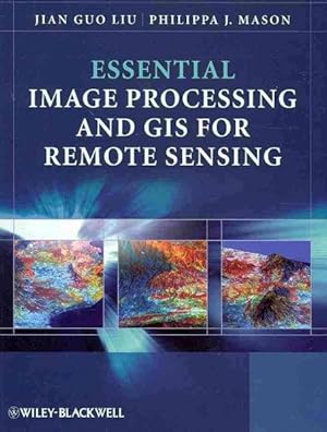
Essential Image Processing and GIS for Remote Sensing
Editore: Wiley & Sons, Incorporated, John, 2009
ISBN 10: 0470510315 ISBN 13: 9780470510315
Lingua: Inglese
Da: Better World Books Ltd, Dunfermline, Regno Unito
EUR 6,69
Convertire valutaEUR 5,95 per la spedizione da Regno Unito a ItaliaQuantità: 1 disponibili
Aggiungi al carrelloCondizione: Good. Ships from the UK. Former library book; may include library markings. Used book that is in clean, average condition without any missing pages.
-
Essential Image Processing and GIS for Remote Sensing (Essential (John Wiley & Sons))
Da: WeBuyBooks, Rossendale, LANCS, Regno Unito
EUR 11,41
Convertire valutaEUR 12,61 per la spedizione da Regno Unito a ItaliaQuantità: 1 disponibili
Aggiungi al carrelloCondizione: Good. Most items will be dispatched the same or the next working day. A copy that has been read but remains in clean condition. All of the pages are intact and the cover is intact and the spine may show signs of wear. The book may have minor markings which are not specifically mentioned.
-
Essential Image Processing and GIS for Remote Sensing
Da: Ria Christie Collections, Uxbridge, Regno Unito
EUR 72,93
Convertire valutaEUR 10,70 per la spedizione da Regno Unito a ItaliaQuantità: Più di 20 disponibili
Aggiungi al carrelloCondizione: New. In.
-
Essential Image Processing and GIS for Remote Sensing
Da: GreatBookPricesUK, Woodford Green, Regno Unito
EUR 72,05
Convertire valutaEUR 17,85 per la spedizione da Regno Unito a ItaliaQuantità: Più di 20 disponibili
Aggiungi al carrelloCondizione: New.
-
EUR 78,79
Convertire valutaEUR 9,70 per la spedizione da Germania a ItaliaQuantità: Più di 20 disponibili
Aggiungi al carrelloCondizione: New. Essential Image Processing and GIS for Remote Sensing is an accessible overview of the subject and successfully draws together these three key areas in a balanced and comprehensive manner. The book provides an overview of essential techniques and a selectio.
-
EUR 84,70
Convertire valutaEUR 7,20 per la spedizione da Regno Unito a ItaliaQuantità: 15 disponibili
Aggiungi al carrelloHRD. Condizione: New. New Book. Shipped from UK. Established seller since 2000.
-
Essential Image Processing and GIS for Remote Sensing
Da: GreatBookPricesUK, Woodford Green, Regno Unito
EUR 74,44
Convertire valutaEUR 17,85 per la spedizione da Regno Unito a ItaliaQuantità: Più di 20 disponibili
Aggiungi al carrelloCondizione: As New. Unread book in perfect condition.
-
EUR 73,98
Convertire valutaEUR 17,58 per la spedizione da U.S.A. a ItaliaQuantità: Più di 20 disponibili
Aggiungi al carrelloCondizione: As New. Unread book in perfect condition.
-
EUR 69,02
Convertire valutaEUR 23,79 per la spedizione da Regno Unito a ItaliaQuantità: 10 disponibili
Aggiungi al carrelloPF. Condizione: New.
-
Essential Image Processing and GIS for Remote Sensing
Da: THE SAINT BOOKSTORE, Southport, Regno Unito
EUR 78,66
Convertire valutaEUR 16,29 per la spedizione da Regno Unito a ItaliaQuantità: Più di 20 disponibili
Aggiungi al carrelloPaperback / softback. Condizione: New. New copy - Usually dispatched within 4 working days. 1150.
-
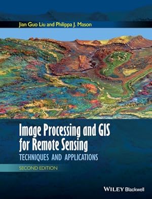
Image Processing and Gis for Remote Sensing : Techniques and Applications
Da: GreatBookPrices, Columbia, MD, U.S.A.
EUR 76,88
Convertire valutaEUR 17,58 per la spedizione da U.S.A. a ItaliaQuantità: Più di 20 disponibili
Aggiungi al carrelloCondizione: New.
-
EUR 78,29
Convertire valutaEUR 17,58 per la spedizione da U.S.A. a ItaliaQuantità: Più di 20 disponibili
Aggiungi al carrelloCondizione: New.
-
EUR 86,65
Convertire valutaEUR 10,53 per la spedizione da Regno Unito a ItaliaQuantità: 3 disponibili
Aggiungi al carrelloCondizione: New. pp. 460.
-
Image Processing and Gis for Remote Sensing : Techniques and Applications
Da: GreatBookPricesUK, Woodford Green, Regno Unito
EUR 80,25
Convertire valutaEUR 17,85 per la spedizione da Regno Unito a ItaliaQuantità: Più di 20 disponibili
Aggiungi al carrelloCondizione: New.
-
Image Processing and GIS for Remote Sensing: Techniques and Applications
Da: Ria Christie Collections, Uxbridge, Regno Unito
EUR 89,65
Convertire valutaEUR 10,70 per la spedizione da Regno Unito a ItaliaQuantità: Più di 20 disponibili
Aggiungi al carrelloCondizione: New. In.
-
EUR 89,25
Convertire valutaEUR 9,70 per la spedizione da Germania a ItaliaQuantità: Più di 20 disponibili
Aggiungi al carrelloGebunden. Condizione: New. Jian Guo Liu received a Ph.D. in 1991 in remote sensing and image processing from Imperial College London, UK and an M.Sc. in 1982 in remote sensing and geology from China University of Geosciences, Beijing, China. He is a Reader in remote sensing in the De.
-
Essential Image Processing and GIS for Remote Sensing (Paperback)
Editore: John Wiley & Sons Inc, New York, 2009
ISBN 10: 0470510315 ISBN 13: 9780470510315
Lingua: Inglese
Da: AussieBookSeller, Truganina, VIC, Australia
Prima edizione
EUR 74,69
Convertire valutaEUR 32,55 per la spedizione da Australia a ItaliaQuantità: 1 disponibili
Aggiungi al carrelloPaperback. Condizione: new. Paperback. Essential Image Processing and GIS for Remote Sensing is an accessible overview of the subject and successfully draws together these three key areas in a balanced and comprehensive manner. The book provides an overview of essential techniques and a selection of key case studies in a variety of application areas. Key concepts and ideas are introduced in a clear and logical manner and described through the provision of numerous relevant conceptual illustrations. Mathematical detail is kept to a minimum and only referred to where necessary for ease of understanding. Such concepts are explained through common sense terms rather than in rigorous mathematical detail when explaining image processing and GIS techniques, to enable students to grasp the essentials of a notoriously challenging subject area. The book is clearly divided into three parts, with the first part introducing essential image processing techniques for remote sensing. The second part looks at GIS and begins with an overview of the concepts, structures and mechanisms by which GIS operates. Finally the third part introduces Remote Sensing Applications. Throughout the book the relationships between GIS, Image Processing and Remote Sensing are clearly identified to ensure that students are able to apply the various techniques that have been covered appropriately. The latter chapters use numerous relevant case studies to illustrate various remote sensing, image processing and GIS applications in practice. Essential Image Processing and GIS for Remote Sensing is an accessible overview of the subject and successfully draws together these three key areas in a balanced and comprehensive manner. The book provides an overview of essential techniques and a selection of key case studies in a variety of application areas. Shipping may be from our Sydney, NSW warehouse or from our UK or US warehouse, depending on stock availability.
-
Image Processing and Gis for Remote Sensing : Techniques and Applications
Da: GreatBookPrices, Columbia, MD, U.S.A.
EUR 91,40
Convertire valutaEUR 17,58 per la spedizione da U.S.A. a ItaliaQuantità: Più di 20 disponibili
Aggiungi al carrelloCondizione: As New. Unread book in perfect condition.
-
Image Processing and Gis for Remote Sensing : Techniques and Applications
Da: GreatBookPricesUK, Woodford Green, Regno Unito
EUR 91,03
Convertire valutaEUR 17,85 per la spedizione da Regno Unito a ItaliaQuantità: Più di 20 disponibili
Aggiungi al carrelloCondizione: As New. Unread book in perfect condition.
-
EUR 102,68
Convertire valutaEUR 7,92 per la spedizione da U.S.A. a ItaliaQuantità: 3 disponibili
Aggiungi al carrelloCondizione: New. pp. 460.
-
Essential Image Processing and GIS for Remote Sensing (Paperback)
Editore: John Wiley & Sons Inc, New York, 2009
ISBN 10: 0470510315 ISBN 13: 9780470510315
Lingua: Inglese
Da: CitiRetail, Stevenage, Regno Unito
Prima edizione
EUR 77,81
Convertire valutaEUR 35,70 per la spedizione da Regno Unito a ItaliaQuantità: 1 disponibili
Aggiungi al carrelloPaperback. Condizione: new. Paperback. Essential Image Processing and GIS for Remote Sensing is an accessible overview of the subject and successfully draws together these three key areas in a balanced and comprehensive manner. The book provides an overview of essential techniques and a selection of key case studies in a variety of application areas. Key concepts and ideas are introduced in a clear and logical manner and described through the provision of numerous relevant conceptual illustrations. Mathematical detail is kept to a minimum and only referred to where necessary for ease of understanding. Such concepts are explained through common sense terms rather than in rigorous mathematical detail when explaining image processing and GIS techniques, to enable students to grasp the essentials of a notoriously challenging subject area. The book is clearly divided into three parts, with the first part introducing essential image processing techniques for remote sensing. The second part looks at GIS and begins with an overview of the concepts, structures and mechanisms by which GIS operates. Finally the third part introduces Remote Sensing Applications. Throughout the book the relationships between GIS, Image Processing and Remote Sensing are clearly identified to ensure that students are able to apply the various techniques that have been covered appropriately. The latter chapters use numerous relevant case studies to illustrate various remote sensing, image processing and GIS applications in practice. Essential Image Processing and GIS for Remote Sensing is an accessible overview of the subject and successfully draws together these three key areas in a balanced and comprehensive manner. The book provides an overview of essential techniques and a selection of key case studies in a variety of application areas. Shipping may be from our UK warehouse or from our Australian or US warehouses, depending on stock availability.
-
EUR 96,51
Convertire valutaEUR 14,99 per la spedizione da Germania a ItaliaQuantità: 2 disponibili
Aggiungi al carrelloTaschenbuch. Condizione: Neu. Neuware - Essential Image Processing and GIS for Remote Sensing is an accessible overview of the subject and successfully draws together these three key areas in a balanced and comprehensive manner. The book provides an overview of essential techniques and a selection of key case studies in a variety of application areas.Key concepts and ideas are introduced in a clear and logical manner and described through the provision of numerous relevant conceptual illustrations. Mathematical detail is kept to a minimum and only referred to where necessary for ease of understanding. Such concepts are explained through common sense terms rather than in rigorous mathematical detail when explaining image processing and GIS techniques, to enable students to grasp the essentials of a notoriously challenging subject area.The book is clearly divided into three parts, with the first part introducing essential image processing techniques for remote sensing. The second part looks at GIS and begins with an overview of the concepts, structures and mechanisms by which GIS operates. Finally the third part introduces Remote Sensing Applications. Throughout the book the relationships between GIS, Image Processing and Remote Sensing are clearly identified to ensure that students are able to apply the various techniques that have been covered appropriately. The latter chapters use numerous relevant case studies to illustrate various remote sensing, image processing and GIS applications in practice.
-
Essential Image Processing and GIS for Remote Sensing
Da: Kennys Bookshop and Art Galleries Ltd., Galway, GY, Irlanda
Prima edizione
EUR 110,99
Convertire valutaEUR 2,00 per la spedizione da Irlanda a ItaliaQuantità: Più di 20 disponibili
Aggiungi al carrelloCondizione: New. Essential Image Processing and GIS for Remote Sensing is an accessible overview of the subject and successfully draws together these three key areas in a balanced and comprehensive manner. The book provides an overview of essential techniques and a selection of key case studies in a variety of application areas. Num Pages: 460 pages, black & white illustrations, colour illustrations, black & white line drawings, colour li. BIC Classification: RGW. Category: (P) Professional & Vocational. Dimension: 247 x 189 x 23. Weight in Grams: 898. . 2009. 1st Edition. Paperback. . . . .
-
Image Processing and GIS for Remote Sensing (Hardcover)
Editore: John Wiley and Sons Ltd, Hoboken, 2016
ISBN 10: 1118724208 ISBN 13: 9781118724200
Lingua: Inglese
Da: CitiRetail, Stevenage, Regno Unito
EUR 80,26
Convertire valutaEUR 35,70 per la spedizione da Regno Unito a ItaliaQuantità: 1 disponibili
Aggiungi al carrelloHardcover. Condizione: new. Hardcover. Following the successful publication of the 1st edition in 2009, the 2nd edition maintains its aim to provide an application-driven package of essential techniques in image processing and GIS, together with case studies for demonstration and guidance in remote sensing applications. The book therefore has a 3 in 1 structure which pinpoints the intersection between these three individual disciplines and successfully draws them together in a balanced and comprehensive manner. The book conveys in-depth knowledge of image processing and GIS techniques in an accessible and comprehensive manner, with clear explanations and conceptual illustrations used throughout to enhance student learning. The understanding of key concepts is always emphasised with minimal assumption of prior mathematical experience. The book is heavily based on the authors own research. Many of the author-designed image processing techniques are popular around the world. For instance, the SFIM technique has long been adopted by ASTRIUM for mass-production of their standard Pan-sharpen imagery data. The new edition also includes a completely new chapter on subpixel technology and new case studies, based on their recent research. Following the successful publication of the 1st edition in 2009, the 2nd edition maintains its aim to provide an application-driven package of essential techniques in image processing and GIS, together with case studies for demonstration and guidance in remote sensing applications. Shipping may be from our UK warehouse or from our Australian or US warehouses, depending on stock availability.
-
Image Processing and GIS for Remote Sensing: Techniques and Applications
Da: Majestic Books, Hounslow, Regno Unito
EUR 107,42
Convertire valutaEUR 10,53 per la spedizione da Regno Unito a ItaliaQuantità: 3 disponibili
Aggiungi al carrelloCondizione: New. pp. 488.
-
Image Processing and GIS for Remote Sensing : Techniques and Applications
Da: AHA-BUCH GmbH, Einbeck, Germania
EUR 110,19
Convertire valutaEUR 14,99 per la spedizione da Germania a ItaliaQuantità: 2 disponibili
Aggiungi al carrelloBuch. Condizione: Neu. Neuware - Following the successful publication of the 1st edition in 2009, the 2nd edition maintains its aim to provide an application-driven package of essential techniques in image processing and GIS, together with case studies for demonstration and guidance in remote sensing applications. The book therefore has a '3 in 1' structure which pinpoints the intersection between these three individual disciplines and successfully draws them together in a balanced and comprehensive manner.The book conveys in-depth knowledge of image processing and GIS techniques in an accessible and comprehensive manner, with clear explanations and conceptual illustrations used throughout to enhance student learning. The understanding of key concepts is always emphasised with minimal assumption of prior mathematical experience.The book is heavily based on the authors' own research. Many of the author-designed image processing techniques are popular around the world. For instance, the SFIM technique has long been adopted by ASTRIUM for mass-production of their standard 'Pan-sharpen' imagery data. The new edition also includes a completely new chapter on subpixel technology and new case studies, based on their recent research.
-
Image Processing and GIS for Remote Sensing (Hardcover)
Editore: John Wiley and Sons Ltd, Hoboken, 2016
ISBN 10: 1118724208 ISBN 13: 9781118724200
Lingua: Inglese
Da: AussieBookSeller, Truganina, VIC, Australia
EUR 97,15
Convertire valutaEUR 32,55 per la spedizione da Australia a ItaliaQuantità: 1 disponibili
Aggiungi al carrelloHardcover. Condizione: new. Hardcover. Following the successful publication of the 1st edition in 2009, the 2nd edition maintains its aim to provide an application-driven package of essential techniques in image processing and GIS, together with case studies for demonstration and guidance in remote sensing applications. The book therefore has a 3 in 1 structure which pinpoints the intersection between these three individual disciplines and successfully draws them together in a balanced and comprehensive manner. The book conveys in-depth knowledge of image processing and GIS techniques in an accessible and comprehensive manner, with clear explanations and conceptual illustrations used throughout to enhance student learning. The understanding of key concepts is always emphasised with minimal assumption of prior mathematical experience. The book is heavily based on the authors own research. Many of the author-designed image processing techniques are popular around the world. For instance, the SFIM technique has long been adopted by ASTRIUM for mass-production of their standard Pan-sharpen imagery data. The new edition also includes a completely new chapter on subpixel technology and new case studies, based on their recent research. Following the successful publication of the 1st edition in 2009, the 2nd edition maintains its aim to provide an application-driven package of essential techniques in image processing and GIS, together with case studies for demonstration and guidance in remote sensing applications. Shipping may be from our Sydney, NSW warehouse or from our UK or US warehouse, depending on stock availability.
-
Image Processing and GIS for Remote Sensing: Techniques and Applications
Da: Books Puddle, New York, NY, U.S.A.
EUR 124,49
Convertire valutaEUR 7,92 per la spedizione da U.S.A. a ItaliaQuantità: 3 disponibili
Aggiungi al carrelloCondizione: New. pp. 488.
-
EUR 136,28
Convertire valutaEUR 1,94 per la spedizione da U.S.A. a ItaliaQuantità: Più di 20 disponibili
Aggiungi al carrelloCondizione: New. Essential Image Processing and GIS for Remote Sensing is an accessible overview of the subject and successfully draws together these three key areas in a balanced and comprehensive manner. The book provides an overview of essential techniques and a selection of key case studies in a variety of application areas. Num Pages: 460 pages, black & white illustrations, colour illustrations, black & white line drawings, colour li. BIC Classification: RGW. Category: (P) Professional & Vocational. Dimension: 247 x 189 x 23. Weight in Grams: 898. . 2009. 1st Edition. Paperback. . . . . Books ship from the US and Ireland.
-
EUR 128,23
Convertire valutaEUR 11,90 per la spedizione da Regno Unito a ItaliaQuantità: 2 disponibili
Aggiungi al carrelloPaperback. Condizione: Brand New. 1st edition. 460 pages. 9.61x7.40x1.02 inches. In Stock.


