Importo totale (1 articolo articoli):
Destinazione ordine:

map asia (Oltre 2.300 risultati)
Vai alla pagina principale dei risultati di ricerca
Filtri di ricerca
Tipo di articolo
- Tutti i tipi di prodotto
- Libri (1.459)
- Riviste e Giornali (8)
- Fumetti (Nessun altro risultato corrispondente a questo perfezionamento)
- Spartiti (Nessun altro risultato corrispondente a questo perfezionamento)
- Arte, Stampe e Poster (131)
- Fotografie (Nessun altro risultato corrispondente a questo perfezionamento)
- Mappe (776)
- Manoscritti e Collezionismo cartaceo (4)
Condizioni Maggiori informazioni
Legatura
Ulteriori caratteristiche
Lingua (12)
Spedizione gratuita
Paese del venditore
Valutazione venditore
-

Lonely Planet Southeast Asia Planning Map: Durable, Waterproof, Easy-Fold Travel Map with Top Attractions, Itineraries & Themed Lists
Libro 20 di 21: Planning MapDa: Idaho Youth Ranch Books, Boise, ID, U.S.A.
Valutazione del venditore 5 su 5 stelle

Condizione: Very Good. A copy that has been read, but remains in excellent condition. Pages are intact and are not marred by notes or highlighting. The spine remains undamaged. There are no stickers on book or rips in dust cover.
-

Asia/Folded Map
Lingua: Inglese
Editore: Hammond World Atlas Corporation, 1985
ISBN 10: 0843703261 ISBN 13: 9780843703269
Da: POQUETTE'S BOOKS, DEWITT, MI, U.S.A.
Valutazione del venditore 5 su 5 stelle
Paperback. Condizione: Good.
-
Changing Map of Asia
Da: BoundlessBookstore, Wallingford, Regno Unito
Valutazione del venditore 5 su 5 stelle
EUR 3,57
Spedizione EUR 8,07
Spedito da Regno Unito a U.S.A.Quantit�: 1 disponibili
Aggiungi al carrelloCondizione: Good. Light wear to boards. Content is clean and bright. Light toning to page ends. DJ with some edge wear, tears and creasing. Book has a lean.
-
Lonely Planet Southeast Asia Planning Map (Planning Maps)
Libro 20 di 21: Planning MapDa: Lakeside Books, Benton Harbor, MI, U.S.A.
Valutazione del venditore 5 su 5 stelle
Condizione: New. Brand New! Not Overstocks or Low Quality Book Club Editions! Direct From the Publisher! We're not a giant, faceless warehouse organization! We're a small town bookstore that loves books and loves it's customers! Buy from Lakeside Books!
-
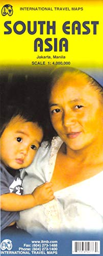
Southeast Asia 1:4M Travel Map 2013 (International Travel Maps)
Lingua: Inglese
Editore: ITMB Publishing Ltd. (edition 6th), 2013
ISBN 10: 1553410777 ISBN 13: 9781553410775
Da: BooksRun, Philadelphia, PA, U.S.A.
Valutazione del venditore 5 su 5 stelle
Map. Condizione: Very Good. 6th. It's a well-cared-for item that has seen limited use. The item may show minor signs of wear. All the text is legible, with all pages included. It may have slight markings and/or highlighting.
-

Lonely Planet Southeast Asia Planning Map (Sheet Map, Folded)
Libro 20 di 21: Planning MapDa: BargainBookStores, Grand Rapids, MI, U.S.A.
Valutazione del venditore 5 su 5 stelle
Sheet Map, Folded. Condizione: New. Lonely Planet Southeast Asia Planning Map. Book.
-

The Mountains of Central Asia 1:3 000 000 Map and Gazetteer
Da: Yak and Yeti Books, Denver, CO, U.S.A.
Valutazione del venditore 5 su 5 stelle
Prima edizione
Soft cover. Condizione: Fine. 1st Edition. xxvii,k 98p plus large folding color map in front pocket.
-

On t he Map the Mountains of Asia
Da: Yak and Yeti Books, Denver, CO, U.S.A.
Valutazione del venditore 5 su 5 stelle
Soft cover. Condizione: Very Good.
-

MAP OF EUROPE AND ADJOINING PORTIONS OF AFRICA AND ASIA, 1915
Lingua: Inglese
Editore: National Geographic Society, 1915
Da: Larry W Price Books, Portland, OR, U.S.A.
Valutazione del venditore 5 su 5 stelle
Paperback. Condizione: Fair. Map of Europe, Color in Pastels, Borders with Intense Color, (28.5 x 31 Inches) (Folded to 6.5 x 9.5 Inches), several breaks at folds, thus Fair only.
-
National Geographic magazine November, 1989 with map supplement Asia-Pacific . Western Pacific Rim.
Editore: National Geographic, 1989
Da: BOOKFINDER, inc, Lawndale, NC, U.S.A.
Valutazione del venditore 5 su 5 stelle
Prima edizione
Magazine. Condizione: Very Good. First Edition. this magazine is in Very Good condition. Clean, tight, and bright. supplement is in Very good condition.
-
SOUTHEAST ASIA PLANNING MAP
Libro 20 di 21: Planning MapDa: Speedyhen LLC, Hialeah, FL, U.S.A.
Valutazione del venditore 2 su 5 stelle

EUR 11,88
Spedizione gratuita
Spedito in U.S.A.Quantit�: Pi� di 20 disponibili
Aggiungi al carrelloCondizione: NEW.
-
MAP OF THE RACES OF EUROPE AND ADJOINING PORTIONS OF ASIA AND AFRICA, 1918 [NATIONAL GEOGRAPHIC MAP SUPPLEMENT FOR DECEMBER, 1918 MAGAZINE]
Lingua: Inglese
Editore: Nat Geographic Soc, 1918
Da: Larry W Price Books, Portland, OR, U.S.A.
Valutazione del venditore 5 su 5 stelle
Prima edizione
Pamphlet. Condizione: Very Good. 1st Edition. Map Supplement, Dec, 1918, 19.75 x 31 inches, Color in Pastels, Folded to 6.75 x 8 3/4 inches, tiny edge tears else VG, 1st ed.
-
Lonely Planet Southeast Asia Planning Map
Libro 20 di 21: Planning MapDa: PBShop.store UK, Fairford, GLOS, Regno Unito
Valutazione del venditore 4 su 5 stelle

EUR 8,46
Spedizione EUR 3,80
Spedito da Regno Unito a U.S.A.Quantit�: 15 disponibili
Aggiungi al carrelloUNK. Condizione: New. New Book. Shipped from UK. Established seller since 2000.
-
Lonely Planet Southeast Asia Planning Map
Libro 20 di 21: Planning MapDa: PBShop.store US, Wood Dale, IL, U.S.A.
Valutazione del venditore 5 su 5 stelle
UNK. Condizione: New. New Book. Shipped from UK. Established seller since 2000.
-

Voyages from Asia to America, for Completing the Discoveries of the North West Coast of America to Which Is Prefixed, a Summary of the Voyages Made Serving as an Explanation of a Map o 1
Da: PBShop.store US, Wood Dale, IL, U.S.A.
Valutazione del venditore 5 su 5 stelle
PAP. Condizione: New. New Book. Shipped from UK. Established seller since 2000.
-
National Geographic. May, 1961 Map of Southeast Asia
Editore: National Geographic Society, Washington, 1961
EUR 1,77
Spedizione EUR 9,47
Spedito da Canada a U.S.A.Quantit�: 1 disponibili
Aggiungi al carrelloMap. Condizione: Very Good-. The map has slight wear to its edges.
-
National Geographic. December, 1959 Map of Asia and Adjacent Areas
Editore: National Geographic Society, Washington, 1959
EUR 1,77
Spedizione EUR 9,47
Spedito da Canada a U.S.A.Quantit�: 1 disponibili
Aggiungi al carrelloMap. Condizione: Very Good-. The map has slight wear to its edges.
-
National Geographic. March, 1951 map of Asia and Adjacent Areas
Editore: National Geographic Society, Washington, 1951
EUR 1,77
Spedizione EUR 9,47
Spedito da Canada a U.S.A.Quantit�: 1 disponibili
Aggiungi al carrelloMap. Condizione: Good. The map has a little wear to its edges.
-
National Geographic. December, 1942 Map of Asia and Adjacent Areas
Editore: National Geographic Society, Washington, 1942
EUR 1,77
Spedizione EUR 9,47
Spedito da Canada a U.S.A.Quantit�: 1 disponibili
Aggiungi al carrelloMap. Condizione: Good. December, 1942 National Geographic map of Asia and adjacent areas. A little wear to the edges.
-

Southeast Asia 1:4M Travel Map 2013 (International Travel Maps)
Da: Big River Books, Powder Springs, GA, U.S.A.
Valutazione del venditore 5 su 5 stelle
Condizione: very_good. This book is in Very Good condition. The cover and pages have minor shelf wear. Binding is tight and pages are intact.
-

The War and the Bagdad Railway, the Story of Asia Minor and Its Relation to the Present Conflict; With Map
Da: PBShop.store US, Wood Dale, IL, U.S.A.
Valutazione del venditore 5 su 5 stelle
PAP. Condizione: New. New Book. Shipped from UK. Established seller since 2000.
-

Voyages From Asia to America, for Completing the Discoveries of the North West Coast of America. To Which is Prefixed, a Summary of the Voyages Made ... Passage. Serving as an Explanation of a map O
Da: California Books, Miami, FL, U.S.A.
Valutazione del venditore 4 su 5 stelle
EUR 20,39
Spedizione gratuita
Spedito in U.S.A.Quantit�: Pi� di 20 disponibili
Aggiungi al carrelloCondizione: New.
-
Voyages from Asia to America, for Completing the Discoveries of the North West Coast of America to Which Is Prefixed, a Summary of the Voyages Made Serving as an Explanation of a Map o 1
Da: PBShop.store UK, Fairford, GLOS, Regno Unito
Valutazione del venditore 5 su 5 stelle
EUR 16,63
Spedizione EUR 3,80
Spedito da Regno Unito a U.S.A.Quantit�: 15 disponibili
Aggiungi al carrelloPAP. Condizione: New. New Book. Shipped from UK. Established seller since 2000.
-

Middle East and Central Asia Map (Folded)
Da: Grand Eagle Retail, Bensenville, IL, U.S.A.
Valutazione del venditore 5 su 5 stelle
Folded. Condizione: new. Folded. This bright colorful map shows the countries in the Middle East and Central Asia, along with population and religion information about each one. Helps you pray for missionaries and persecuted Christians in Iran, Iraq, Turkey, Egypt, Afghanistan, Saudi Arabia, Pakistan, Kazakhstan, Uzbekistan, and more. Perfect for studying the 10-40 window.3 Key Features of this Middle East and Central Asia Map Poster1. Easy-to-See Size and Laminated for DurabilityFull color, large Bible wall chart for Bible study, Sunday school or Summer Bible School use. Durable and water resistant (spill proof) - sturdy and unlikely to rip, crease, or wrinkle over time! Size: 19.5 x 26. Printed on heavy chart paper, and laminated front and back with high quality 3 mil lamination. Perfect for use with water-soluble markers. Rolls for easy storage.2. Shows the Middle East and Central Asia Side by Side!This full-color chart is great for visually presenting the following side by side at a glance:CountriesPercent ChristianMain ReligionLargest Ethnic Groups3. Easily Teach Your Sunday School with 4 Reproducible Printable WorksheetsThe back of the chart is packed with bonus teaching curriculum for review and discussion. Sized for easy copying, you can prepare a lesson in just the push of a button! Enjoy having:Teaching tipsA mini mapStatistics about each countryHow to talk with Muslims about Christ Shipping may be from multiple locations in the US or from the UK, depending on stock availability.
-
National Geographic Map - Asia-Pacific - November, 1989 (MAP ONLY)
Editore: NATIONAL GEOGRAPHIC SOCIETY, 1989
Da: The Media Foundation, BEAVERTON, OR, U.S.A.
Valutazione del venditore 4 su 5 stelle
single_issue_magazine. Condizione: New. BRAND NEW. 100% Satisfaction Guaranteed. Orders received before 3PM PT typically ship same day. All profits support the non-profit community.
-

South East Asia (World Travel Map)
Da: Reuseabook, Gloucester, GLOS, Regno Unito
Valutazione del venditore 5 su 5 stelle
EUR 3,57
Spedizione EUR 11,56
Spedito da Regno Unito a U.S.A.Quantit�: 1 disponibili
Aggiungi al carrellomap. Condizione: Used; Good. Dispatched, from the UK, within 48 hours of ordering. This book is in good condition but will show signs of previous ownership. Please expect some creasing to the spine and/or minor damage to the cover.
-
MAP OF TURKEY IN ASIA FOR 1903
Editore: P.F. Collier & Son, NY, 1908
Da: Larry W Price Books, Portland, OR, U.S.A.
Valutazione del venditore 5 su 5 stelle
Pamphlet. Condizione: Very Good. Color Illus Map (8.5 X 10.5 Inches). Map is folded in middle for shipping, else VG.
-
MAP OF ASIA MINOR AND ARABIA, 1907
Editore: P.F. Collier & Son, NY, 1908
Da: Larry W Price Books, Portland, OR, U.S.A.
Valutazione del venditore 5 su 5 stelle
Pamphlet. Condizione: Very Good. Color Illus Map (8.5 X 10.5 Inches). Map is folded in middle for shipping, else VG.
-
A Vegetation Map of Tropical Continental Asia at Scale 1:5 Million
Editore: J Vegetation Sci, 1996
Da: Larry W Price Books, Portland, OR, U.S.A.
Valutazione del venditore 5 su 5 stelle
Rivista / Giornale
Pamphlet. Condizione: Very Good. No 7, pp. 623-634, Map, Illus, 4to, Extracted from orig vol, thus begins with title page, trimmed & stapled Pamphlet, else VG.
-
THE CHANGING MAP OF ASIA, A POLITICAL GEOGRAPHY
Editore: Methuen, Ldn, 1961
Da: Larry W Price Books, Portland, OR, U.S.A.
Valutazione del venditore 5 su 5 stelle
Hardcover. Condizione: Fine. Condizione sovraccoperta: Very Good. 436 pp.+ 2 Lge FoldOut Maps at back, Blk Hardback, Gilt title, Fine in VG DJ, 4th Revised Ed.