Importo totale (1 articolo articoli):
Destinazione ordine:

map state colorado (47 risultati)
Vai alla pagina principale dei risultati di ricerca
Filtri di ricerca
Tipo di articolo
- Tutti i tipi di prodotto
- Libri (31)
- Riviste e Giornali (Nessun altro risultato corrispondente a questo perfezionamento)
- Fumetti (Nessun altro risultato corrispondente a questo perfezionamento)
- Spartiti (Nessun altro risultato corrispondente a questo perfezionamento)
- Arte, Stampe e Poster (1)
- Fotografie (Nessun altro risultato corrispondente a questo perfezionamento)
- Mappe (14)
- Manoscritti e Collezionismo cartaceo (1)
Condizioni Maggiori informazioni
Legatura
Ulteriori caratteristiche
- Prima ed. (5)
- Copia autograf. (Nessun altro risultato corrispondente a questo perfezionamento)
- Sovracoperta (2)
- Con foto (21)
- Non Print on Demand (44)
Lingua (2)
Spedizione gratuita
Paese del venditore
Valutazione venditore
-
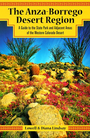
The Anza-Borrego Desert Region: A Guide to the State Park and Adjacent Areas of the Western Colorado Desert With Map
Da: ThriftBooks-Dallas, Dallas, TX, U.S.A.
Valutazione del venditore 5 su 5 stelle

Paperback. Condizione: Very Good. No Jacket. May have limited writing in cover pages. Pages are unmarked. ~ ThriftBooks: Read More, Spend Less.
-
paperback. Condizione: Very Good. Connecting readers with great books since 1972! Used books may not include companion materials, and may have some shelf wear or limited writing. We ship orders daily and Customer Service is our top priority!
-

map. Condizione: Good. Connecting readers with great books since 1972! Used books may not include companion materials, and may have some shelf wear or limited writing. We ship orders daily and Customer Service is our top priority!
-
The Anza-Borrego Desert Region: A Guide to the State Park and Adjacent Areas of the Western Colorado Desert With Map
Da: Banbury Road Books, Fountain Valley, CA, U.S.A.
Valutazione del venditore 5 su 5 stelle
Clean, unread copy in Very Good + condition (almost Near Fine). No marking or writing in the book - text is completely clean, and the book appears unread. Covers are clean and show only very slight shelf wear along bottom edge. Binding is firm.
-

a detailed map Railroads in the State of Colorado
Lingua: Inglese
Editore: Colorado Railroad Museum, 1969
Da: Yak and Yeti Books, Denver, CO, U.S.A.
Valutazione del venditore 5 su 5 stelle
No Binding. Condizione: Very Good. 36" x 24" 2-sided map. Small tear in one of the map folds. o/w very nice.
-
AAA Colorado, Wyoming Map (AAA State Series)
Editore: AAA, 2021
Da: Bank of Books, Ventura, CA, U.S.A.
Valutazione del venditore 5 su 5 stelle
map. Condizione: Very Good. 2021 folded map. We have 75,000 books to choose from -- Ship within 24 hours -- Satisfaction Guaranteed!
-
EUR 9,34
Spedizione EUR 10,00
Spedito da Germania a U.S.A.Quantit�: 1 disponibili
Aggiungi al carrelloCondizione: good. Befriedigend/Good: Durchschnittlich erhaltenes Buch bzw. Schutzumschlag mit Gebrauchsspuren, aber vollst�ndigen Seiten. / Describes the average WORN book or dust jacket that has all the pages present.
-
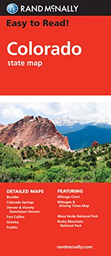
Easy to Read Colorado State Map
Da: Sell Books, Elland, YORKS, Regno Unito
Valutazione del venditore 5 su 5 stelle
EUR 5,93
Spedizione EUR 14,07
Spedito da Regno Unito a U.S.A.Quantit�: 1 disponibili
Aggiungi al carrellomap. Condizione: Acceptable. Please see the condition note after this for details, if this is missing please consider Acceptable to mean poor quality that could include major staining, water damage, writing, missing dustjacket, etc etc. Our books are dispatched from a Yorkshire former cotton mill. We list via barcode/ISBN so please note that the images are stock images and may not be the exact copy you receive, furthermore the details about edition and year might not be accurate as many publishers reuse the same ISBN for multiple editions and as we simply scan a barcode or enter an ISBN we do not check the validity of the edition data when listing. If you're looking for an exact edition please don't order (at least not without checking with us first, although we don't always have time to check). We aim to dispatch prompty, the service used will depend on order value and book size. We can ship to most countries, see our shipping policies. Payment is via Abe only.
-
A Detailed Map: Railroads in the State of Colorado
Lingua: Inglese
Editore: Colorado Railroad Museum, 1969
Da: Yak and Yeti Books, Denver, CO, U.S.A.
Valutazione del venditore 5 su 5 stelle
No Binding. Condizione: Very Good. Revised Edition. 36" x 23" 2-sided maps. One shows the entire state of Colorado and railroad routes. On reverse side are 8 smaller maps. One small cut in one panel, o/w in very nice condition.
-

Colorado Easy to Fold State Map: Cdef
Da: Revaluation Books, Exeter, Regno Unito
Valutazione del venditore 5 su 5 stelle
Mappa
EUR 9,92
Spedizione EUR 11,58
Spedito da Regno Unito a U.S.A.Quantit�: 1 disponibili
Aggiungi al carrelloMap. Condizione: Brand New. 4.50x0.40x9.00 inches. In Stock.
-
Easy to Read Colorado State Map
Da: WorldofBooks, Goring-By-Sea, WS, Regno Unito
Valutazione del venditore 5 su 5 stelle
EUR 23,85
Spedizione EUR 6,48
Spedito da Regno Unito a U.S.A.Quantit�: 2 disponibili
Aggiungi al carrelloPaperback. Condizione: Very Good. The book has been read, but is in excellent condition. Pages are intact and not marred by notes or highlighting. The spine remains undamaged.
-
State of Colorado Base Map with Highways and Contours. Scale 1:500,000 (United States Geological Survey Map).
Editore: United States Geological Survey., 1980
Da: Eryops Books, Stephenville, TX, U.S.A.
Valutazione del venditore 5 su 5 stelle
No Binding. Condizione: Very Good. Large Folded Topographic Map/Base Map; in very good condition. Map.
-
Colorado/Wyoming State Series Map-AAA-2022
Editore: AAA Publishing, Heathrow, Florida, 2022
Da: James Lasseter, Jr, Brooksville, FL, U.S.A.
Valutazione del venditore 5 su 5 stelle
Soft cover. Condizione: New. A fold out map with one state on each side. Included is an index to help one locate cities and towns in the respective state. Available for immediate shipment, carefully packed1.
-
Colorado Easy to Fold State Map: Cdef
Da: Russell Books, Victoria, BC, Canada
Valutazione del venditore 5 su 5 stelle
EUR 9,75
Spedizione EUR 17,22
Spedito da Canada a U.S.A.Quantit�: 1 disponibili
Aggiungi al carrellomap. Condizione: New. Special order direct from the distributor.
-
State of Colorado : Burlington Northern Railroad Map
Lingua: Inglese
Editore: Burlington Northern, United States, 1983
Da: Cambridge Books, Cambridge, MN, U.S.A.
Valutazione del venditore 5 su 5 stelle
Mappa
Soft cover. Condizione: Fine. 1983. map : color ; 66 x 90 cm. Rail lines are color coded and include not only the Burlington Nothern, but also the Atchison, Topeka and Santa Fe, the Denver Rio Grande, the Union Pacific, the Colorado & Wyoming, the Chicago Rock Island and Pacific, the Great Western, the Manitou and Pike's Peak, the San Luis Central and the Missouri Pacific. A wonderful map in unused condition, albeit with folds stiff. Rare.
-
State of Colorado : Burlington Northern Railroad Map
Lingua: Inglese
Editore: Burlington Northern, United States, 1983
Da: Cambridge Books, Cambridge, MN, U.S.A.
Valutazione del venditore 5 su 5 stelle
Mappa
Soft cover. Condizione: Fine. 1983. map : color ; 66 x 90 cm. Railroad Lines shown in color include not only the Burlington Norther, but also the Atchiso, Topeka and Sante Fe, the Denver and Rio Grande, and the Union Pacific. An additional five other rail lines are "noted". A rare and handsome map in the original folder.
-

MAP SHOWING LINES OF TRANSPORTATION BETWEEN ANTONITO, COLORADO AND CHAMA, NEW MEXICO, INCLUDING THE CUMBRES & TOLTEC SENIC RAILROAD, STATE HIGHWAY 17, AND THE ABANDONED PARK VIEW AND FT. GARLAND TOLL ROAD.
Lingua: Inglese
Editore: Western Guideways, Lakewood, CO, 1975
Da: Robert Gavora, Fine & Rare Books, ABAA, Talent, OR, U.S.A.
Membro dell'associazione: ABAA CBA ILAB
Valutazione del venditore 5 su 5 stelle
Mappa
Folded map. Condizione: Fine. Map measures 34 x 21.5 inches. A fine and bright, as new map.
-

National Geographic Trails Illustrated Map State Bridge / Burns: Colorado
Lingua: Inglese
Editore: Natl Geographic Society Maps, 2001
ISBN 10: 1566952875 ISBN 13: 9781566952873
Da: Revaluation Books, Exeter, Regno Unito
Valutazione del venditore 5 su 5 stelle
EUR 28,91
Spedizione EUR 11,58
Spedito da Regno Unito a U.S.A.Quantit�: 1 disponibili
Aggiungi al carrelloPaperback. Condizione: Brand New. map edition. 2 pages. 0.25x9.25x4.25 inches. In Stock.
-
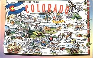
Postkarte Carte Postale 11694126 Colorado US-State Map of the Centennial State
Da: Versandhandel Boeger, Weil am Rhein, Germania
Valutazione del venditore 5 su 5 stelle
Manoscritto / Collezionismo cartaceo
EUR 7,80
Spedizione EUR 2,50
Spedito da Germania a U.S.A.Quantit�: 1 disponibili
Aggiungi al carrelloMap of the Centennial State Alte Ansichtskarte Postkarte 1921-1965 postalisch gelaufen.
-

Rand McNally Easy to Read: Colorado State Map
Da: Revaluation Books, Exeter, Regno Unito
Valutazione del venditore 5 su 5 stelle
Mappa
EUR 21,99
Spedizione EUR 11,58
Spedito da Regno Unito a U.S.A.Quantit�: 1 disponibili
Aggiungi al carrellomap. Condizione: Brand New. 4.09x0.15x9.44 inches. In Stock.
-
Colorful Colorado. Folding Map of the State of Colorado 1964
Editore: Department of Highways - State of Colorado, Denver, CO U.S.A., 1964
Da: Bargain Finders of Colorado, Simla, CO, U.S.A.
Valutazione del venditore 3 su 5 stelle

No Binding. Condizione: Near Fine. No Jacket. Large 21.5" by 34", Folding color brochure with a highway map and a separate color topographical map. On one side, is a highway map with close-up maps of three cities (Denver, Colorado Springs and Pueblo) showing the main routes through cities. The reverse is separated into 4 sections with 4 panels each matching the folds. As you unfold the map sections (5.375" x 8.5" each panel), front & back are designed to be a mailer, with the faux signature of Governor John Love, costing 4 cents postage. Other 2 panels of this section show pictures and one sentence descriptions of state highlights, titled "Colorado, Treasure Chest of History, Zestful Air, Spectacular Scenery, Natural Resources." 2nd Section again shows photographs and description titled "Colorado. Summer and Winter Playground Amid the Grandeur of the Rockies." Unfolding to reveal the final two sections, you find four displays, 1) a list and description of National Parks& Monuments in the state, 2) National Forests, Scenic Areas & Special Events, 3) Mileage Table and list of Colorado cities and towns with their 1960 populations, and 4) a color topographic map. Designed and presented to promote Colorado Tourism. Map carefully stored without use or damage. Faux Signature (No Value Added.
-
Condizione: New. Satisfaction Guaranteed or your money back.
-

Nell's Topographical & Township Map Of The State Of Colorado 1885 (Reprint Dated 1965)
Lingua: Inglese
Editore: Chain, Hardy & Co (1965), Denver, 1885
Da: Arroyo Seco Books, Pasadena, Member IOBA, Pasadena, CA, U.S.A.
Membro dell'associazione: IOBA
Valutazione del venditore 4 su 5 stelle

Prima edizione
Hardcover. Condizione: Near Fine. 1st Edition. Very Large Folding Map Printed In Purplish Blue, Facsimile Printed In 1965. No Wear Or Damage But Reddish Tint To Folds.
-
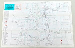
A Detailed Map: Railroads in the State of Colorado
Lingua: Inglese
Editore: Colorado Railroad Museum, Golden, CO, 1963
Da: Argyl Houser, Bookseller, Altadena, CA, U.S.A.
Valutazione del venditore 4 su 5 stelle
Prima edizione
No Binding. Condizione: Fine. 1st Edition. No tears, stains, or damage of any kind. Looks like new. This is a folded map so there are creases where the map is folded, but no other creases. Will be bubble-wrapped and carefully packed in a sturdy box to ensure safe transit.
-
The Anza-Borrego Desert Region: A Guide to the State Park and Adjacent Areas of the Western Colorado Desert With Map
Da: BennettBooksLtd, Los Angeles, CA, U.S.A.
Valutazione del venditore 5 su 5 stelle
Paperback. Condizione: New. In shrink wrap. Looks like an interesting title!
-
Colorado Easy to Fold State Map (Folded)
Da: AussieBookSeller, Truganina, VIC, Australia
Valutazione del venditore 5 su 5 stelle
EUR 26,57
Spedizione EUR 31,87
Spedito da Australia a U.S.A.Quantit�: 1 disponibili
Aggiungi al carrelloFolded. Condizione: new. Folded. Shipping may be from our Sydney, NSW warehouse or from our UK or US warehouse, depending on stock availability.
-
Colorado Easy to Fold State Map (Folded)
Da: CitiRetail, Stevenage, Regno Unito
Valutazione del venditore 5 su 5 stelle
EUR 16,08
Spedizione EUR 42,84
Spedito da Regno Unito a U.S.A.Quantit�: 1 disponibili
Aggiungi al carrelloFolded. Condizione: new. Folded. Shipping may be from our UK warehouse or from our Australian or US warehouses, depending on stock availability.
-

Nell's New Topographical & Township Map Of The State Of Colorado 1880 (Late 20Th Century Reprint)
Lingua: Inglese
Data di pubblicazione: 1880
Da: Arroyo Seco Books, Pasadena, Member IOBA, Pasadena, CA, U.S.A.
Membro dell'associazione: IOBA
Valutazione del venditore 4 su 5 stelle
Mappa
Hardcover. Condizione: Fine. Reprint. Very Large Folding Map Printed In Black, Immaculate And Unworn So Apparently A Very High Quality Facsimile Printed Perhaps In The Nineteen Sixties.
-

Post Route Map Of The State Of Colorado, Showing Post Offices, With The Intermediate Distances On Mail Routes, In Operation On The 1St Of August, 1932 ( Reprint)
Lingua: Inglese
Editore: Post Office Department, Wsshington, 1932
Da: Arroyo Seco Books, Pasadena, Member IOBA, Pasadena, CA, U.S.A.
Membro dell'associazione: IOBA
Valutazione del venditore 4 su 5 stelle
Mappa
Soft cover. Condizione: Near Fine. Extremely Large Multi-Fold Map, Yellowing/Browning To Map Side Of Paper But Almost No Wear. Printed In Blue On White Paper, Now Aged To Pinkish-Tan. This May Be A Reprint, But No Marks To Indicate Reprinting.
-

Map Showing System Of Main Roads In Colorado Now Open To Travel, Revised By The State Highway Commission Of Colorado January 1916 (Reprint)
Lingua: Inglese
Editore: State Highway Commission, 1916
Da: Arroyo Seco Books, Pasadena, Member IOBA, Pasadena, CA, U.S.A.
Membro dell'associazione: IOBA
Valutazione del venditore 4 su 5 stelle
Mappa
Soft cover. Condizione: Near Fine. Reprint. Large Folding Map, Circa 1960'S Reprint, Lacking Text On Reverse Side. Some Browning Otherwise Fine.