
Importo totale (1 articolo articoli):
Destinazione ordine:

tables computed altitude azimuth latitudes di navy hydrographic office (12 risultati)
Vai alla pagina principale dei risultati di ricerca
Filtri di ricerca
Tipo di articolo
- Tutti i tipi di prodotto
- Libri (12)
- Riviste e Giornali (Nessun altro risultato corrispondente a questo perfezionamento)
- Fumetti (Nessun altro risultato corrispondente a questo perfezionamento)
- Spartiti (Nessun altro risultato corrispondente a questo perfezionamento)
- Arte, Stampe e Poster (Nessun altro risultato corrispondente a questo perfezionamento)
- Fotografie (Nessun altro risultato corrispondente a questo perfezionamento)
- Mappe (Nessun altro risultato corrispondente a questo perfezionamento)
- Manoscritti e Collezionismo cartaceo (Nessun altro risultato corrispondente a questo perfezionamento)
Condizioni Maggiori informazioni
- Nuovo (Nessun altro risultato corrispondente a questo perfezionamento)
- Come nuovo, Ottimo o Quasi ottimo (1)
- Molto buono o Buono (8)
- Discreto o Mediocre (1)
- Come descritto (2)
Legatura
- Tutte
- Rilegato (9)
- Brossura (Nessun altro risultato corrispondente a questo perfezionamento)
Ulteriori caratteristiche
- Prima ed. (2)
- Copia autograf. (Nessun altro risultato corrispondente a questo perfezionamento)
- Sovracoperta (Nessun altro risultato corrispondente a questo perfezionamento)
- Con foto (3)
- Non Print on Demand (12)
Lingua (1)
Spedizione gratuita
Paese del venditore
Valutazione venditore
-

Tables of Computed Altitude and Azimuth: Latitudes 10 to 19, Inclusive Vol. II
Editore: United States Government Printing Office, 1940
EUR 14,88
Convertire valutaEUR 3,43 per la spedizione in U.S.A.Quantit�: 1 disponibili
Aggiungi al carrelloHardcover. Condizione: Very Good. This book is in very good condition. The binding is tight and pages are clean. Tabs are crisp. The cover has wear with fading, bumps and scuffs. It has been corner bumped.
-
Tables of Computed Altitude and Azimuth: Latitudes 50 to 59, Inclusive VoI. VI
Editore: United States Government Printing Office, 1940
EUR 14,88
Convertire valutaEUR 3,43 per la spedizione in U.S.A.Quantit�: 1 disponibili
Aggiungi al carrelloHardcover. Condizione: Very Good. This book is in very good to near fine condition. The binding is tight and pages are clean. Tabs are crisp. The cover has bumps and scuffs.
-
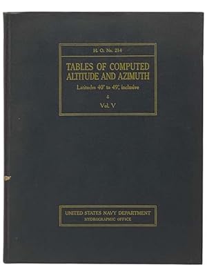
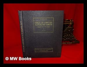
Tables of Computed Altitude and Azimuth: Latitudes 40 to 49, Inclusive VoI. V
Editore: United States Government Printing Office, 1940
EUR 14,88
Convertire valutaEUR 3,43 per la spedizione in U.S.A.Quantit�: 1 disponibili
Aggiungi al carrelloHardcover. Condizione: Very Good. This book is in very good condition. The binding is tight and pages are clean. Tabs are crisp. The cover has wear with bumps and scuffs. It has been corner bumped.
-
Tables of Computed Altitude and Azimuth: Latitudes 0 to 9, Inclusive Vol. I
Editore: United States Government Printing Office, 1941
EUR 14,88
Convertire valutaEUR 3,43 per la spedizione in U.S.A.Quantit�: 1 disponibili
Aggiungi al carrelloHardcover. Condizione: Very Good. This book is in very good condition. The binding is tight and pages are clean. Tabs are crisp. The cover has wear with bumps and scuffs. It has been corner bumped.
-
Tables of Computed Altitude and Azimuth Latitudes 40-49 degrees, Inclusive Volume V H. O. Pub. No. 214
Editore: U. S. Navy Hydrographic Office, 1952
Da: Friendly Books, Lakewood, OH, U.S.A.
Valutazione del venditore 5 su 5 stelle

EUR 8,86
Convertire valutaEUR 5,16 per la spedizione in U.S.A.Quantit�: 1 disponibili
Aggiungi al carrelloCondizione: Good. Blue hardcover without dust jacket. Corners are bent with some wear noted to head and tail of spine. Pages browning with age but very readable. These tables consist of tabulated solutions of the navigational triangle, so arranged as to yield computed altitude and azimuth angle by inspection. The scheme of precomputing such values for ready use is a long-established one. It is in the scope, arrangement, and convenience of interpolation, developed by the Hydrographic Office, that these tables are unique.
-
Tables of Computed Altitude and Azimuth: Latitudes 60 Degress-69 Degrees Inclusive; H.O. Publication No. 214, Volume 7
Editore: U.S. Government Printing Office
Da: Wonder Book, Frederick, MD, U.S.A.
Membro dell'associazione: ABAA ILAB
Valutazione del venditore 5 su 5 stelle
EUR 19,45
Convertire valutaGratis per la spedizione in U.S.A.Quantit�: 1 disponibili
Aggiungi al carrelloCondizione: Fair. Acceptable condition. #214, Volume 7. Corrections laid in. (charts, altitude, latitudes) A readable, intact copy that may have noticeable tears and wear to the spine. All pages of text are present, but they may include extensive notes and highlighting or be heavily stained. Includes reading copy only books.
-
Tables of Computed Altitude and Azimuth, Latitudes 10 to 19, Inclusive, Vol. II
Editore: U. S. Navy Department
Da: Wonder Book, Frederick, MD, U.S.A.
Membro dell'associazione: ABAA ILAB
Valutazione del venditore 5 su 5 stelle
EUR 19,45
Convertire valutaGratis per la spedizione in U.S.A.Quantit�: 1 disponibili
Aggiungi al carrelloCondizione: Good. Good condition. #214, Volume 2. Corrections laid in. (charts, altitude, latitudes) A copy that has been read but remains intact. May contain markings such as bookplates, stamps, limited notes and highlighting, or a few light stains.
-
Tables of Computed Altitude and Azimuth Latitudes 40 Degrees to 49 Degrees, Inclusive, Vol. V (H.O. NO. 214) (United States Navy Department, Hydrographic Office)
Editore: United States Navy Department, Hydrographic Office/Government Printing Office, 1940
Da: Yesterday's Muse, ABAA, ILAB, IOBA, Webster, NY, U.S.A.
Membro dell'associazione: ABAA ILAB IOBA
Valutazione del venditore 5 su 5 stelle
EUR 32,77
Convertire valutaGratis per la spedizione in U.S.A.Quantit�: 1 disponibili
Aggiungi al carrelloLarge Hardcover. Condizione: Near Fine. No Jacket. Ink stamp, some pencil notes. 1940 Large Hardcover. x, 263 pp. These tables consist of tabulated solutions of the navigational triangle, so arranged as to yield computed altitude and azimuth angle by inspection. The scheme of precomputing such values for ready use is a long-established one. It is in the scope, arrangement, and convenience of interpolation, developed by the Hydrographic Office, that these tables are unique. The tables are applicable equally to observations of the sun, moon, planets, and navigational stars, whether observed in north or south latitude. For convenience, the values for only 10 degrees of latitude are included in each volume. This series of tables, commonly known as H.O. Pub No. 214, is intended primarily for marine navigation.
-
Tables of Computed Altitude and Azimuth: Latitudes 60 Degress-69 Degrees Inclusive; H.O. Publication No. 214, Volume 7
Editore: U.S. Government Printing Office, 1940
Da: BookDepart, Shepherdstown, WV, U.S.A.
Valutazione del venditore 5 su 5 stelle
EUR 54,98
Convertire valutaEUR 7,26 per la spedizione in U.S.A.Quantit�: 1 disponibili
Aggiungi al carrelloHardcover. Condizione: Good. Hardcover with flexible covers; H.O. Pub. No. 214, Volume 7; fading and edge wear to exterior; corners bumped; otherwise contents in good condition with clean text, firm binding.
-
Tables of Computed Altitude and Azimuth: Latitudes 30 Degress-39 Degrees Inclusive; Corrected Reprint; H.O. Pub. No. 214, Volume 4
Editore: U.S. Government Printing Office, 1952
Da: BookDepart, Shepherdstown, WV, U.S.A.
Valutazione del venditore 5 su 5 stelle
EUR 54,98
Convertire valutaEUR 7,26 per la spedizione in U.S.A.Quantit�: 1 disponibili
Aggiungi al carrelloHardcover. Condizione: Good. Hardcover with flexible covers; H.O. Pub. No. 214, Volume 4; fading and edge wear to exterior; corners bumped; otherwise contents in good condition with clean text, firm binding.
-

Tables of Computed Altitude and Azimuth: Latitudes 30 Degrees to 39 Degrees, Inclusive - Volume 4
Editore: United States Government Printing Office, Washington, 1940
Prima edizione
EUR 60,00
Convertire valutaEUR 13,95 per la spedizione da Irlanda a U.S.A.Quantit�: 1 disponibili
Aggiungi al carrelloFirst Edition. Near fine copy in the original title-blocked buckram. Slightest suggestion only of dust-dulling to the spine bands and panel edges. Remains particularly well-preserved overall; tight, bright, clean and strong. ; 262 pages; Description: p. 262 ; diagrs. , tables ; 30cm. Subjects: Subject: Navigation - Tables. Azimuth. Extensively table illustrated. - Series: H. O. Publication No. 214. 2 Kg.
-
Tables of Computed Altitude and Azimuth: Latitudes 30 Degrees to 39 Degrees, Inclusive - Volume 4
Editore: United States Government Printing Office, Washington, 1940
Prima edizione
EUR 76,20
Convertire valutaGratis per la spedizione in U.S.A.Quantit�: 1 disponibili
Aggiungi al carrelloFirst Edition. Near fine copy in the original title-blocked buckram. Slightest suggestion only of dust-dulling to the spine bands and panel edges. Remains particularly well-preserved overall; tight, bright, clean and strong. ; 262 pages; Description: p. 262 ; diagrs. , tables ; 30cm. Subjects: Subject: Navigation - Tables. Azimuth. Extensively table illustrated. - Series: H. O. Publication No. 214. 2 Kg.
