
Importo totale (1 articolo articoli):
Destinazione ordine:

urban spatial structure analysis di perera k a m (14 risultati)
Vai alla pagina principale dei risultati di ricerca
Filtri di ricerca
Tipo di articolo
- Tutti i tipi di prodotto
- Libri (14)
- Riviste e Giornali (Nessun altro risultato corrispondente a questo perfezionamento)
- Fumetti (Nessun altro risultato corrispondente a questo perfezionamento)
- Spartiti (Nessun altro risultato corrispondente a questo perfezionamento)
- Arte, Stampe e Poster (Nessun altro risultato corrispondente a questo perfezionamento)
- Fotografie (Nessun altro risultato corrispondente a questo perfezionamento)
- Mappe (Nessun altro risultato corrispondente a questo perfezionamento)
- Manoscritti e Collezionismo cartaceo (Nessun altro risultato corrispondente a questo perfezionamento)
Condizioni Maggiori informazioni
- Nuovo (13)
- Come nuovo, Ottimo o Quasi ottimo (1)
- Molto buono o Buono (Nessun altro risultato corrispondente a questo perfezionamento)
- Discreto o Mediocre (Nessun altro risultato corrispondente a questo perfezionamento)
- Come descritto (Nessun altro risultato corrispondente a questo perfezionamento)
Legatura
- Tutte
- Rilegato (Nessun altro risultato corrispondente a questo perfezionamento)
- Brossura (14)
Ulteriori caratteristiche
- Prima ed. (Nessun altro risultato corrispondente a questo perfezionamento)
- Copia autograf. (Nessun altro risultato corrispondente a questo perfezionamento)
- Sovracoperta (Nessun altro risultato corrispondente a questo perfezionamento)
- Con foto (5)
- Non Print on Demand (7)
Lingua (1)
Prezzo
- Qualsiasi prezzo
- Inferiore a EUR 20 (Nessun altro risultato corrispondente a questo perfezionamento)
- EUR 20 a EUR 45
- Superiore a EUR 45
Spedizione gratuita
Paese del venditore
Valutazione venditore
-

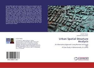
Urban Spatial Structure Analysis: An Alternative Approach using Remote Sensing & GIS: A Case Study in Battaramulla, Sri Lanka
Editore: LAP LAMBERT Academic Publishing, 2011
ISBN 10: 3846511366 ISBN 13: 9783846511367
Lingua: Inglese
Da: Lucky's Textbooks, Dallas, TX, U.S.A.
Valutazione del venditore 5 su 5 stelle

Condizione: New.
-
Urban Spatial Structure Analysis: An Alternative Approach using Remote Sensing & GIS: A Case Study in Battaramulla, Sri Lanka
Editore: LAP LAMBERT Academic Publishing, 2011
ISBN 10: 3846511366 ISBN 13: 9783846511367
Lingua: Inglese
Da: Ria Christie Collections, Uxbridge, Regno Unito
Valutazione del venditore 5 su 5 stelle
EUR 46,55
EUR 13,63 per la spedizione da Regno Unito a U.S.A.Quantit�: Pi� di 20 disponibili
Aggiungi al carrelloCondizione: New. In.
-
Urban Spatial Structure Analysis: An Alternative Approach using Remote Sensing & GIS: A Case Study in Battaramulla, Sri Lanka
Editore: LAP LAMBERT Academic Publishing 2011-10-11, 2011
ISBN 10: 3846511366 ISBN 13: 9783846511367
Lingua: Inglese
Da: Chiron Media, Wallingford, Regno Unito
Valutazione del venditore 4 su 5 stelle

EUR 43,86
EUR 17,62 per la spedizione da Regno Unito a U.S.A.Quantit�: 10 disponibili
Aggiungi al carrelloPaperback. Condizione: New.
-
Urban Spatial Structure Analysis
Editore: Editorial Academica Espanola, 2011
ISBN 10: 3846511366 ISBN 13: 9783846511367
Lingua: Inglese
Da: Books Puddle, New York, NY, U.S.A.
Valutazione del venditore 4 su 5 stelle
Condizione: New. pp. 88.
-

Urban Spatial Structure Analysis
Editore: LAP LAMBERT Academic Publishing Okt 2011, 2011
ISBN 10: 3846511366 ISBN 13: 9783846511367
Lingua: Inglese
Da: buchversandmimpf2000, Emtmannsberg, BAYE, Germania
Valutazione del venditore 5 su 5 stelle
EUR 49,00
EUR 60,00 per la spedizione da Germania a U.S.A.Quantit�: 2 disponibili
Aggiungi al carrelloTaschenbuch. Condizione: Neu. Neuware -Uncontrolled rapid urban growth due to built-up area expansion over the last few decades has created critical problems to urban planners. Therefore, it is worth to identify spatial distribution pattern of built-up area in a town. Remote Sensing (RS) and Geographical Information System (GIS) provide a great potential for urban data collection & spatial analysis and not much academic literature exists on how to best utilize these technologies for urban studies. Traditional approaches to data collection and analysis no longer adequate to provide updated information for urban planners. This book, therefore, introduces alternative techniques for data collection, updating, detection of built-up area change and unauthorised constructions, identifying urban spatial distribution pattern considering built-up area density. New GIS spatial analysis techniques such as weighted mean centre and spatial autocorrelation tools introduced. These analysis techniques should help to shed light on the field of urban planning, and should be especially useful to students and professionals in urban planning or anyone else who may be considering utilizing RS and GIS for urban spatial structure analysis.Books on Demand GmbH, �berseering 33, 22297 Hamburg 88 pp. Englisch.
-
Urban Spatial Structure Analysis | An Alternative Approach using Remote Sensing & GIS: A Case Study in Battaramulla, Sri Lanka
Editore: LAP LAMBERT Academic Publishing, 2011
ISBN 10: 3846511366 ISBN 13: 9783846511367
Lingua: Inglese
EUR 43,35
EUR 70,00 per la spedizione da Germania a U.S.A.Quantit�: 5 disponibili
Aggiungi al carrelloTaschenbuch. Condizione: Neu. Urban Spatial Structure Analysis | An Alternative Approach using Remote Sensing & GIS: A Case Study in Battaramulla, Sri Lanka | K. A. M. Perera (u. a.) | Taschenbuch | 88 S. | Englisch | 2011 | LAP LAMBERT Academic Publishing | EAN 9783846511367 | Verantwortliche Person f�r die EU: BoD - Books on Demand, In de Tarpen 42, 22848 Norderstedt, info[at]bod[dot]de | Anbieter: preigu.
-
Urban Spatial Structure Analysis: An Alternative Approach using Remote Sensing & GIS: A Case Study in Battaramulla, Sri Lanka
Editore: LAP LAMBERT Academic Publishing, 2011
ISBN 10: 3846511366 ISBN 13: 9783846511367
Lingua: Inglese
Da: Mispah books, Redhill, SURRE, Regno Unito
Valutazione del venditore 4 su 5 stelle
EUR 104,27
EUR 28,44 per la spedizione da Regno Unito a U.S.A.Quantit�: 1 disponibili
Aggiungi al carrelloPaperback. Condizione: Like New. Like New. book.
-
Urban Spatial Structure Analysis An Alternative Approach using Remote Sensing GIS A Case Study in Battaramulla, Sri Lanka
Editore: LAP LAMBERT Academic Publishing, 2011
ISBN 10: 3846511366 ISBN 13: 9783846511367
Lingua: Inglese
Da: PBShop.store US, Wood Dale, IL, U.S.A.
Valutazione del venditore 5 su 5 stelle
PAP. Condizione: New. New Book. Shipped from UK. THIS BOOK IS PRINTED ON DEMAND. Established seller since 2000.
-
Urban Spatial Structure Analysis An Alternative Approach using Remote Sensing GIS A Case Study in Battaramulla, Sri Lanka
Editore: LAP LAMBERT Academic Publishing, 2011
ISBN 10: 3846511366 ISBN 13: 9783846511367
Lingua: Inglese
Da: PBShop.store UK, Fairford, GLOS, Regno Unito
Valutazione del venditore 5 su 5 stelle
EUR 47,86
EUR 3,74 per la spedizione da Regno Unito a U.S.A.Quantit�: Pi� di 20 disponibili
Aggiungi al carrelloPAP. Condizione: New. New Book. Delivered from our UK warehouse in 4 to 14 business days. THIS BOOK IS PRINTED ON DEMAND. Established seller since 2000.
-
Urban Spatial Structure Analysis
Editore: LAP LAMBERT Academic Publishing Okt 2011, 2011
ISBN 10: 3846511366 ISBN 13: 9783846511367
Lingua: Inglese
Da: BuchWeltWeit Ludwig Meier e.K., Bergisch Gladbach, Germania
Valutazione del venditore 5 su 5 stelle
EUR 49,00
EUR 23,00 per la spedizione da Germania a U.S.A.Quantit�: 2 disponibili
Aggiungi al carrelloTaschenbuch. Condizione: Neu. This item is printed on demand - it takes 3-4 days longer - Neuware -Uncontrolled rapid urban growth due to built-up area expansion over the last few decades has created critical problems to urban planners. Therefore, it is worth to identify spatial distribution pattern of built-up area in a town. Remote Sensing (RS) and Geographical Information System (GIS) provide a great potential for urban data collection & spatial analysis and not much academic literature exists on how to best utilize these technologies for urban studies. Traditional approaches to data collection and analysis no longer adequate to provide updated information for urban planners. This book, therefore, introduces alternative techniques for data collection, updating, detection of built-up area change and unauthorised constructions, identifying urban spatial distribution pattern considering built-up area density. New GIS spatial analysis techniques such as weighted mean centre and spatial autocorrelation tools introduced. These analysis techniques should help to shed light on the field of urban planning, and should be especially useful to students and professionals in urban planning or anyone else who may be considering utilizing RS and GIS for urban spatial structure analysis. 88 pp. Englisch.
-
Urban Spatial Structure Analysis
Editore: Editorial Academica Espanola, 2011
ISBN 10: 3846511366 ISBN 13: 9783846511367
Lingua: Inglese
Da: Majestic Books, Hounslow, Regno Unito
Valutazione del venditore 4 su 5 stelle
EUR 70,10
EUR 7,39 per la spedizione da Regno Unito a U.S.A.Quantit�: 4 disponibili
Aggiungi al carrelloCondizione: New. Print on Demand pp. 88 2:B&W 6 x 9 in or 229 x 152 mm Perfect Bound on Creme w/Gloss Lam.
-
Urban Spatial Structure Analysis
Editore: Editorial Academica Espanola, 2011
ISBN 10: 3846511366 ISBN 13: 9783846511367
Lingua: Inglese
Da: Biblios, Frankfurt am main, HESSE, Germania
Valutazione del venditore 4 su 5 stelle
EUR 70,76
EUR 9,95 per la spedizione da Germania a U.S.A.Quantit�: 4 disponibili
Aggiungi al carrelloCondizione: New. PRINT ON DEMAND pp. 88.
-
Urban Spatial Structure Analysis
Editore: LAP LAMBERT Academic Publishing, 2011
ISBN 10: 3846511366 ISBN 13: 9783846511367
Lingua: Inglese
EUR 41,05
EUR 48,99 per la spedizione da Germania a U.S.A.Quantit�: Pi� di 20 disponibili
Aggiungi al carrelloCondizione: New. Dieser Artikel ist ein Print on Demand Artikel und wird nach Ihrer Bestellung fuer Sie gedruckt. Autor/Autorin: Perera K.A.M.K.A.M.Perera, MBCS,CITP(U.K.), PGDip. (Geoinformatics): Studied RS at IIRS, India & AIT, Geoinformatics at Univ. of Colombo, Sri Lanka. Database Administrator at Urban Development Authority, Sri Lanka.Lasantha Manawadu,.
-

Urban Spatial Structure Analysis : An Alternative Approach using Remote Sensing & GIS: A Case Study in Battaramulla, Sri Lanka
Editore: LAP LAMBERT Academic Publishing, 2011
ISBN 10: 3846511366 ISBN 13: 9783846511367
Lingua: Inglese
EUR 49,00
EUR 60,75 per la spedizione da Germania a U.S.A.Quantit�: 1 disponibili
Aggiungi al carrelloTaschenbuch. Condizione: Neu. nach der Bestellung gedruckt Neuware - Printed after ordering - Uncontrolled rapid urban growth due to built-up area expansion over the last few decades has created critical problems to urban planners. Therefore, it is worth to identify spatial distribution pattern of built-up area in a town. Remote Sensing (RS) and Geographical Information System (GIS) provide a great potential for urban data collection & spatial analysis and not much academic literature exists on how to best utilize these technologies for urban studies. Traditional approaches to data collection and analysis no longer adequate to provide updated information for urban planners. This book, therefore, introduces alternative techniques for data collection, updating, detection of built-up area change and unauthorised constructions, identifying urban spatial distribution pattern considering built-up area density. New GIS spatial analysis techniques such as weighted mean centre and spatial autocorrelation tools introduced. These analysis techniques should help to shed light on the field of urban planning, and should be especially useful to students and professionals in urban planning or anyone else who may be considering utilizing RS and GIS for urban spatial structure analysis.
