Articoli correlati a Early Printed Maps of the British Isles, 1477-1650
Altre edizioni note dello stesso titolo

Risultati della ricerca per Early Printed Maps of the British Isles, 1477-1650

Foto dell'editore
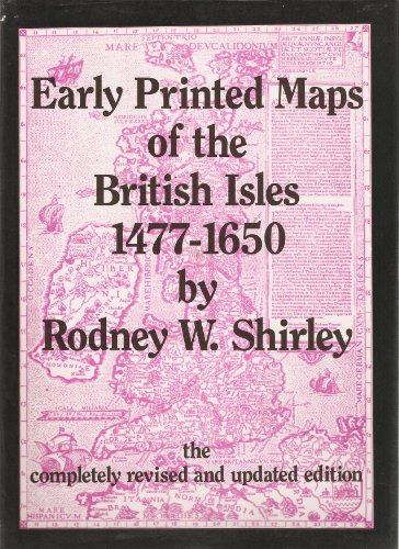
Early Printed Maps of the British Isles, 1477-1650
Editore:
Antique Atlas Publications, East Grinstead, 1991
ISBN 10: 0951491423
ISBN 13: 9780951491423
Antico o usato
Rilegato
Da: Dale A. Sorenson, Silver Spring, MD, U.S.A.
Valutazione del venditore 5 su 5 stelle
![]()
Hardcover. Condizione: Fine. Condizione sovraccoperta: Fine. Revised & Updated Edition. Completely Revised & Updated Edition. (East Grinstead: Antique Atlas Publications, 1991). xx,233pp, Index, List of Plates, References. Red boards, gilt letters. Fine condition in fine dj. With 670 entries and 160 b&w illustrations. Detailed carto-bibliography of 759 different printed maps listed chronologically. ISBN 0951491423; 8vo 8" - 9" tall; 223 pages. Codice articolo 14648
Quantit�: 1 disponibili
Immagini fornite dal venditore
Early Printed Maps of the British Isles 1477-1650. The Completely Revised and Updated Edition.
Editore:
East Grinstead Antique Atlas Publications 1991, 1991
ISBN 10: 0951491423
ISBN 13: 9780951491423
Antico o usato
Rilegato
Da: Chaucer Bookshop ABA ILAB, Canterbury, Regno Unito
Valutazione del venditore 5 su 5 stelle
![]()
Revised and Updated Edition. Tall 4to (30cm x 21.5cm) red clothbound hardback gilt,with gilt lettering to upper cover, with pictorial dust jacket (unclipped); [xx] + 233pp, indexed, with 160 b/w illustrations plus map endpapers. A clean copy with no previous ownership inscriptions or annotation. Dust jacket a little edgeworn, overall VG/VG. (Shelf 8/10) ISBN: 0951491423 PLEASE NOTE: Heavy Book ( 1.3kg+) Postage rates vary according to destination, weight and speed. For an accurate overseas quote PLEASE either call or email us before ordering. [AbeBooks shipping quote is based on items weighing up to 1 kilo only]. Buyer is responsible for any additional duties, taxes, or fees required by recipient's country.** Pictures available upon request.** Visit our homepage for our shop opening hours. Over 20,000 books in stock - come and browse. PayPal, credit and most debit cards welcome. Books posted worldwide. For any queries please contact us direct. Codice articolo 59251
Quantit�: 1 disponibili
Immagini fornite dal venditore
Early Printed Maps of the British Isles 1477-1650 *SIGNED*
Editore:
Antique Atlas Publications, 1991
ISBN 10: 0951491423
ISBN 13: 9780951491423
Antico o usato
Rilegato
Copia autografata
Da: Klondyke, Almere, Paesi Bassi
Valutazione del venditore 5 su 5 stelle
![]()
Condizione: Good. Gilt cloth, dust jacket, illustrated with b/w maps; signed with small dedication by the author on title-page, The completely Revised and Updated edition. Codice articolo 279296
Quantit�: 1 disponibili