
Articoli correlati a Prepare, Respond, Renew: GIS for Wildland Fire
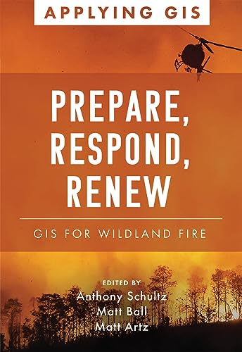
Sinossi
Discover a geographic approach to resilience strategies for wildland fire.
Wildfires claim lives, destroy structures, and devastate communities and landscapes. The increasing areas where development meets nature—and more days of hot and dry weather— have magnified the impact of wildfires from Canada to Australia and around the world. The response to and recovery from increasingly complex firestorms stress budgets, economies, communities, and environments.
Increasingly, responders use the latest tools of geographic information systems (GIS) to analyze wildfires through data that can be modeled to visualize threats in real time. Prepare, Respond, Renew: GIS for Wildland Fire explores a collection of real-life stories about wildland fire agencies successfully using GIS technology for preparedness, mitigation, response, and recovery and rehabilitation workflows. Preemptively, GIS helps firefighters model how wildfires spread depending on weather, geologic features, and human development. Through predictive analytics and mapping technologies, firefighters can model the direction and rate of spread of wildfire can give a community, a nature preserve, a fire department, or a single homeowner time to prepare for or even prevent the next wildland fire. As they identify priorities and reduce fire vulnerabilities, agencies can visualize, record, and track the status of their accomplishments in the field.
The book also includes a section on next steps that provides ideas, strategies, tools, and actions to help jump-start your own use of GIS for wildland fire management. A collection of online resources, including additional stories, videos, new ideas and concepts, and downloadable tools and content, complements this book.
Le informazioni nella sezione "Riassunto" possono far riferimento a edizioni diverse di questo titolo.
Dalla quarta di copertina
PREPARE, RESPOND, RENEW
GIS FOR WILDLAND FIRE
Discover a geographic approach to resilience strategies for wildland fire.
Prepare, Respond, Renew: GIS for Wildland Fire explores a collection of real-life stories about wildland fire agencies successfully using GIS for preparedness, mitigation, response, and recovery and rehabilitation workflows. The book also includes a section on next steps that provides ideas, strategies, tools, and actions to help jump-start your own use of GIS for wildland fire management. A collection of online resources, including additional stories, videos, new ideas and concepts, and downloadable tools and content, complements this book.
Edited by Anthony Schultz, director of wildland fire solutions at Esri; Matt Ball, a senior writer and editor at Esri; and Matt Artz, an Esri content strategist.
Le informazioni nella sezione "Su questo libro" possono far riferimento a edizioni diverse di questo titolo.
Risultati della ricerca per Prepare, Respond, Renew: GIS for Wildland Fire

Foto dell'editore
Prepare, Respond, Renew : Gis for Wildland Fire
Da: GreatBookPrices, Columbia, MD, U.S.A.
Valutazione del venditore 5 su 5 stelle

Condizione: As New. Unread book in perfect condition. Codice articolo 47109678
Compra usato
EUR 20,11
Spedizione EUR 2,35
Spedito in U.S.A.
Spedito in U.S.A.
Quantità: Più di 20 disponibili
Foto dell'editore
Prepare, Respond, Renew : Gis for Wildland Fire
Da: GreatBookPrices, Columbia, MD, U.S.A.
Valutazione del venditore 5 su 5 stelle
Condizione: New. Codice articolo 47109678-n
Compra nuovo
EUR 21,04
Spedizione EUR 2,35
Spedito in U.S.A.
Spedito in U.S.A.
Quantità: Più di 20 disponibili
Immagini fornite dal venditore
Prepare, Respond, Renew
Da: Rarewaves.com USA, London, LONDO, Regno Unito
Valutazione del venditore 5 su 5 stelle
Paperback. Condizione: New. Discover a geographic approach to resilience strategies for wildland fire. Wildfires claim lives, destroy structures, and devastate communities and landscapes. The increasing areas where development meets nature-and more days of hot and dry weather- have magnified the impact of wildfires from Canada to Australia and around the world. The response to and recovery from increasingly complex firestorms stress budgets, economies, communities, and environments. Increasingly, responders use the latest tools of geographic information systems (GIS) to analyze wildfires through data that can be modeled to visualize threats in real time. Prepare, Respond, Renew: GIS for Wildland Fire explores a collection of real-life stories about wildland fire agencies successfully using GIS technology for preparedness, mitigation, response, and recovery and rehabilitation workflows. Preemptively, GIS helps firefighters model how wildfires spread depending on weather, geologic features, and human development. Through predictive analytics and mapping technologies, firefighters can model the direction and rate of spread of wildfire can give a community, a nature preserve, a fire department, or a single homeowner time to prepare for or even prevent the next wildland fire. As they identify priorities and reduce fire vulnerabilities, agencies can visualize, record, and track the status of their accomplishments in the field. The book also includes a section on next steps that provides ideas, strategies, tools, and actions to help jump-start your own use of GIS for wildland fire management. A collection of online resources, including additional stories, videos, new ideas and concepts, and downloadable tools and content, complements this book. Codice articolo LU-9781589487703
Compra nuovo
EUR 23,47
Spedizione gratuita
Spedito da Regno Unito a U.S.A.
Spedito da Regno Unito a U.S.A.
Quantità: Più di 20 disponibili
Foto dell'editore
Prepare, Respond, Renew (Paperback)
Da: Grand Eagle Retail, Bensenville, IL, U.S.A.
Valutazione del venditore 5 su 5 stelle
Paperback. Condizione: new. Paperback. Discover a geographic approach to resilience strategies for wildland fire. Wildfires claim lives, destroy structures, and devastate communities and landscapes. The increasing areas where development meets natureand more days of hot and dry weather have magnified the impact of wildfires from Canada to Australia and around the world. The response to and recovery from increasingly complex firestorms stress budgets, economies, communities, and environments. Increasingly, responders use the latest tools of geographic information systems (GIS) to analyze wildfires through data that can be modeled to visualize threats in real time. Prepare, Respond, Renew: GIS for Wildland Fire explores a collection of real-life stories about wildland fire agencies successfully using GIS technology for preparedness, mitigation, response, and recovery and rehabilitation workflows. Preemptively, GIS helps firefighters model how wildfires spread depending on weather, geologic features, and human development. Through predictive analytics and mapping technologies, firefighters can model the direction and rate of spread of wildfire can give a community, a nature preserve, a fire department, or a single homeowner time to prepare for or even prevent the next wildland fire. As they identify priorities and reduce fire vulnerabilities, agencies can visualize, record, and track the status of their accomplishments in the field. The book also includes a section on next steps that provides ideas, strategies, tools, and actions to help jump-start your own use of GIS for wildland fire management. A collection of online resources, including additional stories, videos, new ideas and concepts, and downloadable tools and content, complements this book. Prepare, Respond, Renew: GIS for Wildland Fire explores a collection of real-life stories about wildland fire agencies successfully using GIS for preparedness, mitigation, response, and recovery and rehabilitation workflows. Shipping may be from multiple locations in the US or from the UK, depending on stock availability. Codice articolo 9781589487703
Compra nuovo
EUR 26,21
Spedizione gratuita
Spedito in U.S.A.
Spedito in U.S.A.
Quantità: 1 disponibili
Immagini fornite dal venditore
Prepare, Respond, Renew : Gis for Wildland Fire
Da: GreatBookPricesUK, Woodford Green, Regno Unito
Valutazione del venditore 5 su 5 stelle
Condizione: New. Codice articolo 47109678-n
Compra nuovo
EUR 20,75
Spedizione EUR 17,70
Spedito da Regno Unito a U.S.A.
Spedito da Regno Unito a U.S.A.
Quantità: 3 disponibili
Foto dell'editore
Prepare, Respond, Renew: Gis for Wildland Fire
Da: Revaluation Books, Exeter, Regno Unito
Valutazione del venditore 5 su 5 stelle
Paperback. Condizione: Brand New. 104 pages. 8.00x5.50x0.25 inches. In Stock. Codice articolo xr1589487702
Compra nuovo
EUR 28,10
Spedizione EUR 11,80
Spedito da Regno Unito a U.S.A.
Spedito da Regno Unito a U.S.A.
Quantità: 1 disponibili
Foto dell'editore
Prepare, Respond, Renew: GIS for Wildland Fire (Applying GIS, 17)
Da: Ria Christie Collections, Uxbridge, Regno Unito
Valutazione del venditore 5 su 5 stelle
Condizione: New. In English. Codice articolo ria9781589487703_new
Compra nuovo
EUR 29,11
Spedizione EUR 11,05
Spedito da Regno Unito a U.S.A.
Spedito da Regno Unito a U.S.A.
Quantità: 3 disponibili
Foto dell'editore
Prepare, Respond, Renew: GIS for Wildland Fire (Applying GIS)
Da: Russell Books, Victoria, BC, Canada
Valutazione del venditore 5 su 5 stelle
paperback. Condizione: New. Special order direct from the distributor. Codice articolo ING9781589487703
Compra nuovo
EUR 23,14
Spedizione EUR 17,83
Spedito da Canada a U.S.A.
Spedito da Canada a U.S.A.
Quantità: 1 disponibili
Foto dell'editore
Prepare, Respond, Renew : Gis for Wildland Fire
Da: GreatBookPricesUK, Woodford Green, Regno Unito
Valutazione del venditore 5 su 5 stelle
Condizione: As New. Unread book in perfect condition. Codice articolo 47109678
Compra usato
EUR 23,61
Spedizione EUR 17,70
Spedito da Regno Unito a U.S.A.
Spedito da Regno Unito a U.S.A.
Quantità: 3 disponibili
Foto dell'editore
Prepare, Respond, Renew: Gis for Wildland Fire
Da: Revaluation Books, Exeter, Regno Unito
Valutazione del venditore 5 su 5 stelle
Paperback. Condizione: Brand New. 104 pages. 8.00x5.50x0.25 inches. In Stock. Codice articolo 1589487702
Compra nuovo
EUR 33,92
Spedizione EUR 11,80
Spedito da Regno Unito a U.S.A.
Spedito da Regno Unito a U.S.A.
Quantità: 1 disponibili