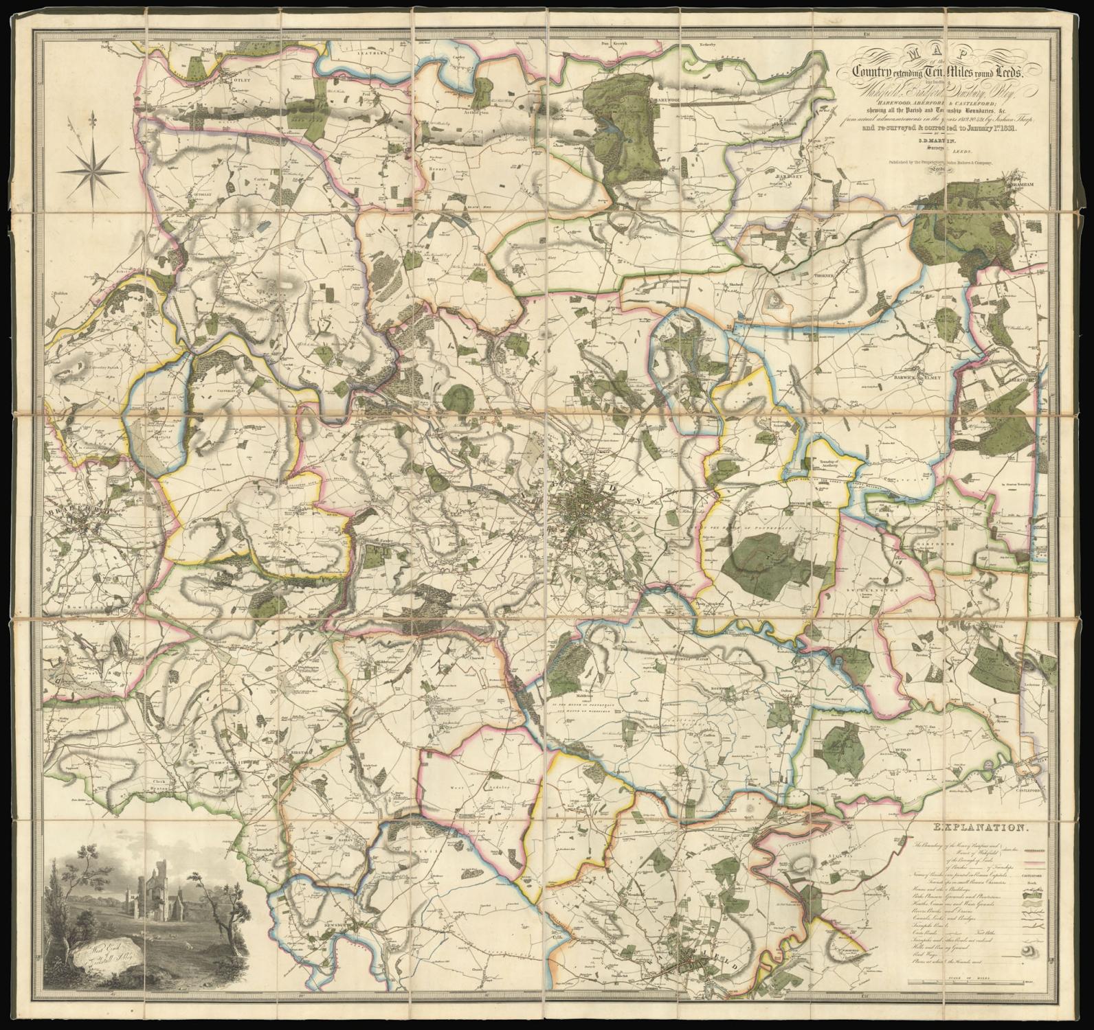
[Yorkshire] Map of the Country extending ten miles around Leeds. Including Wakefield, Bradford, Dewsbury, Otley, Harewood, Aberford & Castleford, shewing all the Parish and Township Boundaries, &c, from actual admeasurements in the years 1819, 20 & 21 by Joshuan Thorp and re-surveyed & corrected to January 1st 1831.
THORP, Joshua and MARTIN, S. D.
Editore: John Baines & Company,, Leeds,, 1831
Mappa
Condizione: Usato
Venduto da Daniel Crouch Rare Books Ltd, London, Regno Unito
Membro dell'associazione:
Venditore AbeBooks dal 7 novembre 2011
Valutazione del venditore 4 su 5 stelle
![]()
Usato
Prezzo:
EUR 2.358,24
Convertire valuta
EUR 22,90
per la spedizione da Regno Unito a U.S.A.
Destinazione, tempi e costi
Quantit�: 1 disponibili
Aggiungere al carrello