
1680 1730 (41 risultati)

Editore: [Musica Musica] [ca 1970], [Basel], 1970
- Brossura
- Spartito
Da: Colin Coleman Music, Stewkley, Regno UnitoColin Coleman Music
Contatta il venditoreVenditore con 5 stelleCondizione: Usato
EUR 21,16
EUR 22,89 spedizioneSpedito da Regno Unito a U.S.A.Quantità: 1 disponibili
Size: Four parts. Folio. Each 24pp. Spiral bound. Facsimile reprint of Walsh and Hare's publication of 1725.

Lingua: Francese
Editore: Paris c. 1728., 1728
- Arte / Stampa / Poster
Da: Antiquariat Steffen Völkel GmbH, Seubersdorf, GermaniaAntiquariat Steffen Völkel GmbH
Contatta il venditoreVenditore con 5 stelleCondizione: Usato
EUR 39,99
EUR 30,00 spedizioneSpedito da Germania a U.S.A.Quantità: 1 disponibili
Schöner, großformatiger Kupferstich. -- Blatt-Maße: ca. 54 x 40 cm. Plattenmaße: ca. 45 x 34 cm. -- im Außenrand leicht fleckig, sonst gut erhalten. || Beautiful, large copper engraving -- slightly stained on the outer margin, otherwise in good condition. // Wir, das Antiquariat Steffen Völkel, kaufen und verkaufen alte Bücher,…Handschriften, Zeichnungen, Autographen, Grafiken und Fotografien. Wir sind stets am Ankauf von kompletten Bibliotheken, Sammlungen und Nachlässen interessiert. Sprache: Französisch Gewicht in Gramm: 35.

"Moyse trouvé sur le Nil" - Moses Mose Nil Nile Rettung saving
Simon Vallée (1680-1730 after) und Giovanni Francesco Romanelli (1610-1662):
Lingua: Francese
Editore: Paris c. 1729., 1729
- Arte / Stampa / Poster
Da: Antiquariat Steffen Völkel GmbH, Seubersdorf, GermaniaAntiquariat Steffen Völkel GmbH
Contatta il venditoreVenditore con 5 stelleCondizione: Usato
EUR 49,99
EUR 30,00 spedizioneSpedito da Germania a U.S.A.Quantità: 1 disponibili
Schöner, großformatiger Kupferstich. -- Blatt-Maße: ca. 54 x 40 cm. Plattenmaße: ca. 45 x 30 cm. -- gut erhalten. || Beautiful, large copper engraving -- in good condition. // Wir, das Antiquariat Steffen Völkel, kaufen und verkaufen alte Bücher, Handschriften, Zeichnungen, Autographen, Grafiken und Fotografien. Wir sind stets a…m Ankauf von kompletten Bibliotheken, Sammlungen und Nachlässen interessiert. Sprache: Französisch Gewicht in Gramm: 15.

"Resurrrection du Lazarus" - Raising of Lazarus
Simon de la Vallee (1680-c.1730) und Girolamo Muziano (1532-1592):
Lingua: Tedesco
Editore: Paris c. 1728., 1728
- Arte / Stampa / Poster
Da: Antiquariat Steffen Völkel GmbH, Seubersdorf, GermaniaAntiquariat Steffen Völkel GmbH
Contatta il venditoreVenditore con 5 stelleCondizione: Usato
EUR 29,99
EUR 30,00 spedizioneSpedito da Germania a U.S.A.Quantità: 1 disponibili
Großer original Kupferstich von Simon de la Vallee (1680-c.1730) nach einem Gemälde/Zeichnung von Girolamo Muziano (1532-1592). -- Von ca. 1728. -- Blatt-Maße: ca. 55 x 40 cm. Plattenmaße: ca. 45 x 33 cm. -- im unteren Blattrand mit hinterlegtem Randeinrissen bis knapp über den Plattenrand, sonst gut erhalten. || Large original…copper engraving by Simon de la Vallee (1680-c.1730) after a painting/drawing by Girolamo Muziano (1532-1592). -- From c. 1728. -- with a deposited tear on the lower margin that goes slightly over the plate margin, otherwise in good condition. || Dies ist ein Original! - Kein Nachdruck! - Keine Kopie! -- This is an original! No copy! - No reprint! // Wir, das Antiquariat Steffen Völkel, kaufen und verkaufen alte Bücher, Handschriften, Zeichnungen, Autographen, Grafiken und Fotografien. Wir sind stets am Ankauf von kompletten Bibliotheken, Sammlungen und Nachlässen interessiert. Sprache: Deutsch Gewicht in Gramm: 1550.

"St. Jean Baptiste" - John the Baptist Johannes der Täufer
Simon de la Vallee (1680-c.1730) und Raphael (1483-1520) (nach):
Lingua: Francese
Editore: Paris c. 1728., 1728
- Arte / Stampa / Poster
Da: Antiquariat Steffen Völkel GmbH, Seubersdorf, GermaniaAntiquariat Steffen Völkel GmbH
Contatta il venditoreVenditore con 5 stelleCondizione: Usato
EUR 79,99
EUR 30,00 spedizioneSpedito da Germania a U.S.A.Quantità: 1 disponibili
Schöner, großformatiger Kupferstich. -- Blatt-Maße: ca. 54 x 40 cm. Plattenmaße: ca. 42 x 31 cm. -- gut erhalten. || Beautiful, large copper engraving -- in good condition. // Wir, das Antiquariat Steffen Völkel, kaufen und verkaufen alte Bücher, Handschriften, Zeichnungen, Autographen, Grafiken und Fotografien. Wir sind stets a…m Ankauf von kompletten Bibliotheken, Sammlungen und Nachlässen interessiert. Sprache: Französisch Gewicht in Gramm: 35.
 Altre immagini
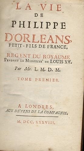
La vie de Philippe d'Orleans, petit-fils de France, Regent du Royaume pendant la minorité de Louis XV. Par Mr. L. M. D. M. Tome premier.
(LA MOTTE, ou LA MOTHE, de, Yves Joseph, dit de La HODE, 1680-1730).
- Rilegato
Da: Libreria Oreste Gozzini snc, Firenze, FI, ItaliaLibreria Oreste Gozzini snc
Contatta il venditoreVenditore con 5 stelleCondizione: Usato
EUR 50,00
EUR 38,00 spedizioneSpedito da Italia a U.S.A.Quantità: 1 disponibili
Londres (ma Amsterdam o l'Aja), aux depens de la Compagnie, 1738, vol. 1 (su 2), in-12, pieno vitello marmorizzato coevo, dorso a 5 nervi con titolo e fregi oro negli scomparti, sguardie marmorizzate, tagli rossi, pp. (4), 343, (1). Frontespizio in rosso e nero. Rade spellature alla cop. posteriore.
Editore: London: printed for 1704. Quarto., A. Baldwin in Warwick-lane,, 1704
Da: Alec R. Allenson, Inc., Westville, FL, U.S.A.Alec R. Allenson, Inc.
Contatta il venditoreVenditore con 4 stelleCondizione: Usato
EUR 121,79
EUR 5,69 spedizioneSpedito in U.S.A.Quantità: 1 disponibili
Pamphlet. 23 p.; 20 cm. Text: Judges 5, 12: Awake, awake, Deborah; awake, awake, utter a Song: arise Barak,and lead thy captivity captive. Worn, unbound. Heavily chipped on margins, not affecting text.

Le Cours du Rhein depuis Rheinberg jusque a Arnheim, ou se trouvent le Duché de Cleves et partie de ce luy de la Gueldres Espagnole et Hollandoise . First edition of the map .
Fer, Nicolas de (1646 - 1720); Pieter Starckman (fl. c. 1680 - 1730), a.k.a Peter or Petrus, engraver
Editore: Paris: chez l'auteur dans l'Isle du Palais sur le quay de l'orloge a la Sphére Royale avec privilége du Roy-1717, 1705
- Arte / Stampa / Poster
Da: Wittenborn Art Books, San Francisco, CA, U.S.A.Wittenborn Art Books
Contatta il venditoreVenditore con 5 stelleCondizione: Usato - Buono
EUR 135,33
EUR 8,76 spedizioneSpedito in U.S.A.Quantità: 1 disponibili
Condizione: Good. Engraved map. 27.3 x 38 cm. Contemporary laid paper uniformly time aged.Published in "L'atlas curieux ou Le monde répresénté dans des cartes générales et particulieres du ciel et de la terre, : divisé tant en ses quatre principales parties que par états et provinces et orné par des plans et descriptions des vil…les capitales et principales et des plus superbes edifices qui les embelissent comme sont les eglises, les palais, les maisons de plaisance, les iardins, les fontaines &c. ". OCLC Number / Unique Identifier:79022119.LThe Atlas Curieux is geographic encyclopedia of images and maps of France, with detailed views of the grand waterworks at Marly, views of the great palaces and chateaux, views and plans of the Paris Observatory, and samples of military architecture. Issued in six annual parts from 1700-1705, the maps are based on the new observations of the Académie des Sciences, and drawn up with the assistance of Philipe de La Hire.ibrary of Congress:The French cartographer and engraver, Nicolas de Fer, was a master at creating maps that were works of art. The maps that he published were printed during the Baroque period when the decorative arts were characterized by ornate detail. De Fer's detailed maps and atlases were valued more for their decorative content than their geographical accuracy.Nicolas de Fer was born in 1646. His father, Antoine de Fer, owned a mapmaking firm. At the age of twelve, Nicolas was apprenticed to a Parisian engraver named Louis Spirinx. The family business was starting to decline when his father died in 1673. Nicolas de Fer's mother, Genevieve, took over the business after the death of her husband. In 1687 the business was passed on to Nicolas and the profits increased after he took over the firm. Nicolas de Fer was a prolific cartographer who produced atlases and hundreds of single maps. He eventually became the official geographer to King Louis XIV of France and King Philip V of Spain.One of de Fer's major works is an atlas titled L'atlas curieux (The curious atlas).

Les Environs de Landau. Par N. de Fer . First edition of the map .
Fer, Nicolas de (1646 - 1720); Pieter Starckman (fl. c. 1680 - 1730), a.k.a Peter or Petrus, engraver
Editore: Paris: chez l'auteur dans l'Isle du Palais sur le quay de l'orloge a la Sphére Royale avec privilége du Roy-1717, 1705
- Arte / Stampa / Poster
Da: Wittenborn Art Books, San Francisco, CA, U.S.A.Wittenborn Art Books
Contatta il venditoreVenditore con 5 stelleCondizione: Usato - Buono
EUR 135,33
EUR 8,76 spedizioneSpedito in U.S.A.Quantità: 1 disponibili
Condizione: Good. Engraved map. 27.3 x 38 cm. Contemporary laid paper uniformly time aged.Loss fof paper and borderline upper left.Published in "L'atlas curieux ou Le monde répresénté dans des cartes générales et particulieres du ciel et de la terre, : divisé tant en ses quatre principales parties que par états et provinces et o…rné par des plans et descriptions des villes capitales et principales et des plus superbes edifices qui les embelissent comme sont les eglises, les palais, les maisons de plaisance, les iardins, les fontaines &c. ". OCLC Number / Unique Identifier:79022119.LThe Atlas Curieux is geographic encyclopedia of images and maps of France, with detailed views of the grand waterworks at Marly, views of the great palaces and chateaux, views and plans of the Paris Observatory, and samples of military architecture. Issued in six annual parts from 1700-1705, the maps are based on the new observations of the Académie des Sciences, and drawn up with the assistance of Philipe de La Hire.ibrary of Congress:The French cartographer and engraver, Nicolas de Fer, was a master at creating maps that were works of art. The maps that he published were printed during the Baroque period when the decorative arts were characterized by ornate detail. De Fer's detailed maps and atlases were valued more for their decorative content than their geographical accuracy.Nicolas de Fer was born in 1646. His father, Antoine de Fer, owned a mapmaking firm. At the age of twelve, Nicolas was apprenticed to a Parisian engraver named Louis Spirinx. The family business was starting to decline when his father died in 1673. Nicolas de Fer's mother, Genevieve, took over the business after the death of her husband. In 1687 the business was passed on to Nicolas and the profits increased after he took over the firm. Nicolas de Fer was a prolific cartographer who produced atlases and hundreds of single maps. He eventually became the official geographer to King Louis XIV of France and King Philip V of Spain.One of de Fer's major works is an atlas titled L'atlas curieux (The curious atlas).

La Haute Gueldres ou se trouvent les Environs de Gueldres, Venlo et Ruremonde . . First edition of the map.
Fer, Nicolas de (1646 - 1720); Pieter Starckman (fl. c. 1680 - 1730), a.k.a Peter or Petrus, engraver
Editore: Paris: chez l'auteur dans l'Isle du Palais sur le quay de l'orloge a la Sphére Royale avec privilége du Roy-1717, 1705
- Arte / Stampa / Poster
Da: Wittenborn Art Books, San Francisco, CA, U.S.A.Wittenborn Art Books
Contatta il venditoreVenditore con 5 stelleCondizione: Usato - Buono
EUR 135,33
EUR 8,76 spedizioneSpedito in U.S.A.Quantità: 1 disponibili
Condizione: Good. Engraved map. One fold. Worm hole in lower margin 27.3 x 38 cm. Contemporary laid paper uniformly time aged.Published in "L'atlas curieux ou Le monde répresénté dans des cartes générales et particulieres du ciel et de la terre, : divisé tant en ses quatre principales parties que par états et provinces et orné p…ar des plans et descriptions des villes capitales et principales et des plus superbes edifices qui les embelissent comme sont les eglises, les palais, les maisons de plaisance, les iardins, les fontaines &c. ". OCLC Number / Unique Identifier:79022119.LThe Atlas Curieux is geographic encyclopedia of images and maps of France, with detailed views of the grand waterworks at Marly, views of the great palaces and chateaux, views and plans of the Paris Observatory, and samples of military architecture. Issued in six annual parts from 1700-1705, the maps are based on the new observations of the Académie des Sciences, and drawn up with the assistance of Philipe de La Hire.ibrary of Congress:The French cartographer and engraver, Nicolas de Fer, was a master at creating maps that were works of art. The maps that he published were printed during the Baroque period when the decorative arts were characterized by ornate detail. De Fer's detailed maps and atlases were valued more for their decorative content than their geographical accuracy.Nicolas de Fer was born in 1646. His father, Antoine de Fer, owned a mapmaking firm. At the age of twelve, Nicolas was apprenticed to a Parisian engraver named Louis Spirinx. The family business was starting to decline when his father died in 1673. Nicolas de Fer's mother, Genevieve, took over the business after the death of her husband. In 1687 the business was passed on to Nicolas and the profits increased after he took over the firm. Nicolas de Fer was a prolific cartographer who produced atlases and hundreds of single maps. He eventually became the official geographer to King Louis XIV of France and King Philip V of Spain.One of de Fer's major works is an atlas titled L'atlas curieux (The curious atlas).

Le cours du Rhein depuis Cologne, jusques a Rheinberg : ou se trouvent le bas electorat de Cologne, partie des duchez de Iuliers, de Berg, et de Gueldres et le comté de Meurs . Par N. de Fer . First edition of the map .
Fer, Nicolas de (1646 - 1720); Pieter Starckman (fl. c. 1680 - 1730), a.k.a Peter or Petrus, engraver
Editore: Paris: chez l'auteur dans l'Isle du Palais sur le quay de l'orloge a la Sphére Royale avec privilége du Roy-1717, 1705
- Arte / Stampa / Poster
Da: Wittenborn Art Books, San Francisco, CA, U.S.A.Wittenborn Art Books
Contatta il venditoreVenditore con 5 stelleCondizione: Usato - Buono
EUR 135,33
EUR 8,76 spedizioneSpedito in U.S.A.Quantità: 1 disponibili
Condizione: Good. Engraved map. 27.3 x 38 cm. Contemporary laid paper uniformly time aged.Published in "L'atlas curieux ou Le monde répresénté dans des cartes générales et particulieres du ciel et de la terre, : divisé tant en ses quatre principales parties que par états et provinces et orné par des plans et descriptions des vil…les capitales et principales et des plus superbes edifices qui les embelissent comme sont les eglises, les palais, les maisons de plaisance, les iardins, les fontaines &c. ". OCLC Number / Unique Identifier:79022119.LThe Atlas Curieux is geographic encyclopedia of images and maps of France, with detailed views of the grand waterworks at Marly, views of the great palaces and chateaux, views and plans of the Paris Observatory, and samples of military architecture. Issued in six annual parts from 1700-1705, the maps are based on the new observations of the Académie des Sciences, and drawn up with the assistance of Philipe de La Hire.ibrary of Congress:The French cartographer and engraver, Nicolas de Fer, was a master at creating maps that were works of art. The maps that he published were printed during the Baroque period when the decorative arts were characterized by ornate detail. De Fer's detailed maps and atlases were valued more for their decorative content than their geographical accuracy.Nicolas de Fer was born in 1646. His father, Antoine de Fer, owned a mapmaking firm. At the age of twelve, Nicolas was apprenticed to a Parisian engraver named Louis Spirinx. The family business was starting to decline when his father died in 1673. Nicolas de Fer's mother, Genevieve, took over the business after the death of her husband. In 1687 the business was passed on to Nicolas and the profits increased after he took over the firm. Nicolas de Fer was a prolific cartographer who produced atlases and hundreds of single maps. He eventually became the official geographer to King Louis XIV of France and King Philip V of Spain.One of de Fer's major works is an atlas titled L'atlas curieux (The curious atlas).

Le Cours Du Rhein, depuis Coblens Jusques a Cologne : ou se trouvent partie des Archevêchez et Electorats de Treves, et de Cologne, et partie des Duchez de Juliers et de Berg . Par N. de Fer . First edition of the map .
Fer, Nicolas de (1646 - 1720); Pieter Starckman (fl. c. 1680 - 1730), a.k.a Peter or Petrus, engraver
Editore: Paris: chez l'auteur dans l'Isle du Palais sur le quay de l'orloge a la Sphére Royale avec privilége du Roy-1717, 1705
- Arte / Stampa / Poster
Da: Wittenborn Art Books, San Francisco, CA, U.S.A.Wittenborn Art Books
Contatta il venditoreVenditore con 5 stelleCondizione: Usato - Buono
EUR 135,33
EUR 8,76 spedizioneSpedito in U.S.A.Quantità: 1 disponibili
Condizione: Good. Engraved map. 27.3 x 38 cm. Contemporary laid paper uniformly time aged.Published in "L'atlas curieux ou Le monde répresénté dans des cartes générales et particulieres du ciel et de la terre, : divisé tant en ses quatre principales parties que par états et provinces et orné par des plans et descriptions des vil…les capitales et principales et des plus superbes edifices qui les embelissent comme sont les eglises, les palais, les maisons de plaisance, les iardins, les fontaines &c. ". OCLC Number / Unique Identifier:79022119.LThe Atlas Curieux is geographic encyclopedia of images and maps of France, with detailed views of the grand waterworks at Marly, views of the great palaces and chateaux, views and plans of the Paris Observatory, and samples of military architecture. Issued in six annual parts from 1700-1705, the maps are based on the new observations of the Académie des Sciences, and drawn up with the assistance of Philipe de La Hire.ibrary of Congress:The French cartographer and engraver, Nicolas de Fer, was a master at creating maps that were works of art. The maps that he published were printed during the Baroque period when the decorative arts were characterized by ornate detail. De Fer's detailed maps and atlases were valued more for their decorative content than their geographical accuracy.Nicolas de Fer was born in 1646. His father, Antoine de Fer, owned a mapmaking firm. At the age of twelve, Nicolas was apprenticed to a Parisian engraver named Louis Spirinx. The family business was starting to decline when his father died in 1673. Nicolas de Fer's mother, Genevieve, took over the business after the death of her husband. In 1687 the business was passed on to Nicolas and the profits increased after he took over the firm. Nicolas de Fer was a prolific cartographer who produced atlases and hundreds of single maps. He eventually became the official geographer to King Louis XIV of France and King Philip V of Spain.One of de Fer's major works is an atlas titled L'atlas curieux (The curious atlas).

Plan des environs de Dunkerque et de Mardick, avec le nouveau canal fait pour l'écoulement des Eaux du paîs etles canaux qui envoient leurs embouchures à la Mer par N. de Fer. 1714. First edition of the map .
Fer, Nicolas de (1646 - 1720); Pieter Starckman (fl. c. 1680 - 1730), a.k.a Peter or Petrus, engraver
Editore: Paris: chez l'auteur dans l'Isle du Palais sur le quay de l'orloge a la Sphére Royale avec privilége du Roy-1717, 1714
- Arte / Stampa / Poster
Da: Wittenborn Art Books, San Francisco, CA, U.S.A.Wittenborn Art Books
Contatta il venditoreVenditore con 5 stelleCondizione: Usato - Buono
EUR 135,33
EUR 8,76 spedizioneSpedito in U.S.A.Quantità: 1 disponibili
Condizione: Good. Engraved map. 27.3 x 38cm. Contemporary laid paper uniformly time aged.Published in "L'atlas curieux ou Le monde répresénté dans des cartes générales et particulieres du ciel et de la terre, : divisé tant en ses quatre principales parties que par états et provinces et orné par des plans et descriptions des vill…es capitales et principales et des plus superbes edifices qui les embelissent comme sont les eglises, les palais, les maisons de plaisance, les iardins, les fontaines &c. ". OCLC Number / Unique Identifier:79022119.LThe Atlas Curieux is geographic encyclopedia of images and maps of France, with detailed views of the grand waterworks at Marly, views of the great palaces and chateaux, views and plans of the Paris Observatory, and samples of military architecture. Issued in six annual parts from 1700-1705, the maps are based on the new observations of the Académie des Sciences, and drawn up with the assistance of Philipe de La Hire.ibrary of Congress:The French cartographer and engraver, Nicolas de Fer, was a master at creating maps that were works of art. The maps that he published were printed during the Baroque period when the decorative arts were characterized by ornate detail. De Fer's detailed maps and atlases were valued more for their decorative content than their geographical accuracy.Nicolas de Fer was born in 1646. His father, Antoine de Fer, owned a mapmaking firm. At the age of twelve, Nicolas was apprenticed to a Parisian engraver named Louis Spirinx. The family business was starting to decline when his father died in 1673. Nicolas de Fer's mother, Genevieve, took over the business after the death of her husband. In 1687 the business was passed on to Nicolas and the profits increased after he took over the firm. Nicolas de Fer was a prolific cartographer who produced atlases and hundreds of single maps. He eventually became the official geographer to King Louis XIV of France and King Philip V of Spain.One of de Fer's major works is an atlas titled L'atlas curieux (The curious atlas).

Le cours du Rhein depuis Mayence jusques a Coblens : ou se trouvent partie des estats de Treves, de Mayence et du palatinat du Rhein, les comtes de Cazenellenbogen et de Spanheim &c. Par N. de Fer . First edition of the map .
Fer, Nicolas de (1646 - 1720); Pieter Starckman (fl. c. 1680 - 1730), a.k.a Peter or Petrus, engraver
Editore: Paris: chez l'auteur dans l'Isle du Palais sur le quay de l'orloge a la Sphére Royale avec privilége du Roy-1717, 1705
- Arte / Stampa / Poster
Da: Wittenborn Art Books, San Francisco, CA, U.S.A.Wittenborn Art Books
Contatta il venditoreVenditore con 5 stelleCondizione: Usato - Buono
EUR 135,33
EUR 8,76 spedizioneSpedito in U.S.A.Quantità: 1 disponibili
Condizione: Good. Engraved map. 27.3 x 38 cm. Contemporary laid paper uniformly time aged.Published in "L'atlas curieux ou Le monde répresénté dans des cartes générales et particulieres du ciel et de la terre, : divisé tant en ses quatre principales parties que par états et provinces et orné par des plans et descriptions des vil…les capitales et principales et des plus superbes edifices qui les embelissent comme sont les eglises, les palais, les maisons de plaisance, les iardins, les fontaines &c. ". OCLC Number / Unique Identifier:79022119.LThe Atlas Curieux is geographic encyclopedia of images and maps of France, with detailed views of the grand waterworks at Marly, views of the great palaces and chateaux, views and plans of the Paris Observatory, and samples of military architecture. Issued in six annual parts from 1700-1705, the maps are based on the new observations of the Académie des Sciences, and drawn up with the assistance of Philipe de La Hire.ibrary of Congress:The French cartographer and engraver, Nicolas de Fer, was a master at creating maps that were works of art. The maps that he published were printed during the Baroque period when the decorative arts were characterized by ornate detail. De Fer's detailed maps and atlases were valued more for their decorative content than their geographical accuracy.Nicolas de Fer was born in 1646. His father, Antoine de Fer, owned a mapmaking firm. At the age of twelve, Nicolas was apprenticed to a Parisian engraver named Louis Spirinx. The family business was starting to decline when his father died in 1673. Nicolas de Fer's mother, Genevieve, took over the business after the death of her husband. In 1687 the business was passed on to Nicolas and the profits increased after he took over the firm. Nicolas de Fer was a prolific cartographer who produced atlases and hundreds of single maps. He eventually became the official geographer to King Louis XIV of France and King Philip V of Spain.One of de Fer's major works is an atlas titled L'atlas curieux (The curious atlas).

Les Asturies et La Biscaye Les Royaume de Navarre, D'Arragon Et De Leon Et Celuy De La Vielle Castille. Par N. de Fer. First edition of the map .
Fer, Nicolas de (1646 - 1720); Pieter Starckman (fl. c. 1680 - 1730), a.k.a Peter or Petrus, engraver
Editore: Paris: chez l'auteur dans l'Isle du Palais sur le quay de l'orloge a la Sphére Royale avec privilége du Roy-1717, 1714
- Arte / Stampa / Poster
Da: Wittenborn Art Books, San Francisco, CA, U.S.A.Wittenborn Art Books
Contatta il venditoreVenditore con 5 stelleCondizione: Usato - Buono
EUR 135,33
EUR 8,76 spedizioneSpedito in U.S.A.Quantità: 1 disponibili
Condizione: Good. Engraved map. 27.3 x 38cm and 27.3 x 39.5cm. Fold on right side.lContemporary laid paper uniformly time aged.Published in "L'atlas curieux ou Le monde répresénté dans des cartes générales et particulieres du ciel et de la terre, : divisé tant en ses quatre principales parties que par états et provinces et orné…par des plans et descriptions des villes capitales et principales et des plus superbes edifices qui les embelissent comme sont les eglises, les palais, les maisons de plaisance, les iardins, les fontaines &c. ". OCLC Number / Unique Identifier:79022119.LThe Atlas Curieux is geographic encyclopedia of images and maps of France, with detailed views of the grand waterworks at Marly, views of the great palaces and chateaux, views and plans of the Paris Observatory, and samples of military architecture. Issued in six annual parts from 1700-1705, the maps are based on the new observations of the Académie des Sciences, and drawn up with the assistance of Philipe de La Hire.ibrary of Congress:The French cartographer and engraver, Nicolas de Fer, was a master at creating maps that were works of art. The maps that he published were printed during the Baroque period when the decorative arts were characterized by ornate detail. De Fer's detailed maps and atlases were valued more for their decorative content than their geographical accuracy.Nicolas de Fer was born in 1646. His father, Antoine de Fer, owned a mapmaking firm. At the age of twelve, Nicolas was apprenticed to a Parisian engraver named Louis Spirinx. The family business was starting to decline when his father died in 1673. Nicolas de Fer's mother, Genevieve, took over the business after the death of her husband. In 1687 the business was passed on to Nicolas and the profits increased after he took over the firm. Nicolas de Fer was a prolific cartographer who produced atlases and hundreds of single maps. He eventually became the official geographer to King Louis XIV of France and King Philip V of Spain.One of de Fer's major works is an atlas titled L'atlas curieux (The curious atlas).

La Partie Septentrionale de la Seigneurie de L'Eveche de Liege et le Limbourg Hollandois ou se trouvement les Environs de Maestricht. . First edition of the map.
Fer, Nicolas de (1646 - 1720); Pieter Starckman (fl. c. 1680 - 1730), a.k.a Peter or Petrus, engraver
Editore: Paris: chez l'auteur dans l'Isle du Palais sur le quay de l'orloge a la Sphére Royale avec privilége du Roy-1717, 1705
- Arte / Stampa / Poster
Da: Wittenborn Art Books, San Francisco, CA, U.S.A.Wittenborn Art Books
Contatta il venditoreVenditore con 5 stelleCondizione: Usato - Buono
EUR 135,33
EUR 8,76 spedizioneSpedito in U.S.A.Quantità: 1 disponibili
Condizione: Good. Engraved map. One fold. Worm hole in lower margin 27.3 x 38 cm. Contemporary laid paper uniformly time aged.Published in "L'atlas curieux ou Le monde répresénté dans des cartes générales et particulieres du ciel et de la terre, : divisé tant en ses quatre principales parties que par états et provinces et orné p…ar des plans et descriptions des villes capitales et principales et des plus superbes edifices qui les embelissent comme sont les eglises, les palais, les maisons de plaisance, les iardins, les fontaines &c. ". OCLC Number / Unique Identifier:79022119.LThe Atlas Curieux is geographic encyclopedia of images and maps of France, with detailed views of the grand waterworks at Marly, views of the great palaces and chateaux, views and plans of the Paris Observatory, and samples of military architecture. Issued in six annual parts from 1700-1705, the maps are based on the new observations of the Académie des Sciences, and drawn up with the assistance of Philipe de La Hire.ibrary of Congress:The French cartographer and engraver, Nicolas de Fer, was a master at creating maps that were works of art. The maps that he published were printed during the Baroque period when the decorative arts were characterized by ornate detail. De Fer's detailed maps and atlases were valued more for their decorative content than their geographical accuracy.Nicolas de Fer was born in 1646. His father, Antoine de Fer, owned a mapmaking firm. At the age of twelve, Nicolas was apprenticed to a Parisian engraver named Louis Spirinx. The family business was starting to decline when his father died in 1673. Nicolas de Fer's mother, Genevieve, took over the business after the death of her husband. In 1687 the business was passed on to Nicolas and the profits increased after he took over the firm. Nicolas de Fer was a prolific cartographer who produced atlases and hundreds of single maps. He eventually became the official geographer to King Louis XIV of France and King Philip V of Spain.One of de Fer's major works is an atlas titled L'atlas curieux (The curious atlas).

Partie Septentrionale Du Duché De Brabant ou se trouve le Quartier d'Anvers &c aux Espagnols, le Marqt. de Bergop-Zoom, La Baronnied de Bred Mairie de Bois le Duc &c. aux Hollandois . . . . First edition of the map .
Fer, Nicolas de (1646 - 1720); Pieter Starckman (fl. c. 1680 - 1730), a.k.a Peter or Petrus, engraver
Editore: Paris: chez l'auteur dans l'Isle du Palais sur le quay de l'orloge a la Sphére Royale avec privilége du Roy-1717, 1714
- Arte / Stampa / Poster
Da: Wittenborn Art Books, San Francisco, CA, U.S.A.Wittenborn Art Books
Contatta il venditoreVenditore con 5 stelleCondizione: Usato - Buono
EUR 135,33
EUR 8,76 spedizioneSpedito in U.S.A.Quantità: 1 disponibili
Condizione: Good. Engraved map. 27.3 x 38cm. Contemporary laid paper uniformly time aged.Published in "L'atlas curieux ou Le monde répresénté dans des cartes générales et particulieres du ciel et de la terre, : divisé tant en ses quatre principales parties que par états et provinces et orné par des plans et descriptions des vill…es capitales et principales et des plus superbes edifices qui les embelissent comme sont les eglises, les palais, les maisons de plaisance, les iardins, les fontaines &c. ". OCLC Number / Unique Identifier:79022119.LThe Atlas Curieux is geographic encyclopedia of images and maps of France, with detailed views of the grand waterworks at Marly, views of the great palaces and chateaux, views and plans of the Paris Observatory, and samples of military architecture. Issued in six annual parts from 1700-1705, the maps are based on the new observations of the Académie des Sciences, and drawn up with the assistance of Philipe de La Hire.ibrary of Congress:The French cartographer and engraver, Nicolas de Fer, was a master at creating maps that were works of art. The maps that he published were printed during the Baroque period when the decorative arts were characterized by ornate detail. De Fer's detailed maps and atlases were valued more for their decorative content than their geographical accuracy.Nicolas de Fer was born in 1646. His father, Antoine de Fer, owned a mapmaking firm. At the age of twelve, Nicolas was apprenticed to a Parisian engraver named Louis Spirinx. The family business was starting to decline when his father died in 1673. Nicolas de Fer's mother, Genevieve, took over the business after the death of her husband. In 1687 the business was passed on to Nicolas and the profits increased after he took over the firm. Nicolas de Fer was a prolific cartographer who produced atlases and hundreds of single maps. He eventually became the official geographer to King Louis XIV of France and King Philip V of Spain.One of de Fer's major works is an atlas titled L'atlas curieux (The curious atlas).

Les Quatre Villes Forestieres, Situees Sur le Rhein, Sont du Cercle de Souabe et a l'Empereur, Par N. de Fer . First edition of the map .
Fer, Nicolas de (1646 - 1720); Pieter Starckman (fl. c. 1680 - 1730), a.k.a Peter or Petrus, engraver
Editore: Paris: chez l'auteur dans l'Isle du Palais sur le quay de l'orloge a la Sphére Royale avec privilége du Roy-1717, 1705
- Arte / Stampa / Poster
Da: Wittenborn Art Books, San Francisco, CA, U.S.A.Wittenborn Art Books
Contatta il venditoreVenditore con 5 stelleCondizione: Usato - Buono
EUR 135,33
EUR 8,76 spedizioneSpedito in U.S.A.Quantità: 1 disponibili
Condizione: Good. Engraved map. 27.3 x 38 cm. Contemporary laid paper uniformly time aged.Published in "L'atlas curieux ou Le monde répresénté dans des cartes générales et particulieres du ciel et de la terre, : divisé tant en ses quatre principales parties que par états et provinces et orné par des plans et descriptions des vil…les capitales et principales et des plus superbes edifices qui les embelissent comme sont les eglises, les palais, les maisons de plaisance, les iardins, les fontaines &c. ". OCLC Number / Unique Identifier:79022119.LThe Atlas Curieux is geographic encyclopedia of images and maps of France, with detailed views of the grand waterworks at Marly, views of the great palaces and chateaux, views and plans of the Paris Observatory, and samples of military architecture. Issued in six annual parts from 1700-1705, the maps are based on the new observations of the Académie des Sciences, and drawn up with the assistance of Philipe de La Hire.ibrary of Congress:The French cartographer and engraver, Nicolas de Fer, was a master at creating maps that were works of art. The maps that he published were printed during the Baroque period when the decorative arts were characterized by ornate detail. De Fer's detailed maps and atlases were valued more for their decorative content than their geographical accuracy.Nicolas de Fer was born in 1646. His father, Antoine de Fer, owned a mapmaking firm. At the age of twelve, Nicolas was apprenticed to a Parisian engraver named Louis Spirinx. The family business was starting to decline when his father died in 1673. Nicolas de Fer's mother, Genevieve, took over the business after the death of her husband. In 1687 the business was passed on to Nicolas and the profits increased after he took over the firm. Nicolas de Fer was a prolific cartographer who produced atlases and hundreds of single maps. He eventually became the official geographer to King Louis XIV of France and King Philip V of Spain.One of de Fer's major works is an atlas titled L'atlas curieux (The curious atlas).

Le cours de la Moselle depuis l'embouchure de la Saare jusques a Cocheim, ou se trouve les environs de Treve et de Traebach. Par N. de Fer. First edition of the map.
Fer, Nicolas de (1646 - 1720); Pieter Starckman (fl. c. 1680 - 1730), a.k.a Peter or Petrus, engraver
Editore: Paris: chez l'auteur dans l'Isle du Palais sur le quay de l'orloge a la Sphére Royale avec privilége du Roy-1717, 1705
- Arte / Stampa / Poster
Da: Wittenborn Art Books, San Francisco, CA, U.S.A.Wittenborn Art Books
Contatta il venditoreVenditore con 5 stelleCondizione: Usato - Buono
EUR 135,33
EUR 8,76 spedizioneSpedito in U.S.A.Quantità: 1 disponibili
Condizione: Good. Engraved map. 27.3 x 38cm. Contemporary laid paper uniformly time aged.Published in "L'atlas curieux ou le monde répresénté dans des cartes générales et particulieres du ciel et de la terre, : divisé tant en ses quatre principales parties que par états et provinces et orné par des plans et descriptions des vill…es capitales et principales et des plus superbes edifices qui les embelissent comme sont les eglises, les palais, les maisons de plaisance, les iardins, les fontaines &c. ". OCLC Number / Unique Identifier:79022119.LThe Atlas Curieux is geographic encyclopedia of images and maps of France, with detailed views of the grand waterworks at Marly, views of the great palaces and chateaux, views and plans of the Paris Observatory, and samples of military architecture. Issued in six annual parts from 1700-1705, the maps are based on the new observations of the Académie des Sciences, and drawn up with the assistance of Philipe de La Hire.ibrary of Congress:The French cartographer and engraver, Nicolas de Fer, was a master at creating maps that were works of art. The maps that he published were printed during the Baroque period when the decorative arts were characterized by ornate detail. De Fer's detailed maps and atlases were valued more for their decorative content than their geographical accuracy.Nicolas de Fer was born in 1646. His father, Antoine de Fer, owned a mapmaking firm. At the age of twelve, Nicolas was apprenticed to a Parisian engraver named Louis Spirinx. The family business was starting to decline when his father died in 1673. Nicolas de Fer's mother, Genevieve, took over the business after the death of her husband. In 1687 the business was passed on to Nicolas and the profits increased after he took over the firm. Nicolas de Fer was a prolific cartographer who produced atlases and hundreds of single maps. He eventually became the official geographer to King Louis XIV of France and King Philip V of Spain.One of de Fer's major works is an atlas titled L'atlas curieux (The curious atlas).

Plan de la bataille de Fredelingue gagnée sur les impériaux par l'armée du roy commandée par Mr. le marquis de Villars le 14 octobre 1702 / mis au jour par N. de Fer . First edition of the map .
Fer, Nicolas de (1646 - 1720); Pieter Starckman (fl. c. 1680 - 1730), a.k.a Peter or Petrus, engraver
Editore: Paris: chez l'auteur dans l'Isle du Palais sur le quay de l'orloge a la Sphére Royale avec privilége du Roy-1717, 1705
- Arte / Stampa / Poster
Da: Wittenborn Art Books, San Francisco, CA, U.S.A.Wittenborn Art Books
Contatta il venditoreVenditore con 5 stelleCondizione: Usato - Buono
EUR 135,33
EUR 8,76 spedizioneSpedito in U.S.A.Quantità: 1 disponibili
Condizione: Good. Engraved map. 27.3 x 38 cm. Contemporary laid paper uniformly time aged.Published in "L'atlas curieux ou Le monde répresénté dans des cartes générales et particulieres du ciel et de la terre, : divisé tant en ses quatre principales parties que par états et provinces et orné par des plans et descriptions des vil…les capitales et principales et des plus superbes edifices qui les embelissent comme sont les eglises, les palais, les maisons de plaisance, les iardins, les fontaines &c. ". OCLC Number / Unique Identifier:79022119.LThe Atlas Curieux is geographic encyclopedia of images and maps of France, with detailed views of the grand waterworks at Marly, views of the great palaces and chateaux, views and plans of the Paris Observatory, and samples of military architecture. Issued in six annual parts from 1700-1705, the maps are based on the new observations of the Académie des Sciences, and drawn up with the assistance of Philipe de La Hire.ibrary of Congress:The French cartographer and engraver, Nicolas de Fer, was a master at creating maps that were works of art. The maps that he published were printed during the Baroque period when the decorative arts were characterized by ornate detail. De Fer's detailed maps and atlases were valued more for their decorative content than their geographical accuracy.Nicolas de Fer was born in 1646. His father, Antoine de Fer, owned a mapmaking firm. At the age of twelve, Nicolas was apprenticed to a Parisian engraver named Louis Spirinx. The family business was starting to decline when his father died in 1673. Nicolas de Fer's mother, Genevieve, took over the business after the death of her husband. In 1687 the business was passed on to Nicolas and the profits increased after he took over the firm. Nicolas de Fer was a prolific cartographer who produced atlases and hundreds of single maps. He eventually became the official geographer to King Louis XIV of France and King Philip V of Spain.One of de Fer's major works is an atlas titled L'atlas curieux (The curious atlas).

Le Cercle de Souabe. Par N. de Fer. First edition of the map.
Fer, Nicolas de (1646 - 1720); Pieter Starckman (fl. c. 1680 - 1730), a.k.a Peter or Petrus, engraver
Editore: Paris: chez l'auteur dans l'Isle du Palais sur le quay de l'orloge a la Sphére Royale avec privilége du Roy-1717, 1705
- Arte / Stampa / Poster
Da: Wittenborn Art Books, San Francisco, CA, U.S.A.Wittenborn Art Books
Contatta il venditoreVenditore con 5 stelleCondizione: Usato - Buono
EUR 135,33
EUR 8,76 spedizioneSpedito in U.S.A.Quantità: 1 disponibili
Condizione: Good. Engraved map. 27.3 x 38cm. Contemporary laid paper uniformly time aged.Published in "L'atlas curieux ou le monde répresénté dans des cartes générales et particulieres du ciel et de la terre, : divisé tant en ses quatre principales parties que par états et provinces et orné par des plans et descriptions des vill…es capitales et principales et des plus superbes edifices qui les embelissent comme sont les eglises, les palais, les maisons de plaisance, les iardins, les fontaines &c. ". OCLC Number / Unique Identifier:79022119.LThe Atlas Curieux is geographic encyclopedia of images and maps of France, with detailed views of the grand waterworks at Marly, views of the great palaces and chateaux, views and plans of the Paris Observatory, and samples of military architecture. Issued in six annual parts from 1700-1705, the maps are based on the new observations of the Académie des Sciences, and drawn up with the assistance of Philipe de La Hire.ibrary of Congress:The French cartographer and engraver, Nicolas de Fer, was a master at creating maps that were works of art. The maps that he published were printed during the Baroque period when the decorative arts were characterized by ornate detail. De Fer's detailed maps and atlases were valued more for their decorative content than their geographical accuracy.Nicolas de Fer was born in 1646. His father, Antoine de Fer, owned a mapmaking firm. At the age of twelve, Nicolas was apprenticed to a Parisian engraver named Louis Spirinx. The family business was starting to decline when his father died in 1673. Nicolas de Fer's mother, Genevieve, took over the business after the death of her husband. In 1687 the business was passed on to Nicolas and the profits increased after he took over the firm. Nicolas de Fer was a prolific cartographer who produced atlases and hundreds of single maps. He eventually became the official geographer to King Louis XIV of France and King Philip V of Spain.One of de Fer's major works is an atlas titled L'atlas curieux (The curious atlas).

Les environs de Namur, de Huy et de Charle-Roy ou se trouve encore La Hasbaye. . . . First edition of the map.
Fer, Nicolas de (1646 - 1720); Pieter Starckman (fl. c. 1680 - 1730), a.k.a Peter or Petrus, engraver
Editore: Paris: chez l'auteur dans l'Isle du Palais sur le quay de l'orloge a la Sphére Royale avec privilége du Roy-1717, 1714
- Arte / Stampa / Poster
Da: Wittenborn Art Books, San Francisco, CA, U.S.A.Wittenborn Art Books
Contatta il venditoreVenditore con 5 stelleCondizione: Usato - Buono
EUR 180,43
EUR 8,76 spedizioneSpedito in U.S.A.Quantità: 1 disponibili
Condizione: Good. Engraved map. One fold. 27.3 x 51cm. Contemporary laid paper uniformly time aged.Published in "L'atlas curieux ou Le monde répresénté dans des cartes générales et particulieres du ciel et de la terre, : divisé tant en ses quatre principales parties que par états et provinces et orné par des plans et description…s des villes capitales et principales et des plus superbes edifices qui les embelissent comme sont les eglises, les palais, les maisons de plaisance, les iardins, les fontaines &c. ". OCLC Number / Unique Identifier:79022119.LThe Atlas Curieux is geographic encyclopedia of images and maps of France, with detailed views of the grand waterworks at Marly, views of the great palaces and chateaux, views and plans of the Paris Observatory, and samples of military architecture. Issued in six annual parts from 1700-1705, the maps are based on the new observations of the Académie des Sciences, and drawn up with the assistance of Philipe de La Hire.ibrary of Congress:The French cartographer and engraver, Nicolas de Fer, was a master at creating maps that were works of art. The maps that he published were printed during the Baroque period when the decorative arts were characterized by ornate detail. De Fer's detailed maps and atlases were valued more for their decorative content than their geographical accuracy.Nicolas de Fer was born in 1646. His father, Antoine de Fer, owned a mapmaking firm. At the age of twelve, Nicolas was apprenticed to a Parisian engraver named Louis Spirinx. The family business was starting to decline when his father died in 1673. Nicolas de Fer's mother, Genevieve, took over the business after the death of her husband. In 1687 the business was passed on to Nicolas and the profits increased after he took over the firm. Nicolas de Fer was a prolific cartographer who produced atlases and hundreds of single maps. He eventually became the official geographer to King Louis XIV of France and King Philip V of Spain.One of de Fer's major works is an atlas titled L'atlas curieux (The curious atlas).

Description de L'Allemagne [with] L'Allemagne divisé par Cercles., par N. de Fer. First edition of the map and text.
Fer, Nicolas de (1646 - 1720); Pieter Starckman (fl. c. 1680 - 1730), a.k.a Peter or Petrus, engraver
Editore: Paris: chez l'auteur dans l'Isle du Palais sur le quay de l'orloge a la Sphére Royale avec privilége du Roy-1717, 1705
- Arte / Stampa / Poster
Da: Wittenborn Art Books, San Francisco, CA, U.S.A.Wittenborn Art Books
Contatta il venditoreVenditore con 5 stelleCondizione: Usato - Buono
EUR 225,54
EUR 8,76 spedizioneSpedito in U.S.A.Quantità: 1 disponibili
Condizione: Good. Engraved text broadside and engraved map.Each 27.3 x 38cm. Contemporary laid paper uniformly time aged.Published in "L'atlas curieux ou Le monde répresénté dans des cartes générales et particulieres du ciel et de la terre, : divisé tant en ses quatre principales parties que par états et provinces et orné par de…s plans et descriptions des villes capitales et principales et des plus superbes edifices qui les embelissent comme sont les eglises, les palais, les maisons de plaisance, les iardins, les fontaines &c. ". OCLC Number / Unique Identifier:79022119.LThe Atlas Curieux is geographic encyclopedia of images and maps of France, with detailed views of the grand waterworks at Marly, views of the great palaces and chateaux, views and plans of the Paris Observatory, and samples of military architecture. Issued in six annual parts from 1700-1705, the maps are based on the new observations of the Académie des Sciences, and drawn up with the assistance of Philipe de La Hire.ibrary of Congress:The French cartographer and engraver, Nicolas de Fer, was a master at creating maps that were works of art. The maps that he published were printed during the Baroque period when the decorative arts were characterized by ornate detail. De Fer's detailed maps and atlases were valued more for their decorative content than their geographical accuracy.Nicolas de Fer was born in 1646. His father, Antoine de Fer, owned a mapmaking firm. At the age of twelve, Nicolas was apprenticed to a Parisian engraver named Louis Spirinx. The family business was starting to decline when his father died in 1673. Nicolas de Fer's mother, Genevieve, took over the business after the death of her husband. In 1687 the business was passed on to Nicolas and the profits increased after he took over the firm. Nicolas de Fer was a prolific cartographer who produced atlases and hundreds of single maps. He eventually became the official geographer to King Louis XIV of France and King Philip V of Spain.One of de Fer's major works is an atlas titled L'atlas curieux (The curious atlas).

Les environs de Dinant de Philippeville, et de Charlemont ou se Trouve encoreLe Condros. . . First edition of the map.
Fer, Nicolas de (1646 - 1720); Pieter Starckman (fl. c. 1680 - 1730), a.k.a Peter or Petrus, engraver
Editore: Paris: chez l'auteur dans l'Isle du Palais sur le quay de l'orloge a la Sphére Royale avec privilége du Roy-1717, 1705
- Arte / Stampa / Poster
Da: Wittenborn Art Books, San Francisco, CA, U.S.A.Wittenborn Art Books
Contatta il venditoreVenditore con 5 stelleCondizione: Usato - Buono
EUR 225,54
EUR 8,76 spedizioneSpedito in U.S.A.Quantità: 1 disponibili
Condizione: Good. Engraved map. One fold. Worm holes in lower marginEach 27.3 x 64.2 cm. Contemporary laid paper uniformly time aged.Published in "L'atlas curieux ou Le monde répresénté dans des cartes générales et particulieres du ciel et de la terre, : divisé tant en ses quatre principales parties que par états et provinces et… orné par des plans et descriptions des villes capitales et principales et des plus superbes edifices qui les embelissent comme sont les eglises, les palais, les maisons de plaisance, les iardins, les fontaines &c. ". OCLC Number / Unique Identifier:79022119.LThe Atlas Curieux is geographic encyclopedia of images and maps of France, with detailed views of the grand waterworks at Marly, views of the great palaces and chateaux, views and plans of the Paris Observatory, and samples of military architecture. Issued in six annual parts from 1700-1705, the maps are based on the new observations of the Académie des Sciences, and drawn up with the assistance of Philipe de La Hire.ibrary of Congress:The French cartographer and engraver, Nicolas de Fer, was a master at creating maps that were works of art. The maps that he published were printed during the Baroque period when the decorative arts were characterized by ornate detail. De Fer's detailed maps and atlases were valued more for their decorative content than their geographical accuracy.Nicolas de Fer was born in 1646. His father, Antoine de Fer, owned a mapmaking firm. At the age of twelve, Nicolas was apprenticed to a Parisian engraver named Louis Spirinx. The family business was starting to decline when his father died in 1673. Nicolas de Fer's mother, Genevieve, took over the business after the death of her husband. In 1687 the business was passed on to Nicolas and the profits increased after he took over the firm. Nicolas de Fer was a prolific cartographer who produced atlases and hundreds of single maps. He eventually became the official geographer to King Louis XIV of France and King Philip V of Spain.One of de Fer's major works is an atlas titled L'atlas curieux (The curious atlas).

Description de ce qui c'est passé à la journée de Denain le 24 juillet 1712. par N. de Fer. [with] Pan des retranchemens et du camp de Denain, ou est marqué le passage de l'armée du Roy a Neuville sur l'Escaut : Avec la disposition des troupes françoises a l'attaque de ses retranchemens qui furent forcez le 24 juillet 1712. First edition of the map and text.
Fer, Nicolas de (1646 - 1720); Pieter Starckman (fl. c. 1680 - 1730), a.k.a Peter or Petrus, engraver
Editore: Paris: chez l'auteur dans l'Isle du Palais sur le quay de l'orloge a la Sphére Royale avec privilége du Roy, 1715
- Arte / Stampa / Poster
Da: Wittenborn Art Books, San Francisco, CA, U.S.A.Wittenborn Art Books
Contatta il venditoreVenditore con 5 stelleCondizione: Usato - Buono
EUR 225,54
EUR 8,76 spedizioneSpedito in U.S.A.Quantità: 1 disponibili
Condizione: Good. Engraved text broadside 27.3 x 38cm. and engraved map 38 x 57cm. Top left trimmed to borderline. Contemporary laid paper uniformly time aged.Published in "L'atlas curieux ou Le monde répresénté dans des cartes générales et particulieres du ciel et de la terre, : divisé tant en ses quatre principales parties que… par états et provinces et orné par des plans et descriptions des villes capitales et principales et des plus superbes edifices qui les embelissent comme sont les eglises, les palais, les maisons de plaisance, les iardins, les fontaines &c. ". OCLC Number / Unique Identifier:79022119.LThe Atlas Curieux is geographic encyclopedia of images and maps of France, with detailed views of the grand waterworks at Marly, views of the great palaces and chateaux, views and plans of the Paris Observatory, and samples of military architecture. Issued in six annual parts from 1700-1705, the maps are based on the new observations of the Académie des Sciences, and drawn up with the assistance of Philipe de La Hire.Library of Congress:The French cartographer and engraver, Nicolas de Fer, was a master at creating maps that were works of art. The maps that he published were printed during the Baroque period when the decorative arts were characterized by ornate detail. De Fer's detailed maps and atlases were valued more for their decorative content than their geographical accuracy.Nicolas de Fer was born in 1646. His father, Antoine de Fer, owned a mapmaking firm. At the age of twelve, Nicolas was apprenticed to a Parisian engraver named Louis Spirinx. The family business was starting to decline when his father died in 1673. Nicolas de Fer's mother, Genevieve, took over the business after the death of her husband. In 1687 the business was passed on to Nicolas and the profits increased after he took over the firm. Nicolas de Fer was a prolific cartographer who produced atlases and hundreds of single maps. He eventually became the official geographer to King Louis XIV of France and King Philip V of Spain.One of de Fer's major works is an atlas titled L'atlas curieux (The curious atlas).

Description des Pais-Bas catholiques connus sous le nom de Flandre par N. de Fer. First edition of the map and text.
Fer, Nicolas de (1646 - 1720); Pieter Starckman (fl. c. 1680 - 1730), a.k.a Peter or Petrus, engraver
Editore: Paris: chez l'auteur dans l'Isle du Palais sur le quay de l'orloge a la Sphére Royale avec privilége du Roy-1717, 1705
- Arte / Stampa / Poster
Da: Wittenborn Art Books, San Francisco, CA, U.S.A.Wittenborn Art Books
Contatta il venditoreVenditore con 5 stelleCondizione: Usato - Buono
EUR 225,54
EUR 8,76 spedizioneSpedito in U.S.A.Quantità: 1 disponibili
Condizione: Good. Engraved text broadside and engraved map.Each 27.3 x 38cm. Contemporary laid paper uniformly time aged.Published in "L'atlas curieux ou Le monde répresénté dans des cartes générales et particulieres du ciel et de la terre, : divisé tant en ses quatre principales parties que par états et provinces et orné par de…s plans et descriptions des villes capitales et principales et des plus superbes edifices qui les embelissent comme sont les eglises, les palais, les maisons de plaisance, les iardins, les fontaines &c. ". OCLC Number / Unique Identifier:79022119.LThe Atlas Curieux is geographic encyclopedia of images and maps of France, with detailed views of the grand waterworks at Marly, views of the great palaces and chateaux, views and plans of the Paris Observatory, and samples of military architecture. Issued in six annual parts from 1700-1705, the maps are based on the new observations of the Académie des Sciences, and drawn up with the assistance of Philipe de La Hire.Library of Congress:The French cartographer and engraver, Nicolas de Fer, was a master at creating maps that were works of art. The maps that he published were printed during the Baroque period when the decorative arts were characterized by ornate detail. De Fer's detailed maps and atlases were valued more for their decorative content than their geographical accuracy.Nicolas de Fer was born in 1646. His father, Antoine de Fer, owned a mapmaking firm. At the age of twelve, Nicolas was apprenticed to a Parisian engraver named Louis Spirinx. The family business was starting to decline when his father died in 1673. Nicolas de Fer's mother, Genevieve, took over the business after the death of her husband. In 1687 the business was passed on to Nicolas and the profits increased after he took over the firm. Nicolas de Fer was a prolific cartographer who produced atlases and hundreds of single maps. He eventually became the official geographer to King Louis XIV of France and King Philip V of Spain.One of de Fer's major works is an atlas titled L'atlas curieux (The curious atlas).

Description de L'Embouchure de la Rivière du Tage [and] Embouchure de la Rivière du Tage / Par N. de Fer, Geographe de sa Majesté Catholique . . . Par N. de Fer. First edition of the map and text.
Fer, Nicolas de (1646 - 1720); Pieter Starckman (fl. c. 1680 - 1730), a.k.a Peter or Petrus, engraver
Editore: Paris: chez l'auteur dans l'Isle du Palais sur le quay de l'orloge a la Sphére Royale avec privilége du Roy-1717, 1705
- Arte / Stampa / Poster
Da: Wittenborn Art Books, San Francisco, CA, U.S.A.Wittenborn Art Books
Contatta il venditoreVenditore con 5 stelleCondizione: Usato - Buono
EUR 248,10
EUR 8,76 spedizioneSpedito in U.S.A.Quantità: 1 disponibili
Condizione: Good. Engraved text broadside and engraved map.27.3 x 38cm. and 27.3 x 43cm. Missing piece in lower right corner. Fold mark on right side. Contemporary laid paper uniformly time aged.The Tagus is the longest river in the Iberian Peninsula. The river rises in the Montes Universales between Cuenca and Teruel, in mid-ea…stern Spain, flows 1,007 km, generally westward, and empties into the Atlantic Ocean in Lisbon.Published in "L'atlas curieux ou le monde répresénté dans des cartes générales et particulieres du ciel et de la terre, : divisé tant en ses quatre principales parties que par états et provinces et orné par des plans et descriptions des villes capitales et principales et des plus superbes edifices qui les embelissent comme sont les eglises, les palais, les maisons de plaisance, les iardins, les fontaines &c. ". OCLC Number / Unique Identifier:79022119.LThe Atlas Curieux is geographic encyclopedia of images and maps of France, with detailed views of the grand waterworks at Marly, views of the great palaces and chateaux, views and plans of the Paris Observatory, and samples of military architecture. Issued in six annual parts from 1700-1705, the maps are based on the new observations of the Académie des Sciences, and drawn up with the assistance of Philipe de La Hire.Library of Congress:The French cartographer and engraver, Nicolas de Fer, was a master at creating maps that were works of art. The maps that he published were printed during the Baroque period when the decorative arts were characterized by ornate detail. De Fer's detailed maps and atlases were valued more for their decorative content than their geographical accuracy.Nicolas de Fer was born in 1646. His father, Antoine de Fer, owned a mapmaking firm. At the age of twelve, Nicolas was apprenticed to a Parisian engraver named Louis Spirinx. The family business was starting to decline when his father died in 1673. Nicolas de Fer's mother, Genevieve, took over the business after the death of her husband. In 1687 the business was passed on to Nicolas and the profits increased after he took over the firm. Nicolas de Fer was a prolific cartographer who produced atlases and hundreds of single maps. He eventually became the official geographer to King Louis XIV of France and King Philip V of Spain.One of de Fer's major works is an atlas titled L'atlas curieux (The curious atlas).

Description de Mont-Serrat [and] Maison et Chambre Angelique de la Vierge Marie de Mont-Serrat Situee en Catalogne a Sept lieues et au Nord de Barcelone . . . 1705. Par N. de Fer. First edition of the map and text.
Fer, Nicolas de (1646 - 1720); Pieter Starckman (fl. c. 1680 - 1730), a.k.a Peter or Petrus, engraver
Editore: Paris: chez l'auteur dans l'Isle du Palais sur le quay de l'orloge a la Sphére Royale avec privilége du Roy-1717, 1705
- Arte / Stampa / Poster
Da: Wittenborn Art Books, San Francisco, CA, U.S.A.Wittenborn Art Books
Contatta il venditoreVenditore con 5 stelleCondizione: Usato - Buono
EUR 248,10
EUR 8,76 spedizioneSpedito in U.S.A.Quantità: 1 disponibili
Condizione: Good. Engraved text broadside and engraved map.Each 27.3 x 38cm. Contemporary laid paper uniformly time aged.Published in "L'atlas curieux ou le monde répresénté dans des cartes générales et particulieres du ciel et de la terre, : divisé tant en ses quatre principales parties que par états et provinces et orné par de…s plans et descriptions des villes capitales et principales et des plus superbes edifices qui les embelissent comme sont les eglises, les palais, les maisons de plaisance, les iardins, les fontaines &c. ". OCLC Number / Unique Identifier:79022119.LThe Atlas Curieux is geographic encyclopedia of images and maps of France, with detailed views of the grand waterworks at Marly, views of the great palaces and chateaux, views and plans of the Paris Observatory, and samples of military architecture. Issued in six annual parts from 1700-1705, the maps are based on the new observations of the Académie des Sciences, and drawn up with the assistance of Philipe de La Hire.Library of Congress:The French cartographer and engraver, Nicolas de Fer, was a master at creating maps that were works of art. The maps that he published were printed during the Baroque period when the decorative arts were characterized by ornate detail. De Fer's detailed maps and atlases were valued more for their decorative content than their geographical accuracy.Nicolas de Fer was born in 1646. His father, Antoine de Fer, owned a mapmaking firm. At the age of twelve, Nicolas was apprenticed to a Parisian engraver named Louis Spirinx. The family business was starting to decline when his father died in 1673. Nicolas de Fer's mother, Genevieve, took over the business after the death of her husband. In 1687 the business was passed on to Nicolas and the profits increased after he took over the firm. Nicolas de Fer was a prolific cartographer who produced atlases and hundreds of single maps. He eventually became the official geographer to King Louis XIV of France and King Philip V of Spain.One of de Fer's major works is an atlas titled L'atlas curieux (The curious atlas).

Description de La Bataille d'Almanza [and] Bataille d'Almanza dans le Royaume de Valence ou l'armée des allies fut deffaite par celle des deux couronnes le 25 avril 1707 / Par N. de Fer. First edition of the map and text.
Fer, Nicolas de (1646 - 1720); Pieter Starckman (fl. c. 1680 - 1730), a.k.a Peter or Petrus, engraver
Editore: Paris: chez l'auteur dans l'Isle du Palais sur le quay de l'orloge a la Sphére Royale avec privilége du Roy-1717, 1705
- Arte / Stampa / Poster
Da: Wittenborn Art Books, San Francisco, CA, U.S.A.Wittenborn Art Books
Contatta il venditoreVenditore con 5 stelleCondizione: Usato - Buono
EUR 248,10
EUR 8,76 spedizioneSpedito in U.S.A.Quantità: 1 disponibili
Condizione: Good. Engraved text broadside and engraved map.Each 27.3 x 38cm. Contemporary laid paper uniformly time aged.Published in "L'atlas curieux ou le monde répresénté dans des cartes générales et particulieres du ciel et de la terre, : divisé tant en ses quatre principales parties que par états et provinces et orné par de…s plans et descriptions des villes capitales et principales et des plus superbes edifices qui les embelissent comme sont les eglises, les palais, les maisons de plaisance, les iardins, les fontaines &c. ". OCLC Number / Unique Identifier:79022119.LThe Atlas Curieux is geographic encyclopedia of images and maps of France, with detailed views of the grand waterworks at Marly, views of the great palaces and chateaux, views and plans of the Paris Observatory, and samples of military architecture. Issued in six annual parts from 1700-1705, the maps are based on the new observations of the Académie des Sciences, and drawn up with the assistance of Philipe de La Hire.Library of Congress:The French cartographer and engraver, Nicolas de Fer, was a master at creating maps that were works of art. The maps that he published were printed during the Baroque period when the decorative arts were characterized by ornate detail. De Fer's detailed maps and atlases were valued more for their decorative content than their geographical accuracy.Nicolas de Fer was born in 1646. His father, Antoine de Fer, owned a mapmaking firm. At the age of twelve, Nicolas was apprenticed to a Parisian engraver named Louis Spirinx. The family business was starting to decline when his father died in 1673. Nicolas de Fer's mother, Genevieve, took over the business after the death of her husband. In 1687 the business was passed on to Nicolas and the profits increased after he took over the firm. Nicolas de Fer was a prolific cartographer who produced atlases and hundreds of single maps. He eventually became the official geographer to King Louis XIV of France and King Philip V of Spain.One of de Fer's major works is an atlas titled L'atlas curieux (The curious atlas).

Description de l'Ulm, et de Munich [and] Plan de la Ville d'Ulm. Par N. de Fer. First edition of the map and text.
Fer, Nicolas de (1646 - 1720); Pieter Starckman (fl. c. 1680 - 1730), a.k.a Peter or Petrus, engraver
Editore: Paris: chez l'auteur dans l'Isle du Palais sur le quay de l'orloge a la Sphére Royale avec privilége du Roy-1717, 1705
- Arte / Stampa / Poster
Da: Wittenborn Art Books, San Francisco, CA, U.S.A.Wittenborn Art Books
Contatta il venditoreVenditore con 5 stelleCondizione: Usato - Buono
EUR 248,10
EUR 8,76 spedizioneSpedito in U.S.A.Quantità: 1 disponibili
Condizione: Good. Engraved text broadside and engraved map.Each 27.3 x 38cm. Contemporary laid paper uniformly time aged.Published in "L'atlas curieux ou le monde répresénté dans des cartes générales et particulieres du ciel et de la terre, : divisé tant en ses quatre principales parties que par états et provinces et orné par de…s plans et descriptions des villes capitales et principales et des plus superbes edifices qui les embelissent comme sont les eglises, les palais, les maisons de plaisance, les iardins, les fontaines &c. ". OCLC Number / Unique Identifier:79022119.LThe Atlas Curieux is geographic encyclopedia of images and maps of France, with detailed views of the grand waterworks at Marly, views of the great palaces and chateaux, views and plans of the Paris Observatory, and samples of military architecture. Issued in six annual parts from 1700-1705, the maps are based on the new observations of the Académie des Sciences, and drawn up with the assistance of Philipe de La Hire.Library of Congress:The French cartographer and engraver, Nicolas de Fer, was a master at creating maps that were works of art. The maps that he published were printed during the Baroque period when the decorative arts were characterized by ornate detail. De Fer's detailed maps and atlases were valued more for their decorative content than their geographical accuracy.Nicolas de Fer was born in 1646. His father, Antoine de Fer, owned a mapmaking firm. At the age of twelve, Nicolas was apprenticed to a Parisian engraver named Louis Spirinx. The family business was starting to decline when his father died in 1673. Nicolas de Fer's mother, Genevieve, took over the business after the death of her husband. In 1687 the business was passed on to Nicolas and the profits increased after he took over the firm. Nicolas de Fer was a prolific cartographer who produced atlases and hundreds of single maps. He eventually became the official geographer to King Louis XIV of France and King Philip V of Spain.One of de Fer's major works is an atlas titled L'atlas curieux (The curious atlas).


