

Importo totale (1 articolo articoli):
Destinazione ordine:

dorling daniel thomas bethan (26 risultati)
Vai alla pagina principale dei risultati di ricerca
Filtri di ricerca
Tipo di articolo
- Tutti i tipi di prodotto
- Libri (26)
- Riviste e Giornali (Nessun altro risultato corrispondente a questo perfezionamento)
- Fumetti (Nessun altro risultato corrispondente a questo perfezionamento)
- Spartiti (Nessun altro risultato corrispondente a questo perfezionamento)
- Arte, Stampe e Poster (Nessun altro risultato corrispondente a questo perfezionamento)
- Fotografie (Nessun altro risultato corrispondente a questo perfezionamento)
- Mappe (Nessun altro risultato corrispondente a questo perfezionamento)
- Manoscritti e Collezionismo cartaceo (Nessun altro risultato corrispondente a questo perfezionamento)
Condizioni Maggiori informazioni
- Nuovo (18)
- Come nuovo, Ottimo o Quasi ottimo (2)
- Molto buono o Buono (6)
- Discreto o Mediocre (Nessun altro risultato corrispondente a questo perfezionamento)
- Come descritto (Nessun altro risultato corrispondente a questo perfezionamento)
Legatura
Ulteriori caratteristiche
- Prima ed. (1)
- Copia autograf. (Nessun altro risultato corrispondente a questo perfezionamento)
- Sovracoperta (Nessun altro risultato corrispondente a questo perfezionamento)
- Con foto (13)
- Non Print on Demand (26)
Lingua (1)
Spedizione gratuita
Paese del venditore
Valutazione venditore
-

People and places: A 2001 Census atlas of the UK
Da: AwesomeBooks, Wallingford, Regno Unito
Valutazione del venditore 5 su 5 stelle

EUR 5,63
Spedizione EUR 4,78
Spedito da Regno Unito a U.S.A.Quantità: 1 disponibili
Aggiungi al carrelloPaperback. Condizione: Very Good. People and places: A 2001 Census atlas of the UK This book is in very good condition and will be shipped within 24 hours of ordering. The cover may have some limited signs of wear but the pages are clean, intact and the spine remains undamaged. This book has clearly been well maintained and looked after thus far. Money back guarantee if you are not satisfied. See all our books here, order more than 1 book and get discounted shipping. .
-
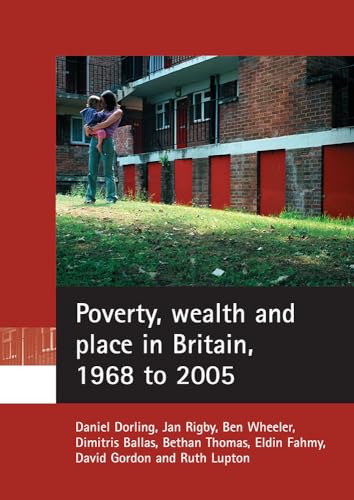
Poverty, Wealth and Place in Britain, 1968 to 2005
Da: Better World Books Ltd, Dunfermline, Regno Unito
Valutazione del venditore 5 su 5 stelle
EUR 5,43
Spedizione EUR 5,80
Spedito da Regno Unito a U.S.A.Quantità: 1 disponibili
Aggiungi al carrelloCondizione: Good. Pages intact with minimal writing/highlighting. The binding may be loose and creased. Dust jackets/supplements are not included. Stock photo provided. Product includes identifying sticker. Better World Books: Buy Books. Do Good.
-
Poverty, Wealth and Place in Britain, 1968 to 2005
Da: Better World Books Ltd, Dunfermline, Regno Unito
Valutazione del venditore 5 su 5 stelle
EUR 5,43
Spedizione EUR 5,80
Spedito da Regno Unito a U.S.A.Quantità: 2 disponibili
Aggiungi al carrelloCondizione: Very Good. Former library copy. Pages intact with possible writing/highlighting. Binding strong with minor wear. Dust jackets/supplements may not be included. Includes library markings. Stock photo provided. Product includes identifying sticker. Better World Books: Buy Books. Do Good.
-

Bankrupt Britain : An Atlas of Social Change
Da: Better World Books Ltd, Dunfermline, Regno Unito
Valutazione del venditore 5 su 5 stelle
EUR 5,43
Spedizione EUR 5,80
Spedito da Regno Unito a U.S.A.Quantità: 2 disponibili
Aggiungi al carrelloCondizione: Very Good. Former library copy. Pages intact with possible writing/highlighting. Binding strong with minor wear. Dust jackets/supplements may not be included. Includes library markings. Stock photo provided. Product includes identifying sticker. Better World Books: Buy Books. Do Good.
-
People and places: A 2001 Census atlas of the UK [Paperback] Dorling, Daniel and Thomas, Bethan
Da: Hay-on-Wye Booksellers, Hay-on-Wye, HEREF, Regno Unito
Valutazione del venditore 5 su 5 stelle
EUR 3,58
Spedizione EUR 29,00
Spedito da Regno Unito a U.S.A.Quantità: 1 disponibili
Aggiungi al carrelloCondizione: Very Good. Used, cover has light scratches, some outer edges have minor scuffs, some outer pages have shelf wear, book content is in very good condition.
-

Identity in Britain: A cradle-to-grave atlas
Da: Bill & Ben Books, Faringdon, Regno Unito
Valutazione del venditore 5 su 5 stelle
EUR 21,75
Spedizione EUR 11,71
Spedito da Regno Unito a U.S.A.Quantità: 1 disponibili
Aggiungi al carrelloPaperback. Condizione: New. Sixty million people live in Britain. Imagine sixty million. Imagine a map of sixty million. What would that map look like and what story would it tell us about identity in Britain today? Bethan Thomas and Danny Dorling have brought together this outstanding atlas to provide us with a unique visual picture of identity and geography combined. "Identity in Britain" explores our changing identities as we progress from infancy to old age and tells the story of the myriad geographies of life in Britain. Features and benefits include: over 280 full colour, detailed maps analysis of the contemporary neighbourhood geographies of people in Britain at various life stages clear introduction and how-to-use guide making the atlas highly accessible for a wide range of users locational reference maps to aid interpretation of the maps on each page Accompanying web resources, including locational cartograms Unlike conventional atlases of human geography, it allows us to see a range of data on a single map; further it allows us to easily see what social mixing does not occur as well as what does. Never before have we had such a vivid geographical picture of identity in Britain today. The atlas is essential reading for those interested in contemporary human identity and the social geography of early twenty first century Britain. It is also an invaluable resource for researchers working in a wide range of statutory and voluntary organisations, policy makers, journalists, politicians, students and academics.
-
Poverty, Wealth and Place in Britain, 1968 to 2005
Da: GreatBookPrices, Columbia, MD, U.S.A.
Valutazione del venditore 5 su 5 stelle
EUR 32,35
Spedizione EUR 2,27
Spedito in U.S.A.Quantità: Più di 20 disponibili
Aggiungi al carrelloCondizione: New.
-

Poverty, wealth and place in Britain, 1968 to 2005
Lingua: Inglese
Editore: Bristol University Press, GB, 2007
ISBN 10: 1861349955 ISBN 13: 9781861349958
Da: Rarewaves.com USA, London, LONDO, Regno Unito
Valutazione del venditore 5 su 5 stelle
EUR 34,69
Spedizione gratuita
Spedito da Regno Unito a U.S.A.Quantità: 2 disponibili
Aggiungi al carrelloPaperback. Condizione: New. This is the first detailed study of the recent geographical distribution of poverty and wealth in Britain. It presents the most comprehensive estimates of the changing levels of poverty and wealth from the late 1960s. A wide range of secondary data is used, beginning with the first national Poverty in the UK survey of Peter Townsend and colleagues, and ending with data released during the middle of the current decade. The authors extend concepts of social exclusion to establish 5 household groupings: the 'exclusive wealthy' - able to exclude themselves from the norms of society; those who are rich but not exclusively so; those who are neither rich nor poor; the 'breadline poor'; and the 'core poor' - who experience a combination of severe income poverty, material deprivation and subjective poverty. Poverty and wealth statistics are mapped in detail to explore geographical patterns over the last four decades, and analysed to determine whether poverty and wealth have become more or less polarised.
-

Poverty, wealth and place in Britain, 1968 to 2005
Lingua: Inglese
Editore: Bristol University Press, GB, 2007
ISBN 10: 1861349955 ISBN 13: 9781861349958
EUR 38,59
Spedizione gratuita
Spedito in U.S.A.Quantità: Più di 20 disponibili
Aggiungi al carrelloPaperback. Condizione: New. This is the first detailed study of the recent geographical distribution of poverty and wealth in Britain. It presents the most comprehensive estimates of the changing levels of poverty and wealth from the late 1960s. A wide range of secondary data is used, beginning with the first national Poverty in the UK survey of Peter Townsend and colleagues, and ending with data released during the middle of the current decade. The authors extend concepts of social exclusion to establish 5 household groupings: the 'exclusive wealthy' - able to exclude themselves from the norms of society; those who are rich but not exclusively so; those who are neither rich nor poor; the 'breadline poor'; and the 'core poor' - who experience a combination of severe income poverty, material deprivation and subjective poverty. Poverty and wealth statistics are mapped in detail to explore geographical patterns over the last four decades, and analysed to determine whether poverty and wealth have become more or less polarised.
-
Poverty, Wealth and Place in Britain, 1968 to 2005
Da: GreatBookPrices, Columbia, MD, U.S.A.
Valutazione del venditore 5 su 5 stelle
EUR 37,75
Spedizione EUR 2,27
Spedito in U.S.A.Quantità: Più di 20 disponibili
Aggiungi al carrelloCondizione: As New. Unread book in perfect condition.
-

The Grim Reaper's road map
Lingua: Inglese
Editore: Bristol University Press, GB, 2008
ISBN 10: 1861348231 ISBN 13: 9781861348234
Da: Rarewaves.com USA, London, LONDO, Regno Unito
Valutazione del venditore 5 su 5 stelle
EUR 49,05
Spedizione gratuita
Spedito da Regno Unito a U.S.A.Quantità: 1 disponibili
Aggiungi al carrelloPaperback. Condizione: New. This impressive full-colour atlas, with over 100 colour-coded and accessible maps, uniquely presents the geography of death in Britain. The first atlas published on this subject for over two decades, this book presents data from more than 14 million deaths over a 24-year period in Britain. The maps detail over 100 separate categories of cause of death, including various cancers, suicides, assault by firearms, multiple sclerosis, pneumonia, hypothermia, falls, and Parkinson's disease, and show how often these occurred in different neighbourhoods. Accompanying each map is a detailed description and brief geographical analysis - the number of people who have died due to each cause, the average age of death and ratio of male to female deaths are listed. Taken as a whole, these provide a comprehensive overview of the geographical pattern of mortality in Britain. This atlas will be essential reading for academics and students of social medicine, sociology of health and illness and epidemiology. It will also be valuable for anyone who wants a better understanding of patterns of mortality within Britain, including medical and healthcare practitioners, policy makers and researchers.
-
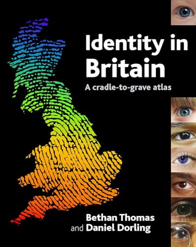
Identity in Britain
Da: Majestic Books, Hounslow, Regno Unito
Valutazione del venditore 4 su 5 stelle

EUR 47,14
Spedizione EUR 7,54
Spedito da Regno Unito a U.S.A.Quantità: 3 disponibili
Aggiungi al carrelloCondizione: New. pp. 312.
-

Poverty, Wealth and Place in Britain, 1968 to 2005
Da: GreatBookPricesUK, Woodford Green, Regno Unito
Valutazione del venditore 5 su 5 stelle
EUR 37,43
Spedizione EUR 17,40
Spedito da Regno Unito a U.S.A.Quantità: Più di 20 disponibili
Aggiungi al carrelloCondizione: As New. Unread book in perfect condition.
-
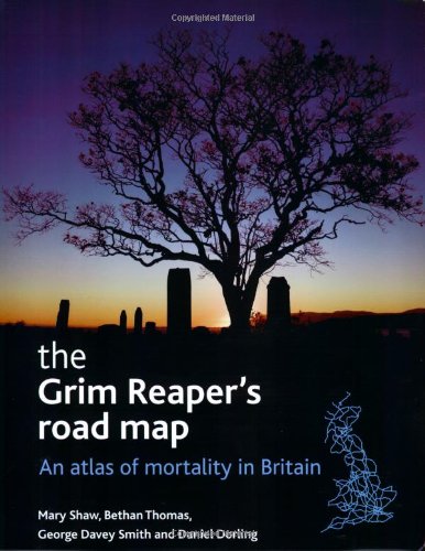
The Grim Reaper's road map An atlas of mortality in Britain
Da: Revaluation Books, Exeter, Regno Unito
Valutazione del venditore 5 su 5 stelle
EUR 39,41
Spedizione EUR 17,40
Spedito da Regno Unito a U.S.A.Quantità: 2 disponibili
Aggiungi al carrelloPaperback. Condizione: Brand New. 238 pages. 11.50x9.25x0.50 inches. In Stock.
-

Identity in Britain
Lingua: Inglese
Editore: Bristol University Press, GB, 2007
ISBN 10: 1861348207 ISBN 13: 9781861348203
Da: Rarewaves.com USA, London, LONDO, Regno Unito
Valutazione del venditore 5 su 5 stelle
EUR 57,56
Spedizione gratuita
Spedito da Regno Unito a U.S.A.Quantità: 5 disponibili
Aggiungi al carrelloPaperback. Condizione: New. Sixty million people live in Britain. Imagine sixty million. Imagine a map of sixty million. What would that map look like and what story would it tell us about identity in Britain today?Bethan Thomas and Danny Dorling have brought together this outstanding atlas to provide us with a unique visual picture of identity and geography combined. "Identity in Britain" explores our changing identities as we progress from infancy to old age and tells the story of the myriad geographies of life in Britain. Features and benefits include:over 280 full colour, detailed mapsanalysis of the contemporary neighbourhood geographies of people in Britain at various life stagesclear introduction and how-to-use guide making the atlas highly accessible for a wide range of userslocational reference maps to aid interpretation of the maps on each pageAccompanying web resources, including locational cartogramsUnlike conventional atlases of human geography, it allows us to see a range of data on a single map; further it allows us to easily see what social mixing does not occur as well as what does. Never before have we had such a vivid geographical picture of identity in Britain today.The atlas is essential reading for those interested in contemporary human identity and the social geography of early twenty first century Britain. It is also an invaluable resource for researchers working in a wide range of statutory and voluntary organisations, policy makers, journalists, politicians, students and academics.
-

Bankrupt Britain
Lingua: Inglese
Editore: Bristol University Press, GB, 2011
ISBN 10: 1847427472 ISBN 13: 9781847427472
Da: Rarewaves.com USA, London, LONDO, Regno Unito
Valutazione del venditore 5 su 5 stelle
EUR 57,77
Spedizione gratuita
Spedito da Regno Unito a U.S.A.Quantità: 2 disponibili
Aggiungi al carrelloPaperback. Condizione: New. Bankrupt Britain is a unique atlas giving a comprehensive picture of the effect of the recession on Britain. In detailed colour maps, it shows how economic, social and environmental fortunes have been affected in different areas in the wake of the 2007 banking crisis, 2008 economic crash and 2009 credit crunch. It is essential reading for a broad audience with detailed local level data and a national snap-shot of Britain during this time.
-
Identity in Britain
Da: Kennys Bookshop and Art Galleries Ltd., Galway, GY, Irlanda
Valutazione del venditore 5 su 5 stelle
Prima edizione
EUR 46,05
Spedizione EUR 10,50
Spedito da Irlanda a U.S.A.Quantità: 1 disponibili
Aggiungi al carrelloCondizione: New. Danny Dorling and Bethan Thomas have brought together this outstanding atlas to provide us with a unique visual picture of identity and geography combined. "Identity in Britain" explores our changing identities as we progress from infancy to old age and tells the story of the myriad geographies of life in Britain. Num Pages: 312 pages, maps. BIC Classification: 1DBK; JHBD. Category: (UP) Postgraduate, Research & Scholarly. Dimension: 302 x 239 x 18. Weight in Grams: 1504. . 2007. First Edition. paperback. . . . .
-

Poverty, Wealth and Place in Britain, 1968 to 2005
Da: GreatBookPricesUK, Woodford Green, Regno Unito
Valutazione del venditore 5 su 5 stelle
EUR 42,73
Spedizione EUR 17,40
Spedito da Regno Unito a U.S.A.Quantità: Più di 20 disponibili
Aggiungi al carrelloCondizione: New.
-
Condizione: New. Danny Dorling and Bethan Thomas have brought together this outstanding atlas to provide us with a unique visual picture of identity and geography combined. "Identity in Britain" explores our changing identities as we progress from infancy to old age and tells the story of the myriad geographies of life in Britain. Num Pages: 312 pages, maps. BIC Classification: 1DBK; JHBD. Category: (UP) Postgraduate, Research & Scholarly. Dimension: 302 x 239 x 18. Weight in Grams: 1504. . 2007. First Edition. paperback. . . . . Books ship from the US and Ireland.
-
Condizione: New. pp. 312.
-

Poverty, wealth and place in Britain, 1968 to 2005
Lingua: Inglese
Editore: Bristol University Press, GB, 2007
ISBN 10: 1861349955 ISBN 13: 9781861349958
Da: Rarewaves USA United, OSWEGO, IL, U.S.A.
Valutazione del venditore 5 su 5 stelle
EUR 42,72
Spedizione EUR 42,97
Spedito in U.S.A.Quantità: Più di 20 disponibili
Aggiungi al carrelloPaperback. Condizione: New. This is the first detailed study of the recent geographical distribution of poverty and wealth in Britain. It presents the most comprehensive estimates of the changing levels of poverty and wealth from the late 1960s. A wide range of secondary data is used, beginning with the first national Poverty in the UK survey of Peter Townsend and colleagues, and ending with data released during the middle of the current decade. The authors extend concepts of social exclusion to establish 5 household groupings: the 'exclusive wealthy' - able to exclude themselves from the norms of society; those who are rich but not exclusively so; those who are neither rich nor poor; the 'breadline poor'; and the 'core poor' - who experience a combination of severe income poverty, material deprivation and subjective poverty. Poverty and wealth statistics are mapped in detail to explore geographical patterns over the last four decades, and analysed to determine whether poverty and wealth have become more or less polarised.
-

Poverty, wealth and place in Britain, 1968 to 2005
Lingua: Inglese
Editore: Bristol University Press, GB, 2007
ISBN 10: 1861349955 ISBN 13: 9781861349958
Da: Rarewaves.com UK, London, Regno Unito
Valutazione del venditore 5 su 5 stelle
EUR 42,72
Spedizione EUR 75,39
Spedito da Regno Unito a U.S.A.Quantità: 2 disponibili
Aggiungi al carrelloPaperback. Condizione: New. This is the first detailed study of the recent geographical distribution of poverty and wealth in Britain. It presents the most comprehensive estimates of the changing levels of poverty and wealth from the late 1960s. A wide range of secondary data is used, beginning with the first national Poverty in the UK survey of Peter Townsend and colleagues, and ending with data released during the middle of the current decade. The authors extend concepts of social exclusion to establish 5 household groupings: the 'exclusive wealthy' - able to exclude themselves from the norms of society; those who are rich but not exclusively so; those who are neither rich nor poor; the 'breadline poor'; and the 'core poor' - who experience a combination of severe income poverty, material deprivation and subjective poverty. Poverty and wealth statistics are mapped in detail to explore geographical patterns over the last four decades, and analysed to determine whether poverty and wealth have become more or less polarised.
-

The Grim Reaper's road map
Da: Rarewaves.com UK, London, Regno Unito
Valutazione del venditore 5 su 5 stelle
EUR 45,64
Spedizione EUR 75,39
Spedito da Regno Unito a U.S.A.Quantità: 1 disponibili
Aggiungi al carrelloPaperback. Condizione: New. This impressive full-colour atlas, with over 100 colour-coded and accessible maps, uniquely presents the geography of death in Britain. The first atlas published on this subject for over two decades, this book presents data from more than 14 million deaths over a 24-year period in Britain. The maps detail over 100 separate categories of cause of death, including various cancers, suicides, assault by firearms, multiple sclerosis, pneumonia, hypothermia, falls, and Parkinson's disease, and show how often these occurred in different neighbourhoods. Accompanying each map is a detailed description and brief geographical analysis - the number of people who have died due to each cause, the average age of death and ratio of male to female deaths are listed. Taken as a whole, these provide a comprehensive overview of the geographical pattern of mortality in Britain. This atlas will be essential reading for academics and students of social medicine, sociology of health and illness and epidemiology. It will also be valuable for anyone who wants a better understanding of patterns of mortality within Britain, including medical and healthcare practitioners, policy makers and researchers.
-

Identity in Britain
Lingua: Inglese
Editore: Bristol University Press, GB, 2007
ISBN 10: 1861348207 ISBN 13: 9781861348203
Da: Rarewaves.com UK, London, Regno Unito
Valutazione del venditore 5 su 5 stelle
EUR 53,80
Spedizione EUR 75,39
Spedito da Regno Unito a U.S.A.Quantità: 5 disponibili
Aggiungi al carrelloPaperback. Condizione: New. Sixty million people live in Britain. Imagine sixty million. Imagine a map of sixty million. What would that map look like and what story would it tell us about identity in Britain today?Bethan Thomas and Danny Dorling have brought together this outstanding atlas to provide us with a unique visual picture of identity and geography combined. "Identity in Britain" explores our changing identities as we progress from infancy to old age and tells the story of the myriad geographies of life in Britain. Features and benefits include:over 280 full colour, detailed mapsanalysis of the contemporary neighbourhood geographies of people in Britain at various life stagesclear introduction and how-to-use guide making the atlas highly accessible for a wide range of userslocational reference maps to aid interpretation of the maps on each pageAccompanying web resources, including locational cartogramsUnlike conventional atlases of human geography, it allows us to see a range of data on a single map; further it allows us to easily see what social mixing does not occur as well as what does. Never before have we had such a vivid geographical picture of identity in Britain today.The atlas is essential reading for those interested in contemporary human identity and the social geography of early twenty first century Britain. It is also an invaluable resource for researchers working in a wide range of statutory and voluntary organisations, policy makers, journalists, politicians, students and academics.
-

Bankrupt Britain
Lingua: Inglese
Editore: Bristol University Press, GB, 2011
ISBN 10: 1847427472 ISBN 13: 9781847427472
Da: Rarewaves.com UK, London, Regno Unito
Valutazione del venditore 5 su 5 stelle
EUR 54,69
Spedizione EUR 75,39
Spedito da Regno Unito a U.S.A.Quantità: 2 disponibili
Aggiungi al carrelloPaperback. Condizione: New. Bankrupt Britain is a unique atlas giving a comprehensive picture of the effect of the recession on Britain. In detailed colour maps, it shows how economic, social and environmental fortunes have been affected in different areas in the wake of the 2007 banking crisis, 2008 economic crash and 2009 credit crunch. It is essential reading for a broad audience with detailed local level data and a national snap-shot of Britain during this time.
-

Identity in Britain: A cradle-to-grave atlas
Da: Stephen White Books, Bradford, Regno Unito
Valutazione del venditore 5 su 5 stelle
EUR 192,80
Spedizione EUR 38,56
Spedito da Regno Unito a U.S.A.Quantità: 1 disponibili
Aggiungi al carrelloHardcover. Condizione: Good. Ex-library book, usual markings. Hardback, in good condition. Clean text, sound binding. Quick dispatch from UK seller.

